West Virginia, known as the Mountain State, is a hiker’s paradise with trails that showcase its stunning Appalachian landscapes, serene rivers, and cascading waterfalls. 😍
Despite being an outdoor enthusiast’s dream, West Virginia often flies under the radar as a travel destination. This underrated gem has an incredible variety of hiking trails that highlight its unique landscapes and rich natural beauty.
From the Endless Wall Trail, celebrated as one of the state’s most iconic hikes, to the Long Point Trail, which rewards adventurers with jaw-dropping views of the New River Gorge Bridge, there’s something for everyone.
For those craving dramatic vistas, Chimney Top delivers with its breathtaking panoramas and striking rock formations, while the Blackwater Canyon Trail enchants visitors with its serene path that winds past four cascading waterfalls.
With so much diversity and wonder waiting to be explored, West Virginia deserves a spot at the top of your adventure list. Dive into this ultimate guide to discover the best hikes in West Virginia! 🥾
Affiliate Disclaimer: Some links on this page may be affiliate links, meaning I may earn a small commission at no extra cost to you. As an Amazon Associate, I earn from qualifying purchases. Thanks for supporting the blog! 🫶
Best Hikes in West Virginia
1. Endless Wall Trail
Starting Point: Fern Creek Trailhead and Nuttall Trailhead
Length: 3.2 miles
Elevation Gain: 320 feet
Difficulty: Easy
Route Type: Loop
Hiking Time: 1.5 to 2 hours
Pet-friendly? Yes, must be on leash
Hike Features: Diamond Point Overlook, view of New River Gorge Bridge, ladders for climbers
✨READ THIS: Endless Wall Trail Hiking Guide
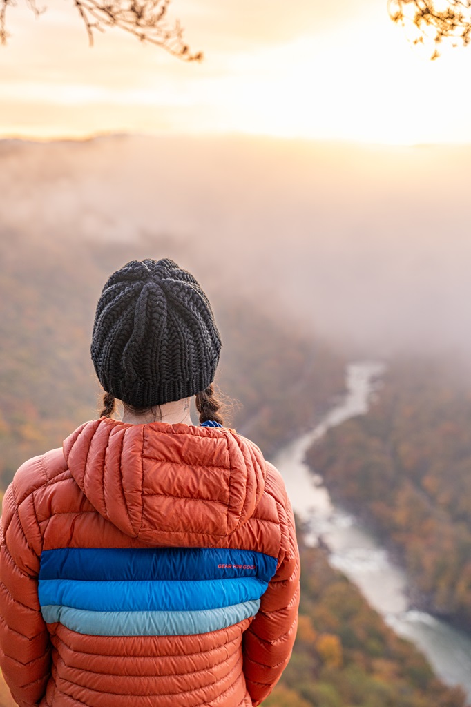
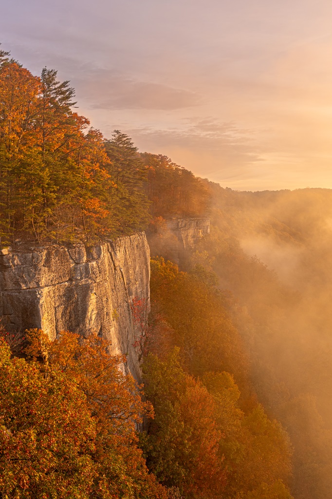
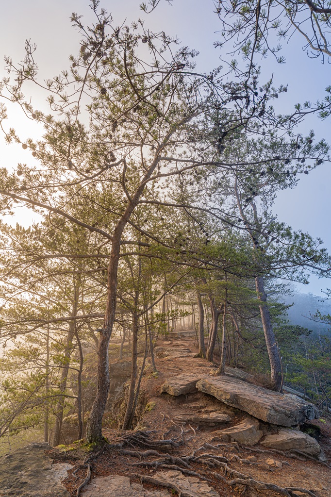
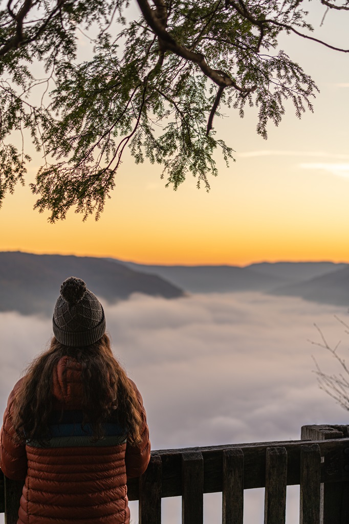
The Endless Wall Trail in New River Gorge National Park is a breathtaking hike that lives up to its name, offering stunning views of the gorge from its rugged sandstone cliffs.
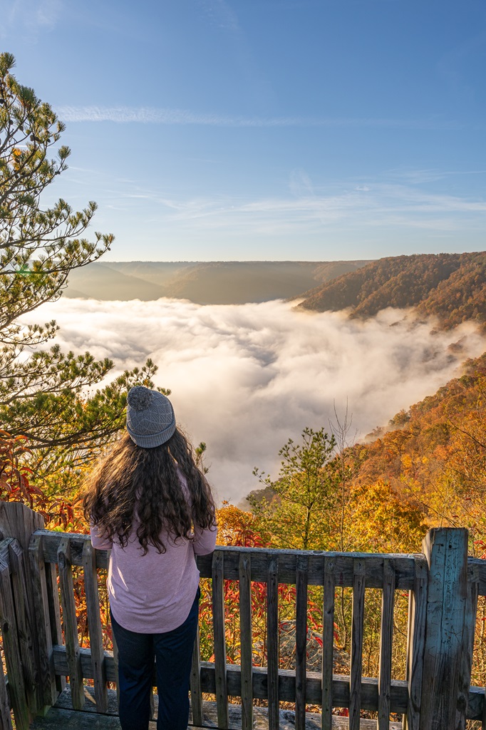
The highlight of the trail is Diamond Point Overlook, a spectacular vantage point that provides panoramic views of the gorge and the New River winding far below.
This spot is particularly magical at sunrise, when the soft golden light bathes the cliffs and valleys, creating a scene straight out of a dream.
This trail is very popular, so get there early to snag a parking spot! If the Fern Creek Trailhead parking area is full, simply drive 0.5 mile down the road to the Nuttall Trailhead parking area.
⚠️ Don’t park on the side of the road! Your car could get towed.
My husband and I have hiked this trail several times, and it never gets old! We always start from the Fern Creek Trailhead and watch sunrise at Diamond Point Overlook.
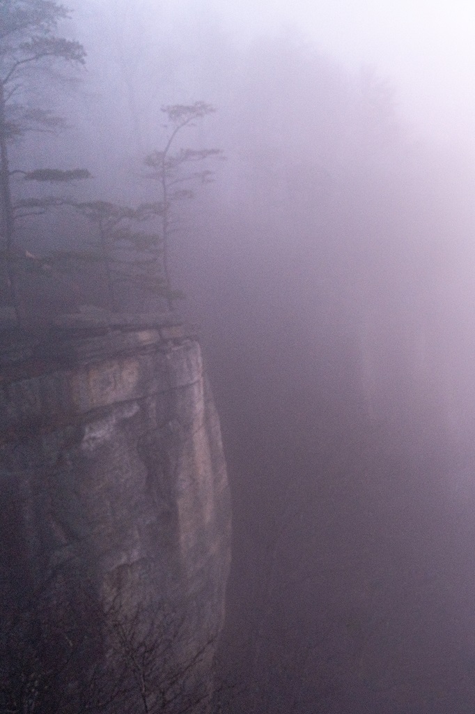
Sometimes the sunrise can be absolutely amazing! But other times, the thick fog rolling in from the gorge can completely block the view, giving the scene a totally different, misty vibe.
Instead of completing the full loop, we always choose to retrace our steps back to the Fern Creek Trailhead from Diamond Point Overlook. This 2.2-mile roundtrip option is not only shorter but also avoids walking on the road.
2. Long Point Trail
Starting Point: Long Point Trailhead
Length: 3 miles
Elevation Gain: 345 feet
Difficulty: Easy to moderate
Route Type: Out-and-back
Hiking Time: 1 to 1.5 hours
Pet-friendly? Yes, must be on leash
Hike Features: Long Point Overlook – best view of the New River Gorge Bridge
✨ READ THIS: Long Point Trail Hiking Guide
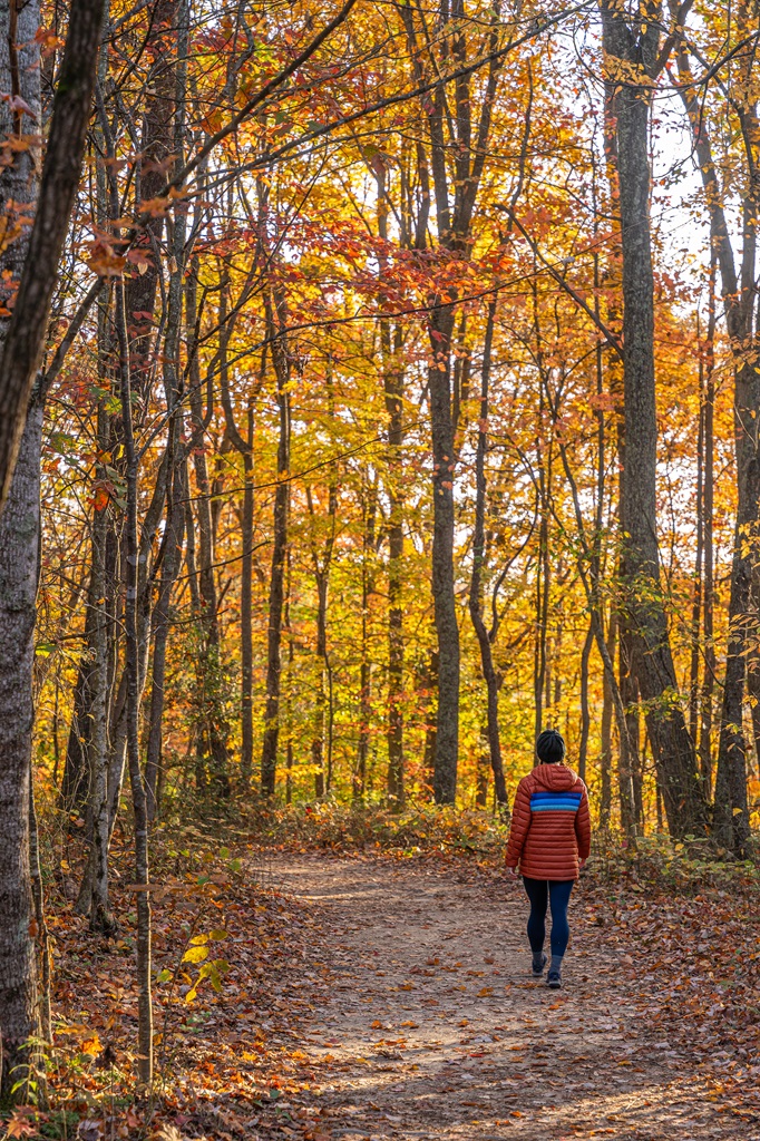
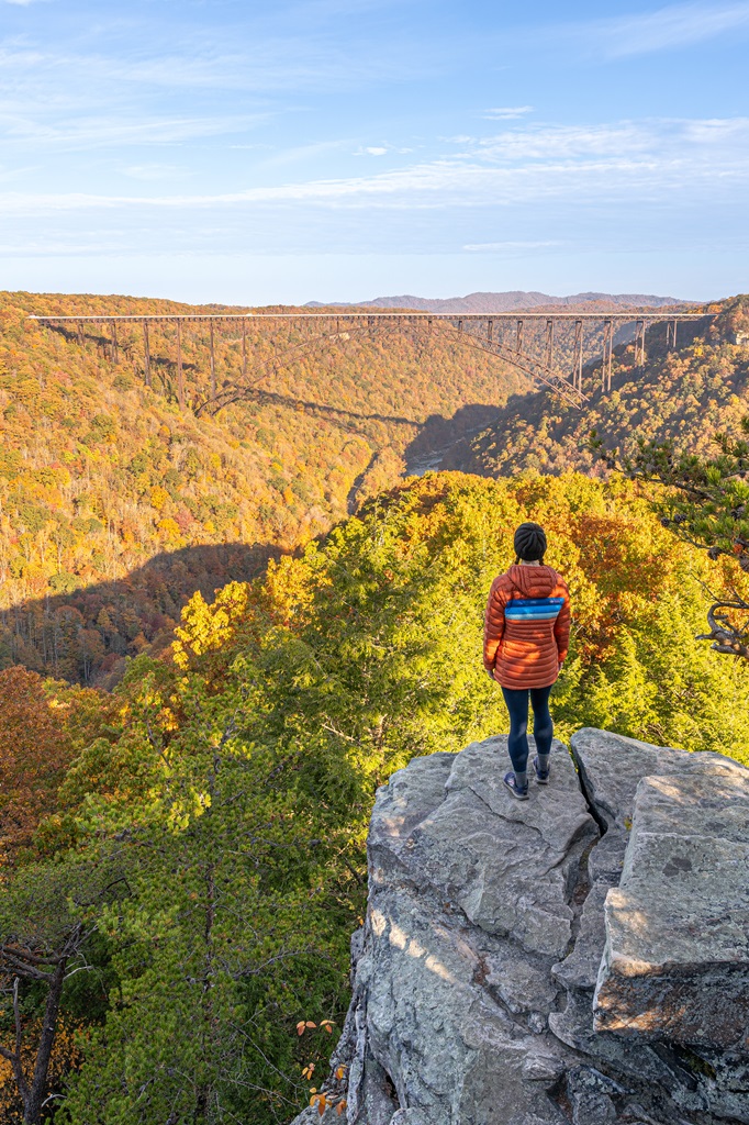
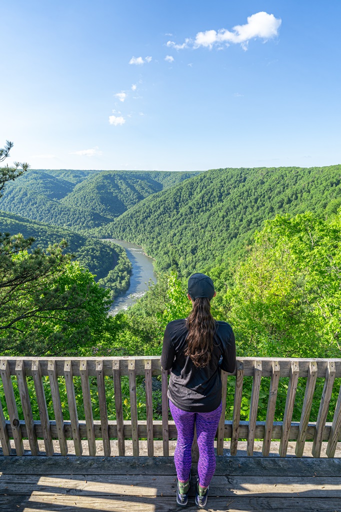
Long Point Trail in New River Gorge National Park offers one of the best panoramic views in the area. This hike takes you through lush forests and along cliffs leading to a stunning viewpoint overlooking the New River Gorge Bridge.
Long Point Trailhead is located off Newton Road near downtown Fayetteville.
This is another popular trail in New River Gorge with incredible views at the Long Point Overlook. It provides the best view (in my opinion) of the New River Gorge Bridge.
It’s a fairly short and easy hike, besides the last little bit which is a bit steep but doable for most people.
⚠️ Be careful near the cliff edges located at the Long Point Overlook.
Despite the overlook facing north, this is a great spot to catch the golden hour glow from either sunrise or sunset!
3. Seneca Rocks Trail
Starting Point: Seneca Rocks Trailhead
Length: 3.6 miles
Elevation Gain: 840 feet
Difficulty: Moderately challenging
Route Type: Out-and-back
Hiking Time: 1.5 to 2 hours
Pet-friendly? Yes, must be on leash
Hike Features: Unique rock formation, stunning views from the top, optional rock scrambling section
✨ READ THIS: Seneca Rocks Hiking Guide
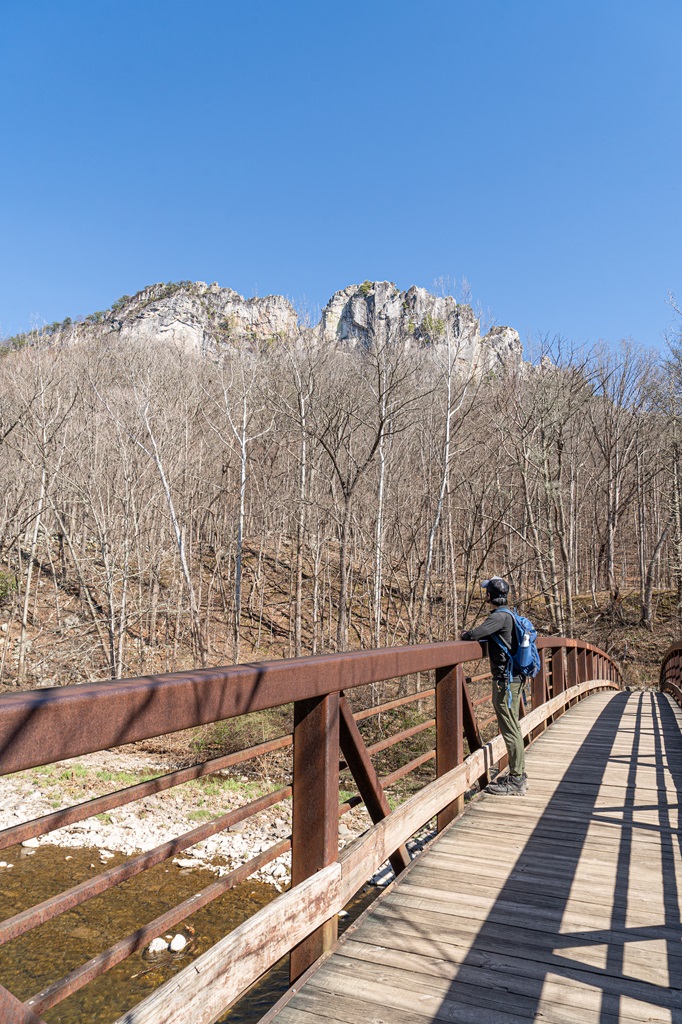
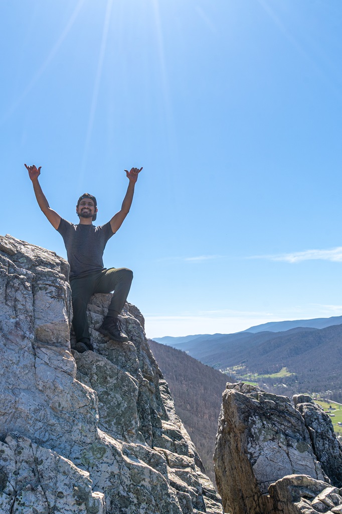
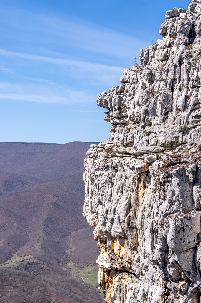
Seneca Rocks is one of West Virginia’s most iconic landmarks, rising nearly 900 feet above the North Fork River.
Popular with climbers and hikers, it offers both a challenging climb and breathtaking views of the Potomac Highlands.
There are two parking areas for easy access to the Seneca Rocks Trailhead – Seneca Rocks Discovery Center parking area and a bigger lot off highway 28 near the Sites Homestead.
The Seneca Rocks Trail leads to an observation deck with amazing views. It’s a short and steep trek to the top, but doable for families and casual hikers.
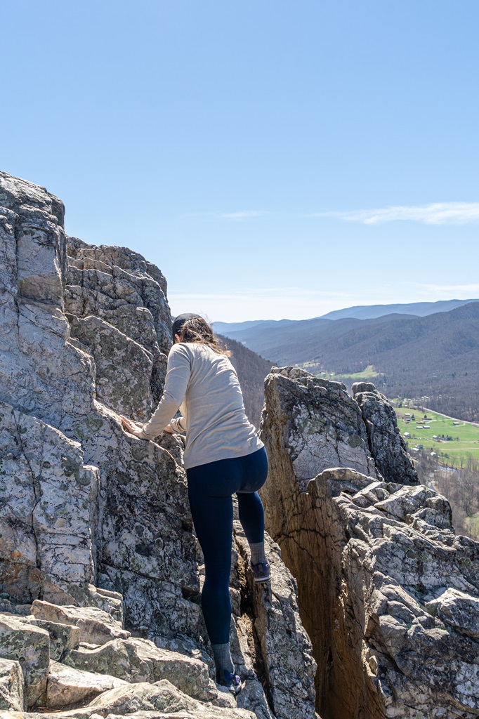
The real fun is climbing further to the top of Seneca Rocks. This should only be done by experienced hikers! There is a big sign that strongly discourages anyone without proper climbing equipment from going any further.
My husband and I are experienced hikers and know our limits with rock scrambling. We were able to reach the top without any problem.
With that being said, go at your own risk! While the trail is family friendly, I wouldn’t recommend taking children past the warning sign.
In conclusion, Seneca Rocks is an exciting hike and one of my favorite spots in West Virginia!
4. Castle Rock and Grandview Rim Trails to Turkey Spur
Parking can be found at the Grandview Main Overlook or at the Turkey Spur Overlook.
Length: 4 miles
Elevation Gain: 410 feet
Difficulty: Moderately challenging
Route Type: Lollipop
Hiking Time: 2 to 3 hours
Pet-friendly? Yes, must be on leash
Hike Features: Grandview Rim overlooks, Turkey Spur Rock, incredible views
✨ READ THIS: Grandview Rim Trail to Turkey Spur Rock (+ Castle Rock Trail) Hiking Guide
Combine the Castle Rock Trail and Grandview Rim Trail for an unforgettable hiking experience!
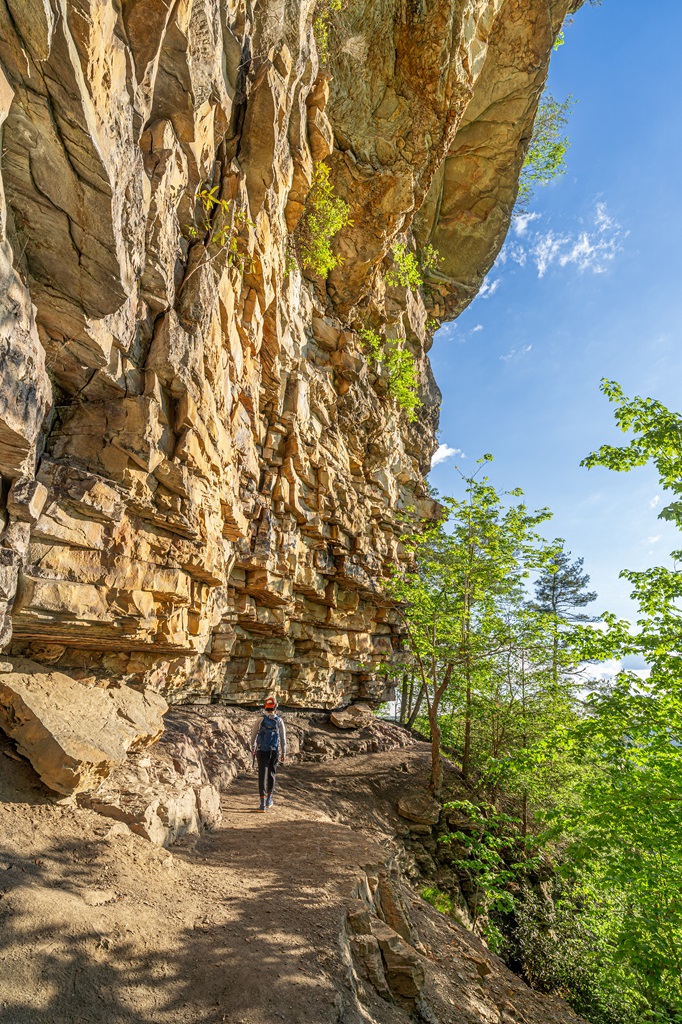
The Castle Rock Trail is a challenging 0.6-mile path that begins near the Grandview Main Overlook and intersects with the Grandview Rim Trail.
Along the way, hikers are treated to stunning close-up views of towering, fortress-like rock walls and exposed coal seams, adding to the trail’s beauty.
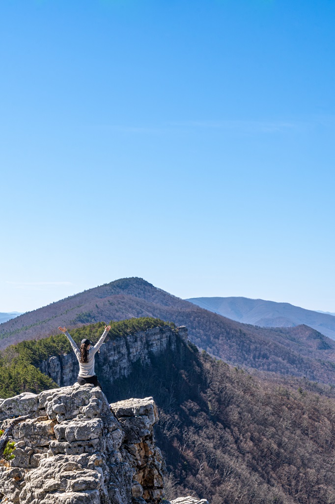
When paired with the Grandview Rim Trail, it creates a rewarding 1.1-mile loop that takes you beneath dramatic overhanging cliffs on the Castle Rock Trail, followed by sweeping panoramic views of the gorge from the Grandview Rim Trail.
For an even more spectacular adventure, continue along the Grandview Rim Trail to Turkey Spur Overlook, where you’ll enjoy even more breathtaking vistas of the New River Gorge.
While there isn’t an official AllTrails map of the trails combined, the route is easy to follow.
Start by hiking along the Castle Rock Trail, which begins near the Grandview Main Overlook. At the junction, take a right onto the Grandview Rim Trail and follow it until you reach Turkey Spur.
Once you’ve enjoyed the views, turn around and retrace your steps along the Grandview Rim Trail back to the Grandview parking area. Be sure to stop at the overlooks along the Grandview Rim Trail!
There’s a large one that veers off to the right at a fork in the trail (heading towards Turkey Spur), which is easy to miss but worth the short detour.
For the best experience, consider hiking at sunrise. Not only will you avoid the crowds, but you’ll also be treated to the most stunning views as the sun rises over the gorge.

5. North Fork Mountain Trail to Chimney Top
Starting Point: North Fork Mountain Trailhead
Length: 5.2 miles
Elevation Gain: 2,000 feet
Difficulty: Challenging
Route Type: Out-and-back
Hiking Time: 3 to 4 hours
Pet-friendly? Yes, must be on leash
Hike Features: Incredible views at Chimney Top and unique rock formations
✨ READ THIS: North Fork Mountain Trail to Chimney Top Hiking Guide
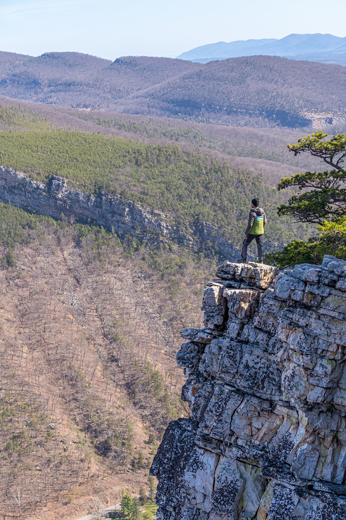
Chimney Top, also known as Chimney Rock, is a stunning natural overlook perched along the North Fork Mountain Trail in West Virginia’s Monongahela National Forest.
Offering panoramic views of the surrounding valleys and ridges, it’s one of the most rewarding hikes in the state.
While the trek to Chimney Top is challenging – featuring steep elevation gains and a final scramble – it delivers unforgettable scenery, making it a favorite among avid hikers.
The North Fork Mountain Trailhead is located off Smoke Hole Road off North Fork Highway near Cabins, West Virginia. The trailhead parking lot is small, so arriving early is essential to secure a spot.
From the parking area, the North Fork Mountain Trail ascends roughly 2,000 feet over 2.6 miles, leading you to the summit.
This trail is no walk in the park – if you’re a beginner, consider preparing in advance by strengthening your glutes, hamstrings, calves, and quads, and boosting your cardiovascular endurance.
This climb will put both your legs and lungs to the test! About 0.1 mile from the summit, you’ll encounter an unmarked junction.
Stay to the right, following the path marked by a possible rock cairn. This final stretch is steep but mercifully short.
At the summit, adventurous hikers can scramble up a striking rock pillar for an even better view. Attempt this only if you’re experienced with rock scrambling and comfortable with heights.
Another option to reach Chimney Top is via the Landis Trail, which connects to the North Fork Mountain Trail. This route covers 5 miles roundtrip with 1,700 feet of elevation gain, offering a similarly challenging climb.
The trailhead for this route is conveniently located about 2 miles south of the North Fork Mountain Trailhead, just off Smoke Hole Road.
6. Kaymoor Miners Trail
Starting Point: Kaymoor Miners Trailhead
Length: 1.5 miles
Elevation Gain: 950 feet
Difficulty: Challenging
Route Type: Out-and-back
Hiking Time: 1 to 1.5 hours
Pet-friendly? Yes, must be on leash
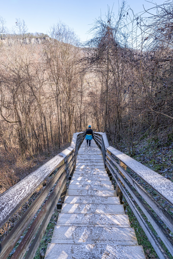
Hike Features: small waterfall, 821 wooden steps, old remnants of the Kaymoor coal mine site and Kaymoor Bottom
✨ READ THIS: Kaymoor Miners Trail Hiking Guide
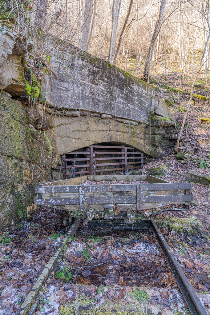
The Kaymoor Miners Trail in New River Gorge National Park offers hikers a unique glimpse into the rich coal mining history of West Virginia.
This steep, 1.5-mile roundtrip hike descends nearly 950 feet via a series of switchbacks and stairs, leading to the ruins of the historic Kaymoor coal mine, processing plant, and Kaymoor Bottom town.
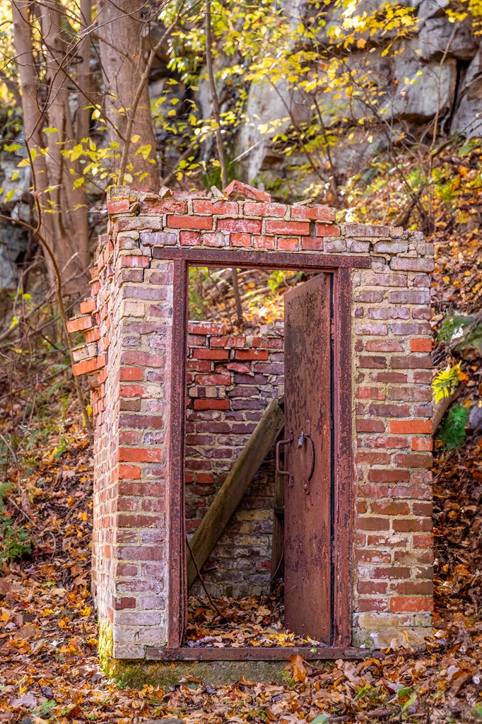
Along the way, you’ll encounter remnants of the area’s industrial past, including rusted machinery, mine entrances, and interpretive signs that tell the story of the miners who once worked there.
🚗 Follow these directions to reach the Kaymoor Top Trailhead:
- Turn onto Gatewood Road and follow for 2.0 miles.
- Turn left at the Kaymoor sign (Kaymoor No. 1 Road).
- Follow for one mile to the “T” intersection.
- Turn left and the parking area is 50 yards on the right.
⚠️ The parking lot at Kaymoor Top is limited in size and narrow, making it difficult for large vehicles, RVs, and trailers to park.
Although the trail is short, its steep inclines and over 800 wooden steps can be physically demanding, so proper footwear and a good fitness level are recommended.
The effort is well worth it, as the lower area provides a fascinating look at the Kaymoor mine ruins and town site.
Please do NOT climb or sit on historic structures. Leave them as they are to preserve their story.
⚠️ Safety Tip: The railroad at river level is active and private property – do not walk on or cross the tracks and note that the trail does not lead to the New River.

If you prefer a slightly less strenuous, alternate route, take the Kaymoor Trail starting at the Kaymoor Trailhead off Fayette Station Road.
This route is 4.4 miles roundtrip to the Kaymoor Bottom and 2 miles roundtrip to the Kaymoor One Mine.
No matter which route you choose, this area is a must-visit in New River Gorge. If you’re like me and enjoy physical challenges, this is the perfect hike for you!
It’s one of my favorite spots, offering a look into the past and the rewarding challenge of over 800 steps to reach the bottom.
7. Blackwater Falls
Starting Point: Blackwater Trading Post
Length: 0.4 miles
Elevation Gain: 120 feet
Difficulty: Easy to moderate
Route Type: Lollipop
Hiking Time: 30 minutes
Pet-friendly? Yes, must be on leash
Hike Features: 2 overlooks of Blackwater Falls
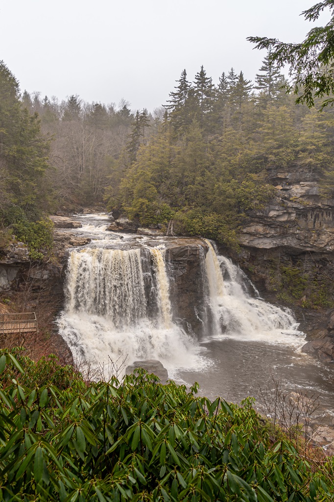
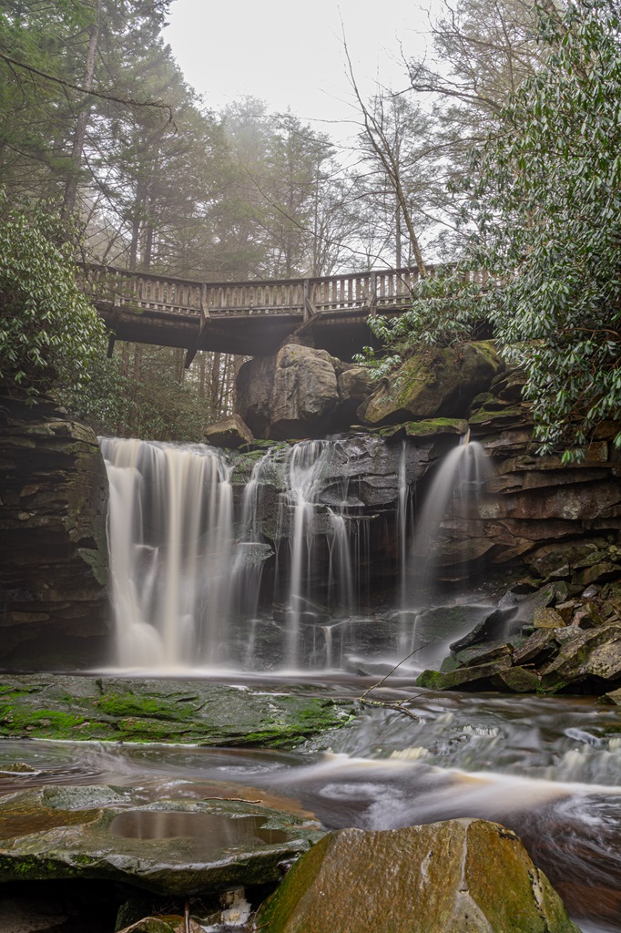
Blackwater Falls State Park is named for the falls of the Blackwater River, whose amber-colored waters plunge five stories then twist and tumble through an eight-mile-long gorge.
This location is one of West Virginia’s most iconic and photographed destinations, making it an absolute must-see!
The Blackwater Falls Trail is a scenic, 0.4-mile loop that takes you to one of West Virginia’s most iconic waterfalls.
Located in Blackwater Falls State Park, the trail is an easy, family-friendly hike that offers stunning views of the 57-foot Blackwater Falls – the tallest waterfall in West Virginia.
The trail provides several viewpoints along the way, giving visitors the opportunity to capture perfect photos of the falls from different angles.
The mist rising from the falls creates a magical atmosphere, especially during the spring and autumn months.
The hike starts at the Blackwater Trading Post parking area.
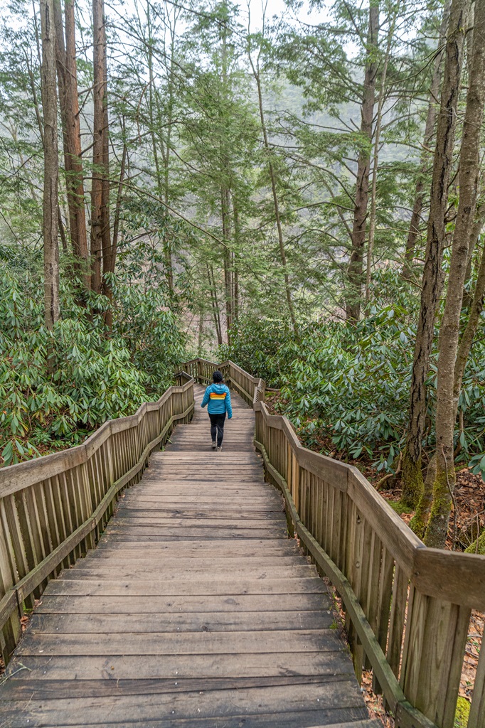
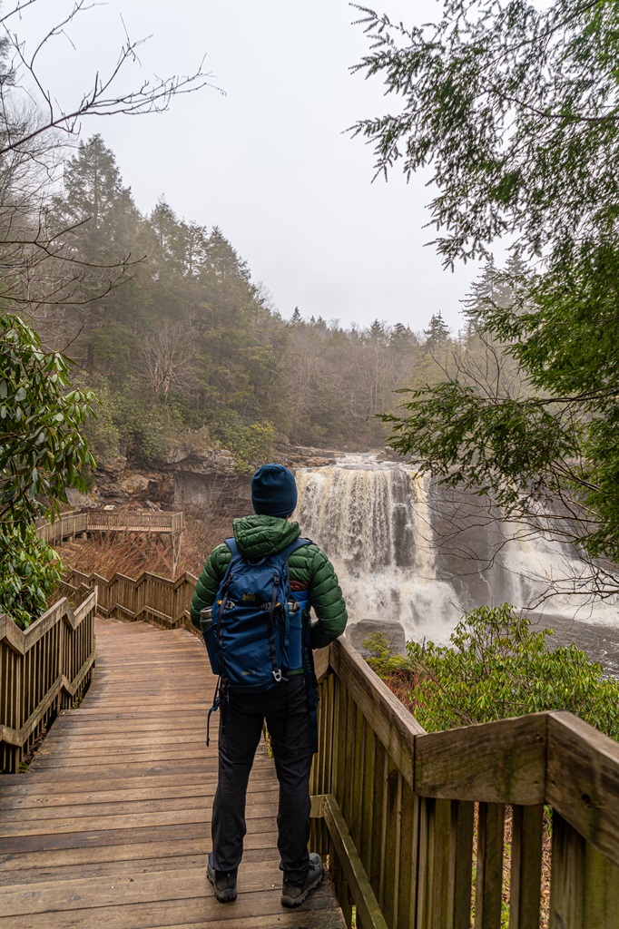
The Blackwater Falls Trail leads to a stone patio featuring an Almost Heaven swing then descends over 200 steps to an observation deck that offers a closer view of the breathtaking waterfall.
✨ READ THIS: Things to Do at Blackwater Falls State Park
8. Elakala Falls
Starting Point: Southwest end of Blackwater Lodge
Length: 4.6 miles
Elevation Gain: 460 feet
Difficulty: Moderately challenging
Route Type: Lollipop
Hiking Time: 2 to 3 hours
Pet-friendly? Yes, must be on leash
Hike Features: Elakala Falls and footbridge over the waterfall
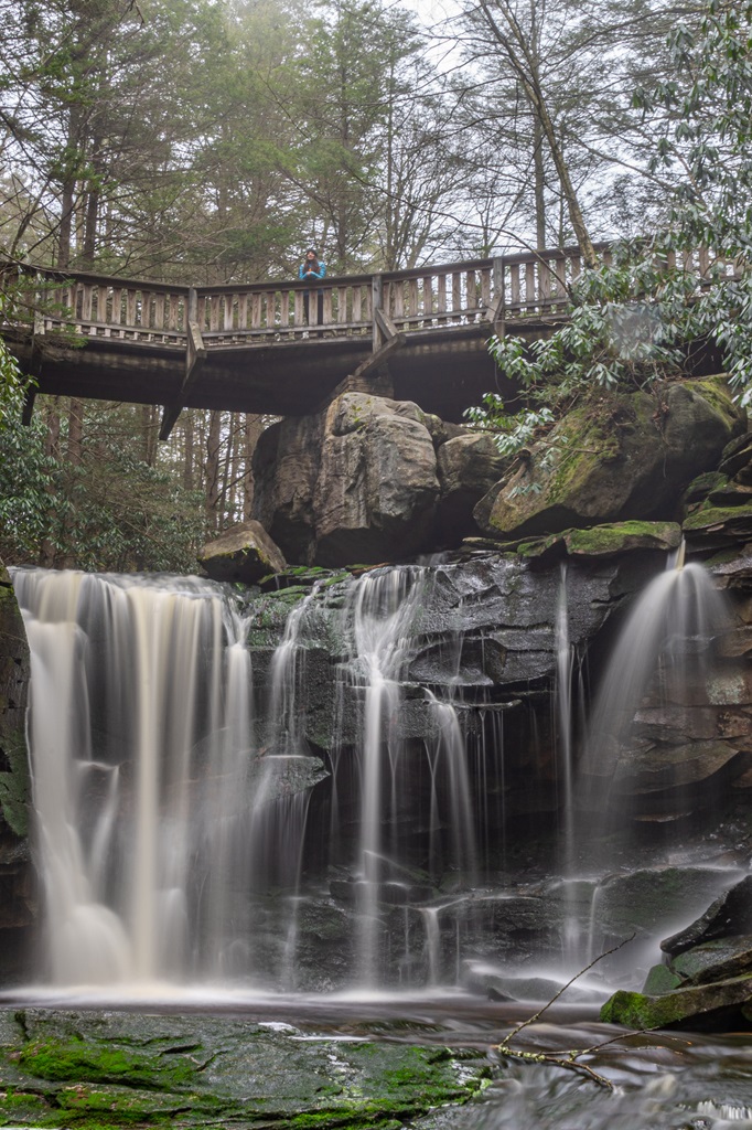
Elakala Falls, located in Blackwater Falls State Park, is a stunning multi-tiered waterfall that cascades gracefully down a series of rocks into the Blackwater River Gorge.
The falls are especially captivating in the spring and autumn, when the surrounding foliage creates a vibrant backdrop, and the water’s flow is at its fullest after rainfall.
The Elakala Falls Trailhead is located at the south end of Blackwater Lodge.
This hike begins at the south end of Blackwater Lodge, following the Elakala Falls Trail, which leads you across a charming bridge overlooking the picturesque Elakala Falls.
As you continue, the trail merges with the Balanced Rock Trail, eventually connecting to the Red Spruce Trail.
At a junction, turn right onto the Yellow Birch Trail and follow it to the Gentle Trail, which takes you to an overlook offering stunning views of Blackwater Falls.
After enjoying the overlook, retrace your steps to the junction and proceed straight on the Yellow Birch Trail, completing the loop back to the Blackwater Lodge parking area.
🏃♀️💨 Quicker Route: If you’re like me and my husband, trying to fit multiple waterfall hikes into a single day, you can opt for a quick and easy 0.5-mile roundtrip hike on the Elakala Falls Trail, focusing solely on the waterfall.
9. Sandstone Falls and Island Trail
Starting Point: Sandstone Falls Trailhead
Length: 1 mile
Elevation Gain: 25 feet
Difficulty: Easy
Route Type: Loop
Hiking Time: 30 minutes
Pet-friendly? Yes, must be on leash
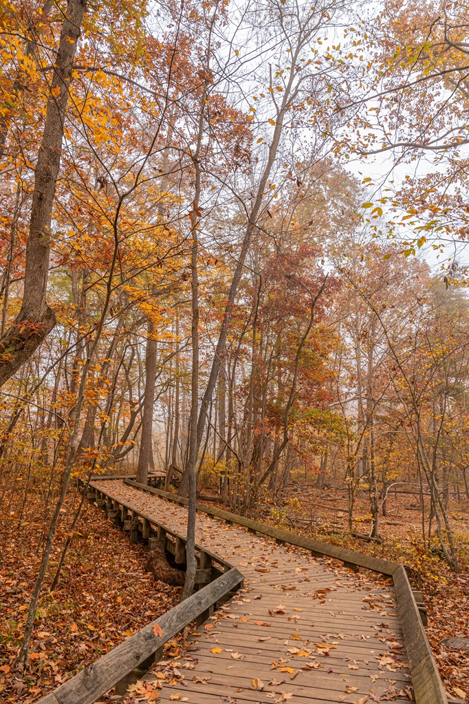
Hike Features: Boardwalk and Sandstone Falls (upper and lower)
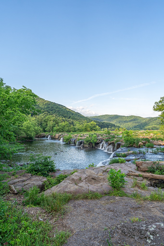
The Island Trail and Sandstone Falls in New River Gorge National Park offer visitors a unique opportunity to explore the scenic beauty of the New River.
The Sandstone Falls Trailhead is located off New River Road near Hinton.
This short, easy loop winds through small islands connected by wooden boardwalks and bridges, giving hikers a front-row seat to the roaring cascades of Sandstone Falls.
Along the way, you’ll find interpretive signs detailing the area’s ecology, geology, and cultural history, making it both a relaxing and educational experience.
The trail is perfect for all ages and abilities, with plenty of spots to pause and enjoy the stunning views of the falls and surrounding landscapes.
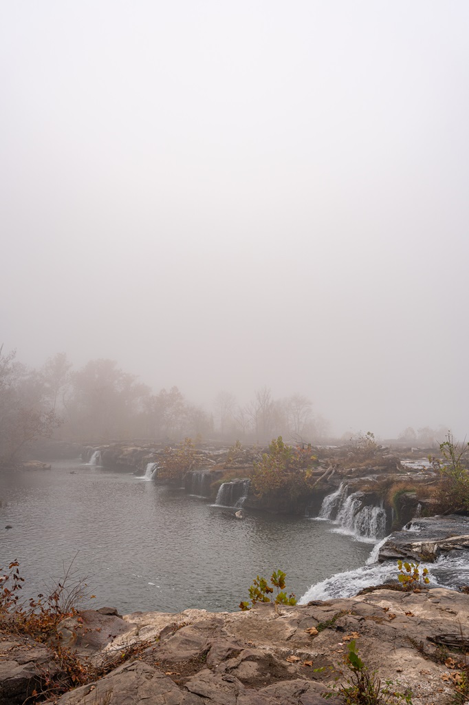
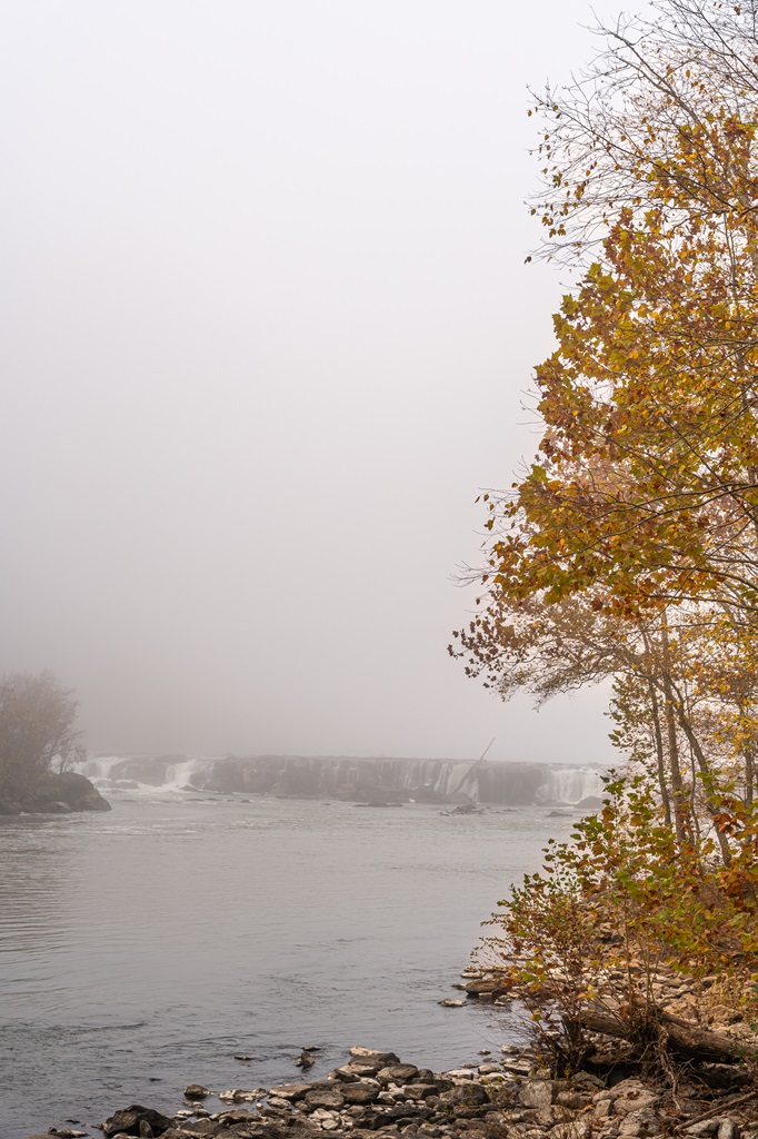
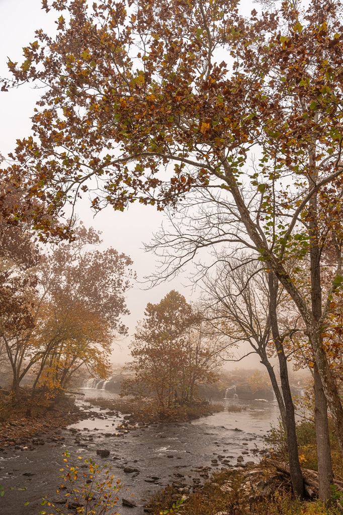
Sandstone Falls, the largest waterfall on the New River, stretches an impressive 1,500 feet across and drops 10 to 25 feet over a series of rugged sandstone ledges.
In the fall, the vibrant foliage combined with a misty morning creates an enchanting, moody atmosphere that’s perfect for capturing unforgettable shots.
Visitors can access the falls via the Sandstone Falls Boardwalk, a short and wheelchair-accessible trail that leads to multiple observation decks.
Whether you’re strolling along the Island Trail or taking in the falls from the boardwalk, this area is a must-visit for anyone exploring New River Gorge National Park.
10. Spruce Knob

Starting Point: Spruce Knob Trailhead
Length: 0.6 miles
Elevation Gain: 30 feet
Difficulty: Easy
Route Type: Loop
Hiking Time: 30 minutes
Pet-friendly? Yes, must be on leash
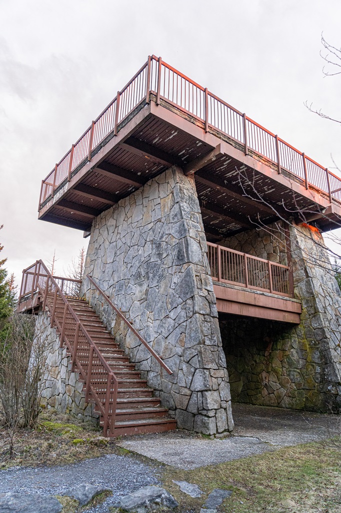
Hike Features: Observation tower and incredible views along the trail
Spruce Knob, the highest point in West Virginia, rises to an impressive 4,863 feet above sea level, offering breathtaking views of the Allegheny Mountains and beyond.
Located in the Monongahela National Forest, this iconic peak is accessible by a scenic drive followed by a quick, easy hike along a paved path to the observation tower at the summit.
The Spruce Knob Trailhead can be found at the end of Forest Road 104 near Riverton. Take the Whispering Spruce Trail, a short loop around the summit, for additional breathtaking panoramic views.
For adventurers seeking a more immersive experience, Spruce Knob is surrounded by a network of hiking trails, including the Huckleberry Trail and the Seneca Creek Trail.
This trail system winds through diverse landscapes, from high-altitude spruce forests to cascading streams and lush meadows.
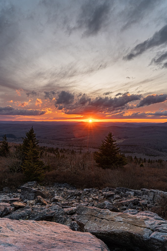
The area is also a prime spot for stargazing, thanks to its remote location and minimal light pollution.
I highly recommend catching the sunset from Spruce Knob. While the observation tower offers great views, the vistas from the Whispering Spruce Trail are even more spectacular!
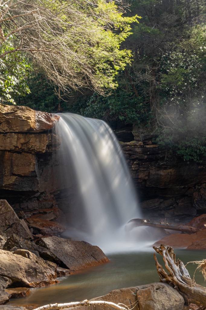
Bonus: Blackwater Canyon Trail (four waterfalls)
The Blackwater Canyon Trail, located in the Monongahela National Forest, is a 10-mile point-to-point trail that follows the Blackwater River through one of West Virginia’s most beautiful canyons.
Along the way, hikers are treated to breathtaking views of the river and canyon, as well as several stunning waterfalls.
Among the highlights are Albert Falls, Teresa Falls, Douglas Falls, and Kennedy Falls, each offering its own unique charm.
The trail also passes through the remains of historic railroad structures, adding an extra layer of interest to the natural beauty of the area.
The Blackwater Canyon Trail is a challenging hike, suitable for experienced hikers and mountain bikers. However, it’s a manageable 1-mile roundtrip hike to see all four waterfalls, making it accessible for most visitors.
The final waterfall, Kennedy Falls, might pose a bit of a challenge, especially for casual hikers or families with young children.
This hike is one of my personal favorites, and I would consider it a hidden gem as it is far less crowded than the nearby Blackwater Falls and Elakala Falls.
The trailhead is located at the end of Rail Falls Road near Coketon.
Length: 1 mile (according to Google Maps)
Difficulty: Moderately challenging
Route Type: Out-and-back
Hiking Time: 30 to 45 minutes
Pet-friendly? Yes, must be on leash
🥾 Blackwater Canyon Trail Map (the entire trail is 20.5 miles)
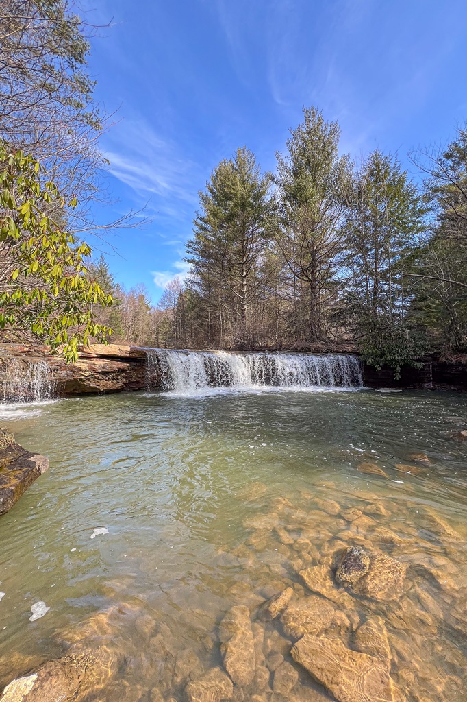
Albert Falls is the first waterfall you’ll encounter on the trail, and it’s easily accessible – located just off Rail Falls Road. You can drive right up to it!
Though small, with a drop of about eight to ten feet, it’s a charming and picturesque waterfall. A short, steep climb takes you to the base of the falls, where the view is even better.
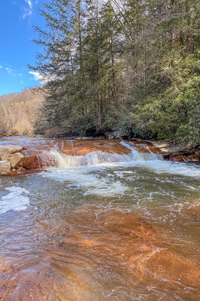
Once you park at the end of the road, follow the path until you reach a side trail that leads to Teresa Falls. This waterfall, also small, is quite unique due to the visible effects of the region’s industrial past.
Acid erosion from historic mine drainage has left the rocks here incredibly smooth, creating a striking contrast as the water cascades into the pool below.
Head back to the Rail Falls Road and pass a metal gate. The next waterfall is just a short distance beyond the gate.
Douglas Falls, the most popular of the four waterfalls, features a dramatic 35-foot drop. There are several excellent vantage points to enjoy the falls. Be careful as the rocks can be slippery.
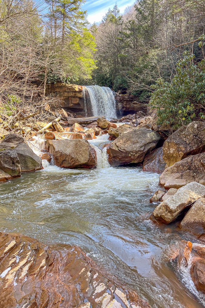
Continue along the Blackwater Canyon Trail until you reach a side trail to the left, which leads to one of the most thrilling parts of the hike – Kennedy Falls.
Unlike the other waterfalls, Kennedy Falls isn’t visible from the main trail, requiring a short, steep descent to the base of the falls.
The trail is marked with orange ribbons, and the descent down to the riverbank involves using a blue rope to navigate a 20-foot drop.
Take your time and be careful as the rocks can be slippery! Once at the bottom, the view of Kennedy Falls, which stands about 25 to 30 feet tall, is incredible!
This was my favorite waterfall of the four. Not only was the hike to get there a fun challenge, but it was more secluded and peaceful.
Best Hikes in West Virginia Map
Best Time to Hike in West Virginia
The best time to hike in West Virginia, largely depends on what kind of experience you’re looking for. Spring and fall are particularly popular seasons, with mild temperatures and stunning scenery.
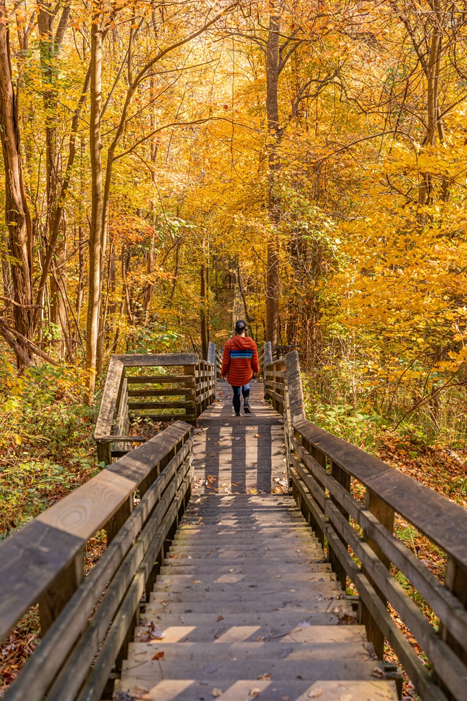
🌷 In spring, you’ll enjoy vibrant wildflowers and lush green forests, 🍂 while fall offers spectacular foliage with the mountains turning into a sea of reds, oranges, and yellows.
☀️ Summer can be a great time to hike as well, especially for those seeking longer days and warmer weather, but be prepared for higher temperatures, occasional humidity, and bugs. Hiking early in the morning or later in the day is ideal to beat the heat and avoid crowds.
☃️ Winter offers quieter trails and the chance to see the landscape dusted with snow, though some higher-elevation trails may be more challenging or even closed due to snow and ice. Make sure you check the weather beforehand and bring the right gear for icy conditions.
West Virginia Hiking Tips
1. Start Early: Beat the crowds and enjoy cooler temperatures by starting your hike early in the morning, especially during peak season.
2. Be Physically Prepared: Some of the hikes mentioned above can be quite challenging. It’s a good idea to train for the harder hikes by strength training and completing cardio exercises for endurance.
3. Waterfall Safety:
- Avoid climbing rocks near the waterfall as they can be slippery and cause you to fall.
- When swimming near the base of a waterfall, stay aware of strong currents and avoid getting too close to the cascade itself.
- Never swim upstream near the edge of a waterfall, as the flow can unexpectedly pull you toward the drop.
- Always assess water depth before jumping in and be mindful of submerged rocks or debris.
- After heavy rain, water levels can rise rapidly, increasing the risk of strong currents – choose calmer conditions for a safer experience.
4. Watch for Bears: Black bears live in New River Gorge National Park – follow these guidelines to avoid any negative interactions with a black bear.
5. Respect Nature: Follow Leave No Trace principles – plan ahead, pack out all trash, avoid disturbing wildlife, be considerate of others, and respect the natural beauty of West Virginia.
What to Bring Hiking in West Virginia
👚 Layers of Clothing (top) – Pack a moisture-wicking base layer, a fleece mid-layer, an insulated jacket, and an outer shell to protect you from the elements, such as rain and wind. You may not need all these layers, especially in the summer months, but it’s always best to be over-prepared!
Check out my favorite tops 👇
- Base layer: REI Co-op Sahara Shade Hoodie (warm/mild conditions) and REI Co-op Midweight Long-Sleeve Base Layer (cooler conditions)
- Fleece mid layer: Cotopaxi Teca Fleece Full-Zip Jacket
- Down mid layer: Cotopaxi Fuego Hooded Down Jacket
- Outer shell: In the summer I always pack a light windbreaker, such as the Cotopaxi Teca Crop Windbreaker or the RevolutionRace Unit Light Windbreaker. If cold, windy, and rainy conditions are in the forecast (or there’s a slight possibility), I make sure to pack my Patagonia Torrentshell 3L Jacket.
🩳 Hiking Shorts or Pants – Pack a comfortable, durable, and stretchy pair of hiking shorts or pants. Also think about what conditions you might run into, such as warm or cold temperatures, wind and/or rain, bugs, and overgrown trails.
Check out my favorite hiking bottoms 👇
- Cotopaxi Losdos Zip-Off Pants
- RevolutionRace Breezy Ankle Outdoor Pants
- Baleaf Fleece-Lined Jogger Pants
- RevolutionRace Summit Pocket Tights
- Revolution Race Hike & Dive Shorts
🥾 Hiking Footwear – Bring a good pair of hiking boots or shoes with good traction. If I’m not expecting to hike in too much mud or snow, my go-to hiking shoes are the Altra Lone Peak trail runners. They have a wide-toe box, 0 mm heel-to-toe drop, and MaxTrac rubber outsole. Plus, they’re lightweight and so comfy!
🧦 Socks – Moisture-wicking, quick-drying socks are the way to go. My favorite pair of hiking socks are Darn Tough Hiker Micro Crew Cushion Socks. Always pack an extra pair!
🎒 Day Pack – What you plan to do (sightseeing, hiking, etc.), determines what size pack you’ll need. Here is what I typically bring based on what I’m doing that day 👇
- Short walks and sightseeing: Cotopaxi Kapai 1.5L Del Dia Hip Pack
- Short, easy to moderate day hikes: REI Co-op Flash 22L Pack
- Long, moderate to challenging day hikes: REI Co-op Trail 25L Pack or Cotopaxi Luzon Del Dia 24L Pack
🥢 Trekking Poles – Essential for stability, balance, and support when hiking trails, especially on tough, rocky, and uneven terrain. I use REI Co-op Trailmade Trekking Poles and love them!
❄️ Microspikes – Bring a pair of microspikes if you’re visiting in the winter and you’re planning to hike along icy trails. They will give you good traction to avoid slipping! I use Black Diamond Access Spike Traction Device.
🦟 Mosquito/Bug Repellants – In the warmer months, be prepared for annoying gnats, mosquitoes, and flies. Wear long-sleeve clothing, a head net, and use bug spray.
🧤 Extra Warm Layers – If you expect cooler conditions or hiking to higher elevations, make sure to pack extra layers for added warmth, such as gloves, beanie, neck gaiter, and a light jacket.
🗺️ Navigation – Carry a physical topographic map, compass, a satellite messenger (or personal locator beacon), and download offline maps to help you stay on course, find your way in unfamiliar terrain, and call for help if needed.
🔦 Headlamp/Flashlight – A reliable light source with extra batteries, in case you end up hiking in the dark or need it for emergency situations.
💧 Water – Water bottles to carry sufficient water to stay hydrated, along with a filtration system or purification tablets if you plan to refill from natural sources.
🍕 Food – Energy-rich snacks or meals to keep your energy levels up during the hike.
😎 Sun Protection – Sunscreen, sunglasses, and a sunhat to protect yourself from harmful UV rays, even when it’s cloudy. Also, polarized sunglasses are important when it’s bright outside and to reduce glare from reflective surfaces like water, snow, and roads.
🩹 First-Aid Kit – A basic first-aid kit with items like bandages, antiseptic, pain relievers, and any personal medications you may need.
🥶 Emergency Shelter – Pack an emergency bivy sack or space blanket for shelter in case of sudden weather changes.
🔥 Fire – A lighter, matches, or fire starter to help you build a fire for warmth or signaling in case of emergency. Along with matches, I also carry a multi-tool carabiner that has a fire starter, utility blade, screwdriver, and bottle opener.
🗡️ Multi-Tool and Repair Kit – A versatile tool/knife and repair kit to handle any task, from preparing food to making repairs.
💩 Waste Disposal Supplies – WAG bags, trowel, toilet paper, pee cloth, wipes, Ziploc bags – be sure to pack out everything!
More Fun Outdoor Adventures in West Virginia
Whitewater Rafting on the New River Gorge – Take on thrilling rapids in one of the most popular whitewater rafting destinations in the U.S.
Caving at Organ Cave – Discover the vast underground beauty of Organ Cave, one of the largest and most famous caves on the east coast.
Biking the Greenbrier River Trail – Ride along this 78-mile trail that winds through picturesque countryside, forests, and small towns.
Ziplining at Ace Adventure Resort – Soar above the New River Gorge on one of the longest zipline courses in the country.
Visiting the Trans-Allegheny Lunatic Asylum – Take a guided tour of this historic site for a mix of history, ghost stories, and eerie architecture.
Skiing at Snowshoe Mountain Resort – Hit the slopes at Snowshoe Mountain, one of the premier ski resorts in the Southeast, offering a variety of trails for all skill levels, plus stunning winter landscapes.
Camping at Dolly Sods Wilderness – Set up camp in this remote wilderness area, known for its alpine-like terrain, hiking trails, and beautiful fall colors.
Bouldering at Coopers Rock State Forest – Challenge yourself with bouldering routes at Coopers Rock, offering scenic overlooks and rugged terrain.
Conclusion
West Virginia is home to some of the most captivating and diverse hiking trails in the Appalachian region.
Whether you’re seeking a short, scenic hike or a more strenuous adventure, this state delivers unforgettable experiences, with lush forests, cascading waterfalls, and panoramic vistas around every corner.
Exploring the best hikes in West Virginia should definitely be on every hiker’s bucket list!
If this guide inspires you to hike any of these incredible trails in West Virginia, I’d love to hear about your adventure. Leave a comment and share your experience!
Enjoyed this post? Pin for later!