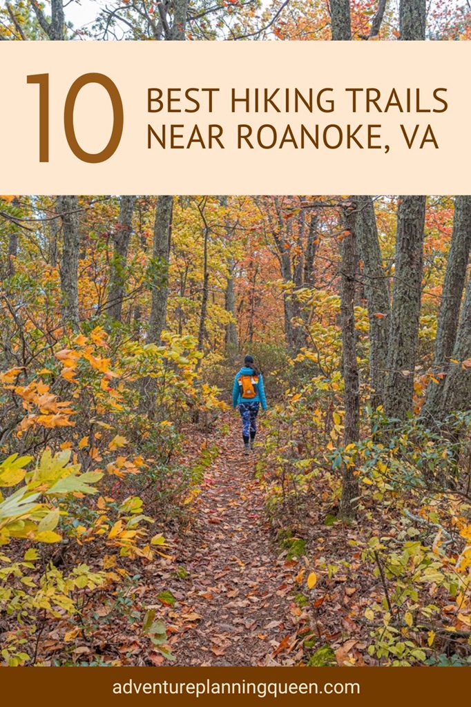
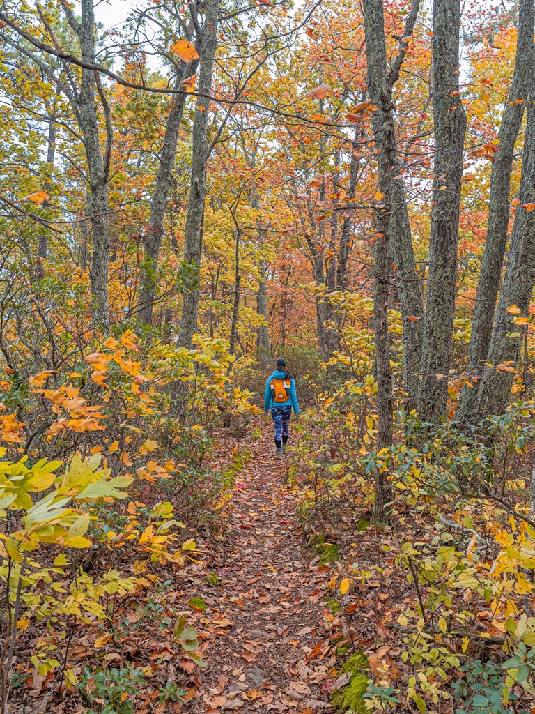
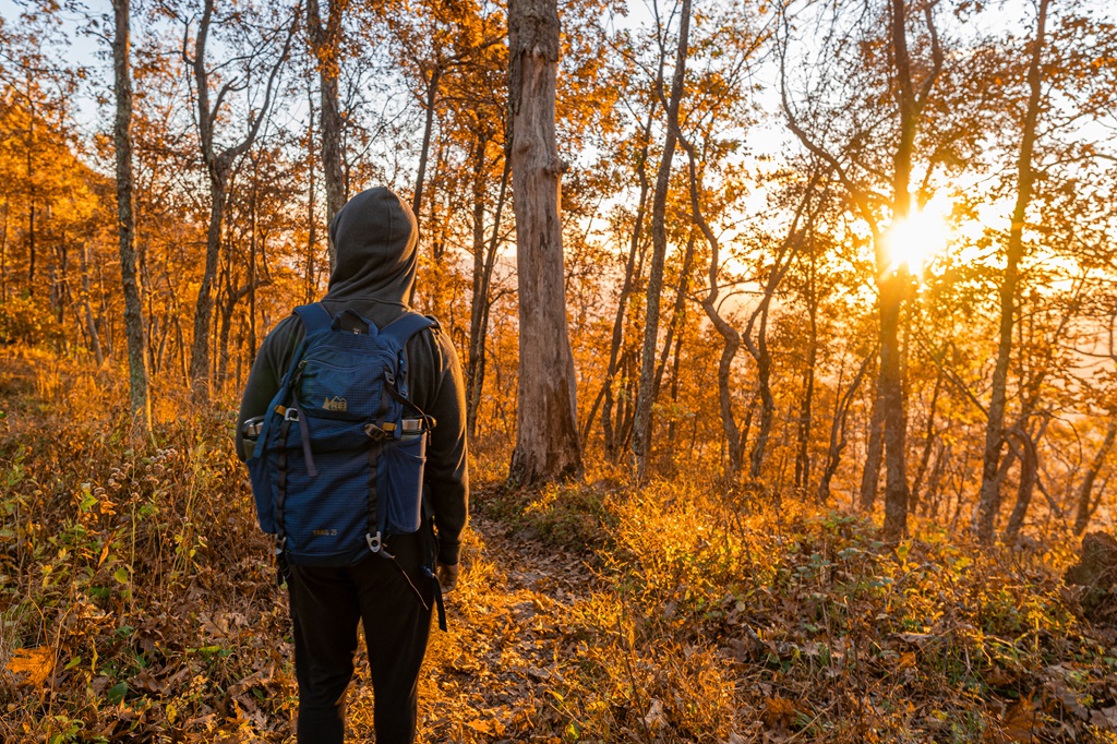
Nestled in the heart of the Blue Ridge Mountains, Roanoke, Virginia, is a haven for outdoor enthusiasts. Known as “Star City of the South,” this vibrant town is surrounded by a network of breathtaking trails. 😍
From panoramic mountain vistas to stunning waterfalls, Roanoke has it all! Climb to the top of Dragon’s Tooth for sunrise, hike along the famous Appalachian Trail to McAfee Knob, or take an easy stroll along the Roaring Run Trail.
In this guide, we’ll explore the 10 best hiking trails near Roanoke, VA. These trails highlight the area’s diverse landscapes, from cascading waterfalls to scenic overlooks of the Blue Ridge Mountains.
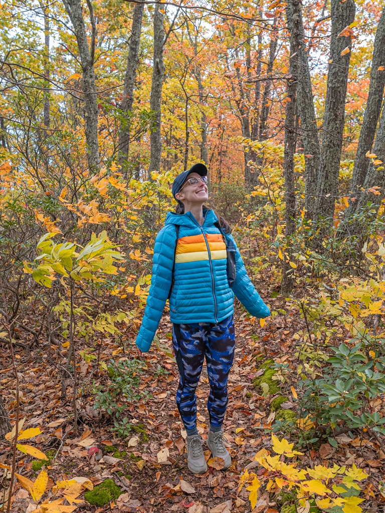
My husband and I have hiked most of these trails and we confidently say they are worth the hype. Get ready to discover why Roanoke is a top destination for outdoor adventurers! 🙌
Affiliate Disclaimer: Some links on this page may be affiliate links, meaning I may earn a small commission at no extra cost to you. As an Amazon Associate, I earn from qualifying purchases. Thanks for supporting the blog! 🫶
10 Best Hiking Trails Near Roanoke, VA
I’ve put together a list of the 10 best hiking trails near Roanoke, Virginia, starting with those closest to the city and working outward.
Having hiked six of these trails myself, I can honestly say each one offers something special that makes it stand out.
But before we dive into the top 10, here’s a quick look at some of my personal favorite hikes 👇
- Best Overall – McAfee Knob
- Most Fun Hike – Dragon’s Tooth
- Best for Sunrise – McAfee Knob and Sharp Top
- Best Fall Hikes – Tinker Cliffs and Harkening Hill/Johnson Farm
Ok, let’s get into the 10 best hiking trails near Roanoke, Virginia!!
1. Star Trail
Starting Point: Mill Mountain Star Trailhead
Length: 3.3 miles
Elevation Gain: 780 feet
Difficulty: Moderately challenging
Route Type: Out-and-back
Hiking Time: 2 to 2.5 hours
Pet-friendly? Yes, must be on leash
Hike Features: Giant star and incredible views of Roanoke
Distance from Roanoke, VA: 3 miles (8 minutes)
The Star Trail takes you up to the famous Roanoke Star, the largest man-made illuminated star in the world.
The climb is relatively short but moderately steep, making it a great option for those looking for a bit of a challenge with a big payoff.
Once you reach the top, you’re treated to panoramic views of Roanoke and the surrounding mountains – perfect for a photo op or a peaceful moment to take in the scenery.
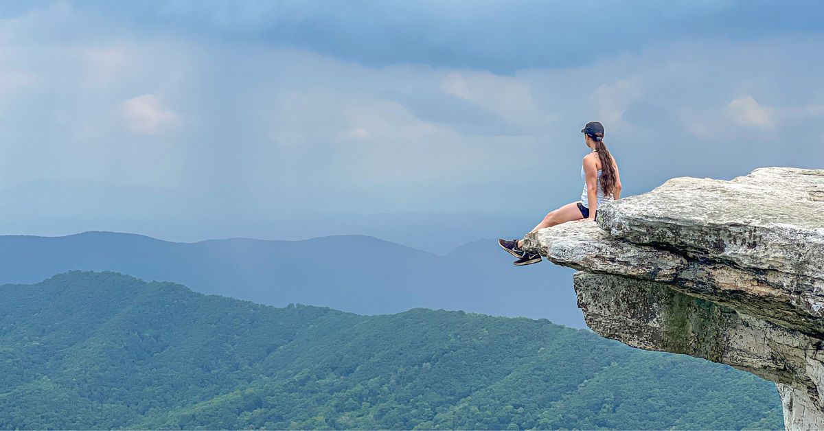
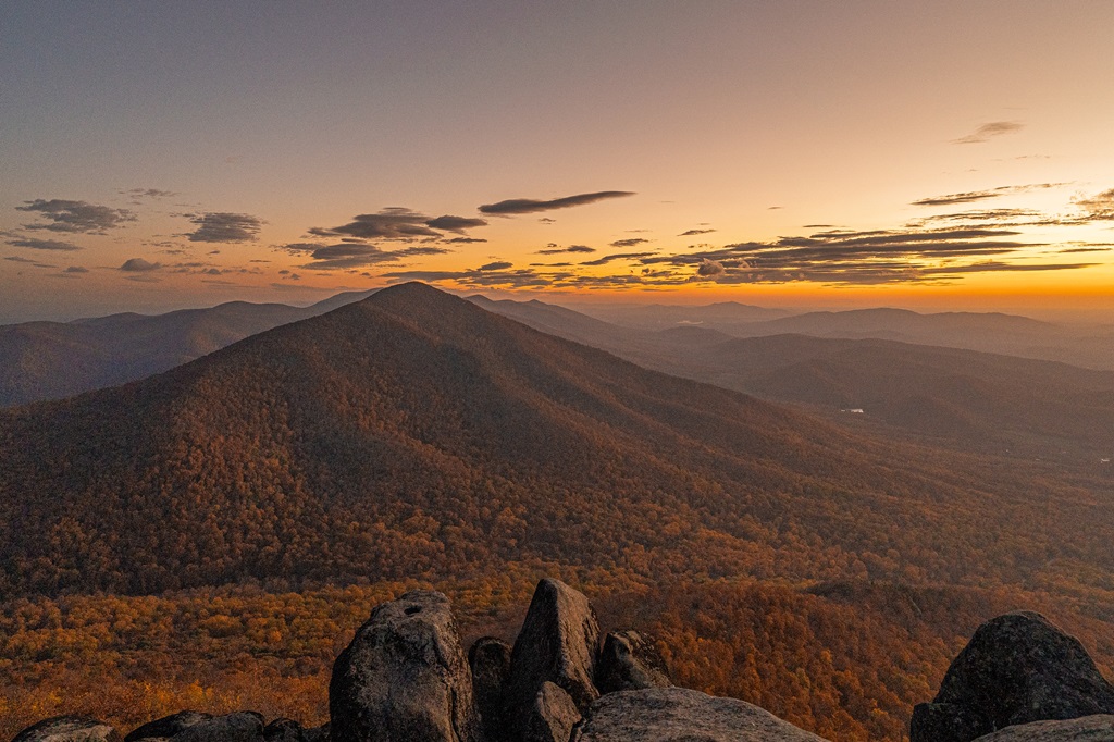
2. McAfee Knob
Starting Point: McAfee Knob Trailhead
Length: 8 miles
Elevation Gain: 1,700 feet
Difficulty: Challenging
Route Type: Out-and-back
Hiking Time: 4 to 6 hours
Pet-friendly? Yes, must be on leash
Hike Features: Stunning views from McAfee Knob
Distance from Roanoke, VA: 15 miles (25 minutes)
McAfee Knob, one of Virginia’s most iconic hikes, features a stunning rock overhang with panoramic views of the Catawba Valley.
It’s a must-see spot on the Appalachian Trail. This is a very popular hike, so make sure to get there early to snag a parking spot!
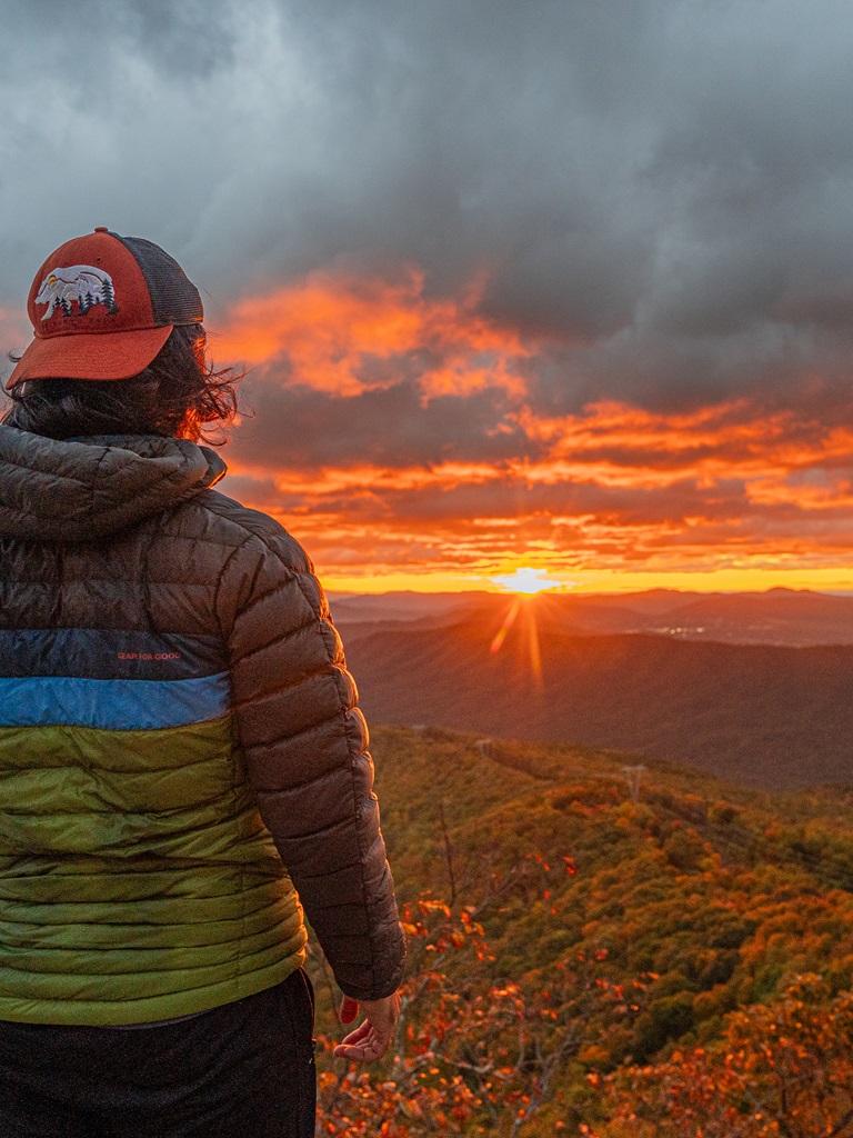
I personally recommend watching sunrise from McAfee Knob. It’ll be an unforgettable experience!
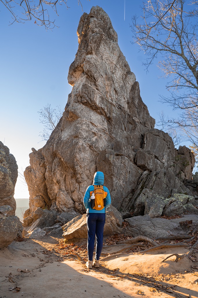
3. Dragon’s Tooth
Starting Point: Dragon’s Tooth Trailhead
Length: 4.8 miles
Elevation Gain: 1,250 feet
Difficulty: Challenging
Route Type: Out-and-back
Hiking Time: 2.5 to 4 hours
Pet-friendly? Yes, must be on leash
Hike Features: Dragon’s Tooth rock formation and amazing views from the top
Distance from Roanoke, VA: 20 miles (25 minutes)
Dragon’s Tooth is a thrilling and challenging adventure! This hike takes you through rugged terrain, leading to a unique rock formation that resembles a dragon’s tooth.
The climb is steep, with some sections requiring scrambling, but the effort is well worth it for the breathtaking views from the top.
This is a very popular hike, so make sure to get there early to snag a parking spot!
4. Tinker Cliffs
Starting Point: Tinker Cliffs / Andy Layne Trailhead
Length: 7.5 miles
Elevation Gain: 2,000 feet
Difficulty: Challenging
Route Type: Out-and-back
Hiking Time: 4 to 6 hours
Pet-friendly? Yes, must be on leash
Hike Features: Stunning views from Tinker Cliffs
Distance from Roanoke, VA: 25 miles (35 minutes)
Tinker Cliffs is a rewarding hike offering some of the best views in the area.
This challenging trek takes you along the Appalachian Trail, leading to dramatic cliffs that overlook the Catawba Valley.
The panoramic views from Tinker Cliffs make it a must-do for hikers looking to experience both natural beauty and a bit of adventure.
5. Sharp Top Mountain
Starting Point: Sharp Top Mountain Trailhead
Length: 3 miles
Elevation Gain: 1,300 feet
Difficulty: Challenging
Route Type: Out-and-back
Hiking Time: 2 to 3 hours
Pet-friendly? Yes, must be on leash
Hike Features: Sharp Top summit and Buzzard’s Roost
Distance from Roanoke, VA: 30 miles (50 minutes)
✨ READ THIS: Sharp Top Hiking Guide
Rising to an elevation of 3,875 feet, Sharp Top Mountain is a popular hiking destination, offering stunning panoramic views that captivate visitors.
Known for its challenging yet rewarding trail, Sharp Top draws hikers of all skill levels in search of an unforgettable adventure.
The summit’s vistas are particularly mesmerizing at sunrise and sunset.
Sharp Top is the most popular of the three iconic peaks in the Peaks of Otter region, alongside Flat Top and Harkening Hill.
Not only do you get incredible views from Sharp Top’s summit, but the trail passes by Buzzard’s Roost, a rocky outcrop that provides even more stunning views.
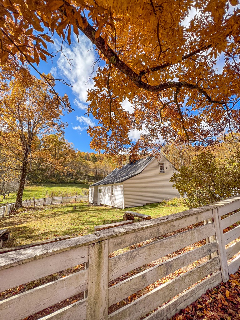
6. Harkening Hill and Johnson Farm
Starting Point: Johnson Farm Trailhead
Length: 4 miles
Elevation Gain: 900 feet
Difficulty: Moderately challenging
Route Type: Loop
Hiking Time: 2 to 3 hours
Pet-friendly? Yes, must be on leash
Hike Features: Harkening Hill summit and Johnson Farm
Distance from Roanoke, VA: 30 miles (50 minutes)
The Harkening Hill loop trail winds through lush forests, leading to a summit with peaceful views of the surrounding landscape.
Along the way, you can explore the historic Johnson Farm, a preserved homestead showcasing Appalachian life in the 19th century.
7. Stiles Falls
Starting Point: Stiles Falls Trailhead
Length: 3.2 miles
Elevation Gain: 350 feet
Difficulty: Moderately challenging
Route Type: Out-and-back
Hiking Time: 1.5 to 2.5 hours
Pet-friendly? Yes, must be on leash
Hike Features: Stiles Falls
Distance from Roanoke, VA: 35 miles (45 minutes)
Stiles Falls is a beautiful hike that takes you through lush forest to a stunning, secluded waterfall.
The path is moderately challenging, making it a great option for hikers of all skill levels.
As you approach the falls, the sound of rushing water grows louder, and the sight of the cascading waterfall is a perfect reward for your efforts.
8. Apple Orchard Falls
Starting Point: Apple Orchard Falls Trailhead
Length: 2.6 miles
Elevation Gain: 1,000 feet
Difficulty: Challenging
Route Type: Out-and-back
Hiking Time: 1.5 to 2.5 hours
Pet-friendly? Yes, must be on leash
Hike Features: Apple Orchard Falls
Distance from Roanoke, VA: 35 miles (1 hour)
🥾 Apple Orchard Falls Trail Map
Apple Orchard Falls offers a scenic hike to a majestic 200-foot cascade. The trail winds through vibrant forests, offering beautiful views and seasonal wildflowers.
I have not had the chance to hike this trail yet but it’s high on my bucket list the next time I visit Virginia!
9. Roaring Run Trail
Starting Point: Roaring Run Falls Trailhead
Length: 1.8 miles
Elevation Gain: 300 feet
Difficulty: Easy
Route Type: Loop
Hiking Time: 1 to 1.5 hours
Pet-friendly? Yes, must be on leash
Hike Features: Roaring Run Falls
Distance from Roanoke, VA: 40 miles (55 minutes)
The Roaring Run Trail is a short, scenic hike that follows the Roaring Run Creek.
The highlight of the hike is the Roaring Run Falls, a stunning 30-foot waterfall that’s especially beautiful after a rainfall.
The peaceful atmosphere and short distance make it a great option for families or anyone looking to enjoy a tranquil escape in nature.
10. Devil’s Marbleyard
Starting Point: Devil’s Marbleyard Parking
Length: 3.5 miles
Elevation Gain: 1,400 feet
Difficulty: Challenging
Route Type: Out-and-back
Hiking Time: 2.5 to 3.5 hours
Pet-friendly? Yes, must be on leash
Hike Features: Devil’s Marbleyard
Distance from Roanoke, VA: 50 miles (1 hour)
🥾 Devil’s Marbleyard Trail Map
Devil’s Marbleyard is a unique hiking destination featuring a massive boulder field surrounded by rugged mountain scenery.
This adventurous trail rewards climbers with stunning panoramic views!
Map of the Best Hiking Trails Near Roanoke, Virginia
Best Time to Hike Near Roanoke, VA
The best time to hike near Roanoke, Virginia, largely depends on what kind of experience you’re looking for. Spring and fall are particularly popular seasons, with mild temperatures and stunning scenery.
🌷 In spring, you’ll enjoy vibrant wildflowers and lush green forests, 🍂 while fall offers spectacular foliage with the Blue Ridge Mountains turning into a sea of reds, oranges, and yellows.
☀️ Summer can be a great time to hike as well, especially for those seeking longer days and warmer weather. However, be prepared for higher temperatures, occasional humidity, and bugs. Hiking early in the morning or later in the day is ideal to avoid the heat (and crowds).
☃️ Winter offers quieter trails and the chance to see the landscape dusted with snow, though some higher-elevation trails may be more challenging or even closed due to snow and ice. Make sure you check the weather beforehand and bring the right gear for icy conditions!
Overall, spring and fall are the most comfortable and visually stunning times to hike near Roanoke, but each season has its own unique charm!
Hiking in Roanoke, VA Tips
1. Start Early: Beat the crowds and enjoy cooler temperatures by starting your hike early in the morning, especially during peak season.
2. Be Physically Prepared: Some of the hikes mentioned above can be quite challenging. It’s a good idea to train for the harder hikes by strength training and completing cardio exercises for endurance.
3. Sun Protection: Even though most of these hikes take you through a shaded forest, it’s always smart to take extra precautions and protect yourself from the sun, so wear sunscreen and SPF lip balm.
4. Be Bear Aware: Black bears are active within Virginia’s mountains – follow these guidelines to avoid any negative interactions with a black bear.
5. Respect Nature: Follow Leave No Trace principles – plan ahead, pack out all trash, avoid disturbing wildlife, be considerate of others, and respect the natural beauty of Virginia’s mountains.
Hiking in Roanoke, VA Packing List
👚 Layers of Clothing (top) – Pack a moisture-wicking base layer, a fleece mid-layer, an insulated jacket, and an outer shell to protect you from the elements, such as rain and wind. You may not need all these layers, especially in the summer months, but it’s always best to be over-prepared!
Check out my favorite tops 👇
- Base layer: REI Co-op Sahara Shade Hoodie (warm/mild conditions) and REI Co-op Midweight Long-Sleeve Base Layer (cooler conditions)
- Fleece mid layer: Cotopaxi Teca Fleece Full-Zip Jacket
- Down mid layer: Cotopaxi Fuego Hooded Down Jacket
- Outer shell: In the summer I always pack a light windbreaker, such as the Cotopaxi Teca Crop Windbreaker or the RevolutionRace Unit Light Windbreaker. If cold, windy, and rainy conditions are in the forecast (or there’s a slight possibility), I make sure to pack my Patagonia Torrentshell 3L Jacket.
🩳 Hiking Shorts or Pants – Pack a comfortable, durable, and stretchy pair of hiking shorts or pants. Also think about what conditions you might run into, such as warm or cold temperatures, wind and/or rain, bugs, and overgrown trails.
Check out my favorite hiking bottoms 👇
- Cotopaxi Losdos Zip-Off Pants
- RevolutionRace Breezy Ankle Outdoor Pants
- Baleaf Fleece-Lined Jogger Pants
- RevolutionRace Summit Pocket Tights
- Revolution Race Hike & Dive Shorts
🥾 Hiking Footwear – Bring a good pair of hiking boots or shoes with good traction. If I’m not expecting to hike in too much mud or snow, my go-to hiking shoes are the Altra Lone Peak trail runners. They have a wide-toe box, 0 mm heel-to-toe drop, and MaxTrac rubber outsole. Plus, they’re lightweight and so comfy!
🧦 Socks – Moisture-wicking, quick-drying socks are the way to go. My favorite pair of hiking socks are Darn Tough Hiker Micro Crew Cushion Socks. Always pack an extra pair!
🎒 Day Pack – What you plan to do (sightseeing, hiking, etc.), determines what size pack you’ll need. Here is what I typically bring based on what I’m doing that day 👇
- Short walks and sightseeing: Cotopaxi Kapai 1.5L Del Dia Hip Pack
- Short, easy to moderate day hikes: REI Co-op Flash 22L Pack
- Long, moderate to challenging day hikes: REI Co-op Trail 25L Pack or Cotopaxi Luzon Del Dia 24L Pack
🥢 Trekking Poles – Essential for stability, balance, and support when hiking trails, especially on tough, rocky, and uneven terrain. I use REI Co-op Trailmade Trekking Poles and love them!
❄️ Microspikes – Bring a pair of microspikes if you’re visiting in the winter and you’re planning to hike along icy trails. They will give you good traction to avoid slipping! I use Black Diamond Access Spike Traction Device.
🦟 Mosquito/Bug Repellants – In the warmer months, be prepared for annoying gnats, mosquitoes, and flies. Wear long-sleeve clothing, a head net, and use bug spray.
🧤 Extra Warm Layers – If you expect cooler conditions or hiking to higher elevations, make sure to pack extra layers for added warmth, such as gloves, beanie, neck gaiter, and a light jacket.
🗺️ Navigation – Carry a physical topographic map, compass, a satellite messenger (or personal locator beacon), and download offline maps to help you stay on course, find your way in unfamiliar terrain, and call for help if needed.
🔦 Headlamp/Flashlight – A reliable light source with extra batteries, in case you end up hiking in the dark or need it for emergency situations.
💧 Water – Water bottles to carry sufficient water to stay hydrated, along with a filtration system or purification tablets if you plan to refill from natural sources.
🍕 Food – Energy-rich snacks or meals to keep your energy levels up during the hike.
😎 Sun Protection – Sunscreen, sunglasses, and a sunhat to protect yourself from harmful UV rays, even when it’s cloudy. Also, polarized sunglasses are important when it’s bright outside and to reduce glare from reflective surfaces like water, snow, and roads.
🩹 First-Aid Kit – A basic first-aid kit with items like bandages, antiseptic, pain relievers, and any personal medications you may need.
🥶 Emergency Shelter – Pack an emergency bivy sack or space blanket for shelter in case of sudden weather changes.
🔥 Fire – A lighter, matches, or fire starter to help you build a fire for warmth or signaling in case of emergency. Along with matches, I also carry a multi-tool carabiner that has a fire starter, utility blade, screwdriver, and bottle opener.
🗡️ Multi-Tool and Repair Kit – A versatile tool/knife and repair kit to handle any task, from preparing food to making repairs.
💩 Waste Disposal Supplies – WAG bags, trowel, toilet paper, pee cloth, wipes, Ziploc bags – be sure to pack out everything!
More Fun Adventures Near Roanoke, VA
1. Biking Trails: Roanoke offers great mountain biking options, like Carvins Cove with over 60 miles of trails, ranging from easy loops to challenging routes.
Mill Mountain Park, right in the city, has both moderate and tough trails, including a climb to the famous Roanoke Star, offering stunning views of the area.
2. Climbing Locations: For climbing, Dragon’s Tooth is a must-visit, known for its spire-like formation and thrilling scrambles.
Nearby, the Hanging Rock area offers both bouldering and traditional climbing routes, with beautiful views and varied difficulty levels.
3. Other Adventure Sports: There are plenty of adventure sports like kayaking and canoeing on the Roanoke and James rivers, as well as white-water rafting on the New and Gauley Rivers.
For a different experience, try ziplining at Treetop Quest offering an aerial view of the surrounding forests.
4. Blue Ridge Parkway: This is a popular, scenic drive with breathtaking mountain views, especially appealing in the fall.
Along the way, enjoy overlooks, hiking trails, waterfalls, and historic sites, making it perfect for a leisurely drive or day of exploration.
5. Swimming Spots: Smith Mountain Lake, just southeast of Roanoke, offers great swimming and boating.
For a quieter spot, check out natural swimming holes in the Jefferson National Forest, like around Roaring Run Falls, where you can cool off in the summer heat.
6. Walking Tours of Downtown Roanoke: Explore Roanoke’s downtown on walking tours of the historic district, City Market, and local murals.
These tours highlight the city’s architecture, vibrant culture, and artistic spirit, offering a fun and educational way to experience the area.
7. Backpacking Trails:
- Triple Crown of Virginia is the most popular backpacking route near Roanoke, including Dragon’s Tooth, Tinker Cliffs, and McAfee Knob for a 35-mile roundtrip trek.
- Jefferson National Forest and George Washington National Forest offer many trails with chances for backpacking.
- If you don’t mind the drive, head to Mount Rogers National Recreational Area for amazing backpacking trails.
8. Visit Shenandoah National Park: Take a weekend trip to Shenandoah and hike more amazing trails. Here’s a list of some of my favorite trails in Shenandoah:
- Old Rag Mountain
- Hawksbill Summit
- Stony Man
- Bearfence Rock Scramble
- Whiteoak Canyon Falls and Cedar Run Falls
Conclusion
Roanoke, Virginia is a paradise for hiking enthusiasts, offering an array of trails that cater to all levels of experience.
From the iconic views atop McAfee Knob to the rugged challenges of Dragon’s Tooth, the area’s hiking trails provide stunning landscapes, diverse ecosystems, and unforgettable vistas.
With its proximity to the Blue Ridge Parkway and the Appalachian Trail, it’s easy to see why Roanoke is a top destination for hikers.
If this guide inspires you to hike any of the incredible trails near Roanoke, I’d love to hear about your adventure. Leave a comment and share your experience!
Enjoyed this post? Pin for later!