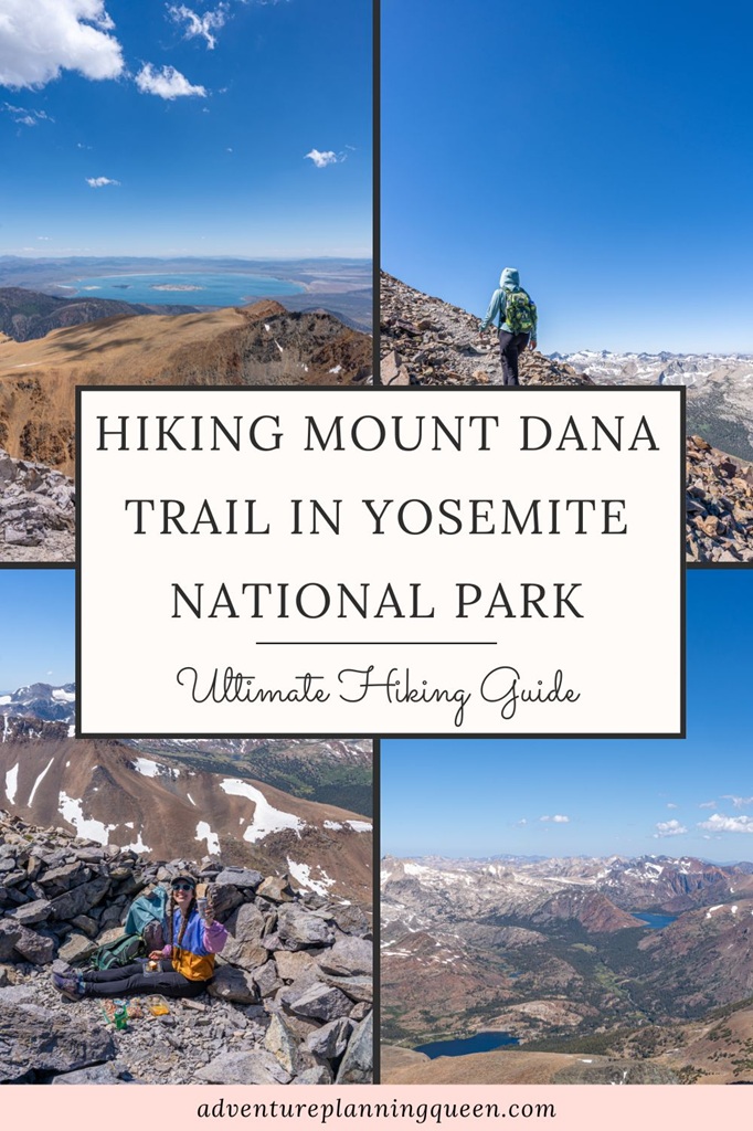
So you want to tackle the second tallest peak in Yosemite National Park, huh? Let’s make sure you are 110% prepared before setting out for your adventure! 💪
Sitting at 13,061 feet, just 61 feet shy of Mount Lyell (the tallest peak in Yosemite), Mount Dana towers over the Tioga Pass and offers the most breathtaking views.
Don’t underestimate this hike based on the mileage! To reach the summit it’s only about 3 miles (one-way), but it’s a steep climb almost the entire way up. 😮💨
And to make things a bit more challenging, the trail begins at nearly 10,000 in elevation. The high altitude can make walking on flat terrain feel more difficult, so try to acclimate as much as possible before attempting this hike.
That said, the challenge is so worth it. Once you reach the top, the 360-degree views will absolutely blow you away!
The route is steep, the air is thin, and the trail is rough and rocky but if you’re prepared for the altitude and elevation gain, you’re in for an epic adventure.
Read my blog post to learn more about hiking Mount Dana and how to successfully summit Yosemite’s second tallest peak! 🙌
Affiliate Disclaimer: Some links on this page may be affiliate links, meaning I may earn a small commission at no extra cost to you. As an Amazon Associate, I earn from qualifying purchases. Thanks for supporting the blog! 🫶
Mount Dana Trail Stats and Map
Mount Dana Trail Stats
Starting Point: Mount Dana Trailhead (next to the Tioga Pass Entrance)
Length: 6 miles roundtrip
Elevation Gain: 3,100 feet
Difficulty: Challenging
Hiking Time: 5 to 7 hours
Route Type: Out-and-back
Pet-friendly? No, pets are not allowed
Hike Features: Mount Dana summit (2nd highest peak in Yosemite) and jaw-dropping views
Mount Dana Trail Map
Yosemite Entrance Fee and Reservations
Entrance to Yosemite National Park costs $35 per vehicle for a 3-day pass. However, if you have the America the Beautiful Annual Pass, your entry is free!
For those who love exploring national parks, investing in the Annual Pass is a smart choice. At just $80, for U.S. residents, it grants you access to over 2,000 federal recreation sites across the country!
FEE UPDATES! Beginning January 1, 2026, non-U.S. residents (without an annual pass) will pay a $100 per person in addition to the standard entrance fee. The Annual Pass for non-US. residents will cost $250.
Reservations are not required at this time (updated January 12, 2026).
Mount Dana Trailhead and Parking
The Mount Dana Trailhead is conveniently located right at the Tioga Pass Entrance, directly across from the Gaylor Lakes parking area.
While the small lot at the trailhead is reserved for authorized vehicles only, hikers can park at the Gaylor Lakes lot and simply cross the road.
You can also find additional parking in the gravel pullouts just outside the entrance along Tioga Road.
✅ Tip: If you are planning to only hike Mount Dana, park in one of the gravel pullouts outside of Yosemite’s Tioga Pass Entrance. This way, you won’t need a reservation but keep in mind, you may still be required to pay the entrance fee. That said, if you arrive early enough in the morning, you can avoid paying the entrance fee!
Best Time to Hike Mount Dana in Yosemite
Aim for mid-July through mid-September for the best chance at a safe and doable summit to Mount Dana.
And no matter when you go, check weather and trail conditions before heading out! This hike is at serious elevation, and nature always gets the final say. 😉
🪻 Late June to Early July: If you plan to hike in early summer (late June/early July), check the trail conditions and be prepared!
Even when Tioga Road is open in late spring/early summer, snowfields often linger along the upper portion of the trail, making navigation tricky and conditions dangerous without proper gear and experience.
☀️ July to August: This is the prime season for hiking Mount Dana! The trail is usually free of snow (some may linger) and days are long and sunny.
Just be prepared with extra layers as the weather will still be cooler at high elevation. And make sure to start early to avoid afternoon thunderstorms and high UV exposure from the sun.
Don’t forget to stop and smell the flowers! Along the way, you’ll find corn lilies, giant larkspur, alpine columbine, and sky pilot.
⚠️ Always check the weather forecast before heading out.
🍂 September to Early October: Early fall can still offer excellent hiking conditions, such as cooler temperatures, fewer crowds, and crisp mountain air.
But by late October, weather can shift quickly. Snowstorms can move in with little warning, and the trail may start icing over, especially in the mornings.
If you’re hiking in fall, come prepared for cold temperatures, windy summit conditions, and earlier sunsets.
❄️ November to May: Mount Dana is completely inaccessible to most hikers in winter. Tioga Road closes after the first major snowfall, and the entire area becomes a snow-covered wilderness.
Winter ascents are possible for skilled mountaineers with winter experience, proper gear, and avalanche knowledge.
⚠️ There is a chance Tioga Road could be open in November or May (on rare occasions even in December). Check if the road is open or closed HERE.
❄️ Yosemite Winter Guides
- Ultimate Guide to Visiting Yosemite in Winter
- The Only Yosemite Winter Itinerary You Need!
- Where to Stay in Yosemite in Winter: 15+ Best Lodges, Hotels, and Cozy Cabins
- The Ultimate Yosemite Winter Packing List
- 20 Best Yosemite Hikes in Winter (Guide to Snowy Adventures)
- 18 Best Yosemite Winter Activities You Can’t Miss!
- Yosemite Firefall: A Complete First-Timer’s Guide
- Beginner’s Guide to Visiting Mariposa Grove in Winter
Hiking Mount Dana: Step-by-Step Directions
This hike starts next to Yosemite’s Tioga Pass Entrance. Look for a small trail tucked behind a paved lot marked for authorized vehicles – this is where your adventure begins.
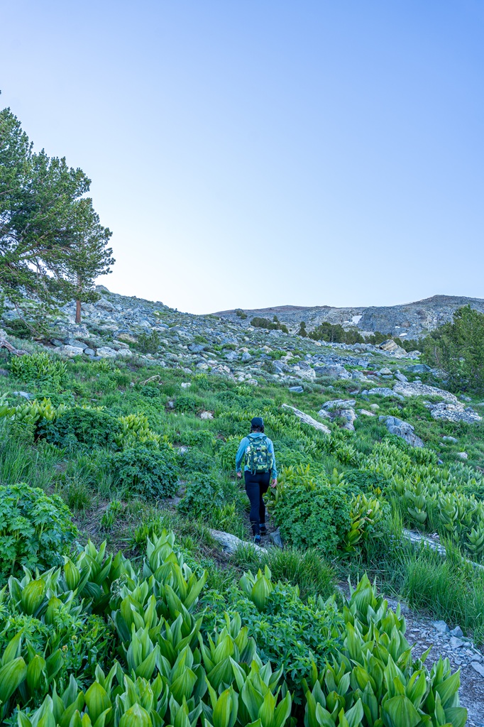
The trail starts off nice and easy, staying relatively flat for the first half mile as it winds past a few peaceful alpine lakes and meadows.
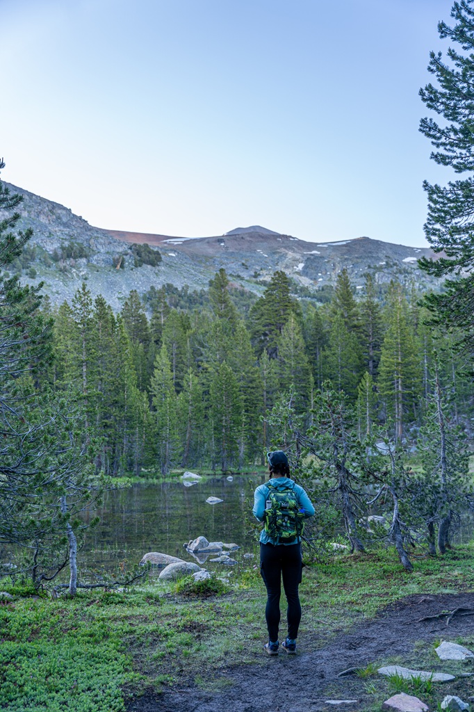
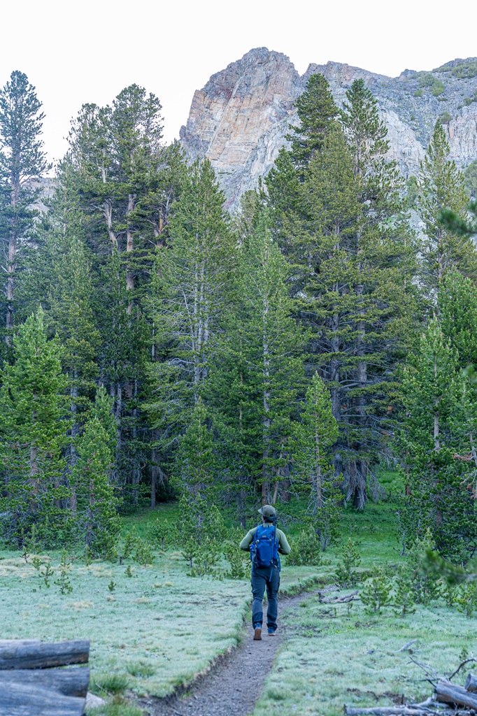
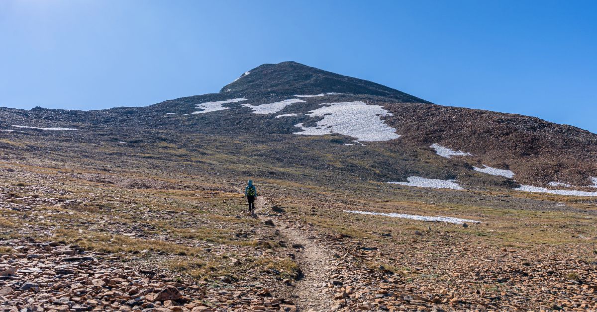
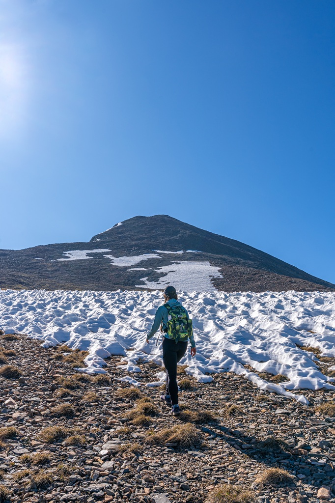
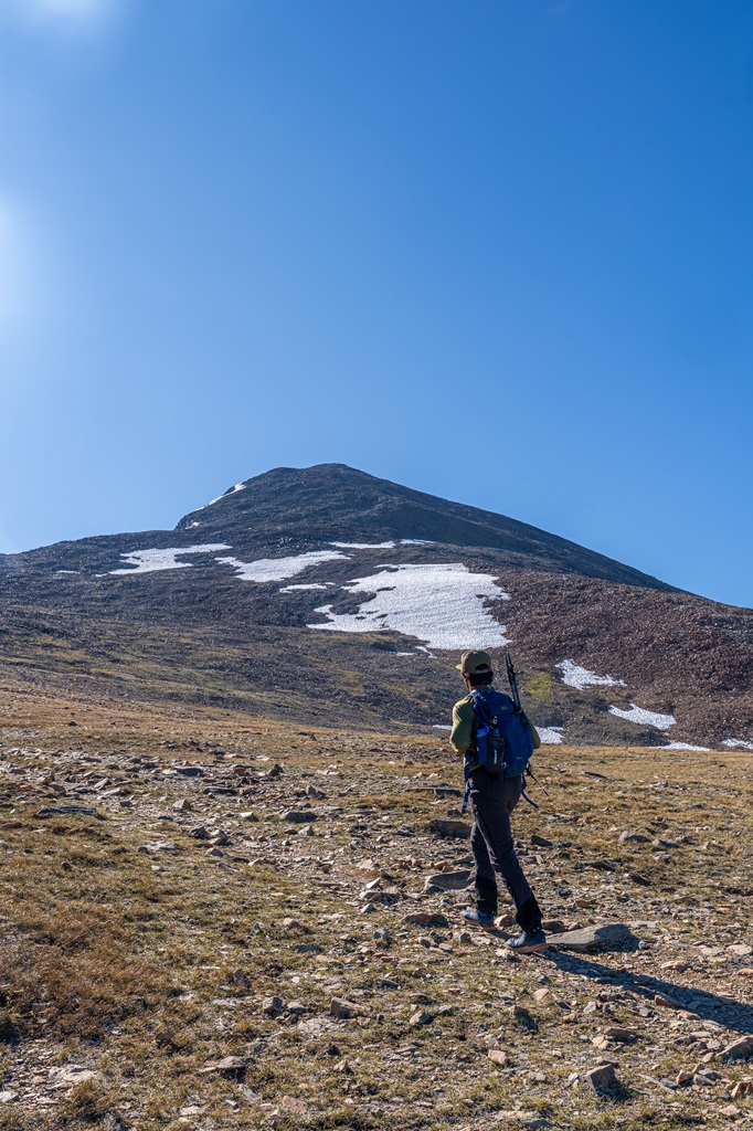
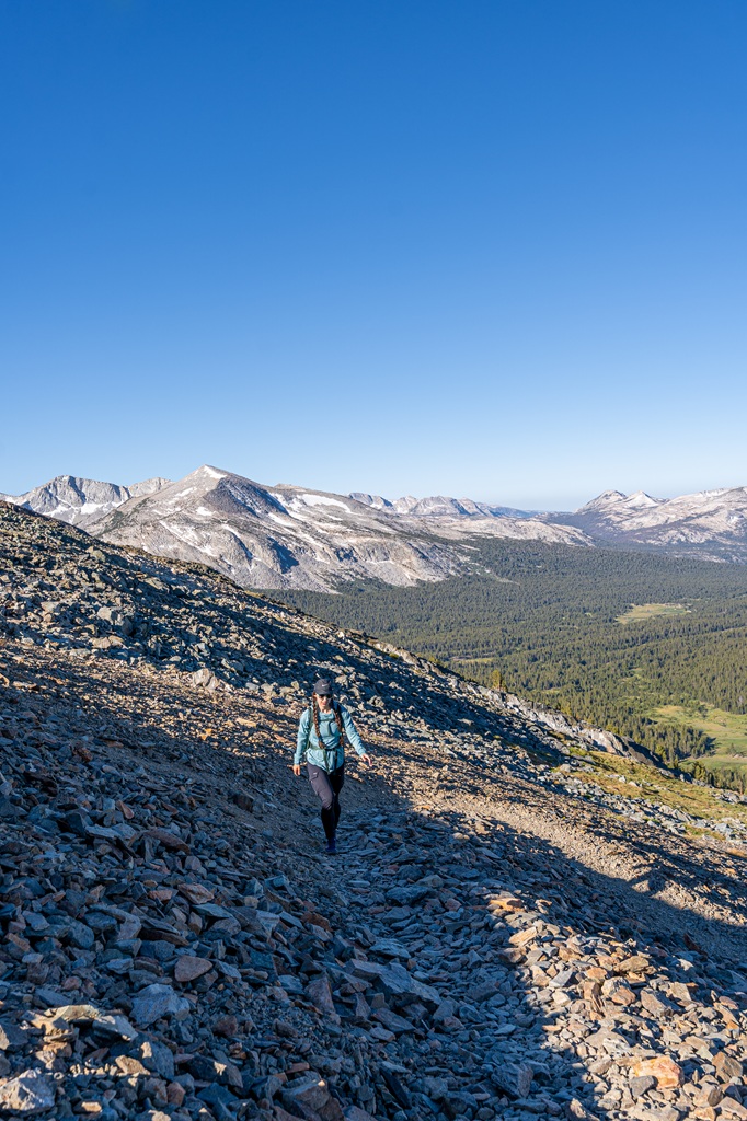
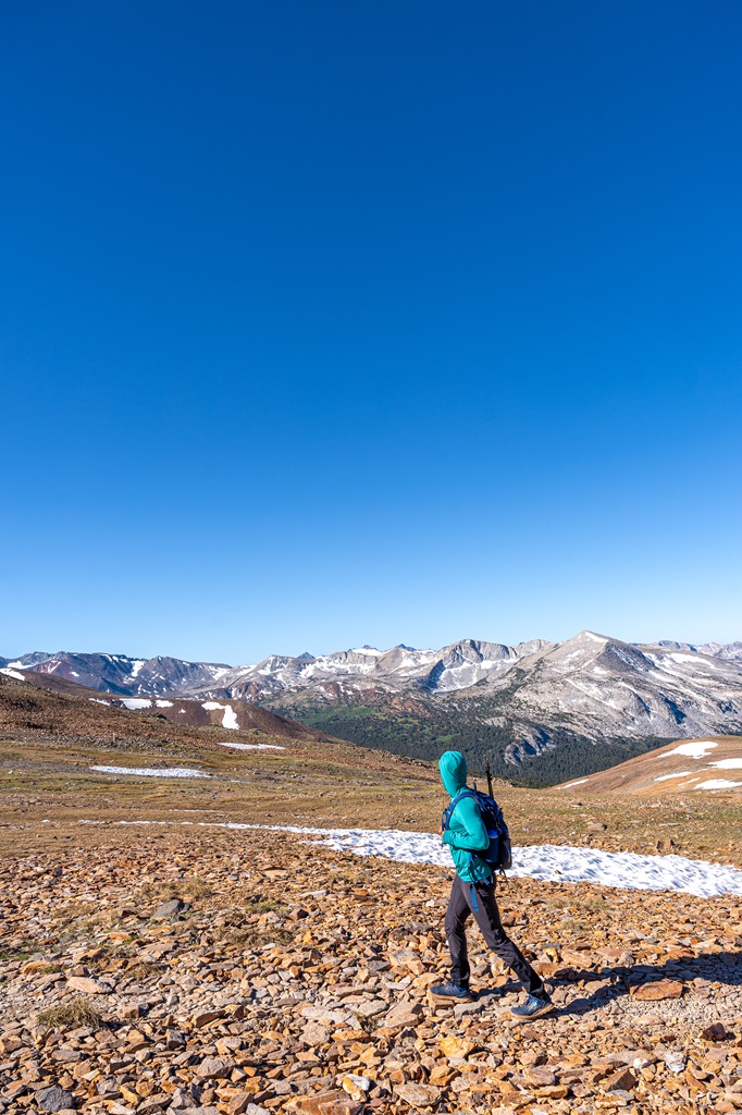
After about 0.5 miles, the climb towards Mount Dana begins and it doesn’t let up much. From here on, it’s a steady and steep ascent, fully exposed to the sun as you rise above the tree line.
✅ Tip: Make sure you’re prepared with sun protection, water, snacks, and extra layers!
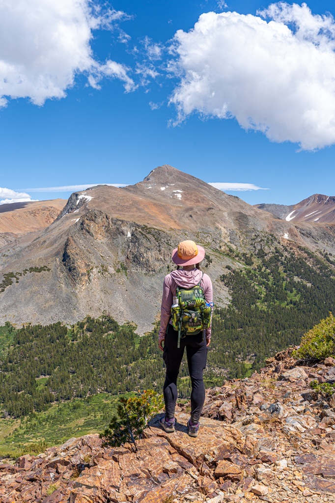
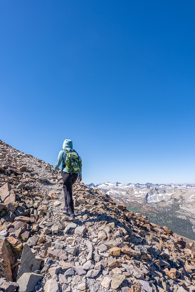
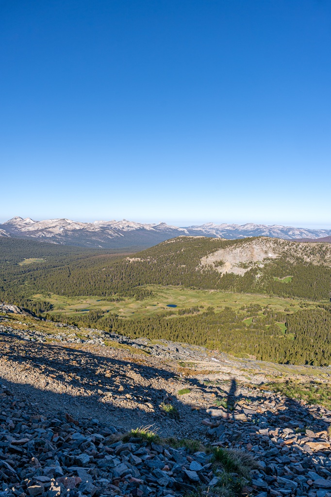
The views on the way up are absolutely stunning. My husband and I took frequent breaks, partly to help prevent altitude sickness and partly just to soak in the scenery. You’ll want to do the same!
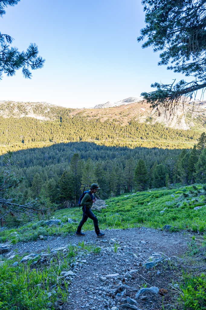

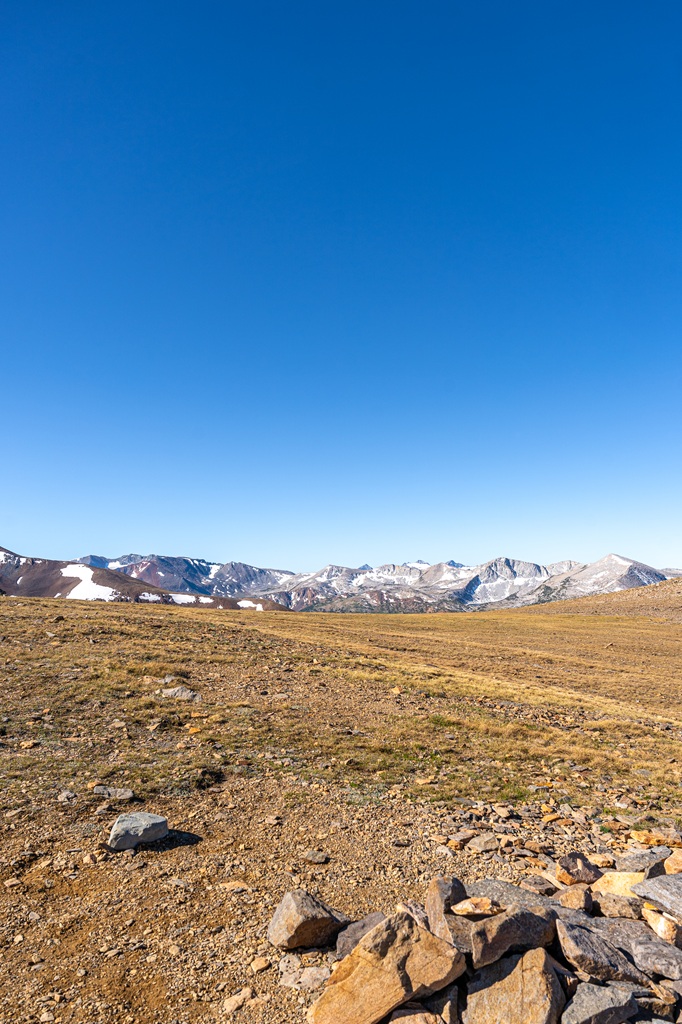
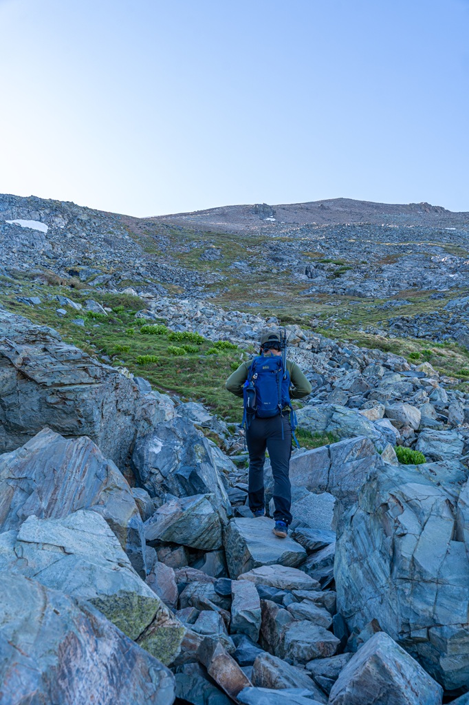
As you gain elevation, the trail grows rockier and the terrain becomes more alpine. You’ll find hardy shrubs, jagged outcrops, and even sky pilots blooming in the summer.
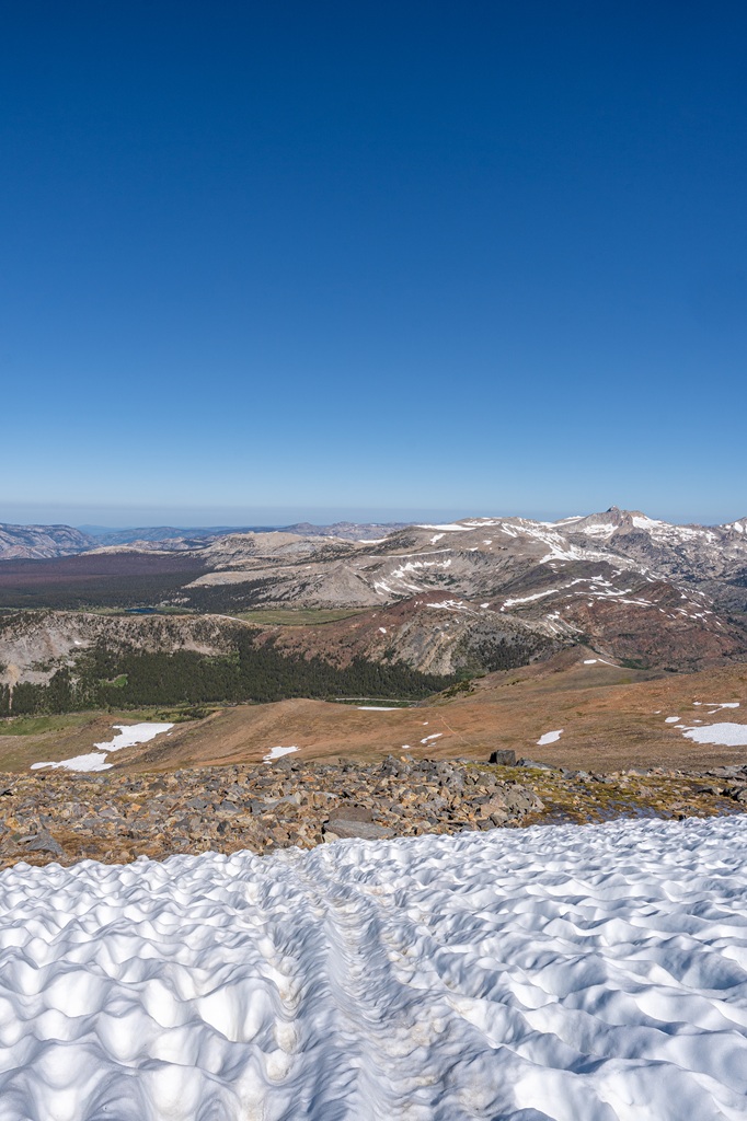
Snowfields can linger into mid to late summer too. In most cases, they’re easy to walk across or go around, but if you’re hiking in late spring or early summer, an ice axe and microspikes/crampons might be necessary depending on snowpack.
✅ Another Tip: Always check trail conditions before heading out!
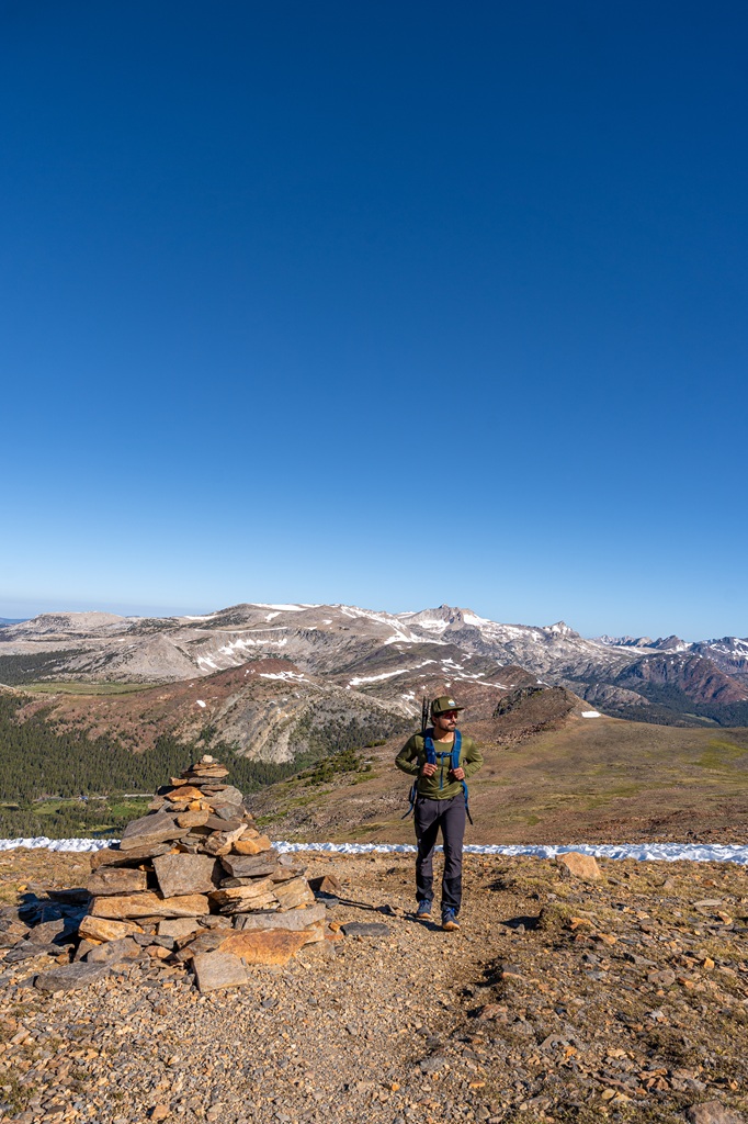
Around the 1.8-mile mark, the trail flattens briefly. This is a perfect spot to catch your breath before the final push.
The real challenge kicks in around mile 2, where you’ll gain roughly 1,000 feet of elevation in less than a mile. This section involves navigating over large rocks and loose scree, so hiking poles can be a huge help.
The trail can be tough to follow in places so keep an eye out for cairns and use your offline maps to guide you.
Take your time here. It’s steep, and the high elevation can hit hard. Stay hydrated and fuel up with your favorite trail snacks!
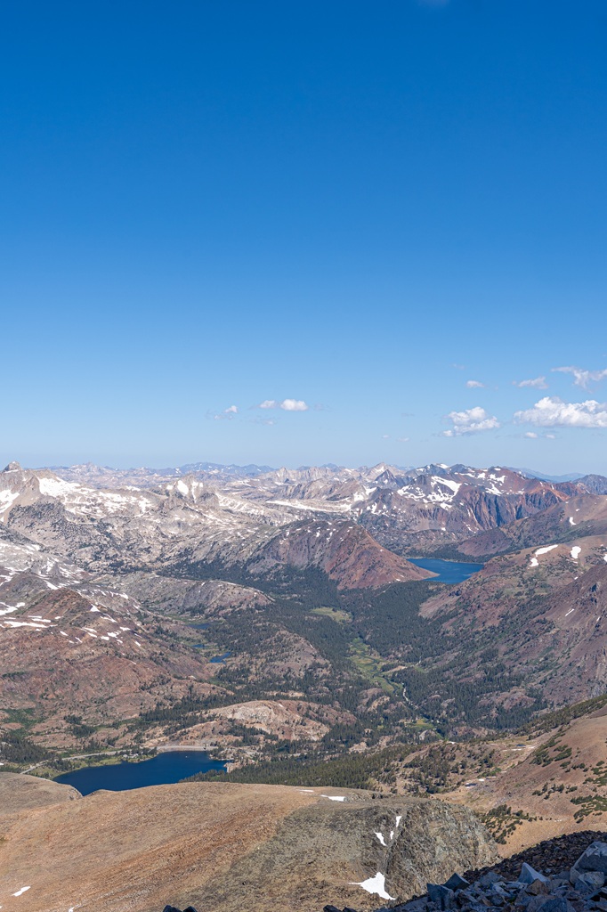
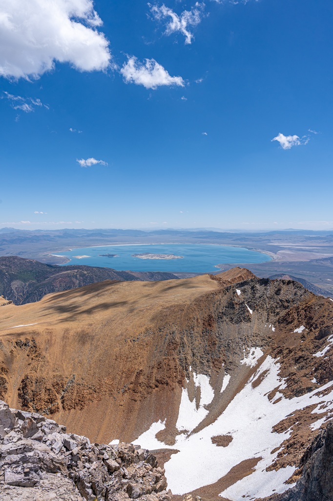
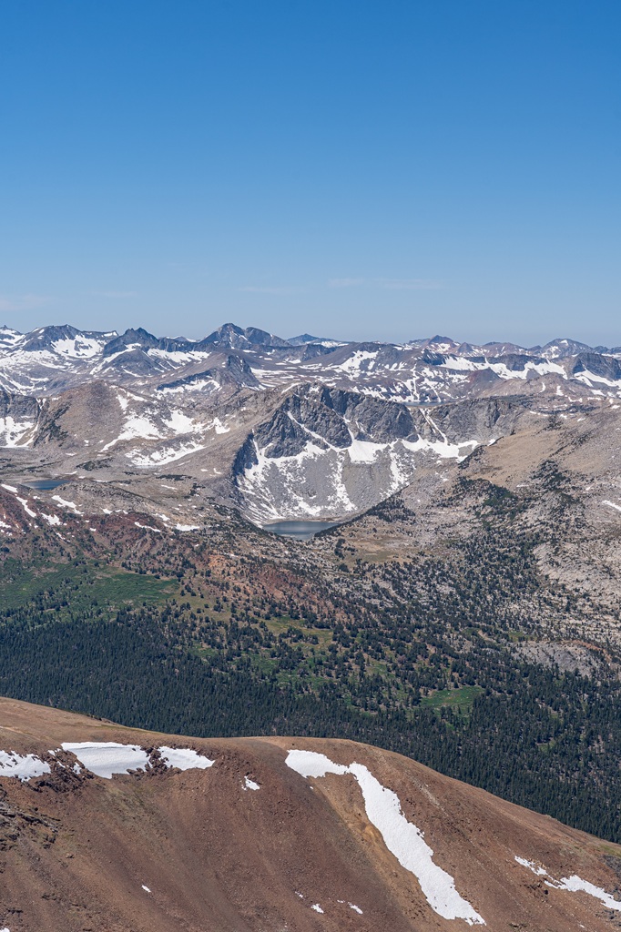
The summit of Mount Dana sits at 13,061 feet, and the views are absolutely unreal. Thanks to the mountain’s prominence, you’ll see Mono Lake, Highway 395, tall peaks and hidden alpine lakes in Yosemite, and more incredible Eastern Sierra scenery.
On the way down, hiking poles will come in handy again. The descent can be slippery with all the loose rocks, so take it slow and steady.
Congrats, you did it! 🥳
Or even if you didn’t quite make it all the way to the top, it’s still an incredible achievement to get as far as you did! 😎
🥾 Explore more of Tuolumne Meadows and Tioga Pass with these hikes!
- Clouds Rest from Sunrise Lakes Trailhead (14.5 miles, challenging)
- Cathedral Lakes (9.5-12 miles, challenging)
- Lembert Dome and Dog Lake (2-4 miles, moderate to challenging)
- May Lake and Mount Hoffmann (2.5-6 miles, moderate to challenging)
- Mono Pass Trail (8 miles, moderate)
- Gaylor Lakes (2.5-4.5 miles, challenging)
- Mount Dana Trail (6 miles, challenging)
Tips for Hiking Mount Dana Trail
1. Pack Plenty of Water and Snacks: This is a strenuous hike, so make sure you have plenty of snacks to fuel up as well as water. There are water sources from the lakes at the beginning of the trail but no reliable sources after that.
As the snow melts, you may find small run-off streams. Always carry a filtration or treatment system!
2. Check the Weather Forecast: Mount Dana Trail goes above the tree line making it dangerous in bad weather. If thunderstorms are in the forecast, postpone your hike for another day.
3. Download Offline Maps: Following the Mount Dana Trail isn’t too difficult but near the summit it can be tricky to stay on the trail. Having offline maps downloaded on your phone is very helpful for navigating.
4. Start Early: Begin this hike early to enjoy cooler temperatures and avoid the risk of surprise afternoon thunderstorms.
5. Acclimate to the Elevation: At over 13,000 feet, Mount Dana’s high elevation can make the hike significantly more challenging than similar distances at lower altitudes. Take time to acclimate if you’re not used to hiking between 10,000 to 13,000 feet.
Altitude sickness is a serious risk, and there have been instances where hikers needed evacuation due to severe symptoms. Pay attention to your body, stay hydrated, and take breaks as needed.
6. Be Bear Aware: Black bears are active within Yosemite. Follow these guidelines to avoid any negative interactions with a black bear.
🐻 Note: bear spray is prohibited in Yosemite!
7. Respect Nature: Follow Leave No Trace principles – plan ahead, pack out all trash, avoid disturbing wildlife, be considerate of others, and respect the natural beauty of Yosemite National Park.
What to Bring to Yosemite
🎟️ Entrance Pass – You will need to purchase an entrance pass once you reach the entrance station or you can buy the America the Beautiful Pass ahead of time and use that for the entire year.
📆 Reservation – Depending on when you plan to visit Yosemite, you may need a reservation.
👚 Layers of Clothing (top) – Pack a moisture-wicking base layer, a fleece mid-layer, an insulated jacket, and an outer shell to protect you from the elements, such as rain and wind. You may not need all these layers, especially in the summer months, but it’s always best to be over-prepared!
Check out my favorite tops 👇
- Base layer: REI Co-op Sahara Shade Hoodie (warm/mild conditions) and REI Co-op Midweight Long-Sleeve Base Layer (cooler conditions)
- Fleece mid layer: Cotopaxi Teca Fleece Full-Zip Jacket
- Down mid layer: Cotopaxi Fuego Hooded Down Jacket
- Outer shell: In the summer I always pack a light windbreaker, such as the Cotopaxi Teca Crop Windbreaker or the RevolutionRace Unit Light Windbreaker. Make sure to also pack a waterproof rain jacket – I like the Patagonia Torrentshell 3L Jacket.
🩳 Hiking Shorts or Pants – Pack a comfortable, durable, and stretchy pair of hiking shorts or pants. Also think about what conditions you might run into, such as warm or cold temperatures, wind and/or rain, bugs, and overgrown trails.
Check out my favorite hiking bottoms 👇
- Cotopaxi Losdos Zip-Off Pants
- RevolutionRace Breezy Ankle Outdoor Pants
- Baleaf Fleece-Lined Jogger Pants
- RevolutionRace Summit Pocket Tights
- Revolution Race Hike & Dive Shorts
🥾 Hiking Footwear – Bring a good pair of hiking boots or shoes with good traction. If I’m not expecting to hike in too much mud or snow, my go-to hiking shoes are the Altra Lone Peak trail runners. They have a wide-toe box, 0 mm heel-to-toe drop, and MaxTrac rubber outsole. Plus, they’re lightweight and so comfy!
🧦 Socks – Moisture-wicking, quick-drying socks are the way to go. My favorite pair of hiking socks are Darn Tough Hiker Micro Crew Cushion Socks. Always pack an extra pair!
🎒 Day Pack – What you plan to do (sightseeing, hiking, etc.), determines what size pack you’ll need. Here is what I typically bring based on what I’m doing that day 👇
- Short walks and sightseeing: Cotopaxi Kapai 1.5L Del Dia Hip Pack
- Short, easy to moderate day hikes: REI Co-op Flash 22L Pack
- Long, moderate to challenging day hikes: REI Co-op Trail 25L Pack or Cotopaxi Luzon Del Dia 24L Pack
🥢 Trekking Poles – Essential for stability, balance, and support when hiking trails, especially on tough, rocky, and uneven terrain. I use REI Co-op Trailmade Trekking Poles and love them!
❄️ Microspikes – Bring a pair of microspikes if you’re visiting in the winter and you’re planning to hike along icy trails. They will give you good traction to avoid slipping! I use Black Diamond Access Spike Traction Device.
🦟 Mosquito/Bug Repellants – In the warmer months, be prepared for annoying gnats, mosquitoes, and flies. Wear long-sleeve clothing, a head net, and use bug spray.
🧤 Extra Warm Layers – If you expect cooler conditions or hiking to higher elevations, make sure to pack extra layers for added warmth, such as gloves, beanie, neck gaiter, and a light jacket.
🗺️ Navigation – Carry a physical topographic map, compass, a satellite messenger (or personal locator beacon), and download offline maps to help you stay on course, find your way in unfamiliar terrain, and call for help if needed.
🔦 Headlamp/Flashlight – A reliable light source with extra batteries, in case you end up hiking in the dark or need it for emergency situations.
💧 Water – Water bottles to carry sufficient water to stay hydrated, along with a filtration system or purification tablets if you plan to refill from natural sources.
🍕 Food – Energy-rich snacks or meals to keep your energy levels up during the hike.
😎 Sun Protection – Sunscreen, sunglasses, and a sunhat to protect yourself from harmful UV rays, even when it’s cloudy. Also, polarized sunglasses are important when it’s bright outside and to reduce glare from reflective surfaces like water, snow, and roads.
🩹 First-Aid Kit – A basic first-aid kit with items like bandages, antiseptic, pain relievers, and any personal medications you may need.
🥶 Emergency Shelter – Pack an emergency bivy sack or space blanket for shelter in case of sudden weather changes.
🔥 Fire – A lighter, matches, or fire starter to help you build a fire for warmth or signaling in case of emergency. Along with matches, I also carry a multi-tool carabiner that has a fire starter, utility blade, screwdriver, and bottle opener.
🗡️ Multi-Tool and Repair Kit – A versatile tool/knife and repair kit to handle any task, from preparing food to making repairs.
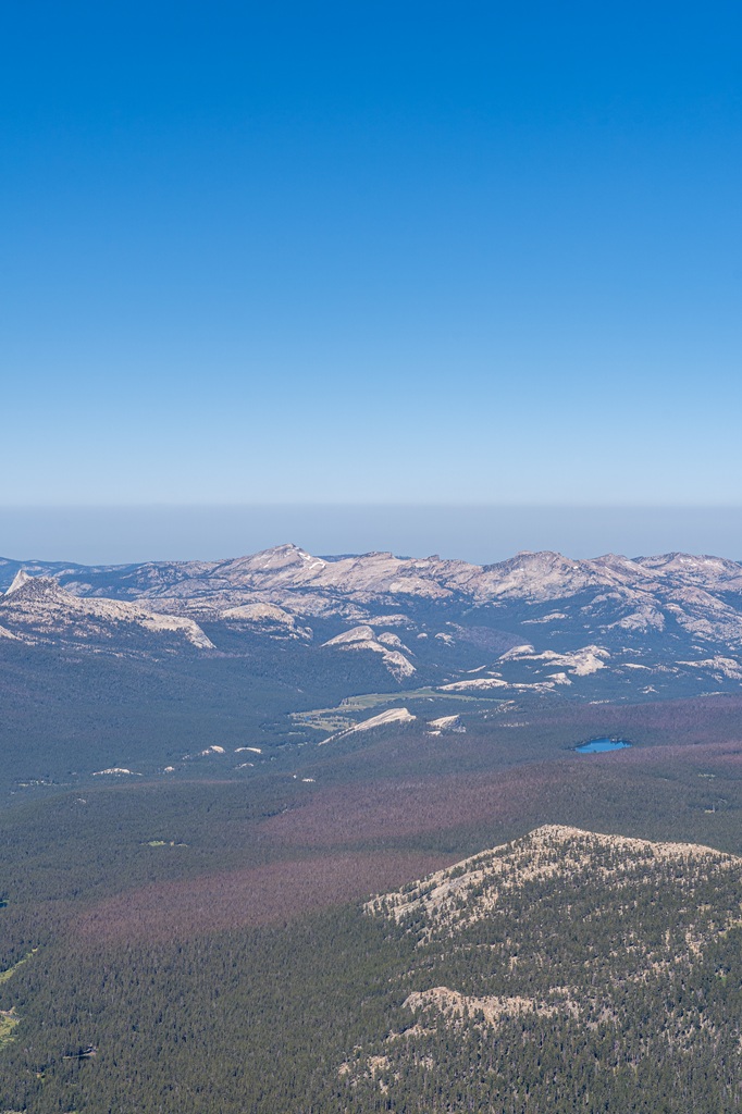
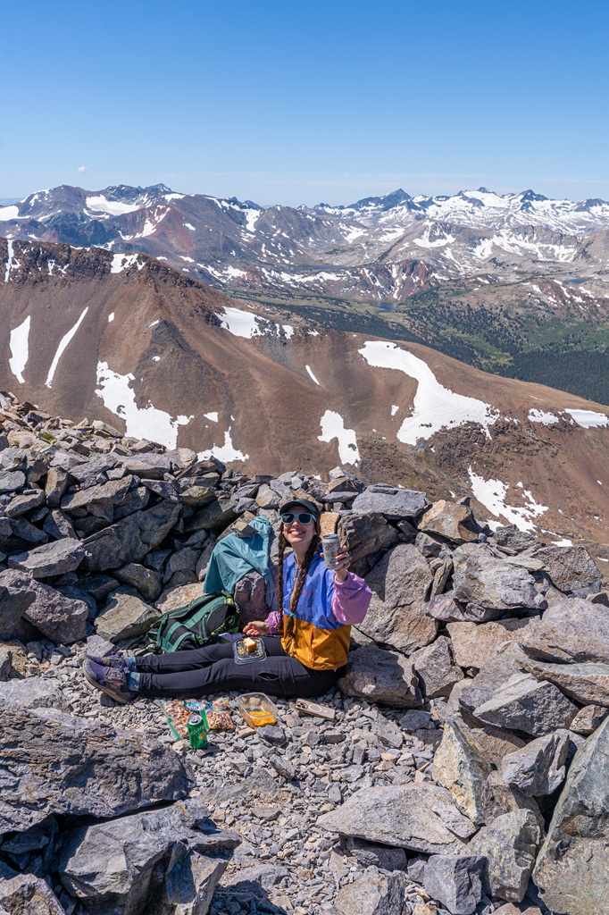
More Mount Dana Photos
Conclusion
Mount Dana might be just 6 miles roundtrip, but it packs a serious punch. With steep, rocky terrain and high elevation from start to finish, this hike is no joke!
But it’s also incredibly rewarding. 😍
If you’re prepared for the altitude and the climb, the 360° summit views will absolutely blow you away. See for yourself why it’s one of my favorite hikes in Yosemite National Park!
If this guide inspires you to hike Mount Dana, I’d love to hear about your adventure.
Leave a comment and share your experience!
🤩 Yosemite Trip Planning Resources
- 1-Day Yosemite Itinerary for First-Time Visitors
- Where to Stay Outside of Yosemite (best places in 2026)
- 13 Best Hikes in Yosemite Valley You Can’t Miss!
- Best Spots to Find Giant Sequoia Trees in Yosemite
- 10 Must-Do Easy Hikes in Yosemite for All Skill Levels
- Hetch Hetchy Hikes: Explore This Hidden Gem
- Best Yosemite Waterfall Hikes: Complete Guide
- Ultimate Guide to Visiting Yosemite in May
- Is Tioga Pass Open? Plan an Epic Trip with This Guide
- 12 Best Tioga Pass Hikes for Adventure Lovers
Enjoyed this post? Pin for later!