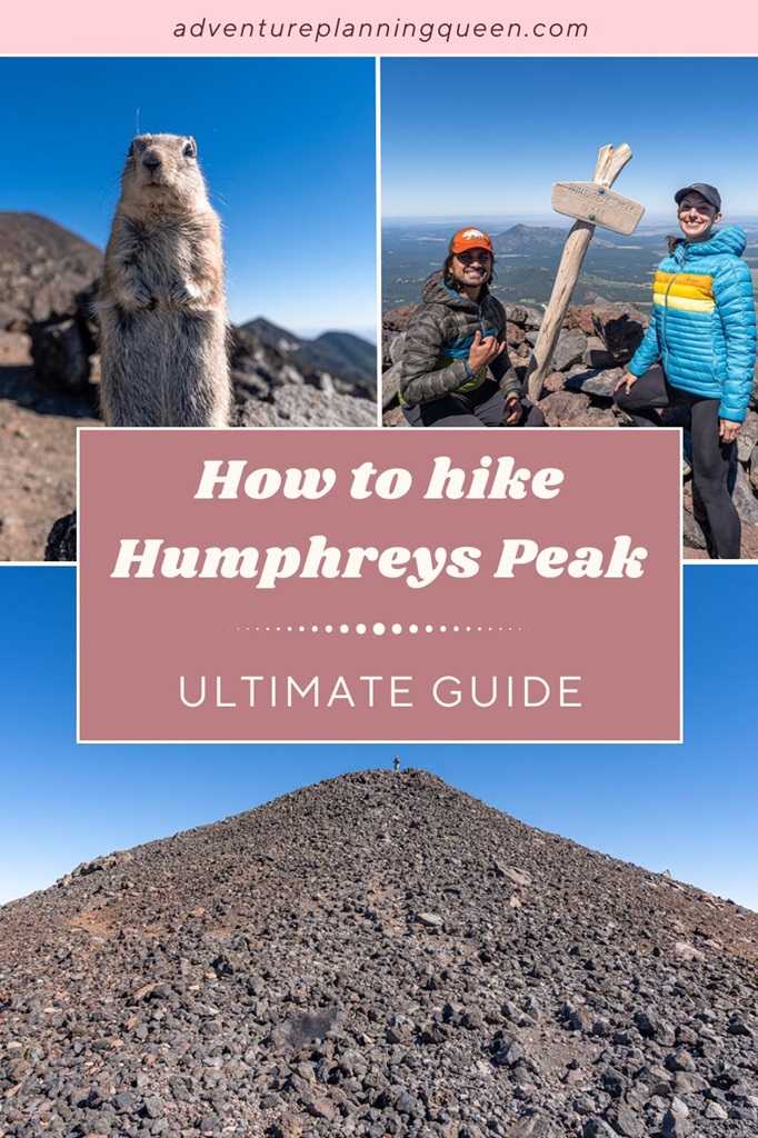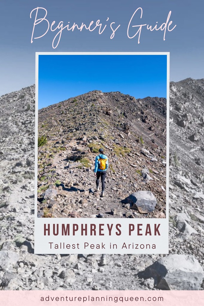
Humphreys Peak, standing at 12,633 feet, is Arizona’s highest peak and offers an unforgettable hiking experience. ⛰️🤩
The journey along Humphreys Peak Trail is a scenic adventure, winding through a beautiful meadow, stunning forests, and a dramatic rocky ridgeline.
Upon reaching the summit, you’re rewarded with breathtaking 360-degree views, where, on clear days, you can see the iconic Grand Canyon, the stunning Painted Desert, and the unique formation of Sunset Crater.
While this hike isn’t technical, thanks to a (somewhat) well-marked trail, there are elements that make this trek challenging, such as the altitude and rocky terrain.
If you plan to tackle the Humphreys Peak hike, be sure to do your research. Read through this complete guide to help you prepare! 🙌
Affiliate Disclaimer: Some links on this page may be affiliate links, meaning I may earn a small commission at no extra cost to you. As an Amazon Associate, I earn from qualifying purchases. Thanks for supporting the blog! 🫶
Humphreys Peak Hike: Trail Stats and Map
Humphreys Peak is part of the San Francisco Peaks – the remnants of a massive stratovolcano that once soared nearly 16,000 to 20,000 feet high, dominating the Colorado Plateau.
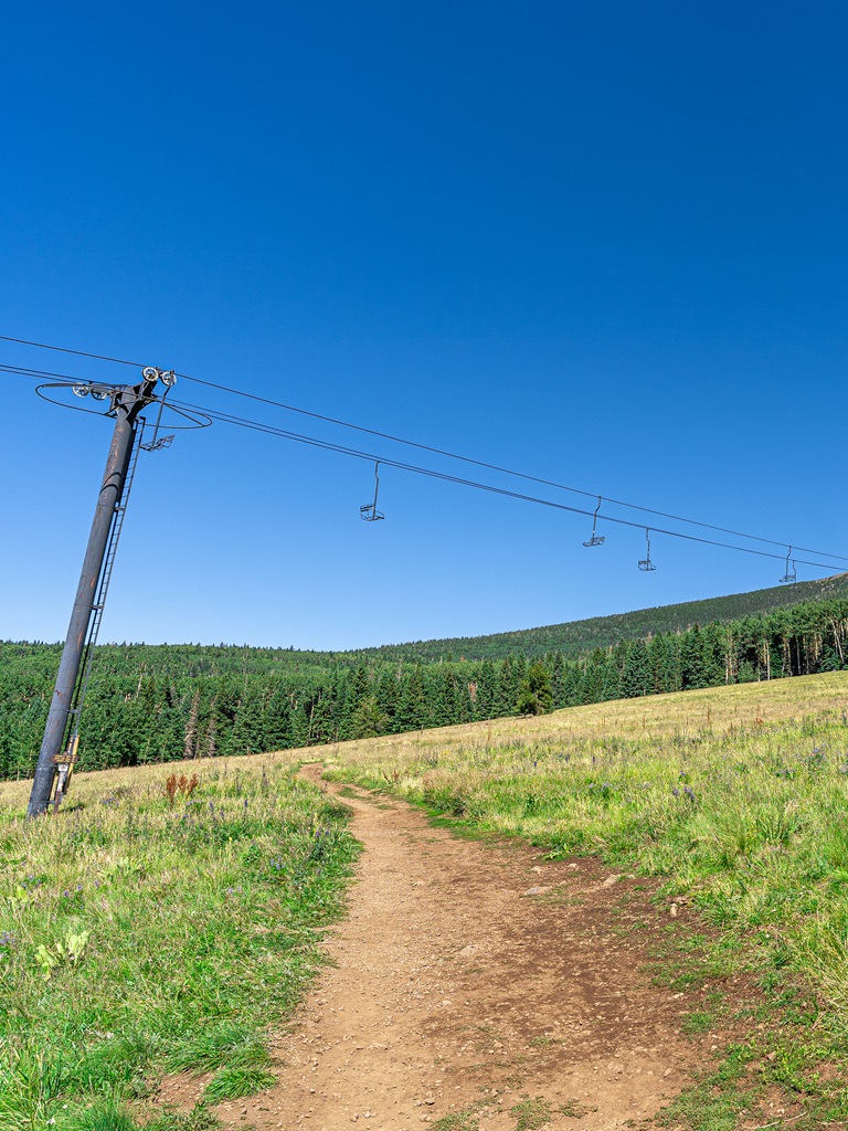
The trail begins at the Arizona Snowbowl, the state’s premier ski resort, and winds up the west side of the San Francisco Peaks through a series of challenging switchbacks.
Hikers will experience a remarkable elevation gain of about 3,350 feet, traversing diverse ecological zones, including Arizona’s only alpine tundra region.
Humphreys Peak Trail Stats
Starting Point: Humphreys Peak Trailhead
Length: 11 miles roundtrip
Elevation Gain: 3,350 feet
Difficulty: Challenging
Hiking Time: 5 to 7 hours
Route Type: Out-and-back
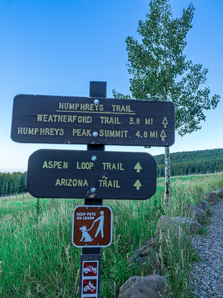
Pet-friendly? Yes, must be on leash
Hike Features: View of Inner Basin from the saddle, rocky ridgeline, and Humphreys Peak summit with stunning views
Humphreys Peak Trail Map
Sacred Land
The San Francisco Peaks, revered as sacred by the Hopi, Navajo, Havasupai, Apache, and other Indigenous tribes, hold profound spiritual significance.
These majestic mountains are deeply intertwined with cultural beliefs surrounding emergence, deities, and ancestors, symbolizing the life-giving moisture essential for sustenance.
This mountain range is not only a source of inspiration and reverence; it continues to play a vital role in the ceremonial practices and traditions of these communities, serving as a living testament to their enduring connection to the land.
When you visit this area, please be respectful of the Native American tribes and their land.
Humphreys Peak Trailhead and Parking
The Humphreys Peak Trailhead is located at the Arizona Snowbowl in the Hart Prairie Lot.
The parking area is huge and there are bathroom facilities.
We drove from Flagstaff which was about a 30-minutes’ drive.
If you are also driving from Flagstaff, head north on US 180 for about 7 miles then turn onto the Snowbowl Road. Continue on this road until you reach the lower parking lot (Hart Prairie Lot) of Arizona Snowbowl ski resort.
✨ Planning a trip to Sedona? Read this 👉 Best Hikes in Sedona, Arizona
Best Time to Hike Humphreys Peak
Humphreys Peak offers stunning hiking opportunities throughout the year, but the best times to tackle this ascent are from late spring to early fall.
Late May to June and mid-September to early November are ideal windows, providing a balance between manageable weather and beautiful scenery.
Fall, particularly in early October, is especially popular for hikers who want to witness the vibrant aspen groves in their autumn glory. Just keep in mind that mountain weather can change rapidly, so preparation is key.
Hiking in June is a fantastic option as the trails may still have some snow but are generally warm and pleasant before the summer monsoon season sets in.
However, from July to September, be prepared for afternoon storms – starting your hike early is essential to avoid getting caught above tree line during inclement weather.
⚠️ Regardless of the season, always check weather forecasts and forest alerts before heading out.
For winter adventurers, proper gear is crucial.
Microspikes, ice axe, proper clothing, and other winter gear are necessary to navigate the snowy, cold, and windy conditions.
Also, be mindful of potential avalanche dangers following heavy snowfall!
⚠️ Staying informed through resources like the Kachina Peaks Avalanche Center and Coconino National Forest’s website.
Humphreys Peak Trail Directions
Trailhead / Arizona Snowbowl (9,300 feet)
The trail begins at an elevation of approximately 9,300 feet, starting from the Arizona Snowbowl.
Park your car in the Hart Prairie Lot and make your way across the ski run.
In the summer, the ski run is a large meadow filled with beautiful wildflowers.
Stay to the right to stay on Humphreys Trail, guiding you straight into an enchanting wooded area ahead.
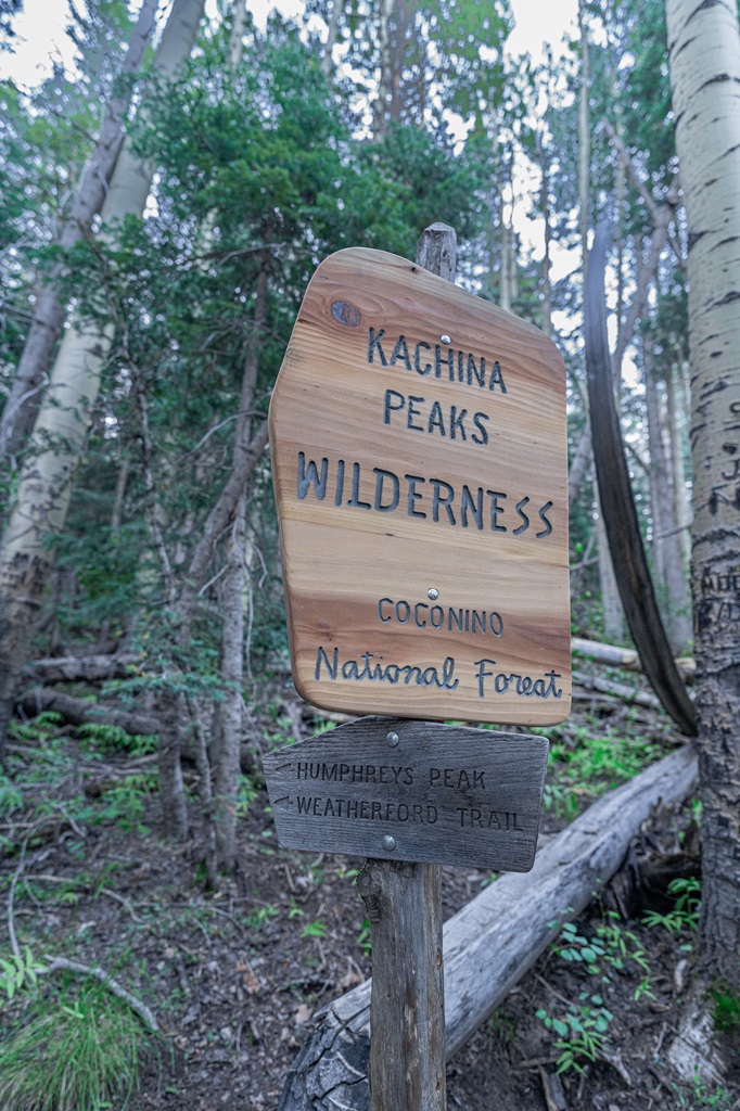
Kachina Peaks Wilderness
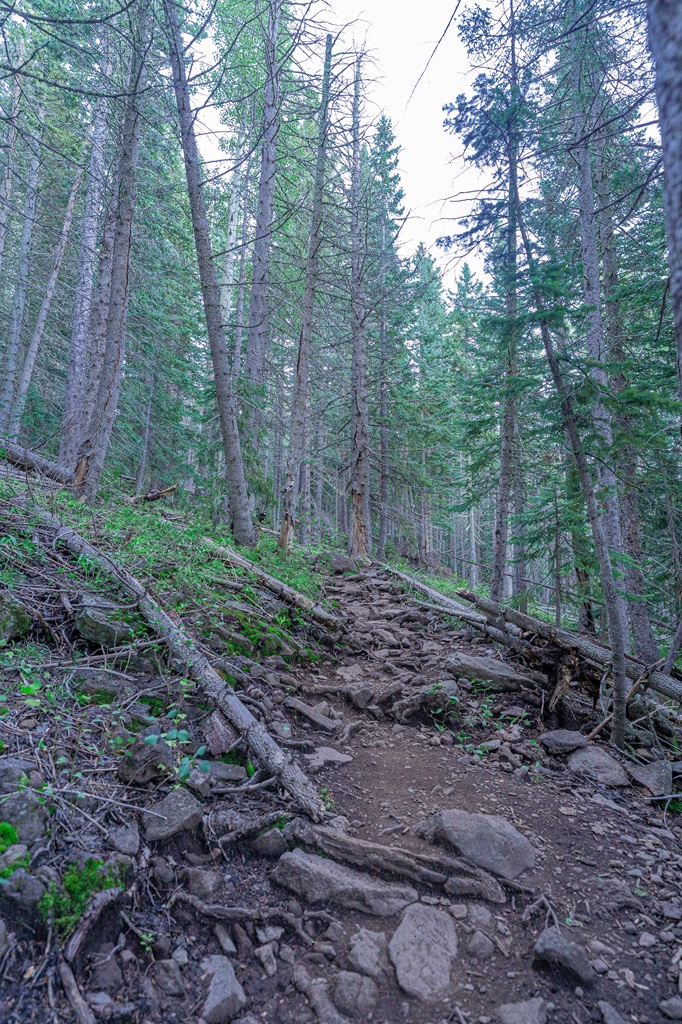
Humphreys Trail enters into a forest, leading you through gentle switchbacks within a mixed conifer landscape. Before long, you’ll cross into the Kachina Peaks Wilderness.
The Hopi Tribe believes the San Francisco Peaks are home of the Kachinas – gods and deities from Hopi mythology.
These peaks hold sacred significance for the Hopi tribe and many other Native American tribes in Arizona.
As you explore this beautiful area, please respect its cultural heritage and avoid disturbing any artifacts you may encounter.
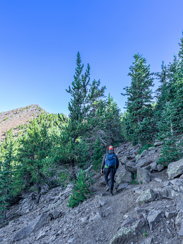
As you continue, the trail transitions into a series of long, steep switchbacks.
Here, you’ll travel between a talus-covered slope to the north and a deep, glacial-carved valley to the south.
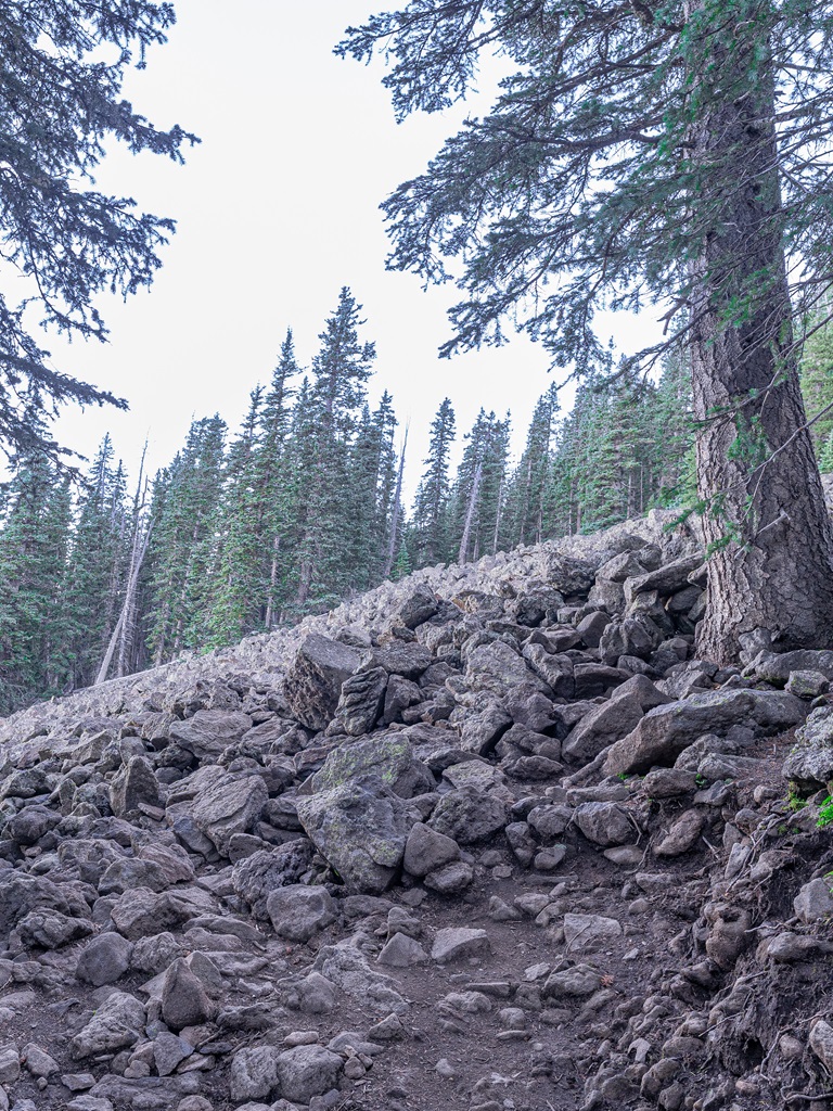
For the most part, the first three to four miles of the trail are shaded by tall trees. There are a few openings along the way that offer tantalizing glimpses of the stunning vistas to come.
This section may feel like the longest, as the thick forest cover can obscure the view.
However, the switchbacks eventually lead you east into the expansive glacial valley, where the scenery truly begins to unfold.
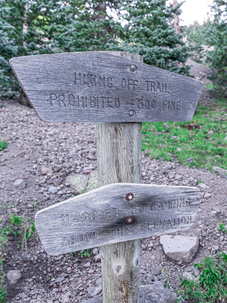
Alpine Transition Zone (11,400 feet)
At about 11,400 feet, you enter the alpine transition zone, where the thick conifer forest gives way to hardy high-elevation flora.
With the tall trees behind you, breathtaking views unfold, but be ready for stronger winds, as the terrain creates a wind funnel.
Hope you brought extra layers with you, particularly a windbreaker!
As you near the saddle between Humphreys Peak and Agassiz Peak, the trail steepens and can become less distinct.
Stay alert to avoid veering off course, but don’t worry, the path is well-marked with signs and trail markers to guide your way.
The Saddle (11,800 feet)
Upon reaching the saddle, you’re greeted by sweeping views in every direction.
To the east, you can gaze down into the Inner Basin – a vast, glacially carved valley nestled among the peaks.
The trail diverges at the saddle where one path leads right to the Weatherford Trail, while the other continues left toward the summit of Humphreys Peak.
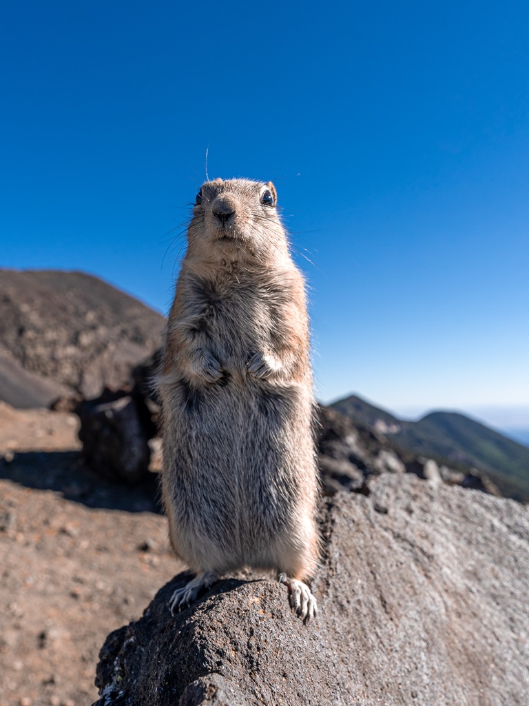
This is an ideal spot to take a much-needed break. The views from here are stunning!
Make sure to keep your snacks close as cute little rodents (not sure what kind they are) like to steal your food.
Also, never feed wildlife! It’s really not good for them.
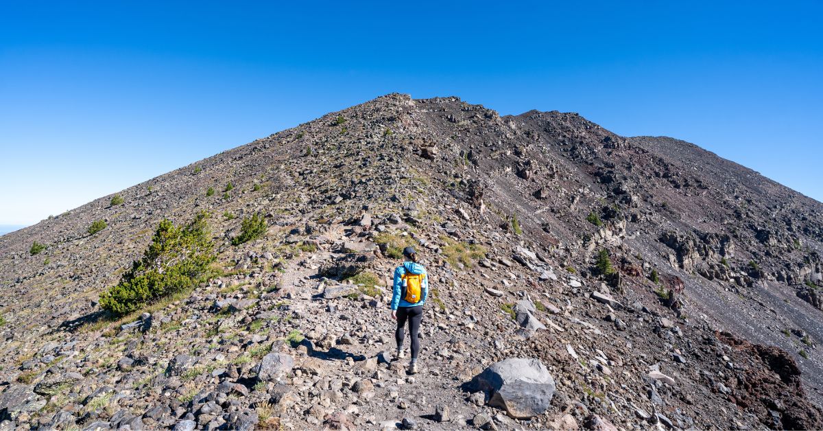
Rocky Ridgeline / False Summits
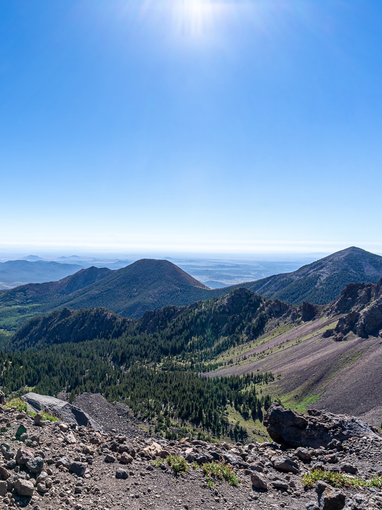
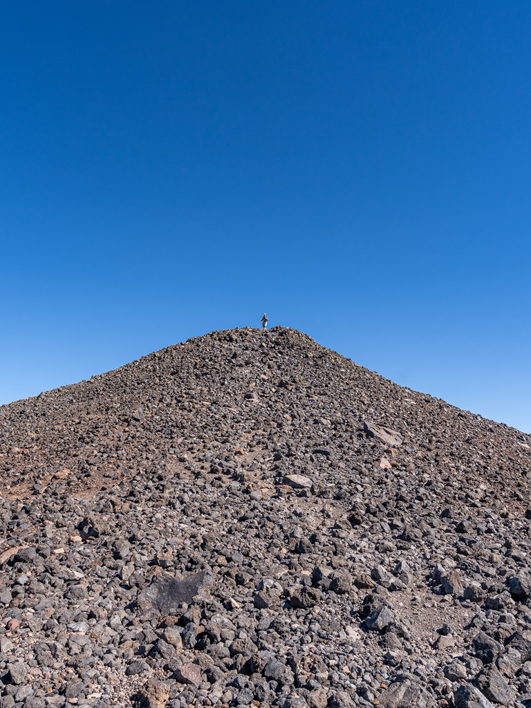
With just one more mile to go, you’ll traverse a rocky field along the ridge toward the summit.
The views beyond the Inner Basin are breathtaking, showcasing recognizable landmarks like Sunset Crater and the vibrant red cliffs of the Painted Desert.
As you head north, the path to the summit becomes less defined, resembling more of a light scramble across a talus field than a traditional trail.
Keep an eye out for wooden signposts that mark your way every few hundred yards.
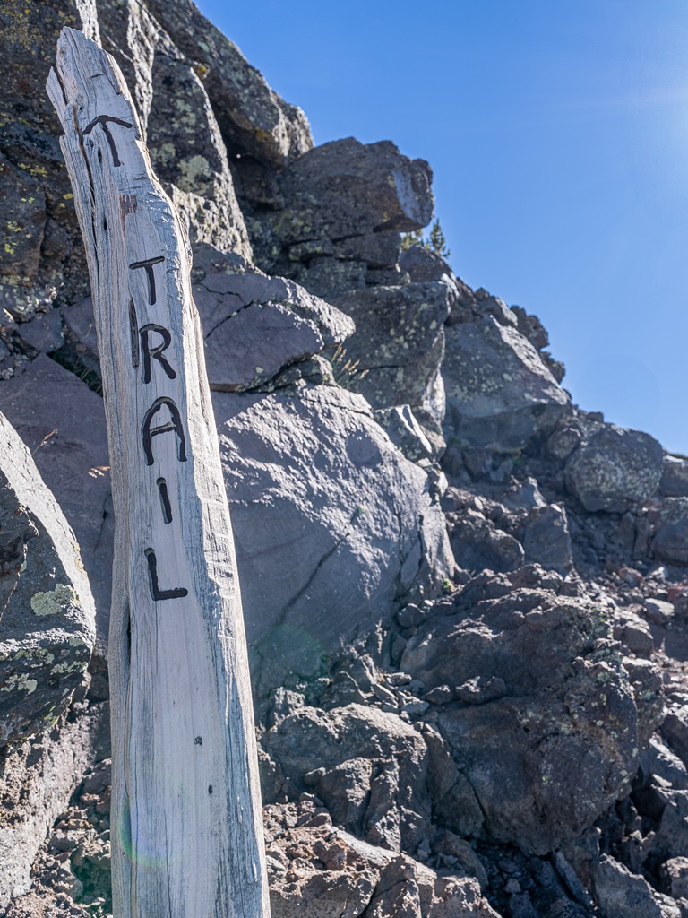
The trail ascends three false summits before leading you to the true summit.
Each step brings you closer to the breathtaking pinnacle of your journey!
Humphreys Peak Summit (12,633 feet)
At the summit you will be welcomed by a sign indicating Humphreys Peak.
Take plenty of pictures to capture this incredible moment!
The wind will more than likely be crazy at the summit, so find some rocks to hide behind as you enjoy a well-deserved break.
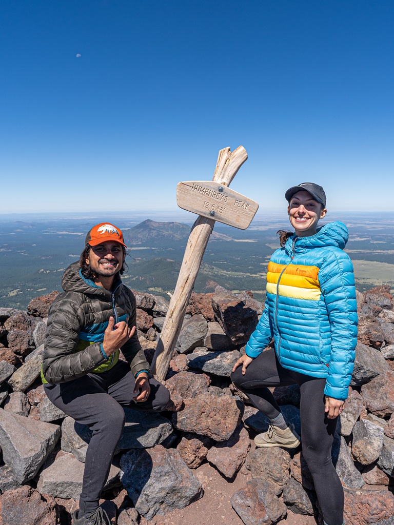
The views from the summit are insanely beautiful! To the south, the striking red rock cliffs of Oak Creek Canyon unfold before you, while on a clear day, the majestic Grand Canyon comes into view to the north.
This is undoubtedly one of the most expansive panoramas for miles, making every step of the climb worthwhile!
To return to the parking lot, simply retrace your steps back.
Congrats, you tackled the tallest peak in Arizona!! 🥳
🥾 Planning a trip to Sedona and looking for a challenging hike? Add Wilson Mountain, Sedona’s tallest peak, to your itinerary!
Humphreys Peak Hiking Tips
1. Start Early: This allows you to beat the crowd during peak season, beat the heat during summer, and avoid afternoon thunderstorms.
2. Check the Weather: Conditions at the summit can be dramatically different from the trailhead. Check the weather forecast for Humphreys Peak. Be prepared for strong winds, sudden temperature drops, and potential snow, even in late spring or early fall.
3. Be Physically Prepared: This is a fairly long and strenuous hike. Get into the habit of working out regularly and eating healthy. This will make hiking feel a lot easier!
4. Sun Protection: The beginner of this hike takes you through a shaded forest, but the ridgeline and summit are exposed. Make sure to apply sunscreen and SPF lip balm and wear a wide-brimmed hat to protect yourself from the sun’s UV rays.
5. High Altitude: Humphreys Peak Trailhead sits at 9,300 feet above sea level, and Humphreys Peak sits at 12,633 feet. If you are not used to being this high in elevation, you could experience altitude sickness symptoms which can progress into a serious situation!
Make sure you know the symptoms, acclimate properly, and turn around and return to lower elevation if needed.
6. Avalanche Danger: After winter storms, the risk of avalanches increases on steep slopes and at high elevations, particularly near or above the tree line.
Before heading out to tackle the Humphreys Peak hike, review the latest Kachina Peaks Avalanche Center Snowpack Report and the San Francisco Peaks Recreational Weather Forecast for updated conditions and safety information.
7. Respect Nature: Follow Leave No Trace principles – plan ahead, pack out all trash, avoid disturbing wildlife, be considerate of others, and respect the natural beauty of Arizona.
Hiking Humphreys Peak Packing List
👚 Layers of Clothing (top) – Pack a moisture-wicking base layer, a fleece mid-layer, an insulated jacket, and an outer shell to protect you from the elements, such as rain and wind. You may not need all these layers, especially in the summer months, but it’s always best to be over-prepared!
Check out my favorite tops 👇
- Base layer: REI Co-op Sahara Shade Hoodie (warm/mild conditions) and REI Co-op Midweight Long-Sleeve Base Layer (cooler conditions)
- Fleece mid layer: Cotopaxi Teca Fleece Full-Zip Jacket
- Down mid layer: Cotopaxi Fuego Hooded Down Jacket
- Outer shell: In the summer I always pack a light windbreaker, such as the Cotopaxi Teca Crop Windbreaker or the RevolutionRace Unit Light Windbreaker. If cold, windy, and rainy conditions are in the forecast (or there’s a slight possibility), I make sure to pack my Patagonia Torrentshell 3L Jacket.
🩳 Hiking Shorts or Pants – Pack a comfortable, durable, and stretchy pair of hiking shorts or pants. Also think about what conditions you might run into, such as warm or cold temperatures, wind and/or rain, bugs, and overgrown trails.
Check out my favorite hiking bottoms 👇
- Cotopaxi Losdos Zip-Off Pants
- RevolutionRace Breezy Ankle Outdoor Pants
- Baleaf Fleece-Lined Jogger Pants
- RevolutionRace Summit Pocket Tights
- Revolution Race Hike & Dive Shorts
🥾 Hiking Footwear – Bring a good pair of hiking boots or shoes with good traction. If I’m not expecting to hike in too much mud or snow, my go-to hiking shoes are the Altra Lone Peak trail runners. They have a wide-toe box, 0 mm heel-to-toe drop, and MaxTrac rubber outsole. Plus, they’re lightweight and so comfy!
🧦 Socks – Moisture-wicking, quick-drying socks are the way to go. My favorite pair of hiking socks are Darn Tough Hiker Micro Crew Cushion Socks. Always pack an extra pair!
🎒 Day Pack – What you plan to do (sightseeing, hiking, etc.), determines what size pack you’ll need. Here is what I typically bring based on what I’m doing that day 👇
- Short walks and sightseeing: Cotopaxi Kapai 1.5L Del Dia Hip Pack
- Short, easy to moderate day hikes: REI Co-op Flash 22L Pack
- Long, moderate to challenging day hikes: REI Co-op Trail 25L Pack or Cotopaxi Luzon Del Dia 24L Pack
🥢 Trekking Poles – Essential for stability, balance, and support when hiking trails, especially on tough, rocky, and uneven terrain. I use REI Co-op Trailmade Trekking Poles and love them!
❄️ Microspikes – Bring a pair of microspikes if you’re visiting in the winter and you’re planning to hike along icy trails. They will give you good traction to avoid slipping! I use Black Diamond Access Spike Traction Device.
🦟 Mosquito/Bug Repellants – In the warmer months, be prepared for annoying gnats, mosquitoes, and flies. Wear long-sleeve clothing, a head net, and use bug spray.
🧤 Extra Warm Layers – If you expect cooler conditions or hiking to higher elevations, make sure to pack extra layers for added warmth, such as gloves, beanie, neck gaiter, and a light jacket.
🗺️ Navigation – Carry a physical topographic map, compass, a satellite messenger (or personal locator beacon), and download offline maps to help you stay on course, find your way in unfamiliar terrain, and call for help if needed.
🔦 Headlamp/Flashlight – A reliable light source with extra batteries, in case you end up hiking in the dark or need it for emergency situations.
💧 Water – Water bottles to carry sufficient water to stay hydrated, along with a filtration system or purification tablets if you plan to refill from natural sources.
🍕 Food – Energy-rich snacks or meals to keep your energy levels up during the hike.
😎 Sun Protection – Sunscreen, sunglasses, and a sunhat to protect yourself from harmful UV rays, even when it’s cloudy. Also, polarized sunglasses are important when it’s bright outside and to reduce glare from reflective surfaces like water, snow, and roads.
🩹 First-Aid Kit – A basic first-aid kit with items like bandages, antiseptic, pain relievers, and any personal medications you may need.
🥶 Emergency Shelter – Pack an emergency bivy sack or space blanket for shelter in case of sudden weather changes.
🔥 Fire – A lighter, matches, or fire starter to help you build a fire for warmth or signaling in case of emergency. Along with matches, I also carry a multi-tool carabiner that has a fire starter, utility blade, screwdriver, and bottle opener.
🗡️ Multi-Tool and Repair Kit – A versatile tool/knife and repair kit to handle any task, from preparing food to making repairs.
💩 Waste Disposal Supplies – WAG bags, trowel, toilet paper, pee cloth, wipes, Ziploc bags – be sure to pack out everything!
Conclusion
The Humphreys Peak hike is a challenging yet rewarding adventure that takes you to the highest point in Arizona, offering breathtaking views and an unforgettable experience.
Whether you’re scaling its rugged terrain in the summer or braving the snow-covered trails in winter, proper preparation and respect for the mountain’s ever-changing conditions are key to a safe and enjoyable journey.
Standing atop the summit, surrounded by panoramic vistas of northern Arizona’s stunning landscapes, makes every step of the climb worth it.
Humphreys Peak is more than just a hike – it’s an opportunity to connect with nature, test your limits, and create memories that will last a lifetime.
If this guide inspires you to tackle the Humphreys Peak hike, I’d love to hear about your adventure. Leave a comment and share your experience!
Enjoyed this post? Pin for later!