Yosemite is, without a doubt, one of my favorite destinations in the world.
My husband and I have had the incredible privilege of exploring Yosemite National Park several times, with our first visit being in January 2023.
Experiencing Yosemite’s serene beauty in the stillness of winter was unforgettable, but our next visit took the magic to an entirely new level. ✨
Why, you ask?
The waterfalls!! 😍
They were utterly breathtaking – so powerful and vibrant, it felt like stepping into a dream.
Late spring and early summer are when Yosemite’s waterfalls truly steal the show, roaring at their peak flow and transforming the park into a mesmerizing wonderland.
Hiking the trails that lead to these iconic cascades made me fall even deeper in love with Yosemite and its natural beauty.
And now, I want to share it all with you!
Ready to witness Yosemite’s stunning waterfalls for yourself? 🙂↕️
Dive into my complete guide, where I’ll share the best Yosemite waterfall hikes, the perfect time to visit, essential hiking tips, and must-have gear to bring along.
Not a big hiker? No problem!
I’ve also included a list of breathtaking waterfalls you can admire without hitting the trails.
This guide has something for everyone, no matter your abilities.
So, what are you waiting for? Let’s go chase waterfalls! 🙌
Affiliate Disclaimer: Some of the links below may be affiliate links. Support the blog by signing up or purchasing through those links at no additional cost to you. We greatly thank you and appreciate you all for supporting us!
Overview of Waterfalls in Yosemite National Park
Yosemite National Park is vast, with each region offering its own unique charm and stunning landscapes.
To make your adventure easier, I’ve made a list of the most popular waterfalls in each region of Yosemite.
I’ve also created an interactive map that lets you visualize exactly where each waterfall is located.
If it’s your first time visiting Yosemite, these must-see waterfalls deserve a spot on your itinerary!
While their popularity often means busy trails, the breathtaking beauty of these iconic cascades makes them absolutely worth the visit.
Seeing them in person is an experience you won’t want to miss!
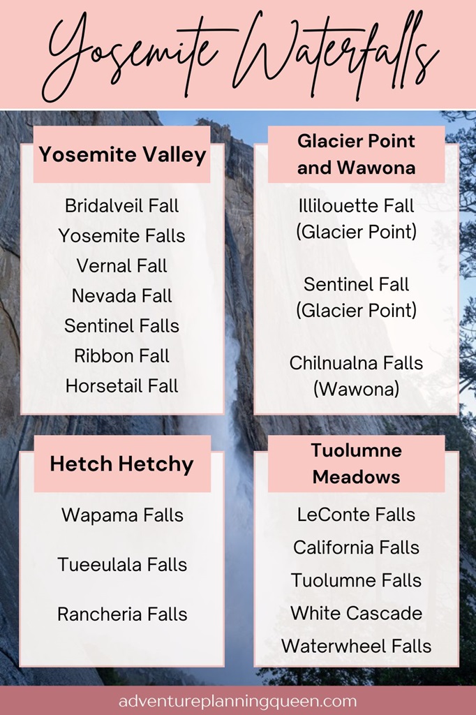
Yosemite Valley Waterfalls
- Bridalveil Fall
- Yosemite Falls
- Vernal Fall
- Nevada Fall
- Sentinel Falls
- Ribbon Fall
- Horsetail Fall
- Royal Arch Cascade
- Silver Strand Falls
- Snow Creek Falls
The closest entrances to Yosemite Valley are Arch Rock Entrance (30-minute drive), Big Oak Flat Entrance (45-minute drive), and South Entrance (1-hour drive).
Glacier Point Waterfalls
- Illilouette Fall
- Sentinel Fall
⚠️ The Glacier Point Road is open to cars approximately late May through October or November, depending on conditions. Check for updates on road closures HERE.
The closest entrances to Glacier Point are Arch Rock Entrance and South Entrance (both are a 1 hour and 30-minute drive).
Wawona Waterfalls
- Chilnualna Falls
The closest entrances to Wawona are South Entrance (10-minute drive), Arch Rock Entrance (50-minute drive), and Big Oak Flat Entrance (1 hour and 15-minute drive).
Hetch Hetchy Waterfalls
- Wapama Falls
- Tueeulala Falls
- Rancheria Falls
The closest entrances to Hetch Hetchy are Hetch Hetchy Entrance (15-minute drive), Big Oak Flat Entrance (40-minute drive), and Arch Rock Entrance (1 hour and 15-minute drive).
Tuolumne Meadows / Tioga Pass Waterfalls
- LeConte Falls
- California Falls
- Tuolumne Falls
- White Cascade (also referred to as Glen Aulin Falls)
- Waterwheel Falls
⚠️ Tioga Road closes from November through late May or early June (depending on conditions). Check for updates HERE.
The closest entrances to Tuolumne Meadows are Tioga Pass Entrance (15-minute drive), Big Oak Flat Entrance (1 hour and 15-minute drive), and Arch Rock Entrance (1 hour and 30-minute drive).
Yosemite Entrance Fee and Reservations
Entrance to Yosemite National Park costs $35 per vehicle for a 3-day pass. However, if you have the America the Beautiful Annual Pass, your entry is free!
For those who love exploring national parks, investing in the Annual Pass is a smart choice. At just $80, it grants you access to over 2,000 federal recreation sites across the country!
A reservation will be required to drive into or through Yosemite National Park on some days from May 24 through September 1, 2025:
- May 24 – May 26 (Memorial Day weekend) – A reservation is required from 6 AM to 2 PM on Saturday through Monday.
- May 27 – June 14 – A reservation is NOT required at any time.
- June 15 – August 15 – A reservation is required from 6 AM to 2 PM every day.
- August 16 – August 29 – A reservation is NOT required at any time.
- August 30 – September 1 (Labor Day weekend) – A reservation is required from 6 AM to 2 PM on Saturday through Monday.
You can purchase reservations on recreation.gov.
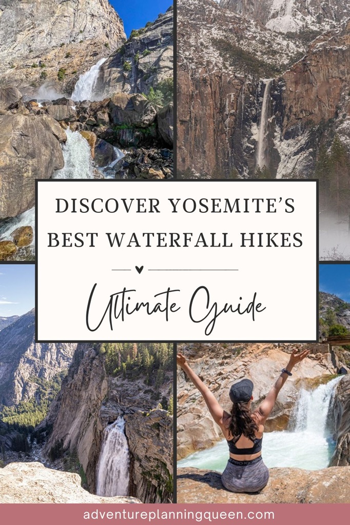
Best Yosemite Waterfall Hikes
I’ve created a list of the best Yosemite waterfall hikes!
These hikes will leave you breathless.
Some trails are so steep they’ll literally leave you breathless! 😮💨
I can assure you each hike is worth the effort to see each of these incredible waterfalls.
Make sure to visit during peak flow (May and June) for the best experience!
The hikes range from easy family-friendly type of hikes to challenging kick-your-butt type of hikes.
If you are not able to hike any of the trails, I created a list of Yosemite waterfalls you can see without hiking.
💧 Before we dive into the best Yosemite waterfall hikes, here’s a quick look at some of my personal favorites:
- Best Overall – Vernal and Nevada Falls (Mist Trail and John Muir Trail)
- Most Fun Hike – Vernal Fall via Mist Trail
- Best Views – Upper Yosemite Fall Trail and Panorama Trail (to Illilouette Fall)
- Most Underrated Hikes – Chilnualna Falls and Rancheria Falls
Ok, let’s get into the best Yosemite waterfall hikes!!
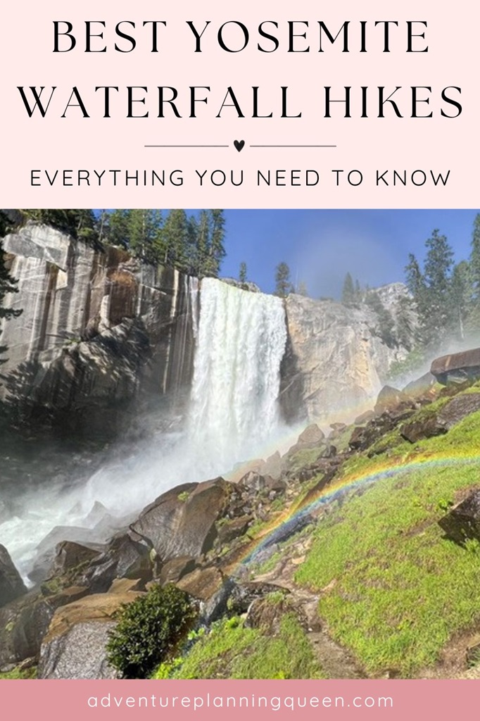
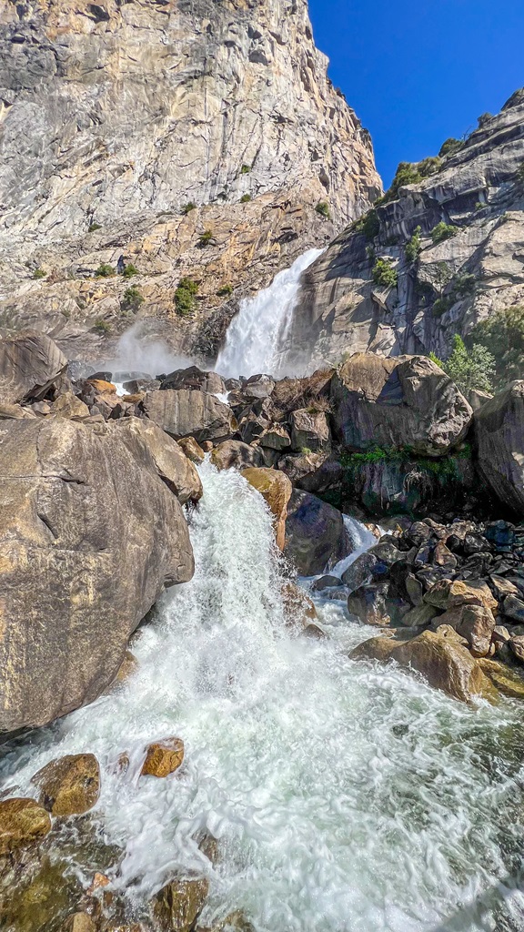
Vernal Fall (Mist Trail)
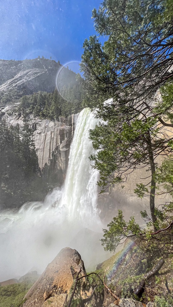
Waterfall Height: 317 feet (97 meters)
Starting Point: Mist Trail / John Muir Trail Trailhead
Length: 3 miles
Elevation Gain: 1,000 feet
Difficulty: Challenging
Route Type: Out-and-back
Hiking Time: 1.5 to 2 hours
Pet-friendly? No, pets are not allowed
Hike Features: Vernal Fall Footbridge, 600+ granite steps, and Vernal Fall
✨ READ THIS: Vernal Fall via Mist Trail Hiking Guide
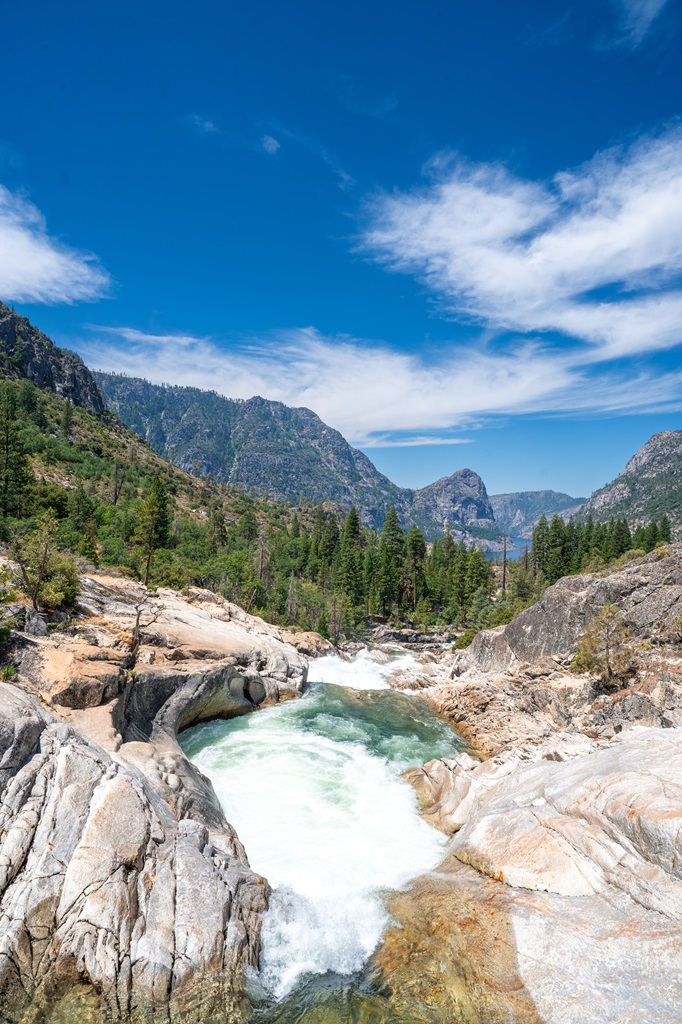
Embark on one of Yosemite National Park’s most iconic hikes to Vernal Fall, a stunning 317-foot waterfall that showcases nature’s power and beauty.
The Mist Trail is the best way to experience this adventure, with a 1.5-mile (one-way) hike that leads you to jaw-dropping views at the top.
Along the way, you’ll climb over 600 granite steps, feeling the mist from Vernal Fall – a rejuvenating experience!
🅿️ Parking and Directions: The Mist Trail / John Muir Trail Trailhead is located near Happy Isles (shuttle stop #16).
The closest parking option for the Mist Trail is at Curry Village, located about a mile from the trailhead.
If you’re parked farther away, take advantage of Yosemite’s convenient shuttle system to reach shuttle stop #16 at Happy Isles.
From Happy Isles, simply follow the signs across the bridge to the trailhead.
Please note that there is no parking available directly at the trailhead.
Plan ahead to make the most of your adventure!
✅ Pro Tips:
- Time your visit for late spring or early summer, when Vernal Fall is at its most powerful.
- Arrive early to beat the crowds.
- Bring a rain jacket, as the trail transforms into a natural waterpark, with mist swirling around you – it’s exhilarating!
- Keep an eye out for rainbows at the base of the waterfall.
- Take your time navigating the slick granite steps.
- For those seeking even more adventure, continue beyond Vernal Fall to Nevada Fall, a towering 594-foot waterfall that’s equally mesmerizing.
This unforgettable hike is a must for any Yosemite waterfall-chaser!
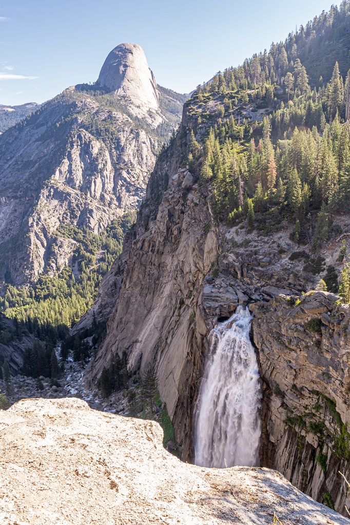
Nevada Fall (Mist Trail and John Muir Trail)
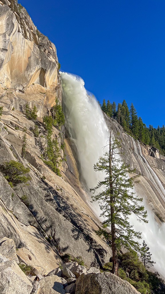
Waterfall Height: 594 feet (180 meters)
Starting Point: Mist Trail / John Muir Trail Trailhead
Length: 7 miles
Elevation Gain: 2,200 feet
Difficulty: Challenging
Route Type: Loop
Hiking Time: 5 to 6 hours
Pet-friendly? No, pets are not allowed
Hike Features: Vernal Fall Footbridge, 600+ granite steps, Vernal Fall, Nevada Fall, and amazing views at Clark Point
✨ READ THIS: Nevada Fall via Mist Trail and John Muir Trail Hiking Guide
Standing at an impressive 594 feet, Nevada Fall is one of Yosemite National Park’s most breathtaking waterfalls.
From the top of Nevada Fall, you’ll be rewarded with sweeping vistas of the Merced River and Yosemite Valley below, making it a must-see destination for any adventurer.
Most hikers combine Vernal Fall and Nevada Fall into one unforgettable adventure via the Mist Trail and John Muir Trail.
🅿️ Parking and Directions: The Mist Trail / John Muir Trail Trailhead is located near Happy Isles (shuttle stop #16).
The closest parking option for the Mist Trail is at Curry Village, located about a mile from the trailhead.
If you’re parked farther away, take advantage of Yosemite’s convenient shuttle system to reach shuttle stop #16 at Happy Isles.
From Happy Isles, simply follow the signs across the bridge to the trailhead.
Please note that there is no parking available directly at the trailhead.
Plan ahead to make the most of your adventure!
Upper Yosemite Fall
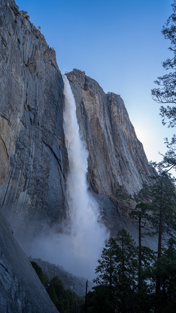
Waterfall Height: 1,430 feet (435 meters)
Starting Point: Upper Yosemite Fall Trailhead
Length: 7 miles
Elevation Gain: 3,200 feet
Difficulty: Challenging
Route Type: Out-and-back
Hiking Time: 4.5 to 7 hours
Pet-friendly? No, pets are not allowed
Hike Features: Columbia Rock, close up view of Upper Yosemite Fall, and Yosemite Falls Overlook
✨ READ THIS: Upper Yosemite Fall Hiking Guide
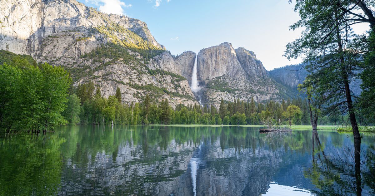
Yosemite Falls, one of the world’s tallest waterfalls, is actually made up of three separate falls: Upper Yosemite Fall (1,430 feet), the middle cascades (675 feet), and Lower Yosemite Fall (320 feet).
Upper Yosemite Fall is a rewarding adventure that offers breathtaking views, a challenging climb, and a memorable connection with the natural beauty of Yosemite.
Reaching the top of one of North America’s tallest waterfalls is an experience worth every step!
🅿️ Parking and Directions: The Upper Yosemite Fall Trailhead is located near Camp 4.
Parking near the trailhead can be tricky (see options below).
Thankfully, Yosemite Valley has a free shuttle system. The Upper Yosemite Falls Trailhead is located at bus stop #7.
Upper Yosemite Fall parking options:
- Yosemite Fall parking area is located across the street from the trailhead.
- Yosemite Village parking area is located further away from the trailhead. You can either walk to the trailhead which is almost a 1.5-mile walk or take the free shuttle.
- Camp 4 parking area is designated only for those camping at Camp 4. If you are camping at Camp 4, congrats. You have the best parking spot for the Upper Yosemite Falls Trail!
🎦 Want to see what Yosemite Falls currently looks like? Check out this webcam!
Lower Yosemite Fall
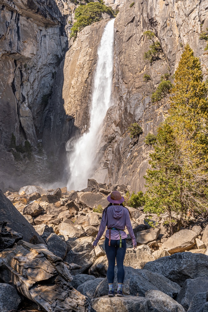
Waterfall Height: 320 feet (97 meters)
Starting Point: Lower Yosemite Fall Trailhead
Length: 1.2 miles
Elevation Gain: 55 feet
Difficulty: Easy
Route Type: Loop
Hiking Time: 30 to 45 minutes
Pet-friendly? Yes, must be on leash
Hike Features: Viewpoints of Lower Yosemite Fall and the entire Yosemite Falls
Take the easy 1.2-mile loop trail for an up-close view of the stunning Lower Yosemite Fall, which cascades 320 feet in a powerful display of nature’s beauty.
This hike is family friendly, dog-friendly (on leash), and wheelchair accessible (when not covered in snow).
Perfect for all ages and abilities, this short walk is a great way to experience one of Yosemite’s iconic waterfalls up close!
✨ READ THIS: 10 Must-Do Easy Hikes in Yosemite
🅿️ Parking and Directions: Parking is not available at the trailhead.
Thankfully, Yosemite Valley has a free shuttle system.
The Lower Yosemite Fall Trailhead is located off Northside Drive in Yosemite Valley, near shuttle stop #6.
Lower Yosemite Fall parking options:
- Yosemite Fall parking area is located across the street from the trailhead.
- Yosemite Village parking area is located further away from the trailhead. You can either walk to the trailhead which is almost a 0.8-mile walk or take the free shuttle.
- Camp 4 parking area is designated only for those camping at Camp 4.
🎦 Want to see what Yosemite Falls currently looks like? Check out this webcam!
Wapama Falls
Waterfall Height: 1,400 feet (427 feet)
Starting Point: Wapama Falls Trailhead
Length: 5 miles
Elevation Gain: 500 feet
Difficulty: Moderately challenging
Route Type: Out-and-back
Hiking Time: 2.5 to 3.5 hours
Pet-friendly? No, pets are not allowed
Hike Features: O’Shaughnessy Dam, Tueeulala Falls, and Wapama Falls
✨ READ THIS: Wapama Falls Hiking Guide
Wapama Falls is a hidden gem tucked away in Yosemite National Park’s serene and less-visited Hetch Hetchy Valley.
This spectacular waterfall plunges 1,400 feet, creating a thunderous roar and a refreshing mist that’s especially nice on a warm day.
The adventure begins at the O’Shaughnessy Dam, where you can catch your first glimpse of the falls from the parking area.
For a closer view, embark on a moderately challenging 5-mile round-trip hike that takes you along the edge of the stunning Hetch Hetchy Reservoir.
🅿️ Parking and Directions: The Wapama Falls Trailhead is located at the O’Shaughnessy Dam in Hetch Hetchy.
A big parking lot is located next to the O’Shaughnessy Dam at the end of Hetch Hetchy Road.
The Hetch Hetchy Road (also known as Evergreen Road) begins outside the park off Highway 120, near the Big Oak Flat Entrance Station.
- Due to the winding nature of Hetch Hetchy Road, vehicles and trailers longer than 25 feet or wider than 8 feet are not permitted.
- There is no public transportation to Hetch Hetchy.
- Hetch Hetchy is only accessible by car during daylight hours, from sunrise to sunset.
Hours of operation can vary by season, and the road may be closed during winter months due to hazardous conditions – check the current conditions before you go.
✨ Planning a trip to Hetch Hetchy but not sure where to begin?
Don’t worry – I created a comprehensive guide that provides everything you need to know, including the best time to visit, how to get there, camping and lodging options, and top hiking trails.
Also, I created one-day itineraries tailored to both family-friendly experiences and adventurous explorers!
Chilnualna Falls
Waterfall Height: 2,200 feet (670 meters)
Starting Point: Chilnualna Falls Trailhead
Length: 8.2 miles
Elevation Gain: 2,400 feet
Difficulty: Challenging
Route Type: Out-and-back
Hiking Time: 4 to 6 hours
Pet-friendly? No, pets are not allowed
Hike Features: Chilnualna Falls (five cascades) and incredible views along the trail
✨ READ THIS: Chilnualna Falls Hiking Guide
Hiking to Chilnualna Falls should be on everyone’s Yosemite National Park itinerary!
Between the stunning waterfall with its five cascades and the amazing views along the trail, this 8-mile hike has a little bit of everything.
If you enjoy challenging waterfall hikes with fewer people, Chilnualna Falls is the perfect hike for you!
🅿️ Parking and Directions: The Chilnualna Falls Trailhead is located within Wawona towards the end of Chilnualna Falls Road.
The trailhead parking area is on the right side off Chilnualna Falls Road.
There will be a sign so you don’t accidentally pass it (like we did lol).
The parking lot is fairly small, so even though this hike is not as popular as others, I would still try to get there early to secure a parking spot.
There are bathrooms at the trailhead parking area along with a trail map and more information about the hike.
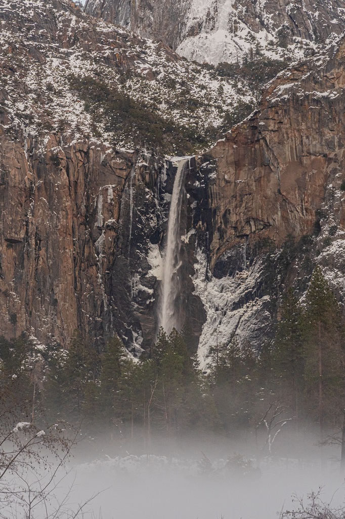
Bridalveil Fall
Waterfall Height: 620 feet (190 meters)
Starting Point: Bridalveil Fall Trailhead
Length: 0.5 miles
Elevation Gain: 80 feet
Difficulty: Easy
Route Type: Out-and-back
Hiking Time: 20 to 30 minutes
Pet-friendly? Yes, must be on leash
Hike Features: Bridalveil Fall Viewpoint
Bridalveil Fall is often the first waterfall to greet visitors upon entering Yosemite Valley, and it never fails to make an impression.
In spring, its powerful cascade roars with intensity, while the rest of the year reveals its delicate, swaying flow.
This easy 0.5-mile out-and-back trail takes just 20 minutes to complete and is paved, making it accessible for most visitors.
Along the way, you’ll be treated to stunning views, culminating in a close-up of the breathtaking 620-foot waterfall.
🅿️ Parking and Directions: The trailhead is located at the Bridalveil Fall Parking Area in Yosemite Valley.
Parking for Bridalveil Fall is conveniently located at the trailhead, accessible via Wawona Road (Highway 41) or Southside Drive.
However, during the busy summer months, the lot fills quickly, and traffic jams can make entering and exiting a challenge.
For a less stressful option, consider driving a bit further east on Southside Drive, where roadside parking is available.
From here, a slightly longer trail (an additional 0.25 miles) leads to the falls, offering unique and picturesque views as you approach the main area.
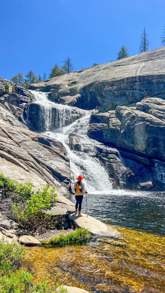
Illilouette Fall (Panorama Trail)
Waterfall Height: 370 feet (113 meters)
Starting Point: Illilouette Fall Trailhead
Length: 5 miles
Elevation Gain: 1,400 feet
Difficulty: Challenging
Route Type: Out-and-back
Hiking Time: 2.5 to 4 hours
Pet-friendly? No, pets are not allowed
Hike Features: Beautiful views of Yosemite Valley and a closer look at Illilouette Fall
✨ READ THIS: Panorama Trail Hiking Guide
Tucked away in Yosemite National Park, Illilouette Fall is a 370-foot cascade that can only be reached by hiking a steep, scenic trail known as the Panorama Trail.
This less-traveled trail is one of Yosemite’s most breathtaking routes, offering stunning vistas of Illilouette Fall, Yosemite Valley, Nevada Fall, Vernal Fall, and the iconic Half Dome.
🅿️ Parking and Directions: The trailhead is located at Glacier Point in Yosemite National Park.
The Panorama Trail begins at Glacier Point, where you’ll find a spacious lot with nearly 200 parking spots.
While this lot fills up quickly, especially during peak season, spots tend to open up frequently, so a little patience often pays off.
At the trailhead, you’ll find convenient amenities, including restrooms and food storage lockers.
⚠️ The Glacier Point Road is open to cars approximately late May through October or November, depending on conditions. Check for updates on road closures HERE.
Rancheria Falls
Waterfall Height: 150 feet (45 meters)
Starting Point: Rancheria Falls Trailhead
Length: 13 miles
Elevation Gain: 2,600 feet
Difficulty: Challenging
Route Type: Out-and-back
Hiking Time: 6.5 to 7.5 hours
Pet-friendly? No, pets are not allowed
Hike Features: O’Shaughnessy Dam, Tueeulala Falls, Wapama Falls, and Rancheria Falls
Rancheria Falls is a beautiful and lesser-known waterfall located in Yosemite’s backcountry within Hetch Hetchy Valley.
The hike to the falls is a rewarding 13-mile round-trip journey, starting at the O’Shaughnessy Dam.
This hike provides a perfect escape from the crowds and is ideal for those looking to explore Yosemite’s quieter, more tranquil spots.
Parking and Directions: The Rancheria Falls Trailhead is located at the O’Shaughnessy Dam in Hetch Hetchy.
A big parking lot is located next to the O’Shaughnessy Dam at the end of Hetch Hetchy Road.
The Hetch Hetchy Road (also known as Evergreen Road) begins outside the park off Highway 120, near the Big Oak Flat Entrance Station.
- Due to the winding nature of Hetch Hetchy Road, vehicles and trailers longer than 25 feet or wider than 8 feet are not permitted.
- There is no public transportation to Hetch Hetchy.
- Hetch Hetchy is only accessible by car during daylight hours, from sunrise to sunset.
Hours of operation can vary by season, and the road may be closed during winter months due to hazardous conditions.
⚠️ Be sure to check the current conditions before you go.
Yosemite Waterfall Hikes Map
Best Time to See Waterfalls in Yosemite
Late spring and early summer are the best times to witness Yosemite National Park’s waterfalls in all their glory!
The peak flow typically occurs in May and June, as snowmelt from the winter transforms the park’s waterfalls into breathtaking cascades of rushing water.
For the best experience, I highly recommend visiting Yosemite in May.
The temperatures are pleasantly warm but not too hot, the crowds are smaller compared to peak summer months, and the waterfalls are truly at their most magical.
To make the most of your trip, plan your hikes for early morning or late afternoon.
This not only helps you avoid the mid-day heat but also provides a more serene experience away from larger crowds.
Yosemite’s waterfalls are unforgettable – don’t miss this spectacular time of year!
Hiking Tips and What to Bring
1. Start Early: Beat the crowds and enjoy cooler temperatures by starting your hike early in the morning, especially during peak season.
2. Be Physically Prepared: Some of the hikes mentioned above can be quite challenging.
It’s a good idea to train for the harder hikes by strength training and completing cardio exercises for endurance.
3. Footwear and Gear:
- Some trails will have lots of rocky sections and steps, so wear comfortable, sturdy hiking shoes (or boots) with good traction.
- Hiking poles may be beneficial on the steep/rocky parts, especially when descending.
- Wear proper clothing for the season and bring layers just in case.
4. Waterfall Safety:
- Avoid climbing rocks near the waterfall as they can be slippery and cause you to fall.
- If swimming near the base of a waterfall, stay aware of strong currents and avoid getting too close to the cascade itself.
- Research if you’re allowed to swim in any swimming holes at the base of waterfalls.
- Never swim upstream near the edge of a waterfall, as the flow can unexpectedly pull you toward the drop.
- Always assess water depth before jumping in and be mindful of submerged rocks or debris.
- After heavy rain, water levels can rise rapidly, increasing the risk of strong currents – choose calmer conditions for a safer experience.
5. Be Bear Aware: Black bears are active within Yosemite. Follow these guidelines to avoid any negative interactions with a black bear.
🐻 Note: bear spray is illegal in Yosemite!
6. Respect Nature: Follow Leave No Trace principles – plan ahead, pack out all trash, avoid disturbing wildlife, be considerate of others, and respect the natural beauty of Yosemite National Park.
Pack the 10 Essentials:
- Navigation – A map, compass, or GPS device to help you stay on course and find your way in unfamiliar terrain.
- Water – Sufficient water to stay hydrated, along with a filtration system or purification tablets if you plan to refill from natural sources.
- Food – Energy-rich snacks or meals to keep your energy levels up during the hike.
- First-Aid Kit – A basic first-aid kit with items like bandages, antiseptic, pain relievers, and any personal medications you may need.
- Sun Protection – Sunscreen, sunglasses, and a hat to protect yourself from harmful UV rays.
- Insulation – Extra layers of clothing (such as a down jacket or fleece) to stay warm in changing weather conditions.
- Rain Gear and Emergency Shelter – A rain jacket or poncho and an emergency bivy sack or space blanket for shelter in case of sudden weather changes.
- Fire – A lighter, matches, or fire starter to help you build a fire for warmth or signaling in case of emergency.
- Multi-tool or Knife – A versatile tool or knife to handle any tasks, from preparing food to making repairs.
- Headlamp/Flashlight – A reliable light source with extra batteries, in case you end up hiking in the dark or need it for emergency situations.
See Yosemite Waterfalls Without Hiking
Are you not able to complete any of the Yosemite waterfall hikes as described above?
That’s ok!
There are lots of great spots to view the beautiful waters in Yosemite National Park without having to put on your hiking boots.
Yosemite Falls can be seen from:
- Swinging Bridge Picnic Area
- Cook’s Meadow
- Yosemite Village
- Yosemite Valley Lodge
- Glacier Point
Sentinel Falls can be seen from:
- Areas along Southside Drive near the Sentinel Beach Picnic Area
- Near the Four Mile Trailhead
- Across Yosemite Valley near Leidig Meadow
Horsetail Falls can be seen from:
- The El Capitan picnic area (on Northside Drive west of Yosemite Valley Lodge) – best seen on the east side of El Capitan
Bridalveil Falls can be seen from:
- Tunnel View
- Valley View
- El Capitan Meadow
- Big Oak Flat Road
Vernal Fall and Nevada Fall can both be seen from:
- Glacier Point
Wapama Falls can be seen from:
- O’Shaughnessy Dam in Hetch Hetchy
Ribbon Fall can be seen from:
- The road as you drive into Yosemite Valley, just beyond the turn for Bridalveil Fall (parking is available in turnouts)
Silver Strand Falls can be seen from:
- Tunnel View
Conclusion
Yosemite waterfall hikes offer an unforgettable experience, blending breathtaking natural beauty with the thrill of exploration.
Whether you’re trekking to the iconic Yosemite Falls, marveling at the misty power of Vernal Fall, or enjoying a quiet moment at Bridalveil Fall, each trail provides a unique perspective on the park’s wonders.
From challenging climbs to leisurely strolls, there’s a waterfall hike for every adventurer.
No matter how you choose to experience them, the waterfalls at Yosemite will leave you in awe, creating memories that will last a lifetime.
If this guide inspires you to tackle any of these Yosemite waterfall hikes, I’d love to hear about your adventure. Leave a comment and share your experience!
🤩 Yosemite Trip Planning Resources
- How to Spend One Day in Yosemite: A First Timer’s Guide
- Where to Stay Outside of Yosemite (best places in 2025)
- 10 Must-Do Easy Hikes for All Skill Levels
- Is Tioga Pass Open? Plan an Epic Trip with This Guide
- Ultimate Guide to Visiting Yosemite in May
- Hetch Hetchy Hikes: Explore This Hidden Gem
- 12 Best Tioga Pass Hikes for Adventure Lovers
- Best Spots to Find Giant Sequoia Trees in Yosemite
Enjoyed this post? Pin for later!