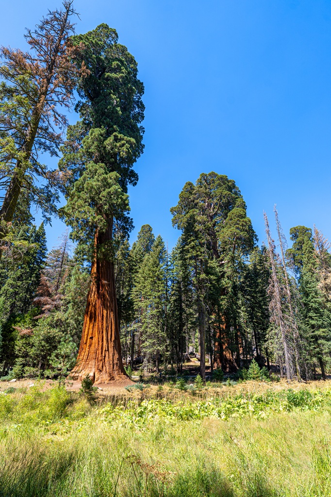
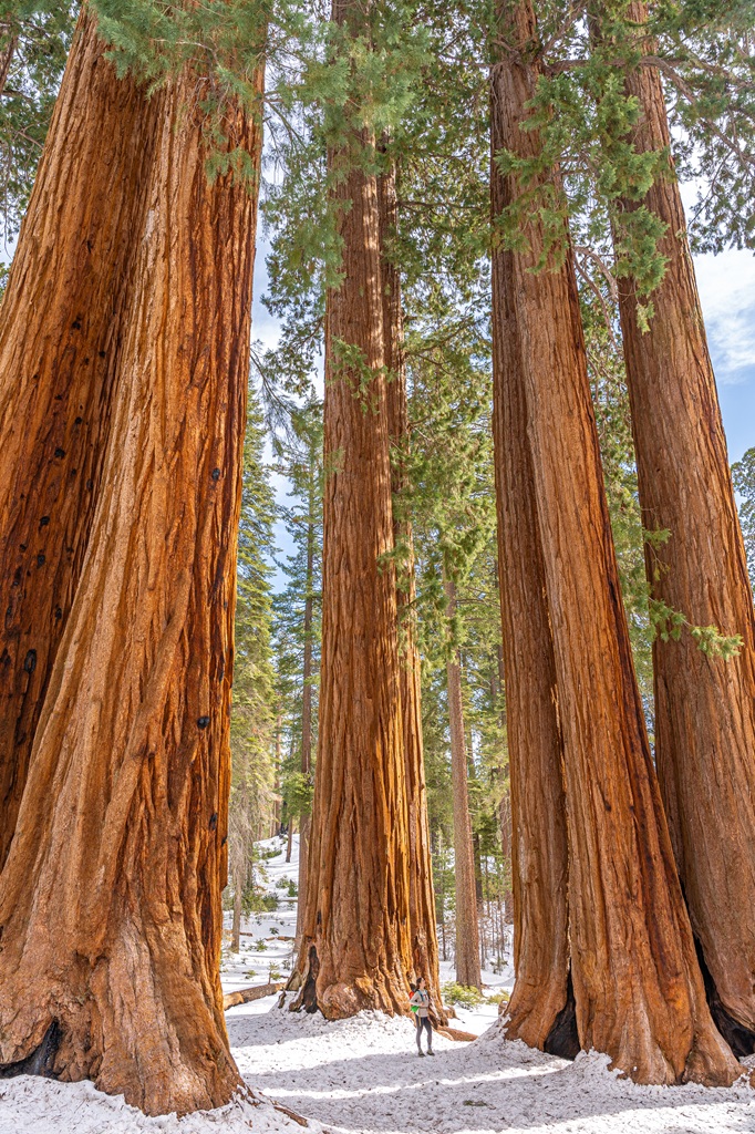
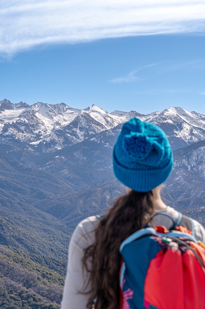
Sequoia National Park is best known for its giant sequoias – hence the name. People travel from all over the world to see these massive trees with their own eyes. 🌳😍
When I say pictures don’t do these trees justice, I mean it. You have to stand beneath one to understand just how enormous they are!
But did you know there are more things to do in Sequoia National Park than just see the giant sequoia trees? Don’t get me wrong, they are insanely cool and worth traveling thousands of miles to see, but there is so much more to see and do in the park in addition to the beautiful sequoias.
You can hike to crystal-clear alpine lakes, explore an underground marble cavern, summit mountains, watch sunsets from granite domes, and see incredible waterfalls. Pair all of that with the giant sequoias, and you’ve got a recipe for one big epic adventure!
Keep reading to discover the best things to do in Sequoia National Park. You will also find trip planning information to help you plan an unforgettable trip! 🙌
Affiliate Disclaimer: Some links on this page may be affiliate links, meaning I may earn a small commission at no extra cost to you. As an Amazon Associate, I earn from qualifying purchases. Thanks for supporting the blog! 🫶
Sequoia National Park Trip Info
📍 Location: California, USA
🗓️ Best Time to Visit: Year-round but most accessible time is May-October
🏞️ Ideal Trip Length: 2–3 days
✈️ Closest Airport: Fresno Yosemite International (2 to 2.5 hours away)
🏨 Where to Stay: Wuksachi Lodge in Sequoia, John Muir Lodge in Kings Canyon, or Lazy J Ranch Motel, Buckeye Tree Lodge, and AutoCamp Sequoia in Three Rivers
🚙 Getting Around: Rent a vehicle from rentalcars.com or discovercars.com
💵 Entrance Fee: $35 per vehicle (7 days) or buy an America the Beautiful Pass (covers the entrance fee for 1 year). There are new non-resident fees – learn more here
🤩 Check out my Sequoia National Park Guide for more travel, hiking, and seasonal guides
Best Things to Do in Sequoia National Park
Planning a trip to Sequoia National Park and not sure where to start? You’re in luck! I’ve put together the ultimate list of the most fun things to do in Sequoia National Park so you can plan an epic trip.
This list has something for everyone – whether it’s your first time visiting or you’ve been before. Want to see lots of giant sequoias? You got it. Want to watch a spectacular sunset? Done. Prefer scenic drives and easy-access viewpoints? Yep, that’s here too. 🙂↕️
And if hiking is on your agenda, you’ll find plenty of trails in Sequoia ranging from easy strolls to more challenging adventures, no matter your skill level.
Take your time going through this list of the best Sequoia National Park activities and start building your perfect itinerary! 🤩
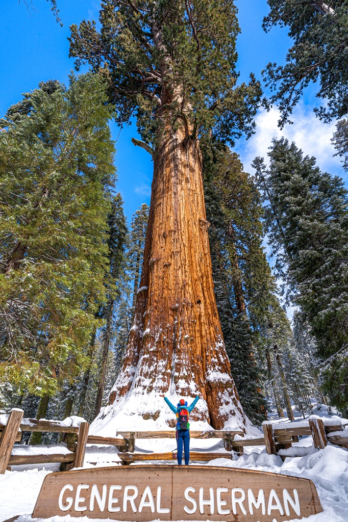
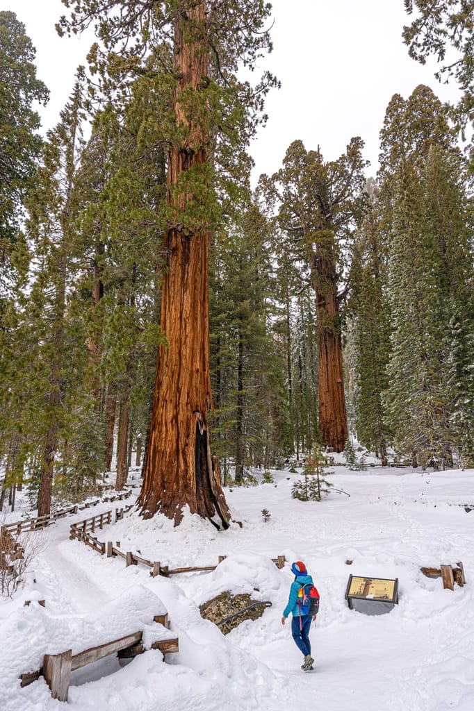
1. See the Largest Tree in the World – General Sherman

Starting Point: Sherman Tree Trailhead
Length: 1.1 miles (1.7 km) roundtrip
Elevation Gain: 190 feet
Difficulty: Easy to moderate
Hiking Time: 30 to 45 minutes
Route Type: Lollipop
Pet-friendly? No, pets are not allowed
Hike Features: General Sherman Tree
✨ READ THIS: General Sherman Tree Hiking Guide
Seeing the General Sherman Tree is the most popular thing to do in Sequoia National Park! For one, it’s the largest tree in the world by volume, and it’s easily accessible. Anybody and everybody can see this incredible tree for themselves!
🌳 General Sherman Tree Stats:
- Height: 275 feet
- Width: 36 feet at the base
- Weight: 1,400 tons
- Volume: 52,500 cubic feet
- Age: 2,300-2,700 years old
The General Sherman Tree was named the largest tree (by volume) in 1931. What’s crazy is that it continues to grow every day, adding enough wood each year to equal a 60-foot-tall tree!
There’s a great photo spot right near the base of the General Sherman Tree. To avoid waiting in a line, get there early in the morning – like just after sunrise. You will notice a fence around tree which is there to protect the tree’s shallow root system. Please do not cross the barriers!
🅿️ Trailhead/Parking: The main access point is the Sherman Tree Trailhead, located off Wolverton Road about 10 minutes south of the Lodgepole Visitor Center. The main parking area offers restrooms and drinking water. There’s also a smaller accessible parking lot off Generals Highway that provides easier access to the General Sherman Tree for those with a disability placard.
From this smaller lot, a wheelchair-accessible paved path leads to the General Sherman Tree. The path is about 500 feet long and has a gentle slope, making it an easy and accessible way to see this famous giant sequoia.
🚌 Shuttle Info: During the busy season (late May through early September), the free Sequoia Shuttle is one of the easiest ways to get around. Route 1 (Green) stops at the accessible parking area, while Route 4 (Orange) serves both the Sherman Tree Trailhead and the accessible lot.
🥾 Alternate Hiking Route: From the Sherman Tree Trailhead, follow the paved path downhill to the General Sherman Tree. To avoid walking back uphill, head towards the accessible parking lot where you’ll find a bus stop. Hop on the shuttle to return to your car in the main parking lot.
If you’re up for it, I highly recommend hiking the Congress Trail next! The trail begins just a short walk from the General Sherman Tree and takes you deeper into the Giant Forest (psst, it’s my favorite trail to see giant sequoia trees).
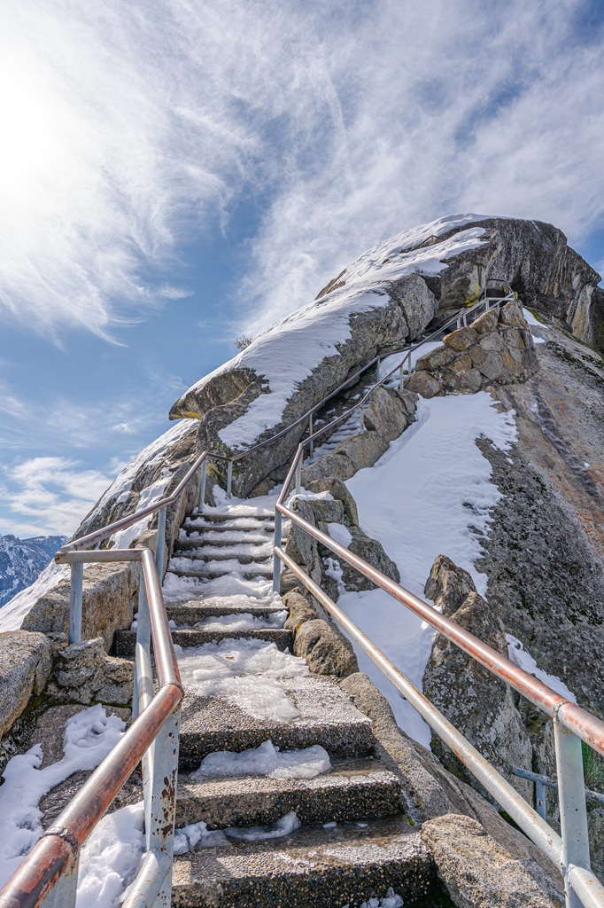
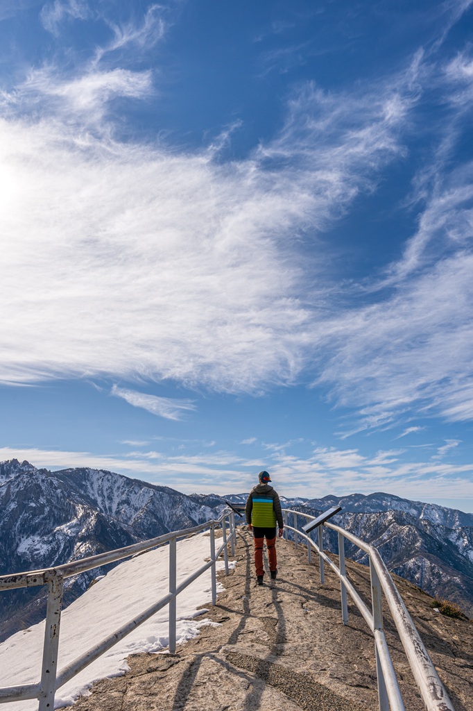
2. Climb to the Top of Moro Rock

Starting Point: Moro Rock Trailhead
Length: 0.5 miles (0.8 km) roundtrip
Elevation Gain: 185 feet
Difficulty: Moderate to hard
Hiking Time: 30 minutes to 1 hour
Route Type: Out-and-back
Pet-friendly? No, pets are not allowed
Hike Features: Moro Rock, 350+ steps, stunning views from the top
✨ READ THIS: Moro Rock Hiking Guide
Moro Rock is one of the most iconic landmarks in Sequoia National Park! Rising to 6,725 feet, this massive granite dome offers incredible 360° views on a clear day, stretching across the Great Western Divide, the San Joaquin Valley, and deep into the surrounding wilderness.
Moro Rock formed millions of years ago from cooled underground magma. Over time, erosion stripped away the softer surrounding rock, leaving this dramatic dome exposed high above the forest.
The hike is short but steep, with more than 350 steps carved directly into the rock. As you climb, the forest drops away beneath you and the views just keep getting better with every step.
Despite the effort, this is an absolute must-do in Sequoia, and it’s an especially great spot for sunrise or sunset!
🅿️ Trailhead/Parking: The Moro Rock Trailhead is located off Moro Rock / Crescent Meadow Road, where you’ll find a small parking area. It fills up quickly during peak season so get there early to snag a spot!
🚌 Shuttle Info: If the parking lot is full, the free Sequoia Shuttle is a great alternative for getting to the trailhead. A smart option is to park at the Giant Forest Museum and hop on the shuttle from there. It also makes it easy to visit other popular spots in the park without worrying about driving or parking.
On weekends, the road to Moro Rock is closed to private vehicles, so the shuttle is your only option. But on weekdays, you can drive your own vehicle to the trailhead. The road also closes entirely during the winter season.
🥾 Alternate Hiking Route: If you’re up for a longer hike, you can park at the Giant Forest Museum and take the Moro Rock Trail to reach the top of Moro Rock. This route is about 3.8 miles (6.1 km) roundtrip with roughly 475 feet of elevation gain.
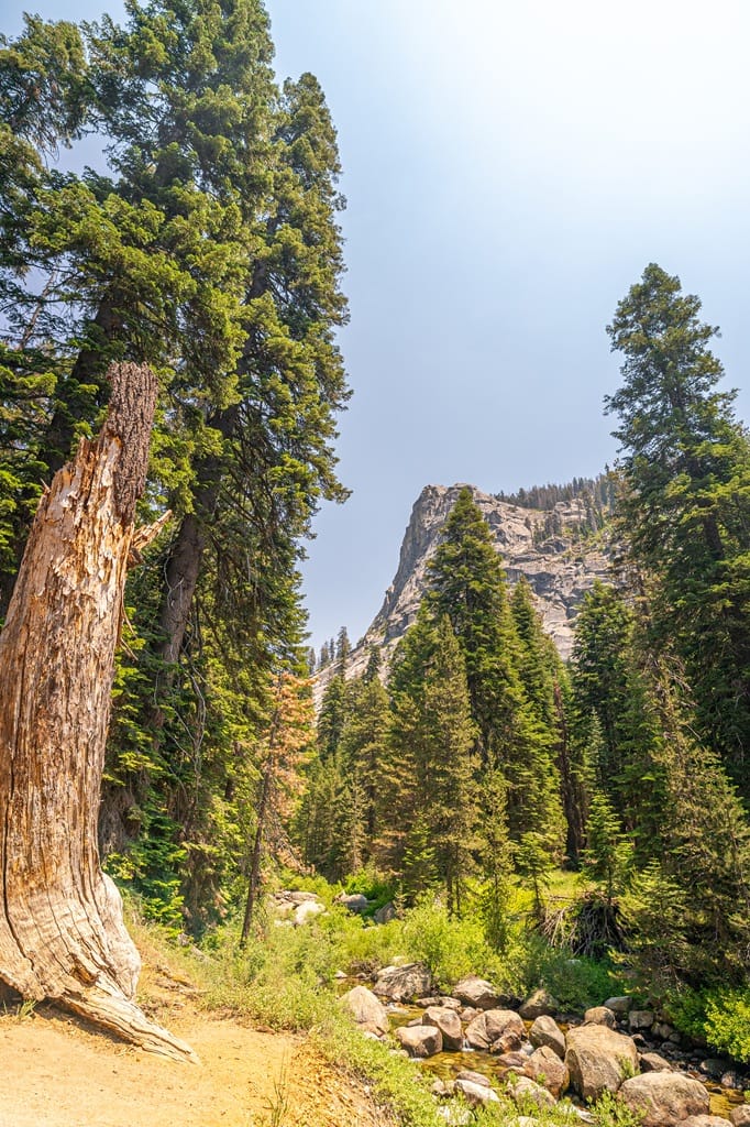
3. Hike to the Largest Waterfall in Sequoia – Tokopah Falls

Starting Point: Tokopah Falls Trailhead in the Lodgepole Campground
Length: 4 miles (6.4 km) roundtrip
Elevation Gain: 540-600 feet
Difficulty: Moderately challenging
Hiking Time: 2 to 2.5 hours
Route Type: Out-and-back
Pet-friendly? No, pets are not allowed
Hike Features: The Watchtower, Tokopah Valley, Marble Fork of the Kaweah River, and Tokopah Falls
✨ READ THIS: Tokopah Falls Hiking Guide
The Tokopah Falls Trail is a moderately challenging yet fairly short hike located near the Lodgepole Campground. This beautiful trail leads to the impressive Tokopah Falls, which drops about 1,200 feet.
The trail follows the Marble Fork of the Kaweah River as it winds through a scenic canyon. You’ll pass towering granite walls, lush meadows, and peaceful pine forests.
The trail is well-maintained with a steady, gradual incline, making it a great option for hikers of all ages!
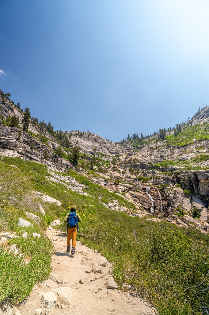
This is one of my favorite hikes in the park, especially in late summer when the river levels drop enough to safely enjoy a swim! Just be sure to use caution if you plan on taking a dip in any of the swimming holes along the trail.
🅿️ Trailhead/Parking: The Tokopah Falls Trailhead is located in the Lodgepole Campground near the Lodgepole Visitor Center. Parking is usually fairly easy as there is a large overflow lot near the trailhead. You’ll also find flush restrooms and potable water here.
🚌 Shuttle Info: During the busy months (late May through early September), you can also take the free Sequoia Shuttle, which stops at both the Lodgepole Visitor Center and Lodgepole Campground.
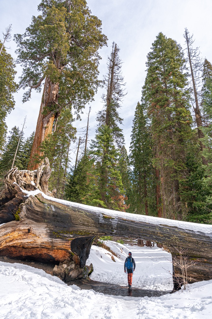
4. Drive Through a Giant Sequoia – Tunnel Log
Driving through a fallen giant sequoia is way more exciting than it sounds, trust me! It’s just something you have to do when visiting Sequoia National Park for the first time.
It’s also extremely popular, so expect traffic and a bit of a wait. If you want to avoid sitting in line to drive through the tunnel, my advice is to simply get there early!
🚗 How to Get There: Tunnel Log is located along Crescent Meadow Road about 1.6 miles (2.5 km) past the Giant Forest Museum.
🅿️ Parking: There is not an official parking lot at Tunnel Log, only small roadside turnouts nearby.
Shortly after the Moro Rock / Crescent Meadow Road was built, a giant sequoia fell across the road, blocking access. Instead of removing it, workers carved a tunnel right through the trunk.
Since 1935, visitors have been driving through what’s now known as Tunnel Log. Vehicles taller than 8 feet can use the bypass road instead.
In winter, the road closes to vehicles, but you can still reach Tunnel Log by hiking, snowshoeing, or cross country skiing along the road.
➡️ Tunnel Log Tip: Please don’t stop in the roadway for photos and be mindful of other vehicles passing through. This a popular spot so have patience! Get there early or wait until later in the day if you want to get photos of your car under Tunnel Log!
🚌 Shuttle Info: On weekends, private vehicles aren’t allowed on the road, so the free Sequoia Shuttle is the only way to reach Moro Rock and Crescent Meadow. The shuttle doesn’t stop directly at Tunnel Log, but you can walk there along the road (just be careful).
🐶 Pets: Pets are allowed in vehicles and on paved park roads, campgrounds, and picnic areas. They must be leashed at all times outside the vehicle (leash no longer than 6 feet).
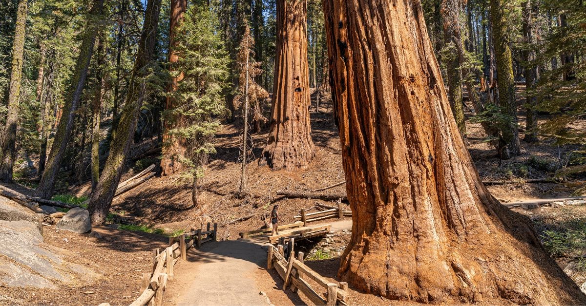
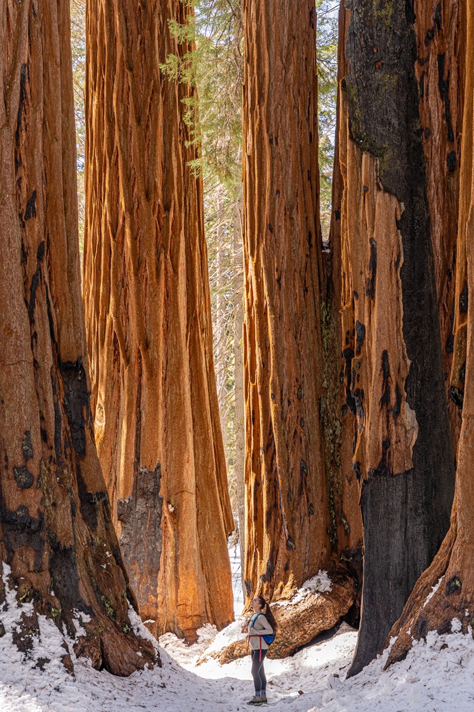
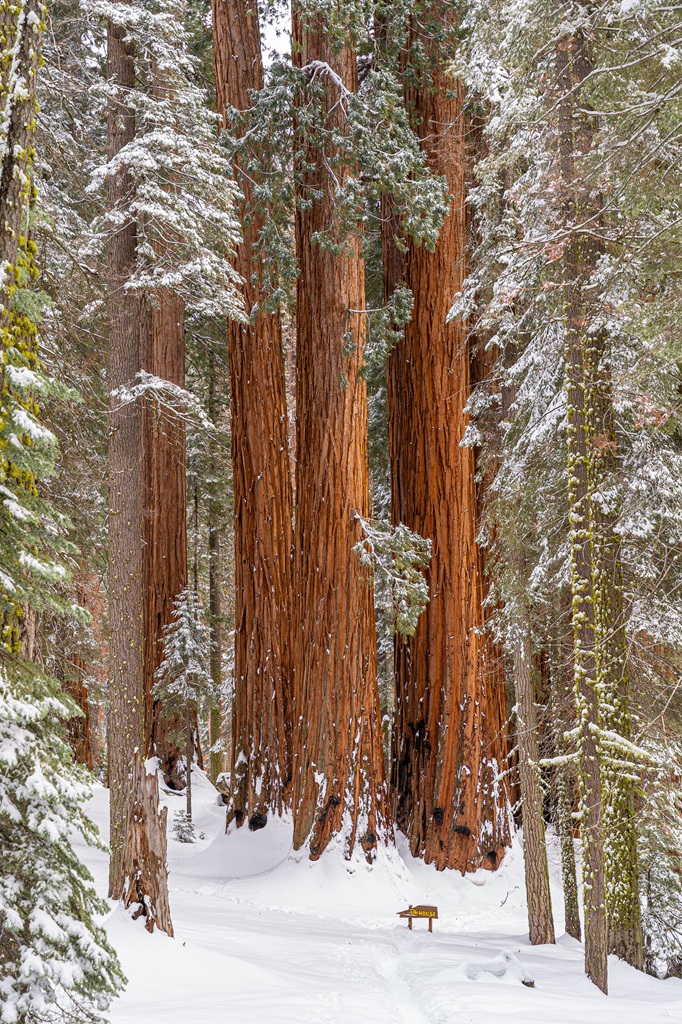
5. Hike in the Giant Forest – Congress Trail and Big Trees Trail
Giant Forest is a massive sequoia grove right in the heart of Sequoia National Park. It’s the largest unlogged grove of giant sequoias and home to more exceptionally large trees than anywhere else in the park.
This area is also where you’ll find the famous General Sherman Tree, the largest tree on Earth (by volume). But that’s not all! The Giant Forest is the most popular part of the park thanks to its variety of incredible hiking trails.
🗺️ Trails in the Giant Forest:
- General Sherman Tree Trail (1.1 miles / 1.7 km, easy to moderate)
- Congress Trail (2.8 miles / 4.5 km, moderate)
- Big Trees Trail (1.2 miles / 1.9 km, easy)
- Moro Rock (0.5 miles / 0.8 km, moderate to hard)
- Tokopah Falls (4 miles / 6.4 km, moderate)
- Crescent Meadow Loop and Tharp’s Log (1.3 miles / 2 km, easy)
- Alta Peak Trail (14 miles / 22.5 km, hard)
- Lakes Trail (13 miles / 20.9 km, hard)
- Circle Meadow Loop (4.3 miles / 6.9 km, moderate)
Most of the trails mentioned above are manageable for the average hiker. However, some of the longer hikes, like the Alta Peak Trail and Lakes Trail, are much more challenging, taking you to higher elevations and deeper into the Sequoia wilderness.
Now, let’s talk about two of my favorite hikes in the Giant Forest for seeing amazing giant sequoias up close – Congress Trail and Big Trees Trail.
🥾 Congress Trail
Starting Point: Sherman Tree Trailhead
Length: 2.8 miles (4.5 km) roundtrip
Elevation Gain: 460 feet
Difficulty: Moderately challenging
Hiking Time: 1 to 1.5 hours
Route Type: Lollipop
Pet-friendly? No, pets are not allowed
Hike Features: Chief Sequoyah, The President Tree, The Senate Group, The House Group, McKinley Tree, and other unique giant sequoias
✨ READ THIS: Congress Trail Hiking Guide
The Congress Trail is a beautiful loop trail that winds through the heart of the Giant Forest. If your goal is to see giant sequoias up close, this is the hike for you!
🌳 Congress Trail Highlights:
- The President Tree – The third-largest tree in the world by volume, estimated to be around 3,200 years old.
- Chief Sequoyah – The ninth-largest tree in the Giant Forest, named after the Cherokee leader who created the Cherokee syllabary.
- The Senate Group and The House Group – Massive clusters of towering sequoias, named back in the 1920s.
- McKinley Tree – Standing over 240 feet tall, this giant sequoia sits near a five-way junction and is easy to spot thanks to its height.
- Room Tree – A hollow sequoia you can actually step inside. The opening at its base was formed naturally by fire over time.
🅿️ Trailhead/Parking: The main access point for the Congress Trail is the Sherman Tree Trailhead, located off Wolverton Road about 10 minutes south of the Lodgepole Visitor Center. There are restrooms and drinking water here.
If you have a disability placard, you can park at the smaller accessible lot off Generals Highway. This smaller lot is open to everyone during winter, and it also has restrooms available.

🗺️ How to Reach the Congress Trail: From the Sherman Tree Trailhead, follow a paved path downhill. You will see a sign indicating the start of the Congress Trail on the left. Either start the hike or continue along the paved path to see the General Sherman Tree first. After seeing General Sherman, retrace your steps to start the Congress Trail.
I highly recommend combining the General Sherman Tree Trail and Congress Trail. They’re right next to each other and make the perfect combo for first time visitors who want to see lots of stunning giant sequoias!
🚌 Shuttle Info: If you’re visiting during the busy season (late May through early September), the free Sequoia Shuttle is a great way to reach one of the starting points. Route 1 (Green) stops at the accessible parking area, while Route 4 (Orange) takes you to both the Sherman Tree Trailhead and the accessible lot.
🥾 Big Trees Trail

Starting Point: Big Trees Trailhead near the Giant Forest Museum
Length: 1.2 miles (1.9 km) roundtrip
Elevation Gain: 105 feet
Difficulty: Easy
Hiking Time: 30 minutes to 1 hour
Route Type: Loop
Pet-friendly? No, pets are not allowed
Hike Features: Sentinel Tree, Clara Barton Tree, giant sequoia trees, and Round Meadow
✨ READ THIS: Big Trees Trail Hiking Guide
The Big Trees Trail is one of the easiest and most scenic walks in Sequoia National Park. This flat, mostly paved loop is very accessible for visitors of all ages and abilities, and there are benches along the way where you can relax and take in scenery.
🌳 Big Trees Trail Highlights:
- Giant Forest Museum
- Sentinel Tree
- Clara Barton Tree
- Round Meadow
- Interpretive signs about the giant sequoia ecosystem
If you want the ultimate day of exploring giant sequoias, combine the Big Trees Trail with the General Sherman Tree Trail and the Congress Trail. This is one of the best ways to spend a day in Sequoia National Park!

🅿️ Trailhead/Parking: The Big Trees Trailhead is located just down the road from the Giant Forest Museum, near Round Meadow. The main parking area is across from the museum, and from there it’s an easy 0.3-mile (0.4 km) paved walk to reach the trailhead. Vault toilets and drinking water are available near the museum as well.
There’s also a small parking lot directly at the trailhead with a few designated accessible spaces. In the summer, this lot is reserved for visitors with disability placards, while in the winter it’s open to all visitors.
🚌 Shuttle Info: During peak season (late May through early September), the free shuttle system is a great way to reach the Giant Forest Museum. Route 1 (Green) stops at the Giant Forest Museum. You may have to transfer from one shuttle bus to another to reach the museum. Make sure to check out the shuttle bus map!
6. Learn More About Giant Sequoias at the Giant Forest Museum
The Giant Forest Museum is a great first stop before hitting the trails in the Giant Forest. You’ll learn a lot about giant sequoias, surrounding meadows, and the area’s human history. This will give you a better understanding and deeper appreciation once you’re out on the trails.
Inside, you’ll find interactive exhibits where you can learn how to identify trees, understand the difference between giant sequoias and California coastal redwoods, and explore the park’s ecology in a fun, engaging way.
Several trails start right from the museum, including the Big Trees Trail, Sunset Rock, Beetle Rock, and Moro Rock Trail.
There’s a large parking lot across the street that can fit up to 240 vehicles, a smaller accessible lot next to the museum, and a shuttle stop for easy access during the busy months.
The Giant Forest Museum is definitely worth a quick stop because who doesn’t love to learn more about the place they’re visiting? 😉
7. Explore an Underground Marble Cavern – Crystal Cave
If you’re up for a little adventure, visiting Crystal Cave is one of the most unique experiences in Sequoia National Park!
This cave is a stunning marble cavern, and the only way to visit is on a guided tour to help protect its fragile formations. The experience includes a 0.5-mile (0.8 km) loop inside the cave, plus a steep 0.5-mile (0.8 km) walk from the parking area down to the entrance (and back up after).
🎟️ Tours and Tickets: Guided tours are typically offered from spring through fall by the Sequoia Parks Conservancy. Tickets must be purchased online – at least 36 hours in advance. I recommend buying tickets as early as possible, at least 1-2 months ahead of time. Tickets are not sold at the cave!
🚗 How to Reach the Cave: Crystal Cave is located near the Giant Forest Museum. Be aware that vehicles over 22 feet and trailers are not allowed on Cave Road.
- From Foothills Visitor Center: drive 13 miles (20 km) on Generals Highway, then turn onto Cave Road and continue 6.5 miles (10 km).
- From Lodgepole Visitor Center: drive 6.5 miles (10 km), turn onto Cave Road, then continue another 6.5 miles (10 km).
⚠️ Know Before You Go:
- Buy your park pass ahead of time – entrance lines can get long, especially on weekends.
- Bring a jacket! It’s pretty cold inside the cave – about 50˚F / 10˚C.
- Pets are not allowed in or around the cave, on the trail, or unattended in the vehicle.
- Strollers are not allowed due to stairs and steep sections.
- The tour may not be a good fit if you have claustrophobia or certain health conditions.
🦇 Important Note: White-nose syndrome (a fungal disease affecting bats) has made its way to California. To help protect wildlife, avoid wearing the same shoes or gear if you’ve visited other caves recently.
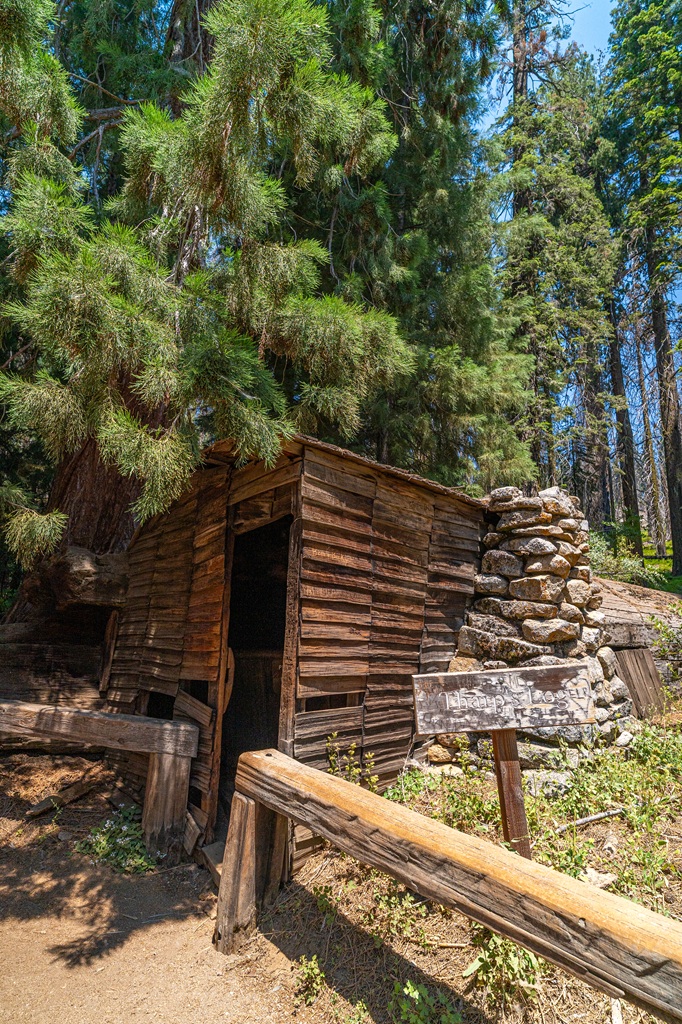
8. Hike to Tharp’s Log in Crescent Meadow
Starting Point: Crescent Meadow Trailhead (also known as the High Sierra Trailhead)
Length: 1.8 miles (2.8 km) roundtrip
Elevation Gain: 220 feet
Difficulty: Easy
Hiking Time: 45 minutes to 1 hour
Route Type: Loop
Pet-friendly? No, pets are not allowed
Hike Features: Crescent Meadow, Tharp’s Log, and Chimney Tree
✨ READ THIS: Crescent Meadow Loop and Tharp’s Log Hiking Guide
If you’re looking for a beautiful, family-friendly hike in Sequoia National Park that’s not as crowded as the General Sherman Tree, the Crescent Meadow Loop Trail is it!
This easy loop winds through towering giant sequoias, passes by open meadows, and leads to Tharp’s Log – a really cool cabin built in the 1800s by Hale Tharp inside a fallen sequoia log.
The main loop is about 1.3 miles (2 km), but if you want to see Tharp’s Log (which I definitely recommend), you’ll take a short detour onto the Tharp’s Log Trail. It reconnects with the main loop, turning it into a slightly longer but still easy 1.8-mile (2.8 km) hike.
It’s a very peaceful trail and one of my favorite easy hikes in Sequoia National Park!


🅿️ Trailhead/Parking: The Crescent Meadow Trailhead (also known as the High Sierra Trailhead) is located at the very end of Crescent Meadow Road, about 2.6 miles (4.1 km) past the Giant Forest Museum. There are restrooms and picnic tables at the trailhead.
🚌 Shuttle Info: During the busy summer season, it’s often easier to park at the Giant Forest Museum and take the shuttle. Shuttles run regularly to Crescent Meadow and Moro Rock, and on summer weekends, Crescent Meadow Road is closed to private vehicles, so the shuttle is your only option.
9. Cruise Along the Generals Highway (scenic viewpoints and quick stops)
One of the best ways to experience Sequoia National Park is by driving the Generals Highway. This scenic 47-mile mountain road connects Sequoia to Kings Canyon National Park. It was completed in 1935 and has been a popular route between the two parks ever since.
The drive starts in the foothills at the Ash Mountain Entrance (around 1,700 feet) and climbs all the way up into the Giant Forest at about 6,500 feet, eventually reaching elevations around 7,500 feet as you head towards Kings Canyon.
It’s definitely not your average drive. Expect narrow sections, tight turns, and steep drop-offs. Take it slow, enjoy the journey, and use pullouts if cars start stacking up behind you.
⚠️ Length Restrictions: Because the road is narrow and winding, there are length restrictions. Vehicles over 22 feet are not recommended on the Generals Highway between Potwisha Campground and the Giant Forest Museum, and vehicles over 24 feet are not advised between Foothills Visitor Center and Potwisha Campground.
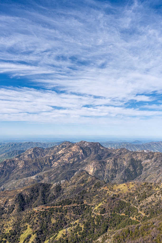
Along the way, there are plenty of easy stops and viewpoints where you can stretch your legs and take in incredible views of Kaweah Canyon and the surrounding mountains.
🛣️ Generals Highway Stops:
- Historic Sequoia National Park Sign – Built by the Civilian Conservation Corps in 1935, this classic wooden sign is a popular photo stop. It was intended to honor Sequoyah, though the figure actually reflects a more generalized (and inaccurate) depiction of a Plains Native American rather than Sequoyah or any California tribe.
- Foothills Visitor Center – A great first stop to grab maps, check current conditions, and learn about the foothills ecosystem. Plus, restrooms are available here.
- Tunnel Rock – A massive granite boulder that once formed a natural tunnel over the Generals Highway. The road has since been rerouted, but you can still check it out up close! There’s parking nearby and a short paved path that leads to the old roadway beneath the rock.
- Hospital Rock – A historic site with Native American pictographs and grinding mortars from a former village area.
- Amphitheater Point – A scenic pullout at a sharp hairpin turn with awesome views of Moro Rock and the surrounding canyon.
- Eleven Range Overlook – Offers sweeping views over Kaweah Canyon all the way toward the San Joaquin Valley.
- Four Guardsmen – A small but impressive group of four giant sequoias standing right beside the road.
- Halstead Meadow Picnic Area – A nice spot to take a break with picnic tables and a pit toilet. In spring, you might even spot black bears out in the meadow.
- Redwood Mountain Overlook – A pullout with views overlooking the largest intact giant sequoia grove in the world.
🗺️ Generals Highway Map:
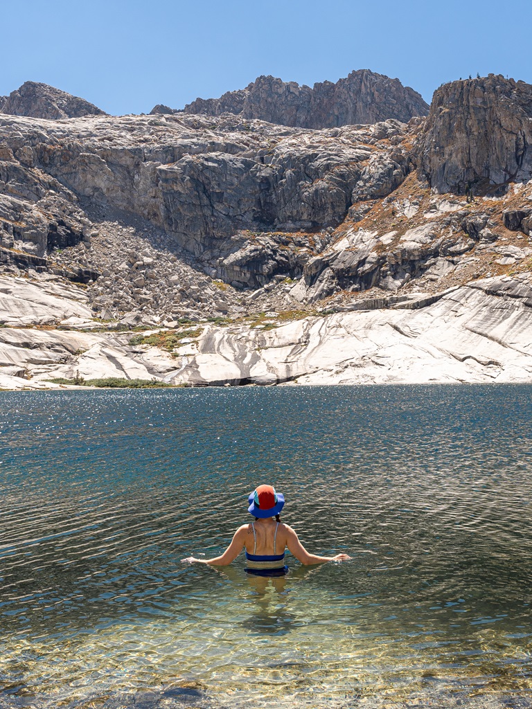
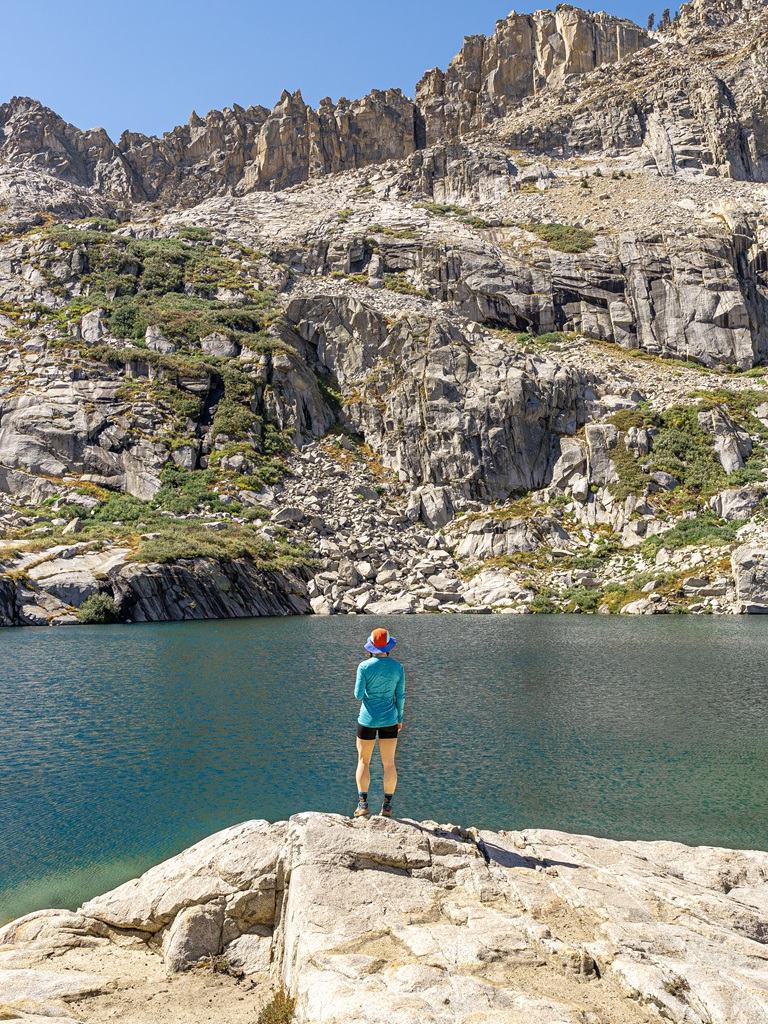
10. Hike to Alpine Lakes via the Lakes Trail
Starting Point: Wolverton Trailhead (Lakes Trail Trailhead)
Length: 13 miles (20.9 km) roundtrip
Elevation Gain: 3,200 feet
Difficulty: Challenging
Hiking Time: 6 to 8 hours
Route Type: Out-and-back
Pet-friendly? No, pets are not allowed
Hike Features: Watchtower, Heather Lake, Aster Lake, Emerald Lake, and Pear Lake
✨ READ THIS: Lakes Trail Hiking Guide
The Lakes Trail is easily one of the most beautiful hikes in the park – at least in my opinion. Combine it with the Watchtower Trail and you’ll be on one of the most adventurous and scenic day hikes in Sequoia National Park! 😍
This trail takes you past a series of stunning alpine lakes, including Heather Lake, Aster Lake, Emerald Lake, and Pear Lake, with incredible views of meadows, forests, and granite peaks along the way.
The hike starts around 7,300 feet and climbs steadily up to Pear Lake at 9,550 feet. There is a risk of altitude sickness as you get closer to Pear Lake so take it slow, drink plenty of water, and listen to your body.
The nice thing about this hike is that you don’t have to go all the way to Pear Lake to enjoy it. A lot of people turn around at the Watchtower (7 miles / 11.2 km roundtrip), Heather Lake (8 miles / 12.8 km roundtrip) or Emerald Lake (10.4 miles / 16.7 km roundtrip).
Either way, it’s a challenging hike, but 100% worth the effort!
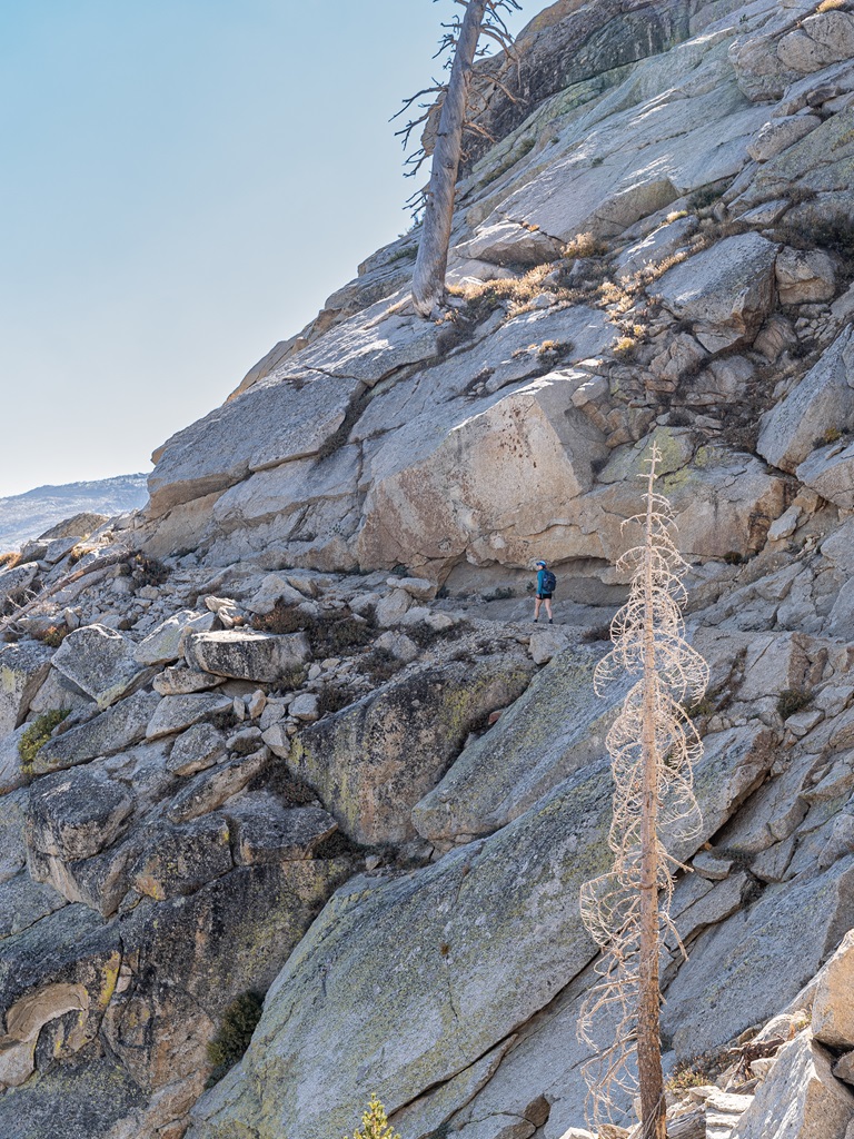
🥾 Route Options: In the summer, I highly recommend taking the Watchtower Trail instead of the Hump Trail. It’s way more scenic as compared to the latter. That said, if you have a strong fear of heights, the Hump Trail might be the better choice.
The Watchtower Trail is wide enough for two-way foot traffic, and I personally felt completely safe on it. But it does have steep drop-offs with no guardrails, which can feel a little intimidating. If you’re okay with some mild exposure, the views are absolutely worth it. If not, the Hump Trail is a great alternative – just be ready for a climb!
🅿️ Trailhead/Parking: The hike starts at the Wolverton Trailhead at the end of Wolverton Road. The parking lot is pretty large, but it can fill up quickly during peak season. Restrooms, trash cans, and bear boxes are available here.
🚌 Shuttle Info: During peak season (late May through early September), you can take the Sequoia shuttle to the Wolverton area. Be sure to check the shuttle map ahead of time so you know which route to take!
11. Watch Sunset at Sunset Rock
Starting from the Giant Forest Museum, the Sunset Rock Trail is a short, scenic hike that winds through a beautiful mixed-conifer forest filled with red fir, Jeffrey pine, sugar pine, and incense cedar.
The trail climbs gently to a large granite dome called Sunset Rock, where you’re rewarded with sweeping views over the deep canyon carved by the Kaweah River.
As the name suggests, it’s supposed to be an amazing sunset spot, at least that’s what I’ve heard. I haven’t actually done this hike or caught sunset here yet, but it’s on my list for this summer!
🥾 Sunset Rock Trail Stats:
- Length – 1.6 miles (2.5 km) roundtrip
- Elevation Gain – 150 feet
- Difficulty – Easy
- Pets? Not allowed
🅿️ Trailhead/Parking: The Sunset Rock Trailhead is located right across the street from the Giant Forest Museum. There’s a large parking area nearby, along with vault toilets and drinking water.
🚌 Shuttle Info: During peak season (late May through early September), the free shuttle system is a great way to reach the museum. Route 1 (Green) stops at the Giant Forest Museum, and you may have to transfer from one bus to another to reach the museum. Make sure to check out the shuttle map!
12. Summit an 11,200-Foot Mountain – Alta Peak

Starting Point: Alta Peak and Pear Lake Trailhead (also known as the Wolverton Trailhead)
Length: 14 miles (22.5 km) roundtrip
Elevation Gain: 4,000 feet
Difficulty: Challenging
Hiking Time: 8 to 10 hours
Route Type: Out-and-back
Pet-friendly? No, pets are not allowed
Hike Features: Panther Gap, Mehrten Meadow, Alta Meadow (side quest), Tharps Rock, and Alta Peak summit
✨ READ THIS: Alta Peak Hiking Guide
At 11,204 feet, Alta Peak offers some of the most incredible views in the park – the Great Western Divide, the Kaweah Peaks, the Tablelands, and endless Sierra Nevada wilderness. If you enjoy summiting mountains and don’t mind a good challenge, this adventure is perfect for you!
If you’re well acclimated and start early, this can be done as a long but very rewarding day hike. It’s definitely tough, but the views make every step worth it.
For a more relaxed pace, it also works really well as a 1-night backpacking trip. There are backcountry camping options along the way at Panther Gap, Mehrten Meadow, and Alta Meadow.
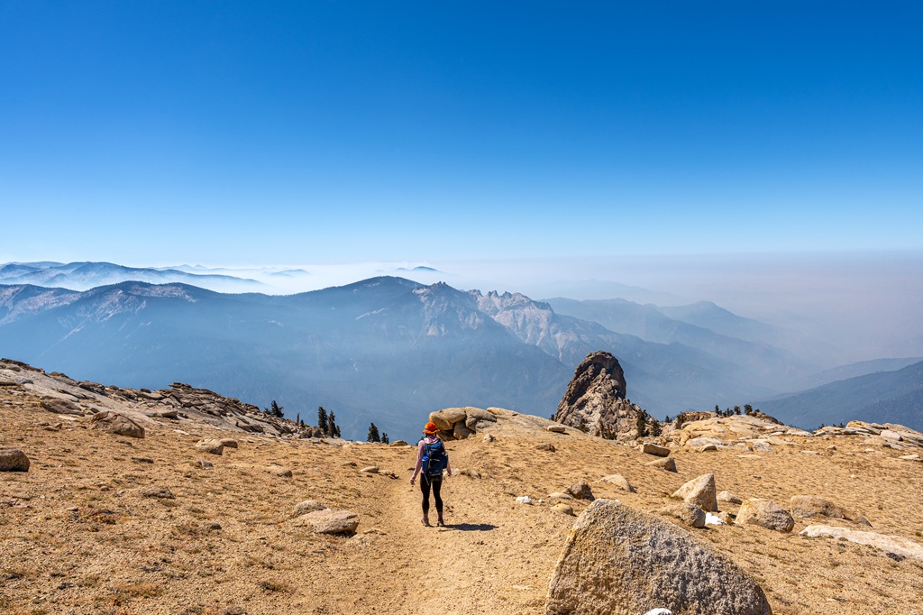
I’ve only summited Alta Peak once back in 2024, and I can’t wait to do it again! The entire hike was incredible from start to finish. There was a wildfire the first time we summited so some of the views were hazy but thankfully the smoke didn’t affect our ability to hike this trail.
🅿️ Trailhead/Parking: The hike starts at the Alta Peak and Pear Lake Trailhead (also known as the Wolverton Trailhead) at the end of Wolverton Road. The parking lot is fairly large, but it still fills up quickly during peak season. You’ll find restrooms, trash cans, and bear boxes available at the trailhead.
🚌 Shuttle Info: During peak season (late May through early September), the Sequoia shuttle is a great option for reaching the Wolverton parking area. You will have to transfer from one shuttle bus to another to reach the trailhead parking. Make sure to check out the shuttle map!
13. Hike a Trail in Mineral King
Looking to experience a totally different side of Sequoia National Park? Skip the crowds and head deep into the mountains to Mineral King Valley. This subalpine valley has a beautiful mix of dense pine, sequoia, and fir forests, set against vibrant granite and shale landscapes.
A long, narrow, winding mountain road leads you into this remote valley sitting at 7,800. It’s the highest place you can drive to in both Sequoia and Kings Canyon National Park – and one of the most peaceful.
A lot of people, especially first-time visitors, skip Mineral King since it’s far from the park’s main attractions and the hikes here are more challenging. But if you’re up for a tougher adventure, want to ditch the crowds, and explore a quieter side of Sequoia National Park, Mineral King is 100% worth it!
🥾 Popular Hikes in Mineral King
Monarch Lakes
- Length – 10 miles (16 km) roundtrip
- Elevation Gain – 2,850 feet
- Difficulty – Challenging
- Hike Features – Upper and Lower Monarch Lakes, epic views of Sawtooth Peak, meadows, red fir forest, and an alpine basin called Chihuahua Bowl
- Monarch Lakes Trail Map
Franklin Lakes
- Length – 12.2 miles (19.6 km) roundtrip
- Elevation Gain – 2,730 feet
- Difficulty – Challenging
- Hike Features – Franklin Lakes and views of rainbow-colored metamorphic rocks
- Franklin Lakes Trail Map
White Chief Trail
- Length – 7.4 miles (11.9 km) roundtrip
- Elevation Gain – 2,240 feet
- Difficulty – Challenging
- Hike Features – White Chief mine, James Crabtree cabin, and scenic views
- White Chief Trail Map
Crystal Lake
- Length – 9.6 miles (15.4 km) roundtrip
- Elevation Gain – 3,320 feet
- Difficulty – Challenging
- Hike Features – Crystal Lake, panoramic views of Mineral King Valley, an alpine basin called Chihuahua Bowl, and remnants of old Chihuahua Mine
- Crystal Lake Trail Map
Eagle and Mosquito Lakes
- Length – 9.7 miles (15.6 km) roundtrip
- Elevation Gain – 3,030 feet
- Difficulty – Challenging
- Hike Features – Eagle Lake, Mosquito Lakes, and incredible views along the trail
- Eagle and Mosquito Lakes Trail Map
Let me tell you something crazy – I still haven’t hiked any trails in Mineral King yet. 😱 I know, I know. My husband and I had plans to tackle a few trails in September 2024, but the area ended up closing because of the Coffee Pot Fire. That was a huge bummer! But this year will be the year we finally take on some of the trails in Mineral King. I’ll keep you posted!
⚠️ Road Construction: Mineral King Road will be undergoing major construction from 2025–2027, so expect weekday delays or occasional closures during spring, summer, and fall. Check the schedule before you go and plan for extra drive time!
✅ Know Before You Go
- Road Conditions: Mineral King Road is extremely narrow, steep, and winding, with some unpaved sections. RVs and trailers aren’t recommended and aren’t allowed in campgrounds.
- High Elevation: Sitting between 7,000–14,000 feet, hikes here are remote and often steep with lots of elevation gain. Take it slow, hydrate, and give yourself time to acclimate.
- Bear Activity: This is an active bear area, so always store food and scented items in lockers or sealed in your car (windows up) and never leave anything unattended.
- Marmots: From spring to mid-summer, marmots are known to chew on car wiring and radiator hoses – wrap your car with a tarp (available at the Mineral King Ranger Station) if you’ll be gone a while and check for damage before leaving.
- Ranger Station: The Mineral King Ranger Station offers maps, permits, first aid, bear canisters, and a limited supply of tarp. Food is not available here.
- No Services: There’s no gas or electricity in Mineral King. Fuel up or charge up in Three Rivers or Visalia beforehand.
- Seasonal Access: Mineral King is typically open late May through October and closes in winter due to snow.
14. Join a Guided Hike with a Ranger
Want to experience National Park Service programs in a more immersive way? Join a ranger for a guided walk through towering sequoia groves, a peaceful moonlight stroll, or sunset views from Beetle Rock.
All ranger-led walks, talks, and activities are free and open to the public. No reservations needed, just show up and join in!
Most programs run during the busy summer season from Memorial Day (late May) through Labor Day (early September). Outside of that window, there are usually fewer offerings depending on staffing.
You can check the online calendar ahead of time, but it’s always a good idea to stop by a visitor center when you arrive for the latest updates – schedules can change, guided walks can get canceled, or sometimes extra programs get added last minute.
15. Go Backpacking in Sequoia’s Backcountry
I have a lot of things on my bucket list and backpacking in Sequoia National Park’s backcountry is high on the list!
I won’t get into all the details on how to prepare here, but you can learn more about backpacking in Sequoia and Kings Canyon National Park HERE.
If you already have some backpacking experience and are looking for route ideas, here are a few popular options to check out. And if you’re new to backpacking, make sure you do plenty of research and plan carefully – these trips require a lot more preparation as compared to a typical day hike.
🥾 High Sierra Trail (Crescent Meadow to Whitney Portal)
- Length – 72 miles (115 km) one-way
- Elevation Gain – 16,430 feet
- Difficulty – Challenging
- Permit – Wilderness permit is required to hike the High Sierra Trail.
- Trail Description – The High Sierra Trail runs from Crescent Meadow to Whitney Portal, taking you on an unforgettable journey across the Sierra. It follows the Middle Fork of the Kaweah River, crosses the Great Western Divide at Kaweah Gap, dips into Big Arroyo and the Kern River Canyon, then climbs to meet the John Muir Trail with the option to summit Mount Whitney before finishing at Whitney Portal.
- High Sierra Trail Map
🥾 Five Lakes Loop
- Length – 29 miles (47 km) roundtrip
- Elevation Gain – 9,570 feet
- Difficulty – Challenging
- Permit – Wilderness permit is required to hike this route.
- Trail Description – This route is a scenic backpacking loop through the Big and Little Five Lakes and Monarch Lakes basins in the Mineral King area of Sequoia National Park. Along the way, you’ll hike through lush forests, pass waterfalls, tackle some tough climbs, and wander across rocky alpine terrain.
- Five Lakes Loop Trail Map
Best Time to Visit Sequoia National Park
🌷 Spring (March – May): Spring in the Giant Forest is unpredictable but beautiful. Expect temperatures between 50–70°F (10-21°C) and the possibility of lingering snow, especially in March and April.
Wildflowers begin to bloom, and the trails are less crowded than in summer. You might still need traction gear early in the season, but by late spring, the lower elevation trails in the Foothills and Giant Forest area are usually free of snow.
If you plan to head up to higher elevations, such as hiking to Alta Peak or Pear Lake, be prepared for snowy conditions. Always do your research beforehand!
☀️ Summer (June – August): Summer is the most popular time to visit Sequoia National Park. Days are warm (usually between 70–80°F / 21-27°C) and all the trails are fully accessible and snow-free. For higher elevation hikes, make sure to check trail conditions before heading out.
It’s a great time for hiking, but it’s also the busiest season. To avoid the biggest crowds and score a good parking spot, plan to hit the trail early in the morning.
Late summer can sometimes bring wildfire smoke, so keep an eye on air quality conditions before you go. If you’re not a fan of busy trailheads, consider using the free park shuttles to avoid the hassle of finding parking.
🍂 Fall (September – November): Fall is a great time to experience Sequoia National Park. Temperatures range from 40–70°F / 4-21°C, the summer crowds start to fade, and the air is crisp and cool.
While giant sequoias stay green year-round, you’ll still spot some colorful foliage from dogwoods and other nearby trees.
September usually still feels like summer, while October and November start to cool off, especially in the mornings and evenings. Be aware that early winter storms can happen in the fall so be prepared and check the weather forecast!
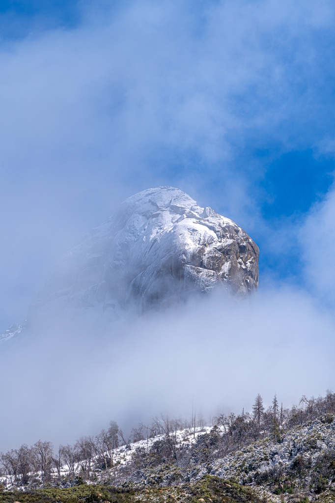
☃️ Winter (December – February): Visiting Sequoia National Park in winter is a completely different experience. It’s my favorite season to visit the park!
Temperatures can get really cold so dress appropriately and pack plenty of layers, and the trails may be icy and slippery so bring microspikes and hiking poles.
If you’re up to a fun winter adventure, use snowshoes or cross country skis to explore the trails if there’s enough snow.
⛓️ Chain Requirements: From November through March, it’s common for Sequoia National Park to activate chain control zones when road conditions get snowy or icy. All vehicles, including 4WD and AWD, are required by state law to carry tire chains or cables when entering these zones.


Tips for Visiting Sequoia National Park
✈️ Flying to Sequoia: The closest airport is Fresno Yosemite International Airport which is about a 1.5-hour drive to the Ash Mountain Entrance. Don’t forget you’ll need to rent a car!
🚗 Getting in Sequoia: Sequoia National Park has two main entrances. The Ash Mountain Entrance, near Three Rivers, brings you in through the foothills and up the scenic Generals Highway. The Big Stump Entrance is technically in Kings Canyon National Park but you can easily reach Sequoia from this entrance.
There are vehicle length restrictions on the General Highway from the Ash Mountain Entrance – vehicles over 22-24 feet aren’t recommend. The Big Stump Entrance is a better option if you have a larger vehicle.
💵 Sequoia National Park Entrance Fee:
Entrance to Sequoia National Park costs $35 per vehicle for a 7-day pass. However, if you have the America the Beautiful Annual Pass, your entry is free!
For those who love exploring national parks, investing in the Annual Pass is a smart choice. At just $80, it grants you access to over 2,000 federal recreation sites across the country!
FEE UPDATES! Beginning January 1, 2026, non-U.S. residents (without an annual pass) will pay a $100 per person in addition to the standard entrance fee. The Annual Pass for non-US residents will cost $250.
🚌 Shuttle Option: If you don’t want to drive, you can take a seasonal shuttle from Visalia to the Giant Forest Museum (typically late May through September). Once inside the park, free shuttles make it easy to get around the main areas.
⏰ Arrive to Sequoia Early: Sequoia National Park can get super busy during the summer months and holiday weekends resulting in traffic congestion and overcrowded trails. Aim to arrive at one of the entrances before 8 AM (the earlier, the better), grab parking at spots like Giant Forest, Lodgepole, or Wolverton, and then use the shuttle to get around.
⛽ Gas and EV Charging Stations: There are no gas stations inside the park, so fill up before you enter. You’ll find gas in Three Rivers (near Ash Mountain Entrance) and Dunlap (near Big Stump Entrance).
Gas is also available at places like Stony Creek Village (seasonal) and Hume Lake. EV charging stations are available in Three Rivers, Visalia, and Fresno.
📱 Download Offline Maps: Cell service is spotty (and often nonexistent). Download offline maps on Google Maps and AllTrails before you go.
🐾 Pets in Sequoia: Pets are only allowed on paved roads, parking lots, campgrounds, and picnic areas. And they must be on a leash (leash no longer than 6 feet). They are not allowed on trails!
🐻 Be Bear Aware: Black bears are active throughout the park. Store food properly, never leave anything scented in your car, and keep a safe distance if you see one. Follow these guidelines to stay safe! Also, bear spray is prohibited in Sequoia National Park.
🌲 Respect Nature: Follow Leave No Trace principles – plan ahead, pack out all trash, avoid disturbing wildlife, be considerate of others, and respect the natural beauty of Sequoia National Park.
Where to Stay in Sequoia National Park
Trying to figure out where to stay when visiting Sequoia National Park? Don’t worry, I got you covered!
Lodging inside the park is pretty limited, but there are a few great choices. If you’re more into camping, Sequoia has several awesome campgrounds for tents, RVs, and car campers.
Just outside the park, the town of Three Rivers (near the Ash Mountain Entrance) is one of the most convenient places to stay, with everything from cozy cabins to hotels.
Here are the best places to stay in and near Sequoia National Park 👇
Wuksachi Lodge
Wuksachi Lodge is the signature hotel inside Sequoia National Park and one of the best places to stay if you want easy access to all the main highlights.
It’s in a super convenient location near popular spots like the General Sherman Tree, the Giant Forest trails, and the Lodgepole Visitor Center and Market, making it a great place to stay with minimal driving once you’re there.
Open year-round, it’s ideal for exploring the park in any season, but it does book up quickly (often months in advance), so planning ahead is a must.
The lodge offers 102 spacious guest rooms with a few different options depending on your group size.
🏨 Room Options:
- Standard Rooms – Cozy, classic lodge-style rooms with either one king bed or two queen beds. Queen rooms also include a pull-out sofa and can sleep up to 4.
- Deluxe Rooms – A bit more spacious, great for families or small groups. Options include a king bed with a sofa bed or two queens with a table and chairs. Can sleep up to 5 with a rollaway bed or crib.
- Superior Rooms – The largest option, located in corner units for extra space and privacy. These include a king or two queen beds plus a sofa bed and seating area, and can sleep up to 6 with a rollaway bed or crib.
🌲 Amenities and Features: Guests can enjoy The Peaks Restaurant, a gift shop, meeting and event spaces, free parking, WiFi, and pet-friendly room options.
🤩 Book your stay at Wuksachi Lodge!
John Muir Lodge
John Muir Lodge is a cozy, rustic lodge in Kings Canyon National Park. It’s a perfect option if you want to explore both Kings Canyon and Sequoia National Park.
Built in 1998, it has a warm mountain feel with open-beam ceilings, a stone fireplace, and a historic redwood mantel from Sequoia National Park. The lobby great room is a nice place to relax with games, books, and puzzles, and there are public balconies where you can enjoy a Sierra sunset.
The drive from the John Muir Lodge to the Giant Forest Museum in Sequoia is about an hour along the scenic Generals Highway.
🏨 Room Options:
- Standard Rooms – These rooms are the basic mountain lodge accommodation. Rooms feature two queen beds, desk, and chairs, and sleeps up to 4 people.
- Deluxe Rooms – These rooms feature one king bed plus a sofa bed and seating area, and sleeps up to 4 people.
🌲 Amenities and Features: Free parking, WiFi, pet-friendly rooms, common areas with fireplaces, books, and game, and the Grant Grove Restaurant and gift shop are within walking distance.
🤩 Book your stay at John Muir Lodge!
Lazy J Ranch Motel
Lazy J Ranch Motel is a great stay place to stay in the historic town of Three Rivers. Set in the rolling Sierra foothills, this family-owned motel has been welcoming guests since 1975 and offers a relaxing place to unwind after a day in the park.
It’s just about 15 minutes from the Sequoia’s Ash Mountain Entrance, making it a convenient base for exploring the giant sequoias, hiking trails, and everything the park has to offer.
All rooms are one-story with private entrances, and the property is also pet-friendly.
🏨 Room Options:
- King Rooms – Simple and comfortable with one king bed, perfect for couples (sleeps 2).
- Two-Bed Rooms – Great for families or groups, sleeping up to 4 guests.
- Cottages – A more spacious option with a full kitchen, ideal for longer stays or larger groups (sleeps up to 6).
🌲 Amenities and Features: On-site parking, river access, and laundry facilities. Rooms include a mini-fridge, microwave, Keurig coffee maker, and a TV.
🤩 Book your stay at Lazy J Ranch Motel!
Buckeye Tree Lodge
Buckeye Tree Lodge is a stylish, recently updated stay located less than half a mile from Sequoia’s Ash Mountain Entrance. Sitting right along the Kaweah River next to the historic Pumpkin Hollow Bridge, the location really can’t be beat.
Originally established in the late 1940s, this longtime favorite in Three Rivers offers a mix of cozy rooms and cabins, many with river views and the soothing sound of rushing water just outside your door.
🏨 Accommodations:
- Lodge Rooms – Located in two buildings. Odd-numbered rooms are on the ground floor (pet-friendly with patios), while even-numbered rooms are upstairs with private balconies. All include WiFi, TV, microwave, mini-fridge, and A/C.
- Cabins and Cottages – Set across the street, these unique units feature custom woodwork, private outdoor spaces, and barbecue grills. Some also include fireplaces, with options ranging from queen cabins to larger multi-bedroom setups that sleep up to 8.
- Buckeye River House (Presidential Suite) – A spacious 3-bedroom, 2-bath option perfect for families or groups. It includes river-view balconies, a full kitchen, outdoor grill, laundry, and a wood-burning stove.
🤩 Book your stay at the Buckeye Tree Lodge!
AutoCamp Sequoia
AutoCamp Sequoia is a unique glamping stay located in Three Rivers, just about 15 minutes from Sequoia’s Ash Mountain Entrance. Set along the scenic Kaweah River, it combines the outdoor camping experience with the comfort of a boutique hotel.
The property is built for both relaxation and fun, with a seasonal outdoor pool, complimentary bike rentals, outdoor grilling areas, a cozy fireplace lounge, a general store, and an on-site restaurant called The Kitchen. You’ll also find WiFi, lawn games, and a clubhouse hangout space.
Depending on the season, they also offer extras like live music, yoga or Pilates classes, stargazing events, and other community activities.
🏕️ Lodging Options:
- Airstream Suites – Stylish, climate-controlled Airstreams with spa-style bathrooms and private outdoor spaces.
- Premium / Vista Airstream Suites – Upgraded layouts, with Vista options offering river views.
- Explorer Suites – Includes a complimentary AllTrails subscription for nearby hikes.
- BaseCamp Suites – A mix of Airstreams and canvas tents for a true glamping feel.
- Premium / Vista BaseCamp Suites – More privacy, with select river-view options.
- Premium Cabin – Modern tiny-home style stay with added privacy.
- Accessible Suite / King Room – Fully accessible, thoughtfully designed accommodations.
- Double Queen Bunk and King Bunk Rooms – Hotel-style rooms, great for families or groups.
🤩 Book your stay at AutoCamp Sequoia!
Comfort Inn & Suites Sequoia Kings Canyon
Comfort Inn & Suites Sequoia Kings Canyon is a convenient stay located in the foothills town of Three Rivers, just about 15 minutes from Sequoia’s Ash Mountain Entrance.
It’s a great spot to relax after a long day of hiking and exploring, with spacious rooms and suites designed for comfort. All accommodations include free WiFi, flat-screen TVs, premium bedding, and cozy seating areas.
🏨 Room Options:
- Standard Rooms – Comfortable hotel-style rooms with modern amenities and cozy beds.
- Suites – A great choice for families or longer stays, offering extra space and a separate seating area.
🌲 Amenities & Features: Complimentary continental breakfast, outdoor pool and hot tub, sauna and fitness center, EV charging stations, pet-friendly rooms, laundry facilities, gift shop, and a picnic area.
🤩 Book your stay at Comfort Inn & Suites Sequoia Kings Canyon!
There are also two other lodging options between Sequoia National Park and Kings Canyon National Park that are worth briefly mentioning.
🏨 Stone Creek Lodge is located just 15 miles north of the Giant Forest area in the Sequoia National Forest. It’s typically open from May through early October, offering 11 rooms.
On-site, you’ll find a casual restaurant serving pizza, an outdoor dining patio, a small market and gift shop, an ATM, and even a self-serve gas station.
Stony Creek Lodge has pretty mixed reviews. Some people say they had a great stay, while others felt it was a bit overpriced, outdated, or not as clean as expected. The big upside here is definitely the location.
🏨 Montecito Sequoia Lodge is a rustic, year-round lodge set on 40 acres of Sequoia National Forest land at about 7,400 feet elevation. It’s perfectly positioned between Sequoia National Park and Kings Canyon National Park.
The property also features a small private lake exclusively for guests, plus seasonal activities that make it especially popular with families.
Accommodation options include small vintage lodge rooms, vintage family lodge rooms, vintage sequoia lodge suites, new forest cabins, and new lakeview lodge suites.
The Montecito Sequoia Lodge has more positive reviews. That said, a few guests mention issues like unfriendly staff, cleanliness concerns, and not the best food. Still, most reviews are positive rather than negative.
Personally, I’d love to stay at both of these someday so I can share a firsthand review. I recommend doing a little extra research before booking so you can find the spot that fits your style and expectations best. 😊
More Fun Things to Do in Sequoia National Park
Already been to Sequoia National Park a few times and checked off a lot of the classic highlights? Looking for some new, fun things to do?
I may have covered the “best things to do in Sequoia National Park,” but there’s so much more to see and do! Here are a few extra ideas to help you experience even more of what this incredible park has to offer.
Hike More Trails in Sequoia
There are so many great hikes in Sequoia National Park! I mentioned the most popular ones above, but there are a few other ones that deserve an honorable mention.
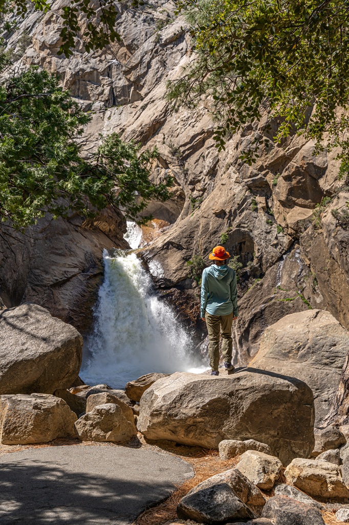
Marble Falls – A moderate to hard 6.5-mile (10.4 km) roundtrip hike with 1,500 feet of elevation gain, leading to Marble Falls – a beautiful series of cascades dropping roughly 510 feet.
Little Baldy – A challenging 3.4-mile (5.4 km) roundtrip hike with 800 feet of elevation gain that climbs to Little Baldy Dome, where you’ll be rewarded with incredible panoramic views.
Beetle Rock – An easy 0.2-mile (0.3 km) roundtrip stroll with 25 feet of elevation gain to Beetle Rock, offering great views for such a short walk.
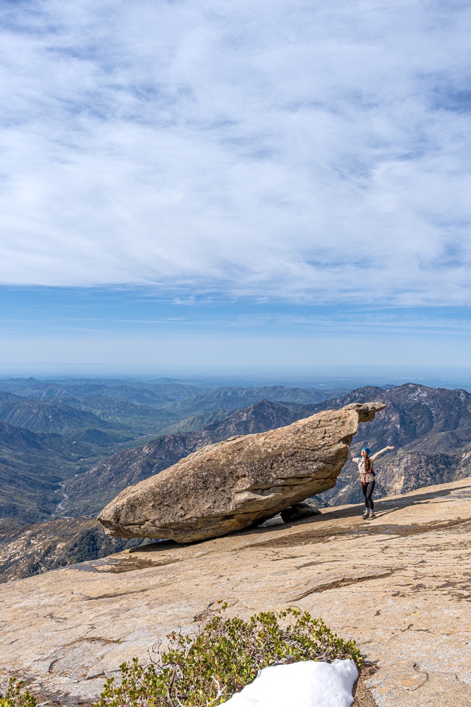
Hanging Rock – An easy to moderate 0.3-mile (0.4 km) roundtrip hike with 70 feet of elevation gain that leads to Hanging Rock, a unique, oval-shaped boulder.
Explore Muir Grove
Starting Point: Muir Grove Trailhead in the Dorst Creek Campground (closed – alternate route options described below)
Length: 4.2 miles (6.7 km) roundtrip (add 2-3 miles or 3.2-4.8 km due to current campground closure)
Elevation Gain: 500 feet
Difficulty: Moderately challenging
Hiking Time: 3-4 hours
Route Type: Out-and-back
Pet-friendly? No, pets are not allowed
Hike Features: Giant sequoia trees
Muir Grove is a beautiful, old-growth sequoia grove tucked away in a quieter part of Sequoia National Park. Because of its location, it sees far fewer visitors than the Giant Forest. It’s a great option if you’re looking to escape the crowds!
Along the Muir Grove Trail, you’ll pass a granite dome with incredible views before reaching the grove itself full of towering giant sequoias.
The hike begins at the Muir Grove Trailhead, located inside Dorst Creek Campground. However, the campground has been closed since 2023 due to winter storm damage, so parking inside is not currently available.
The closest parking option is a small pullout across Generals Highway, which adds about 2 miles to the total hike (6.2 miles / 9.9 km roundtrip).
Some hikers also start from the Little Baldy Trailhead and follow an unmaintained side trail, which adds roughly 3 miles total (7.2 miles / 11.5 km roundtrip).
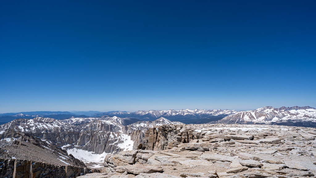
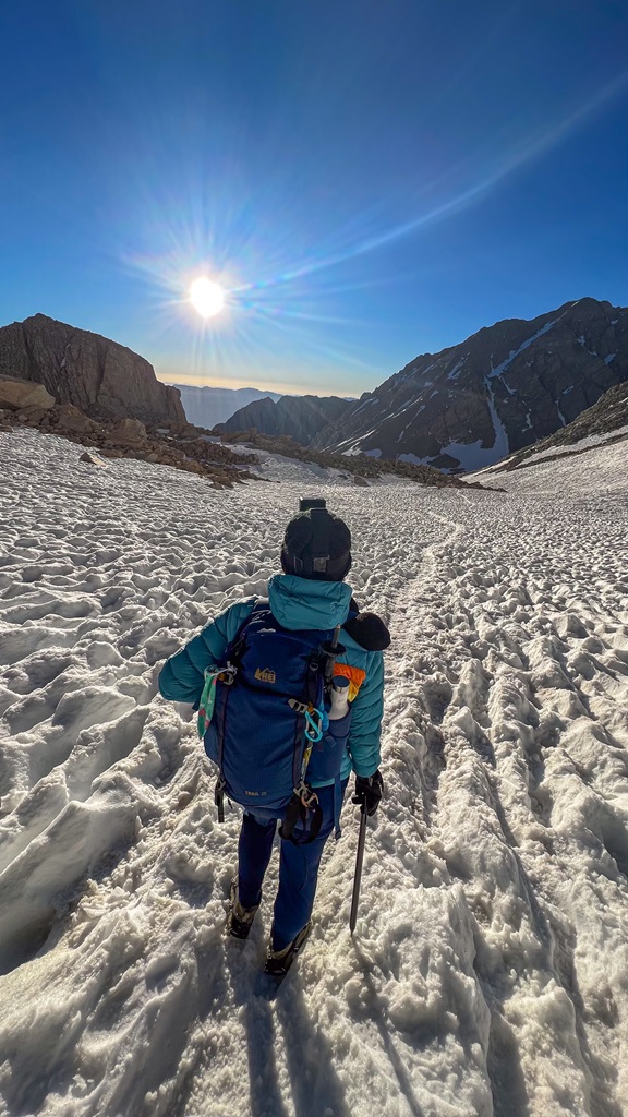
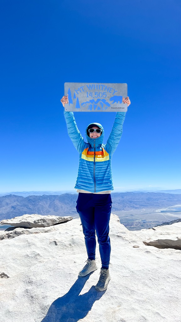
Summit Mount Whitney
Mount Whitney, standing at 14,505 feet, is the tallest peak in the contiguous U.S. and a bucket list hike for many outdoor lovers.
Located in California’s Eastern Sierra, the Mt. Whitney Trail is 22 miles (35 km) roundtrip hike with about 6,600 feet of elevation gain. You might be thinking… why include a hike that’s on the opposite side of the mountains?
Fair question. Technically, Mt. Whitney sits within Sequoia National Park, even though the main trailhead is near Lone Pine on the east side. So, since it’s still in the park, I feel like I should mention it.
The trail itself is well-maintained and non-technical during the typical hiking season (July–September). However, don’t let the words “non-technical” fool you. The altitude, distance, and elevation gain make this a big challenge, even for experienced hikers.
Thousands of people reach the summit each year, but it takes a lot of planning, proper acclimatization, and good fitness to do it safely, especially if you’re attempting it in a single day.
🏔️ If summiting this 14,505-foot mountain is on your bucket list, check out my ultimate Mt. Whitney guide to help you prepare!
Rock Climb in Sequoia National Park
Sequoia National Park is an awesome spot for rock climbing! You’ll find everything from beginner-friendly routes to challenging climbs, though most require a decent hike to reach.
The most accessible spot is Moro Rock, located right off Generals Highway near the Giant Forest. Its west face features about 1,000 feet of cracks and knobs, but keep in mind that some routes close in summer due to peregrine falcon nesting.
Little Baldy is another great option – a granite dome just over 8,000 feet with jaw-dropping views of the Great Western Divide.
For something more remote, head out on the High Sierra Trail to Angel Wings. At around 2,000 feet tall, it’s one of the biggest walls in the park, but it takes an 18-mile hike from Crescent Meadow to reach it.
To learn more about rock climbing in Sequoia, check out the park’s official page for more information!
Go on a Winter Adventure in Sequoia
Winter is my favorite season to visit Sequoia National Park! It’s quieter, less crowded, and the snowy landscape under the giant sequoias and on top of granite peaks is a beautiful sight.
If you’re into snowy adventures, there’s no shortage of things to do this time of year. I have a full blog post that dives into all the details (best things to do in Sequoia National Park in winter) but here are a few of my personal favorites! 👇
See the General Sherman Tree and Hike the Congress Trail – This is my absolute favorite winter activity. General Sherman Tree looks even more impressive with fresh snow at its base, and the nearby Congress Trail is just as incredible. It’s so stunning seeing all the giant sequoias in the snow. Plus, this trail is so much more peaceful during this time of year. Just be prepared! You may need either microspikes or snowshoes depending on trail conditions.
Hike along the Crescent Meadow Road to Tunnel Log – In winter, Crescent Meadow Road closes to cars but stays open for hiking, snowshoeing, and cross country skiing. It’s the perfect time to check out Tunnel Log without the crowds. You’ll also pass other highlights like Auto Log and the Parker Group.
Hike the Big Trees Trail – The Big Trees Trail is a great easy option in winter. It’s short, scenic, and surrounded by giant sequoias. It’s perfect if you want something low effort but still beautiful. Just keep in mind it can get icy, so microspikes might come in handy.
Climb to the top of Moro Rock – Moro Rock can be amazing in winter, but only if it’s safe. If the stairs are covered in snow or ice, it’s best to skip it. When they’re clear, though, the views from the top of snow-covered peaks are absolutely worth it.
Sequoia National Park Tours
If you’d rather skip the stress of planning and driving, booking a guided tour is a great option. There are tons of choices from guided hikes and full 1–2 day trips to winter snowshoe adventures. All you have to do is book the tour then show up and enjoy the experience without worrying about the details!
Here are a few great options from Viator.com 👇
What to Bring to Sequoia National Park
🎟️ Entrance Pass – You will need to purchase an entrance pass once you reach the entrance station or you can buy the America the Beautiful Pass ahead of time and use that for the entire year.
👚 Layers of Clothing (top) – Pack a moisture-wicking base layer, a fleece mid-layer, an insulated jacket, and an outer shell to protect you from the elements, such as rain and wind. You may not need all these layers, especially in the summer months, but it’s always best to be over-prepared!
Check out my favorite tops 👇
- Base layer: REI Co-op Sahara Shade Hoodie (warm/mild conditions) and REI Co-op Midweight Long-Sleeve Base Layer (cooler conditions)
- Fleece mid layer: Cotopaxi Teca Fleece Full-Zip Jacket
- Down mid layer: Cotopaxi Fuego Hooded Down Jacket
- Outer shell: In the summer I always pack a light windbreaker, such as the Cotopaxi Teca Crop Windbreaker or the RevolutionRace Unit Light Windbreaker. Make sure to also pack a waterproof rain jacket – I like the Patagonia Torrentshell 3L Jacket.
🩳 Hiking Shorts or Pants – Pack a comfortable, durable, and stretchy pair of hiking shorts or pants. Also think about what conditions you might run into, such as warm or cold temperatures, wind and/or rain, bugs, and overgrown trails.
Check out my favorite hiking bottoms 👇
- Cotopaxi Losdos Zip-Off Pants
- RevolutionRace Breezy Ankle Outdoor Pants
- Baleaf Fleece-Lined Jogger Pants
- RevolutionRace Summit Pocket Tights
- Revolution Race Hike & Dive Shorts
🥾 Hiking Footwear – Bring a good pair of hiking boots or shoes with good traction. If I’m not expecting to hike in too much mud or snow, my go-to hiking shoes are the Altra Lone Peak trail runners. They have a wide-toe box, 0 mm heel-to-toe drop, and MaxTrac rubber outsole. Plus, they’re lightweight and so comfy!
🧦 Socks – Moisture-wicking, quick-drying socks are the way to go. My favorite pair of hiking socks are Darn Tough Hiker Micro Crew Cushion Socks. Always pack an extra pair!
🎒 Day Pack – What you plan to do (sightseeing, hiking, etc.), determines what size pack you’ll need. Here is what I typically bring based on what I’m doing that day 👇
- Short walks and sightseeing: Cotopaxi Kapai 1.5L Del Dia Hip Pack
- Short, easy to moderate day hikes: REI Co-op Flash 22L Pack
- Long, moderate to challenging day hikes: REI Co-op Trail 25L Pack or Cotopaxi Luzon Del Dia 24L Pack
🥢 Trekking Poles – Essential for stability, balance, and support when hiking trails, especially on tough, rocky, and uneven terrain. I use REI Co-op Trailmade Trekking Poles and love them!
❄️ Microspikes – Bring a pair of microspikes if you’re visiting in the winter and you’re planning to hike along icy trails. They will give you good traction to avoid slipping! I use Black Diamond Access Spike Traction Device.
🦟 Mosquito/Bug Repellants – In the warmer months, be prepared for annoying gnats, mosquitoes, and flies. Wear long-sleeve clothing, a head net, and use bug spray.
🧤 Extra Warm Layers – If you expect cooler conditions or hiking to higher elevations, make sure to pack extra layers for added warmth, such as gloves, beanie, neck gaiter, and a light jacket.
🗺️ Navigation – Carry a physical topographic map, compass, a satellite messenger (or personal locator beacon), and download offline maps to help you stay on course, find your way in unfamiliar terrain, and call for help if needed.
🔦 Headlamp/Flashlight – A reliable light source with extra batteries, in case you end up hiking in the dark or need it for emergency situations.
💧 Water – Water bottles to carry sufficient water to stay hydrated, along with a filtration system or purification tablets if you plan to refill from natural sources.
🍕 Food – Energy-rich snacks or meals to keep your energy levels up during the hike.
😎 Sun Protection – Sunscreen, sunglasses, and a sunhat to protect yourself from harmful UV rays, even when it’s cloudy. Also, polarized sunglasses are important when it’s bright outside and to reduce glare from reflective surfaces like water, snow, and roads.
🩹 First-Aid Kit – A basic first-aid kit with items like bandages, antiseptic, pain relievers, and any personal medications you may need.
🥶 Emergency Shelter – Pack an emergency bivy sack or space blanket for shelter in case of sudden weather changes.
🔥 Fire – A lighter, matches, or fire starter to help you build a fire for warmth or signaling in case of emergency. Along with matches, I also carry a multi-tool carabiner that has a fire starter, utility blade, screwdriver, and bottle opener.
🗡️ Multi-Tool and Repair Kit – A versatile tool/knife and repair kit to handle any task, from preparing food to making repairs.
💩 Waste Disposal Supplies – WAG bags, trowel, toilet paper, pee cloth, wipes, Ziploc bags – be sure to pack out everything!
Things to Do Near Sequoia National Park
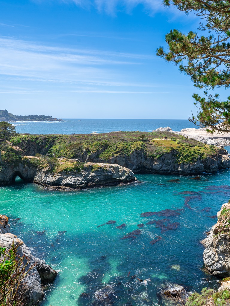
Looking to explore beyond Sequoia National Park? Or planning a road trip and want to add a few more epic stops? You’re in luck – there are some incredible places nearby that are worth the extra drive!
Kings Canyon National Park
Kings Canyon National Park sits right next to Sequoia, and the two parks are often grouped together as one. I recommend dedicating a day to exploring Kings Canyon.
🥾 A few must-do hikes in Kings Canyon:
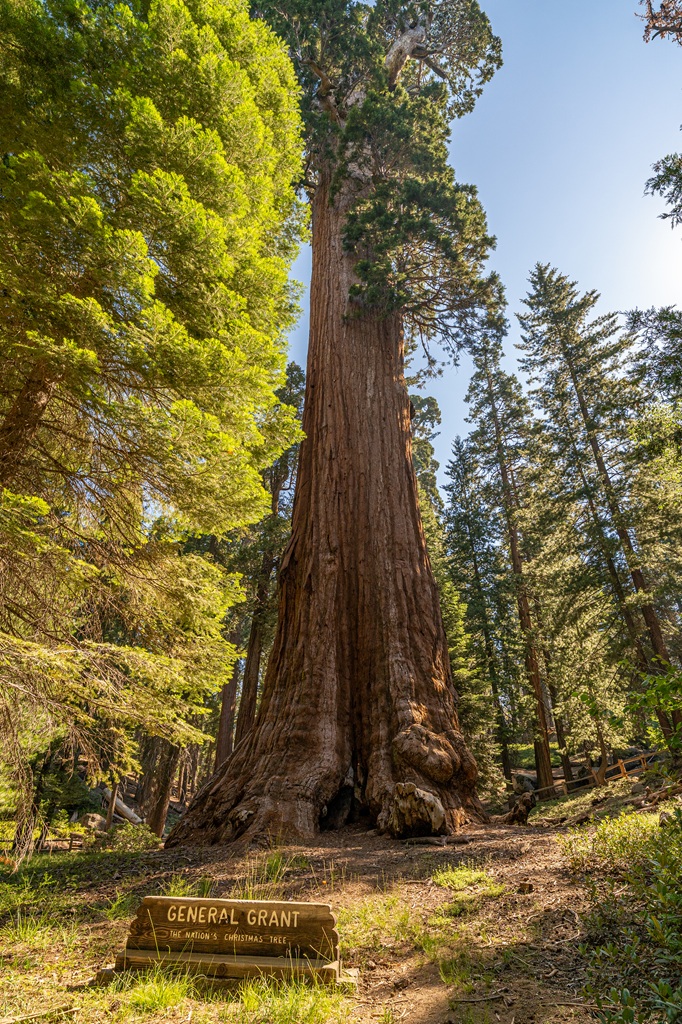
General Grant Tree – See the second-largest tree in the world! Hike along the General Grant Tree Trail for 0.2 miles (0.3 km) to reach the tree. Continue along the trail to see other unique features like Gamlin Cabin and Centennial Stump. Total hike is only 0.6 miles (0.9 km) roundtrip and doable for all ages.
Panoramic Point Overlook – Hike 0.5 miles (0.8 km) to Panoramic Point for incredible view of the Kings Canyon, Hume Lake, and the distant mountains. The trail is entirely paved and perfect for all skill levels.
Roaring River Falls – This is a popular hike that leads you to a powerful 40-foot waterfall called Roaring River Falls. The trail is easy to follow and short at just 0.3 miles / 0.4 km roundtrip.
Zumwalt Meadows – This is one of the park’s most beautiful spots. This is a short, easy, family-friendly hike. It’s a great place to see wildlife, such as deer, black bears, and marmots!
Big Stump Loop – Hike 1.7 miles (2.7 km) along the Big Stump Loop Trail to see the “Big Stump”. It used to be known as the Mark Twain Tree which grew to be 16 feet in diameter. It was unfortunately cut down in 1891 by the U.S. Army so it could be displayed to crowds around the world.
Buena Vista Peak Trail – This is one of my favorite short hikes in Kings Canyon. It’s moderately challenging but only 2 miles (3.2 km) roundtrip. At the top of Buena Vista Peak you’ll get stunning panoramic views of Sequoia and Kings Canyon!
Planning to visit Kings Canyon National Park? Check out my travel guides! 👇
Yosemite National Park
Ah yes, Yosemite National Park. My favorite place in the world. I’ve been more times than I can count, and I love helping others experience just how incredible it is (along with Sequoia and Kings Canyon). It’s a place everyone needs to see at least once with their own eyes.
Below are a few of my favorite hikes in Yosemite. I also have plenty of blog posts that dive deeper into trip planning, itineraries, and detailed trail guides, so you’ll have everything you need to plan your visit.
🥾 A few must-do hikes in Yosemite:
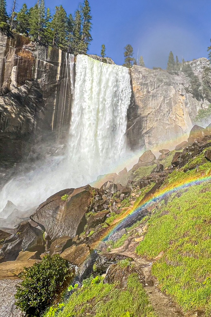
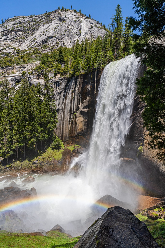
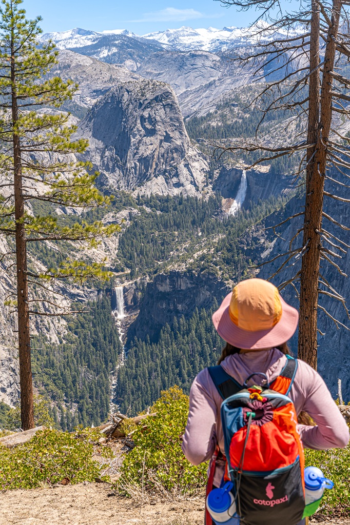
Mist Trail to Vernal and Nevada Falls – This is the most popular and most iconic hike in Yosemite National Park. Hike 1.5 miles one-way to the top of Vernal Fall along the famous granite steps embracing the powerful mist. If you have more energy and time, continue to the top of Nevada Fall – it’s worth the extra effort!
Four Mile Trail to Glacier Point – Want to see amazing views of Yosemite Falls, Half Dome, and the High Sierra peaks? Tackle the Four Mile Trail! It’s about 9.8 miles (15.7 km) from Yosemite Valley to Glacier Point and back down. Be prepared for a tough climb with 3,420 feet of elevation gain!
Upper Yosemite Fall Trail – This is one of my favorite hikes in Yosemite! It’s not as scenic as the Four Mile Trail but if you go during peak flow, you’ll get to feel the power of Upper Yosemite Fall up close! It’s one of the most challenging day hikes in the valley – 7 miles (11 km) roundtrip with 3,200 feet of elevation gain.
Sentinel Dome and Taft Point – Looking for short and moderately challenging hikes that lead to some of the most beautiful views in Yosemite? Add Sentinel Dome and Taft Point to your list! Sentinel Dome is 2.2 miles (3.5 km) roundtrip with 500 feet of elevation gain and Taft Point is 2.4 miles (3.8 km) roundtrip with 350 feet of elevation gain. They’re both great spots for watching sunrise or sunset!
Panorama Trail to Illilouette Fall – This is an insanely scenic hike with views of Half Dome, Vernal Fall, Nevada Fall, and distant granite peaks. It’s all downhill to Illilouette Fall (2.2 miles / 3.5 km one-way). You can continue a bit further to the Illilouette Creek Footbridge which is a great spot to rest and eat a meal before the tough climb back up to Glacier Point.
Wapama Falls Trail – Head over to the lesser-visited side of Yosemite – Hetch Hetchy! There you can hike the Wapama Falls Trail 2.5 miles (4 km) one-way to the 1,300-foot waterfall known as Wapama Falls.
Planning to visit Yosemite National Park? Check out my travel guides! 👇
- 1-Day Yosemite Itinerary for First-Time Visitors
- Where to Stay Outside of Yosemite (best places in 2026)
- 13 Best Hikes in Yosemite Valley You Can’t Miss!
- Fresno to Yosemite Day Trip: Itinerary for Every Season
- First Timer’s Guide to Glacier Point Road in Yosemite
- Best Spots to Find Giant Sequoia Trees in Yosemite
- 10 Must-Do Easy Hikes in Yosemite for All Skill Levels
- Hetch Hetchy Hikes: Explore This Hidden Gem
- 20 Best Yosemite Waterfalls You Can’t Miss!
- Ultimate Guide to Visiting Yosemite in May
- Is Tioga Pass Open? Plan an Epic Trip with This Guide
- 13 Best Tioga Pass Hikes for Adventure Lovers
- 20 Best Things to Do in Tuolumne Meadows and Tioga Pass in Yosemite
Conclusion
Sequoia National Park is best known for its giant sequoias but there’s so much more here than just the trees. Beyond the sequoias, you can hike to alpine lakes, explore a marble cave, summit mountains and granite domes, and hike to stunning waterfalls
Hopefully this guide helped you discover some of the best things to do in Sequoia National Park and gave you inspiration for planning your own epic adventures.
If you’ve visited the park, drop a comment below and share your favorite moments from your trip!
📌 Enjoyed this post? Pin for later!
🏞️ Explore more incredible places in California!