Are you planning your first trip to Yosemite National Park? You must add Glacier Point Road to your itinerary! On this drive you will find jaw-dropping viewpoints and scenic hikes. 😍
Glacier Point Road is a 16-mile (26-km) drive that leads to one of the most popular places in Yosemite – Glacier Point. At the end of the road, you will find a large parking lot, bathrooms, a store with ice cream, snacks, and souvenirs, an overlook with the most amazing views, and several hiking trails.
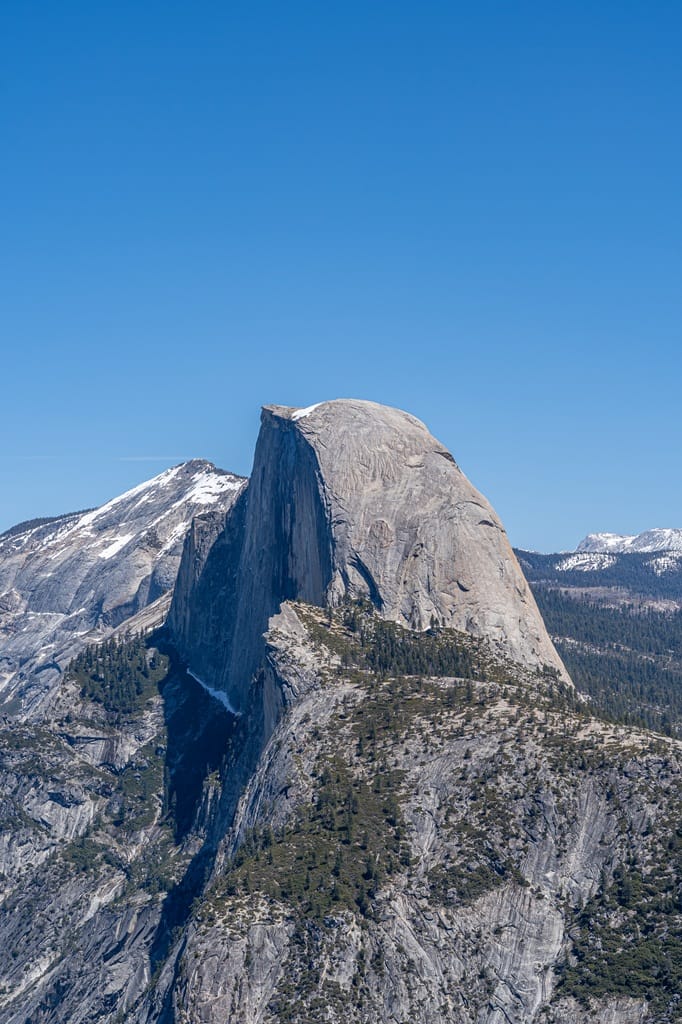
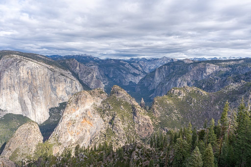
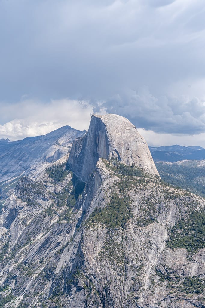
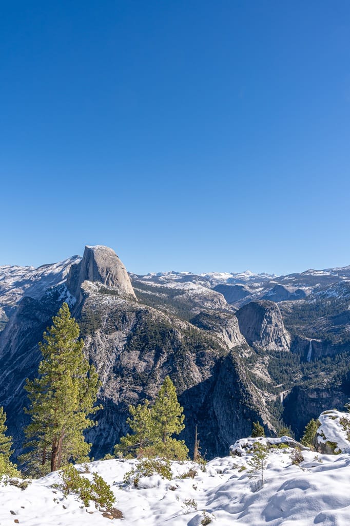
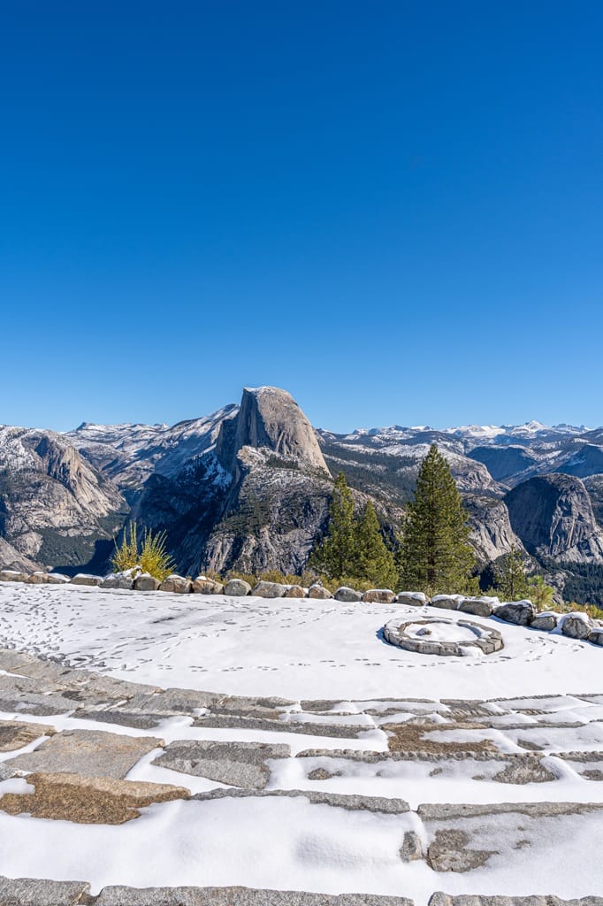
Glacier Point sits about 3,200 feet above Yosemite Valley at an elevation of 7,214 feet. You will get beautiful views of the valley, Half Dome, Yosemite Falls, Vernal and Nevada Falls, and the High Sierra peaks.
Glacier Point Road is seasonal meaning it closes during the snowy months, typically November to May, and reopens sometime in May. If you are visiting when the road is open, it is a must-do! 🚗💨
Read through this complete guide to learn everything you need to know about Glacier Point Road and visiting Glacier Point in Yosemite National Park!
Affiliate Disclaimer: Some links on this page may be affiliate links, meaning I may earn a small commission at no extra cost to you. As an Amazon Associate, I earn from qualifying purchases. Thanks for supporting the blog! 🫶
- Overview of Glacier Point Road in Yosemite National Park
- Glacier Point Road Closure and Opening
- How to Get to Glacier Point
- Glacier Point Parking and Facilities
- Glacier Point Road Points of Interest and Hikes (+ map)
- Tips for Visiting Glacier Point in Yosemite
- FAQs: Glacier Point Road
- Glacier Point Photos
- Glacier Point 1-Day Itinerary
- Where to Stay Near Glacier Point in Yosemite
- What to Bring to Yosemite
- Conclusion
Yosemite National Park Trip Info
📍 Location: California, USA
🗓️ Best Time to Visit: Year-round but most accessible time is May-October
🏞️ Ideal Trip Length: 3-5 days
✈️ Closest Airport: Fresno Yosemite International (2.5 hours away from Yosemite Valley)
🏨 Where to Stay: Yosemite Valley Lodge and Curry Village in Yosemite Valley, Tenaya at Yosemite in Fish Camp, Yosemite View Lodge in El Portal, Best Western Plus Yosemite Gateway Inn in Oakhurst, or Rush Creek Lodge in Groveland
🚙 Getting Around: Rent a vehicle from rentalcars.com or discovercars.com
💵 Entrance Fee: $35 per vehicle (7 days) or buy an America the Beautiful Pass (covers the entrance fee for 1 year). There are new non-resident fees – learn more here
🤩 Check out my Yosemite National Park Guide for more travel, hiking, and seasonal guides
Overview of Glacier Point Road in Yosemite National Park
I know you’re excited to learn where the awe-inspiring vista points and trails are located along Glacier Point Road, but let’s quickly learn more about this area in Yosemite.
Most importantly, is it even open right now? What’s the elevation and weather conditions like? When’s the best time to visit Glacier Point? And I even throw in a little history lesson because there’s a lot more to Glacier Point than you think!
Current Glacier Point Road Status
✅ Glacier Point Road is open for the 2026 season!! It opened on May 9, 2026.
If you’re visiting sometime in October or November, please check the current road status online to make sure the road is still open or call 209-372-0200 (press 1 then 1) for the most up-to-date road conditions.
Glacier Point Elevation
Glacier Point sits at an elevation of 7,214 feet, about 3,200 feet above Yosemite Valley.
Hiking at this elevation can be tough as compared to elevations closer to sea level. Make sure you stay hydrated, take frequent breaks, and start your hikes early so you have plenty of time to complete them.
Glacier Point Weather
In the summer, the temperature at Glacier Point can range from 70-80s°F (22-30°C) during the day and high-30s°F (3°C) to mid-40s°F (7°C) in the early mornings.
The temperatures will be lower during the shoulder season, including April, May, October, and November. Be prepared with plenty of layers as early mornings and evenings can get pretty chilly!
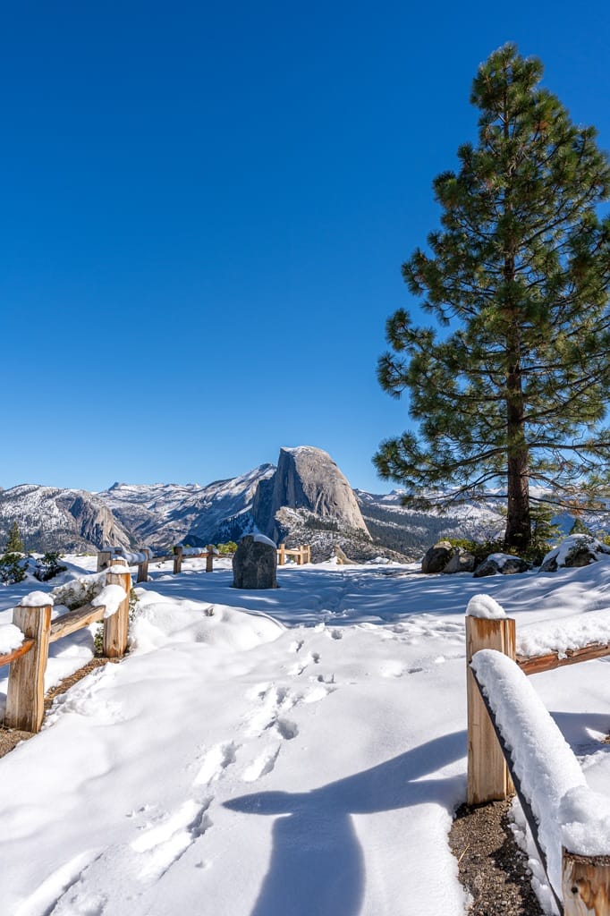
If you are able to reach Glacier Point during the months the road is closed from November to April (dates may vary) then be prepared for cold temperatures and snowy conditions.
Always check the weather forecast before heading out so you’re prepared!

Best Time to Visit Glacier Point
My personal favorite time to visit Glacier Point is when the road is closed and I’m able to safely hike to the top either via the Four Mile Trail or the Mist Trail/Panorama Trail. However, this can be tricky depending on winter conditions.
Obviously, this option is not doable for a lot of people. So, for easier accessibility, the best time to visit Glacier Point is obviously when the road opens! This usually happens sometime in May – dates vary each year depending on snowpack from the previous winter.
If you want to be able to drive up to Glacier Point and avoid large crowds, then I recommend visiting in May (basically right when the road opens). Try to visit on a weekday if you can because the weekends can still get really crowded.
One of my favorite months to visit Yosemite is in May! Glacier Point Road is most likely to open, the waterfalls are at their peak flow, and the crowd levels are not as crazy as the summer months.
If you have no choice but to visit Yosemite during the peak summer months on a weekend, then start your day early!! Try to get to Glacier Point no later than 7 AM – the earlier, the better.
⚠️ Good to Know: If you are planning a trip to Yosemite in May and Glacier Point is on your itinerary, be aware that there is no guarantee that Glacier Point Road will be open! Some years the road opens in April, most years it opens in May, and others it may not open until June or July. I recommend having a backup plan if the road is not open, such as visiting Mariposa Grove instead, hiking the Chilnualna Falls Trail, or hiking more trails in Yosemite Valley.
History of Glacier Point
A lot has happened in this area over many, many years. As most of us know, this area was inhabited by Native Americans (Ahwahnechee people of the Miwok tribe) for thousands of years. They lived off the beautiful land that is now known as Glacier Point.
Once European settlers came to the area, everything changed. Beginning in the mid-1800s, a toll trail was built, cows grazed in the meadows, camps and cabins were established, and trails to Glacier Point were completed.
Around 1875, a saddle trail was constructed from Chinquapin to Glacier Point. In 1882, this saddle trail was reconstructed into a 14-mile (22.5-km) wagon road.
At the top of Glacier Point, two hotels were built. The first one, the Mountain House Hotel, was constructed in 1878, and the second one, the Glacier Point Hotel, was built in 1917. In 1969, an electrical fire destroyed the Glacier Point Hotel, Mountain House, and a comfort station at Glacier Point.
Throughout the 1900s, a new Glacier Point Road was being planned, designed, built, and paved. The old Glacier Point Road was abandoned in 1935. Modifications were done of trails, overlooks, and parking areas, and educational exhibits and restrooms were installed at Glacier Point in late 1900s.
Beginning in 1872, Glacier Point was the site of the original Firefall. It was a man-made spectacle where burning bonfires were pushed over the edge at Glacier Point creating a fiery waterfall. It became a very popular tourist attraction. The National Park Service ended in 1968 as this event was destroying Yosemite – overconsuming natural resources, visitors trampled meadows, and it created fire hazards.
What’s crazy about the original mad-made Firefall ending is that a new, all natural Firefall was discovered in 1973 by photographer Galen Rowell. It’s an incredible sight to see! Check out my Firefall guide to learn more about this natural event ➡️ Complete First Timer’s Guide to Yosemite’s Firefall.
Glacier Point Road Closure and Opening
Knowing the dates in previous years when Glacier Point Road opened and closed will give you a better idea of when the road may potentially open or close this year.
Of course, it all depends on the previous winter season and how much snowpack there was. But from most years, it seems like Glacier Point Road tends to open in early to mid-May.
If you want the best chance of Glacier Point Road being open during your visit, plan your trip between July and September.
Here’s a chart that looks at historical seasonal opening and closing dates of Glacier Point Road.
| Year | Glacier Point Opening | Glacier Point Closure |
|---|---|---|
| 2026 | May 9 | no date yet |
| 2025 | May 10 | November 12 |
| 2024 | May 14 | November 11 |
| 2023 | July 15 | November 14 |
| 2022 | Did not open | Did not open |
| 2021 | April 30 | December 7 |
| 2020 | June 11 | November 5 |
| 2019 | May 10 | November 25 |
| 2018 | April 28 | November 20 |
| 2017 | May 11 | November 14 |
| 2016 | April 19 | November 16 |
How to Get to Glacier Point
🚗 Driving to Glacier Point
The most common way to get to Glacier Point is by driving – once the road is open of course. It’s very easy to reach whether you’re making a day trip from Fresno to Yosemite, staying in Oakhurst or El Portal, or coming from Yosemite Valley.
I recommend downloading Google offline maps so you can just plug Glacier Point into your phone’s GPS. But just in case technology fails, here are the directions, miles, and drive time so you know where you’re going!
🏞️ Yosemite Valley Welcome Center:
- Miles to Glacier Point – 31 miles (50 km)
- Drive Time – 1 hour, 25 minutes
- Directions – From the Yosemite Valley Welcome Center, follow Northside Drive, turn left onto Southside Drive, keep right to merge onto Wawona Road, follow this road for about 9 miles (14 km), turn left onto Glacier Point Road and follow until you reach Glacier Point.
🐻 Oakhurst (near South Entrance):
- Miles to Glacier Point – 48 miles (77 km)
- Drive Time – 1 hour, 50 minutes
- Directions – From Oakhurst, follow Highway 41 north (eventually becomes Wawona Road) through Yosemite’s South Entrance, in about 33 miles (53 km) turn right onto Glacier Point Road, follow until you reach Glacier Point.
🪨 El Portal (near Arch Rock Entrance):
- Miles to Glacier Point – 34 miles (55 km)
- Drive Time – 1 hour, 30 minutes
- Directions – From El Portal, follow Highway 140 east (eventually becomes El Portal Road) through Yosemite’s Arch Rock Entrance, stay right on Southside Drive then merge onto Wawona Road, follow this road for about 9 miles (14 km), turn left onto Glacier Point Road and follow until you reach Glacier Point.
🌳 Groveland (near Big Oak Flat Entrance):
- Miles to Glacier Point – 68 miles (109 km)
- Drive Time – 2 hours, 20 minutes
- Directions – From Groveland, follow Highway 120 east (eventually becomes Big Oak Flat Road) through Yosemite’s Big Oak Flat Entrance, turn left onto El Portal Road, stay right on Southside Drive then merge onto Wawona Road, follow this road for about 9 miles (14 km), turn left onto Glacier Point Road and follow until you reach Glacier Point.
🚌 Glacier Point Tour Bus
Another option if you’re in Yosemite Valley is to book a seat on the Glacier Point Tour Bus. It’s a four-hour tour going from Yosemite Valley to Glacier Point and back to the valley.
There are only two departure times with daily tours starting sometime in June and ending sometime in October. You must purchase tickets online or call 888-413-8869.
You can also book a one-way ticket to Glacier Point then hike back down to the valley via the Four Mile Trail or Panorama Trail. Do not hike up to Glacier Point from Yosemite Valley expecting to catch a ride on the tour bus or vice versa.
⚠️ You might read in some other blog posts that there is a free shuttle that will take you from Badger Pass Ski Area to Glacier Point. That is not true!! There is no free shuttle to Glacier Point. There is only a fee-based tour bus that requires reservations.
🚵♀️ Biking to Glacier Point
Typically, a few days before Glacier Point Road opens to vehicles, the National Park Service will open the road for cyclists only. This is a great way to see Glacier Point before the big crowds show up.
Be aware, this is no ride in the park. It’s 16 miles (26 km) one way with a good bit of elevation gain! It’s an awesome adventure if you’re prepared for it.
🥾 Hiking to Glacier Point
Would you rather hike to Glacier Point versus drive? This is a great option if you’re up for the challenge!
There are only two routes that will take you from the Yosemite Valley floor to Glacier Point.
- Four Mile Trail
- Mist Trail and Panorama Trail
The Four Mile Trail is about 9.8 miles (15.8 km) roundtrip with 3,420 feet of elevation gain. This is an incredibly scenic yet challenging hike but so worth it!
One of my favorite routes in Yosemite Valley is starting on the Mist Trail then hopping on the Panorama Trail to reach Glacier Point then descending on the Four Mile Trail back to the valley. This point-to-point route is about 14 miles (22.5 km) roundtrip with 4,450 feet of elevation gain.
Please do not hike from Glacier Point to Yosemite Valley expecting a shuttle to take you back to Glacier Point (unless you planned ahead and booked a seat on the tour bus or have car arrangements).
⛷️ Cross County Skiing to Glacier Point
After the first major snowstorm, Glacier Point Road closes to vehicles and becomes an incredible route for cross county skiers or even snowshoers. Starting from the Badger Pass Ski Area, it’s about 11 miles (18 km) one way to reach Glacier Point.
The Glacier Point Hut opens if you would like to stay overnight (requires a reservation). This will be the most peaceful time to visit Glacier Point!
✨ READ THIS: Best Yosemite Winter Activities You Can’t Miss!
Glacier Point Parking and Facilities
🅿️ Glacier Point Parking Lot
At the end of Glacier Point Road, you will find a large parking lot that can hold about 200 vehicles. There are no spots for RVs over 30 feet.
Although the parking lot is huge, it can fill up by mid-morning during peak season, especially on the weekends. If you happen to get there when the parking lot is full, have some patience and wait for a spot to become available (just try not to be in the middle of the road).
🚰 Toilets and Water
You will find vault toilets and drinking water (usually available once the road opens but not always so make sure you bring plenty of water just in case).
🍦 Glacier Point Gift Shop and Snack Stand
There is also the Glacier Point Gift Shop and Snack Stand where you will find snacks, light meals, and souvenirs. My favorite thing to get at the store is ice cream!
There are a few tables and chairs in front of the store so you can sit and enjoy your snacks. There are also trashcans nearby so please, please, PLEASE, throw away your trash. Always follow Leave No Trace principles!
Glacier Point Road Points of Interest and Hikes (+ map)
Let’s look at the points of interest and hikes along Glacier Point Road. There is also an interactive map below so you can better plan your trip to Glacier Point! 👇
Glacier Point Road Points of Interest
There are four main points of interests along Glacier Point Road that are so scenic you can’t miss!
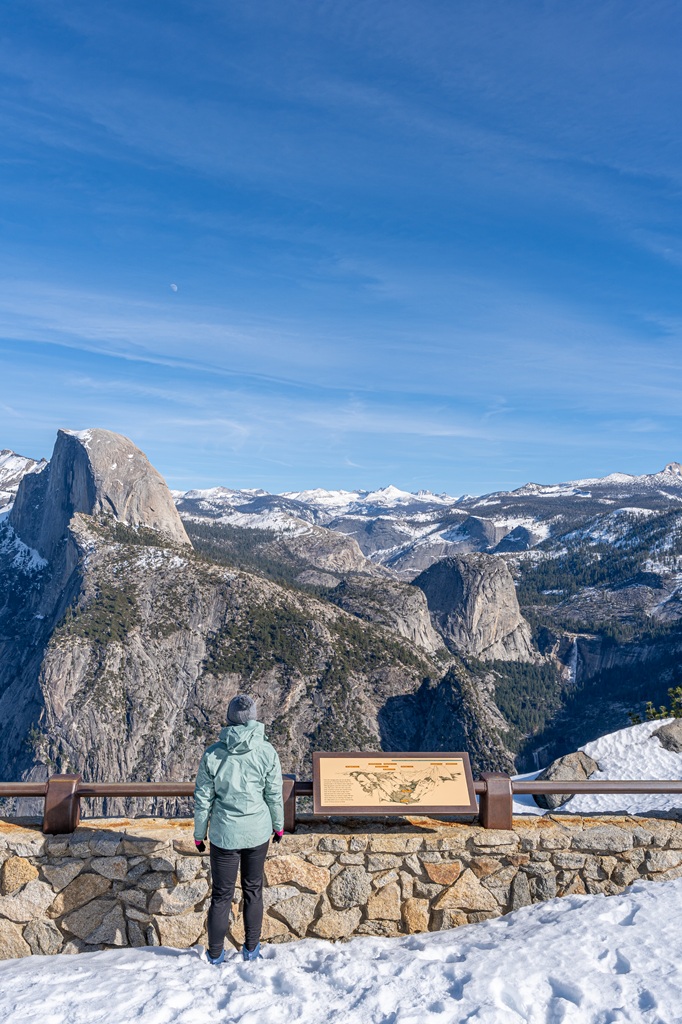
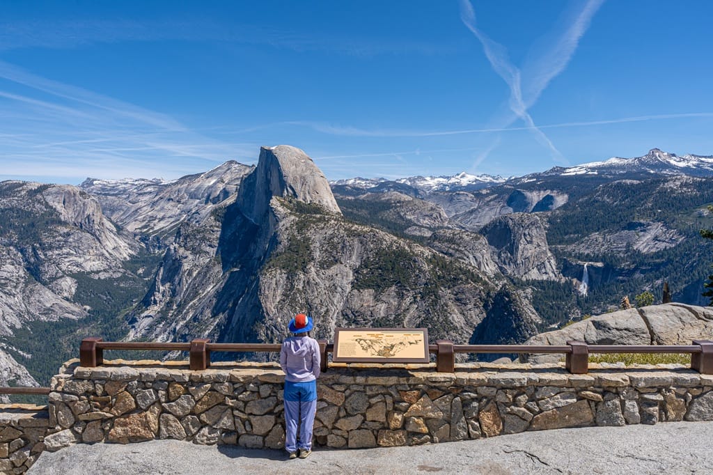
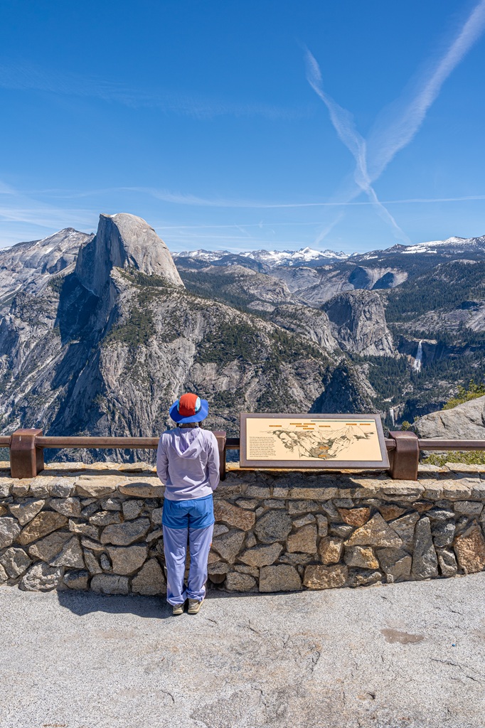
1. Glacier Point Overlook
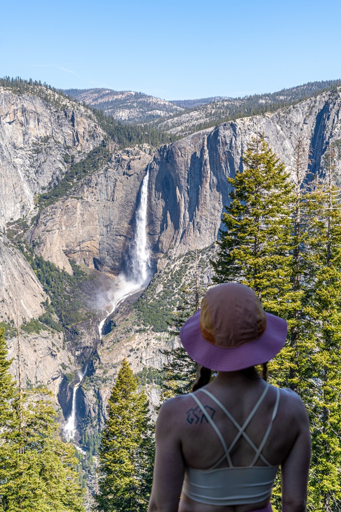
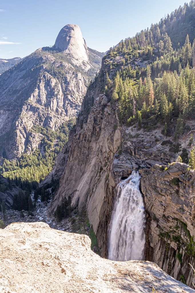
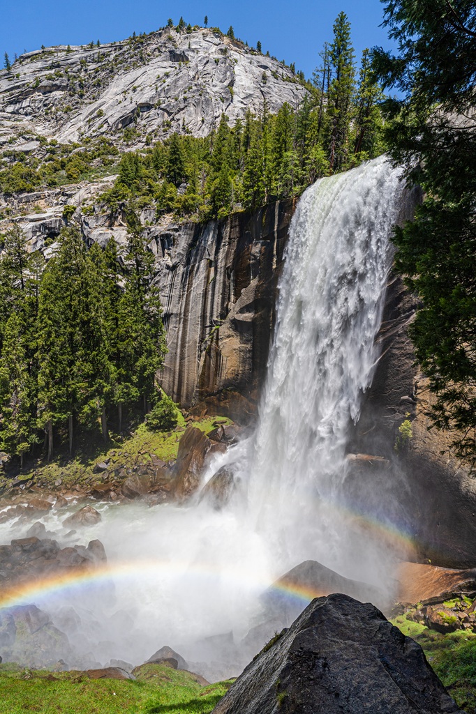
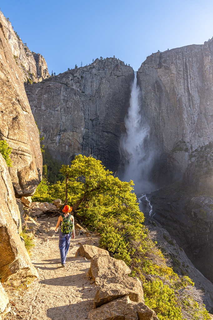
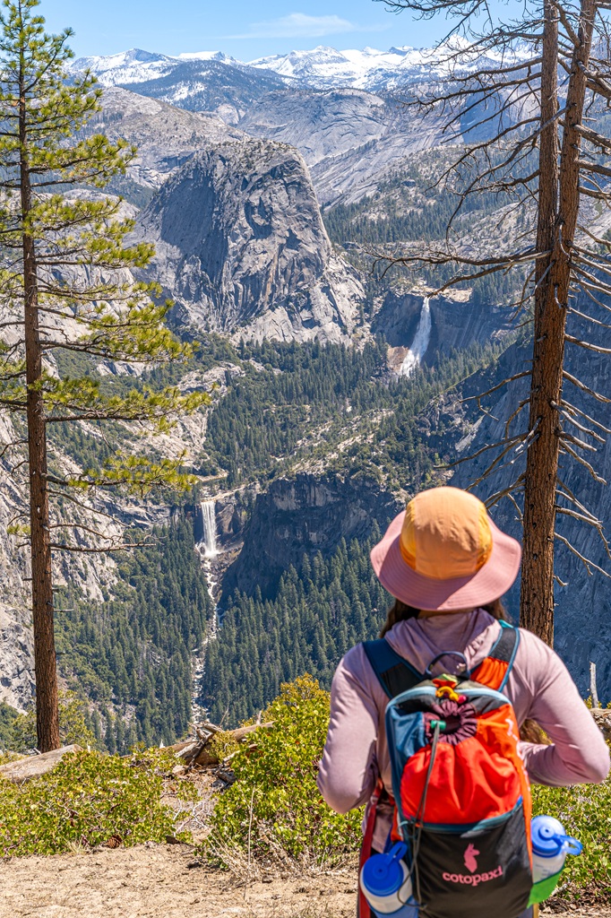
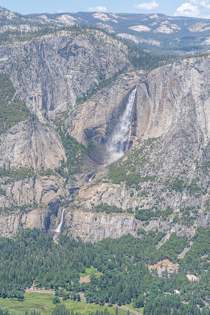
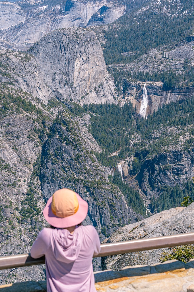
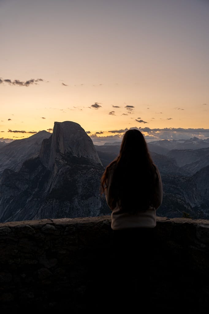
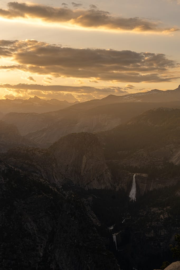
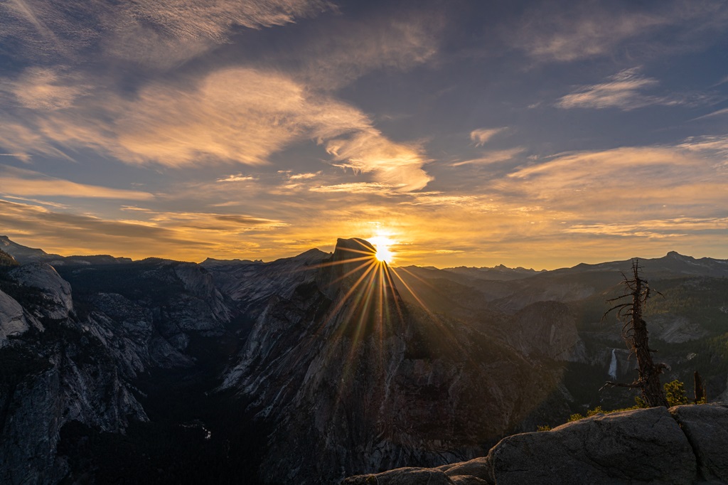
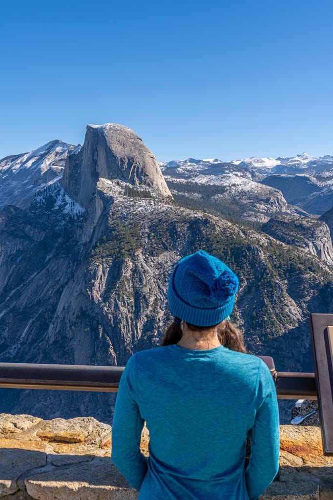
The main attraction at Glacier Point are the views from the top. There are several spots where you can enjoy the views. The main spot is the Glacier Point Overlook – from here you will get the best views of Yosemite Valley, Yosemite Falls, Half Dome, and the High Sierra peaks.
You can also walk over to the amphitheater or geology hut to get the same views of the high country, Half Dome, and Vernal and Nevada Falls. You can’t see Yosemite Falls from these spots.
To reach the Glacier Point Overlook, follow a short, paved, wheelchair-accessible path from the parking lot. It’s an easy, 0.25-mile (0.4-km) walk with a gentle incline. This isn’t a competition, but I personally love the views from Glacier Point more than Tunnel View!
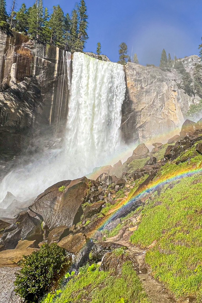
You will get more views of the pointy, granite High Sierra peaks along with Half Dome and several waterfalls, including Yosemite Falls, Vernal Fall, and Nevada Fall.
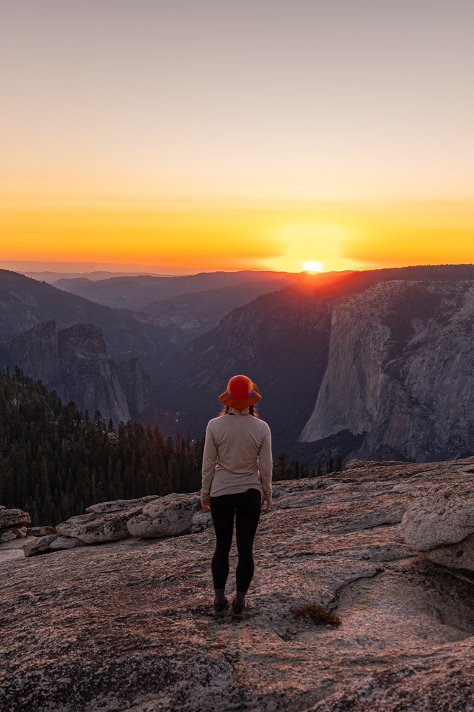
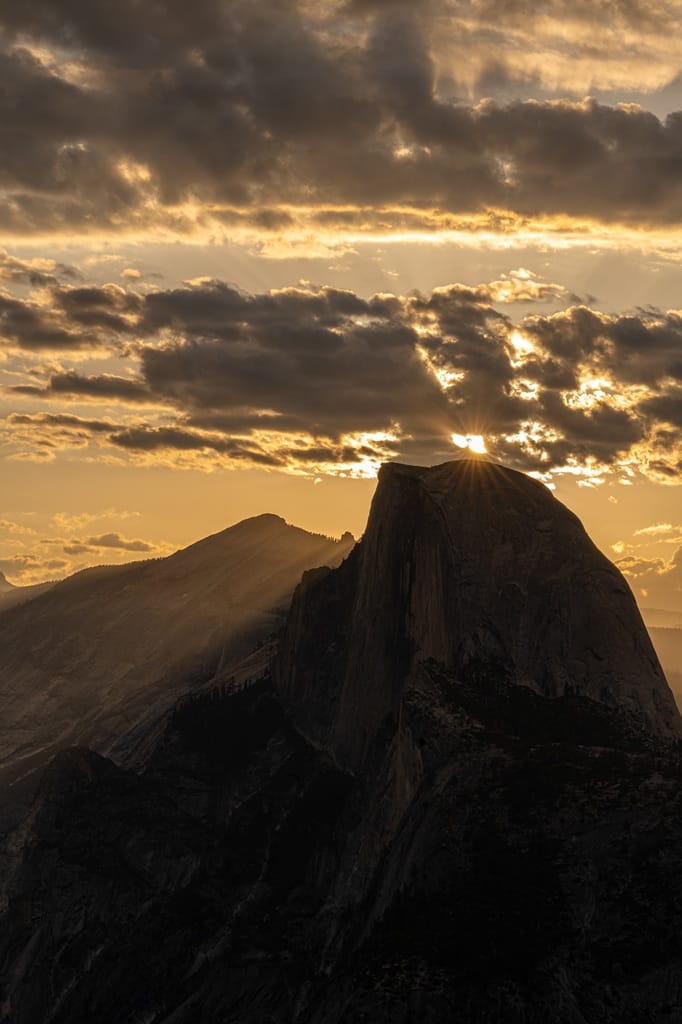
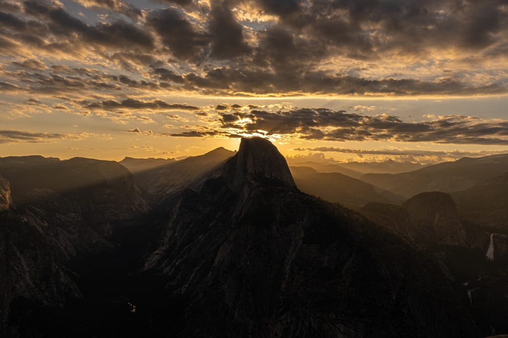
If you can wake up early enough, I highly recommend watching sunrise from Glacier Point! Plus, you’ll get an early start on the hikes which is a bonus if you want to avoid crowds.
2. Washburn Point
Just before reaching Glacier Point, there is another viewpoint called Washburn Point. It offers the same incredible views as Glacier Point Overlook but at a slightly different angle.
Washburn Point sits at 7,450 feet and you will have views of Half Dome, Vernal and Nevada Falls, and the High Sierra peaks.
There are about 35-40 parking spots with one being for those with a disability placard. There are no restrooms or drinking water here.
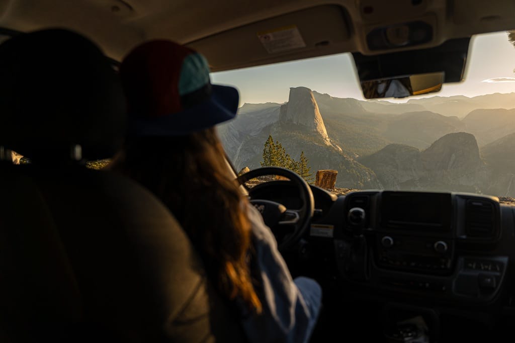
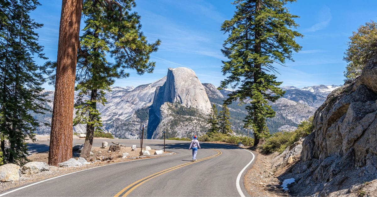
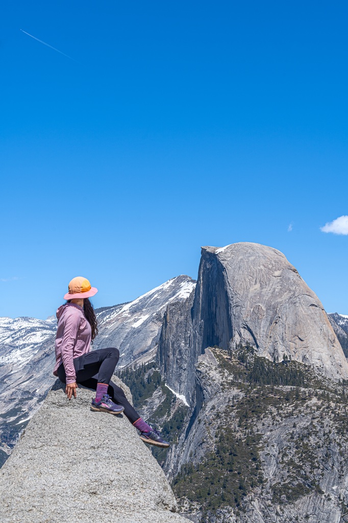
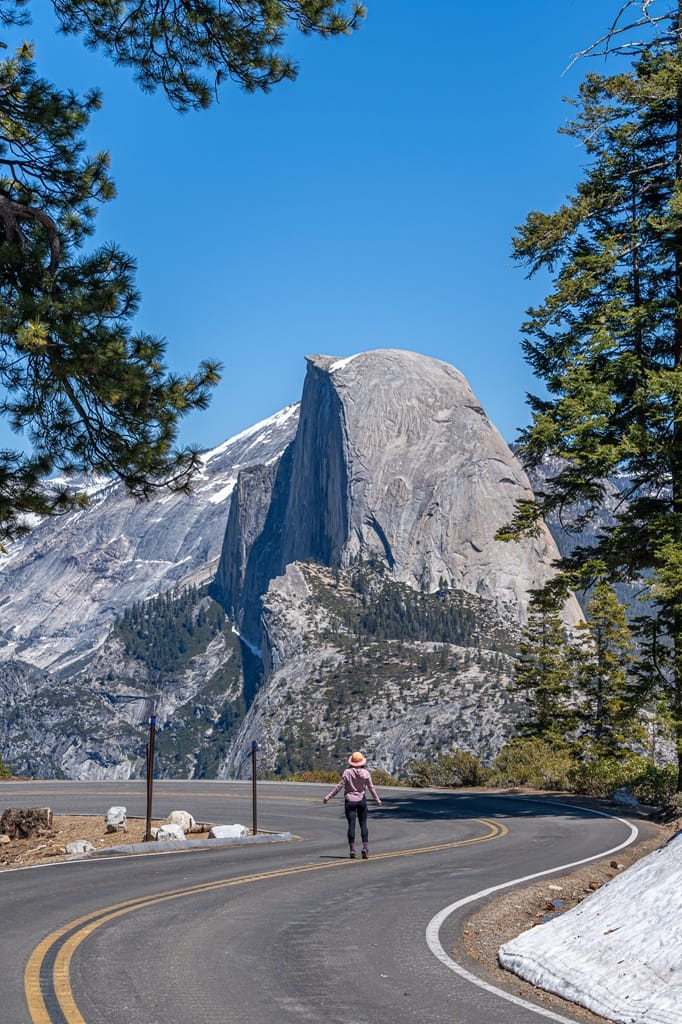
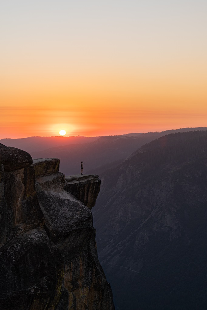
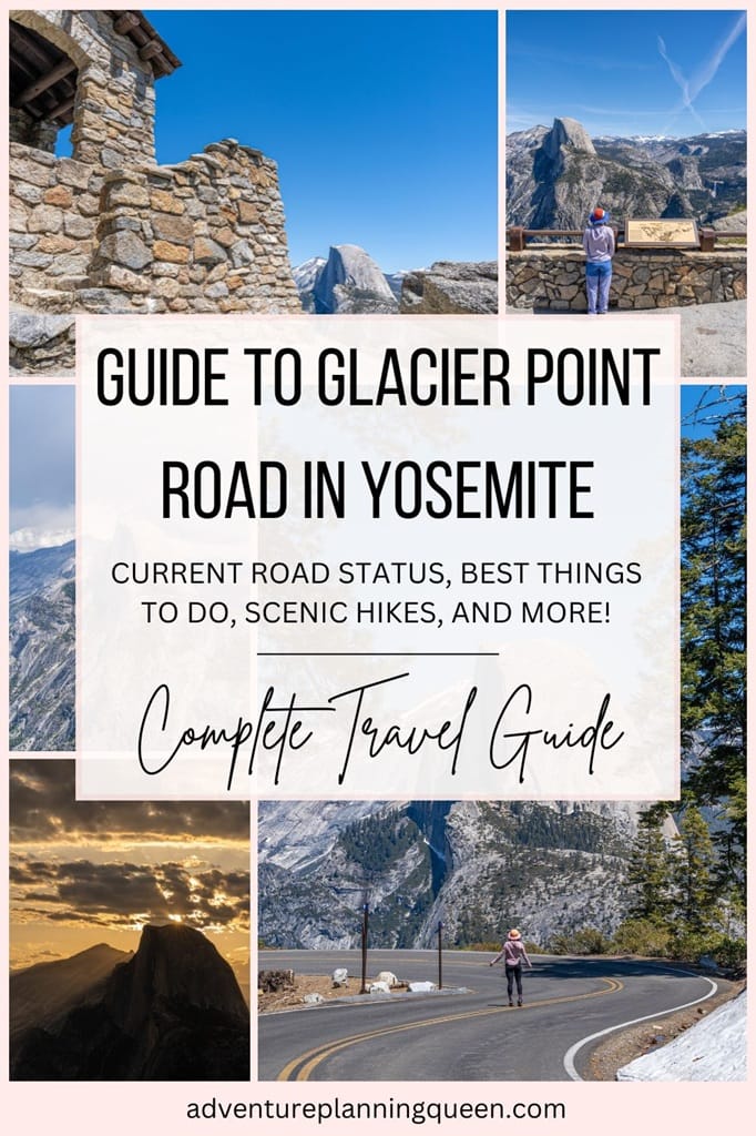
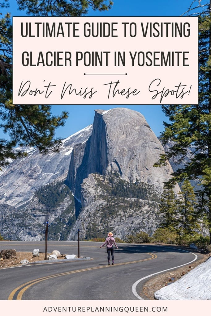
3. Famous Glacier Point Road Curve
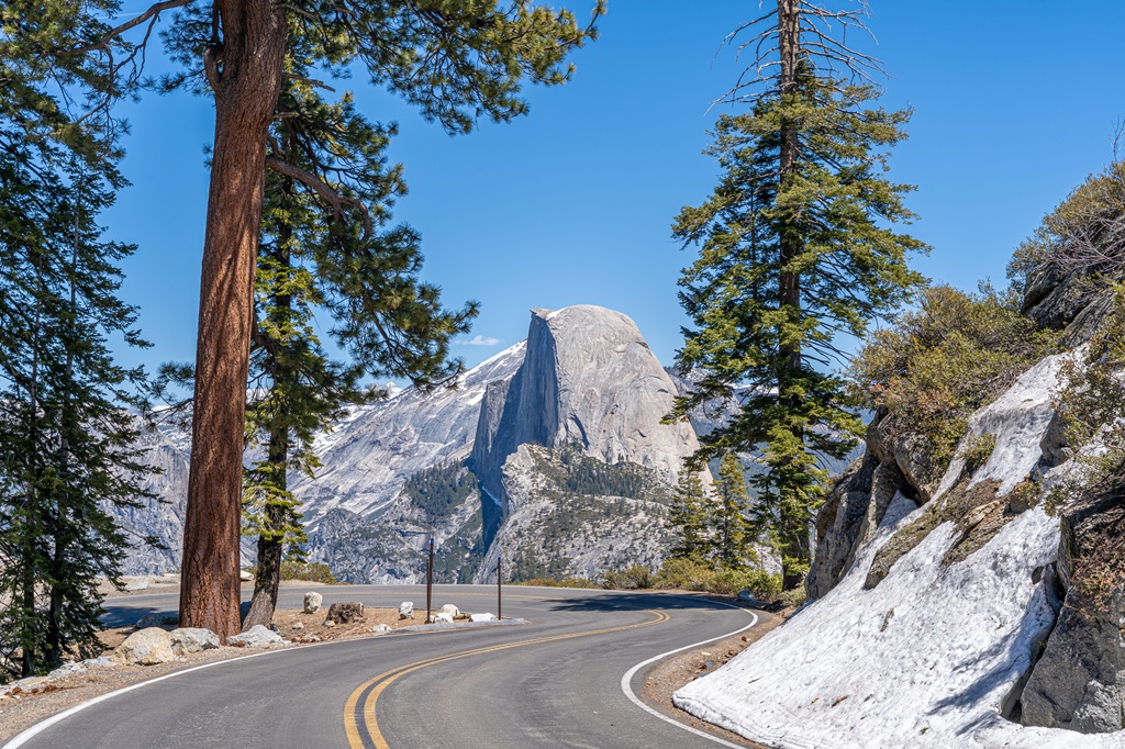
Just about 0.3 miles (0.5 km) from Glacier Point as you are driving along the road, you will come across one of the most incredible views of Half Dome. This is the famous Glacier Point Road curve!
You may have seen pictures of this bend in the road with Half Dome sitting pretty in the background while someone is either driving their vehicle or running on the road.
It’s a hot spot for photographers and content creators. But it’s also a dangerous spot because there is nowhere to safely park your car and this section of the road is very curvy!
I personally would NOT recommend trying to get a picture or video here when Glacier Point Road is open. It’s just too dangerous. Most people probably go early in the morning to avoid heavy traffic but still not safe.
The safest way to get the shot, when the road is open, is to be in the passenger seat, drive slowly (do not stop in the middle of the road), and quickly get your picture or video.
The best time to get pictures and videos of the Glacier Point Road curve is when the road is closed! This means you must either hike, cross country ski, or snowshoe to this spot (depending on conditions).
This is the only time my husband and I have ever been able to get a picture or video here. Even when the road is closed, you still must be cautious! Starting around mid-April, they begin to plow the road, and work trucks may be going up and down the road to get it ready for re-opening so please be careful.
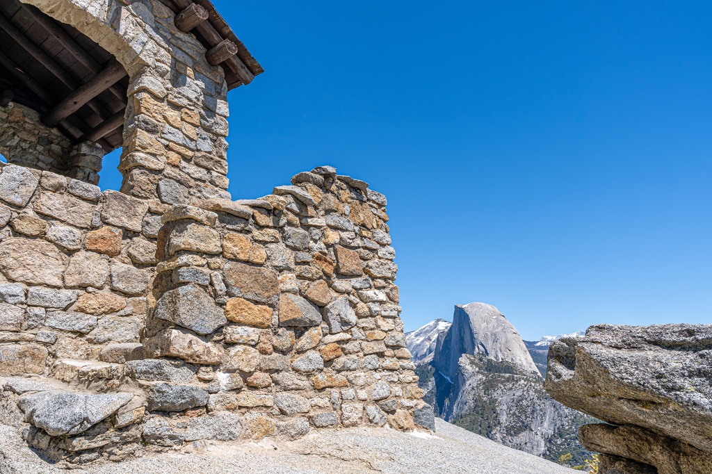
4. Glacier Point Geology Hut
Located at Glacier Point, a small stone building sits between the main overlook and the amphitheater. It’s known as the Geology Hut. It was built in 1925 and originally called the Glacier Point Trailside Museum. It’s a picturesque structure with incredible views!
Glacier Point Hikes
Some of my favorite hikes in Yosemite National Park are located at Glacier Point. Some trails descend down the Yosemite Valley, some lead to incredible vista points, and others head to lesser-known meadows and lakes.
Below is a list of day hikes from Glacier Point, arranged from most popular to least. I have full hiking guides for the most popular hikes, so I recommend you check those out!
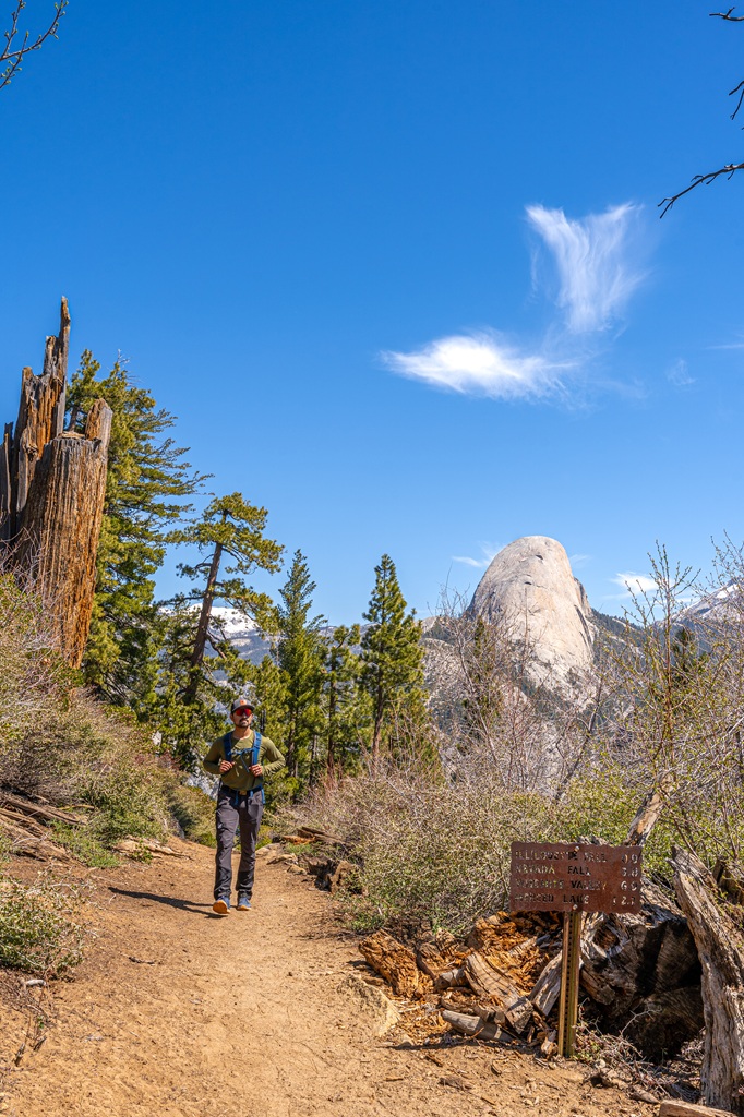
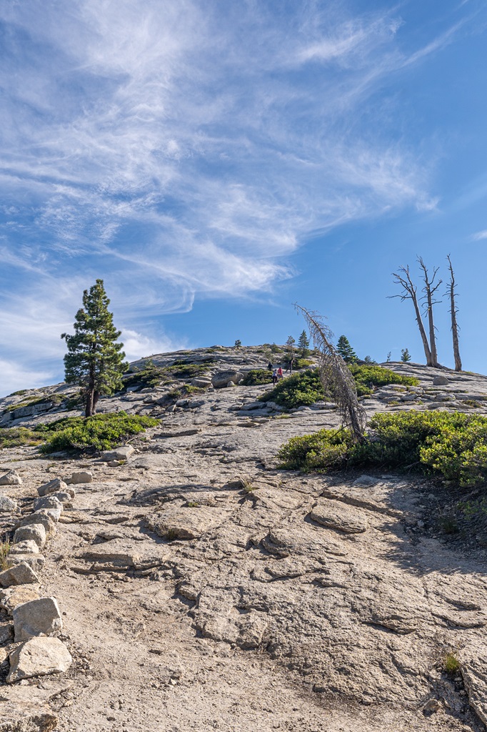
1. Sentinel Dome and Taft Point Loop
Starting Point: Sentinel Dome and Taft Point Trailhead
Length: 5.2 miles (8.4 km) roundtrip
Elevation Gain: 1,200 feet
Difficulty: Moderately challenging
Hiking Time: 2.5 to 3.5 hours
Route Type: Loop
Pet-friendly? No, pets are not allowed
Hike Features: Sentinel Dome, Roosevelt Point, Taft Point, stunning views of Yosemite Valley and its iconic landmarks
✨ READ THIS: Sentinel Dome and Taft Point Loop Hiking Guide
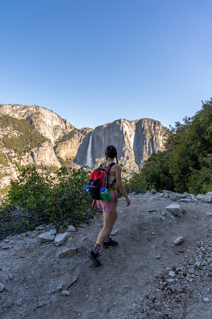
2. Four Mile Trail
Starting Point: Four Mile Trailhead in Yosemite Valley OR from Glacier Point
Length: 9.8 miles (15.8 km) roundtrip
Elevation Gain: 3,420 feet
Difficulty: Challenging
Hiking Time: 6 to 8 hours
Route Type: Out-and-back
Pet-friendly? No, pets are not allowed
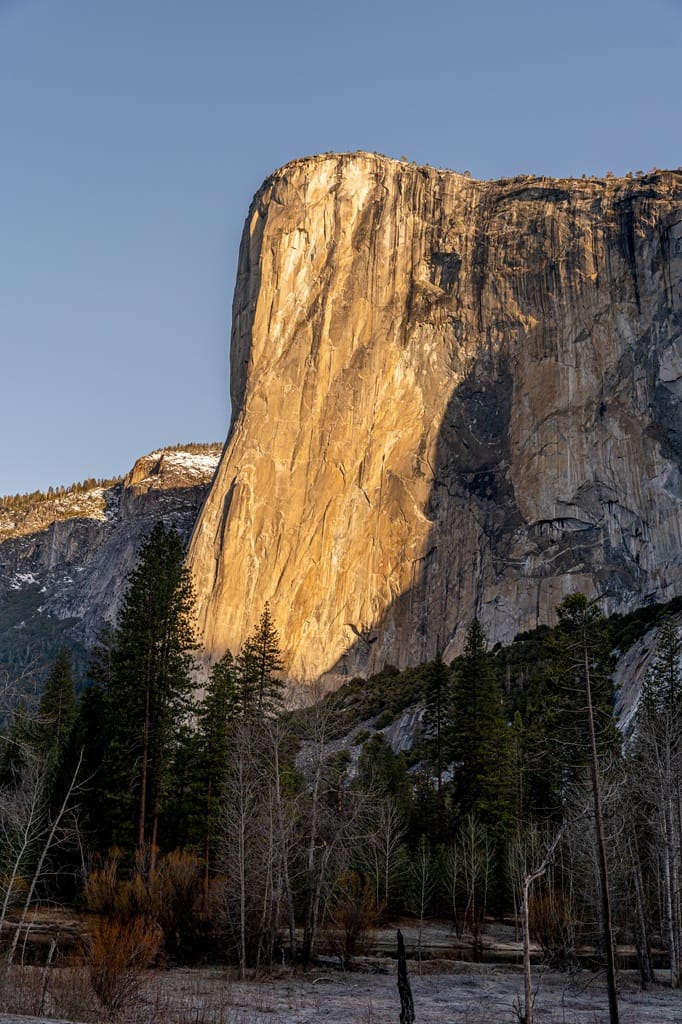
Hike Features: Epic views (El Capitan, Half Dome, Cathedral Rocks, Yosemite Falls, Tenaya Canyon), Union Point, Glacier Point
✨ READ THIS: Four Mile Trail Hiking Guide
In my opinion, the Four Mile Trail is best experienced by starting from Yosemite Valley and hiking up to Glacier Point then hiking back down. A lot of people will take the tour bus to Glacier Point then hike down the Four Mile Trail which is the easiest option.
Or you can start from Glacier Point and hike down to Yosemite Valley but if you don’t have reservations for the tour bus or car arrangements then you’ll have to hike back up which is 3,400 feet of elevation gain in just 4.9 miles (7.9 km) which is tough!
3. Sentinel Dome
Starting Point: Sentinel Dome and Taft Point Trailhead
Length: 2.2 miles (3.5 km) roundtrip
Elevation Gain: 500 feet
Difficulty: Moderately challenging
Hiking Time: 1 to 1.5 hours
Route Type: Out-and-back
Pet-friendly? No, pets are not allowed
Hike Features: Sentinel Dome, easy scramble to the top, incredible views from the summit
✨ READ THIS: Sentinel Dome Hiking Guide
4. Taft Point
Starting Point: Sentinel Dome and Taft Point Trailhead
Length: 2.4 miles (3.9 km) roundtrip
Elevation Gain: 350 feet
Difficulty: Easy to moderate
Hiking Time: 1 to 1.5 hours
Route Type: Out-and-back
Pet-friendly? No, pets are not allowed
Hike Features: Taft Point, The Fissures, jaw-dropping views of Yosemite Valley
✨ READ THIS: Taft Point Hiking Guide
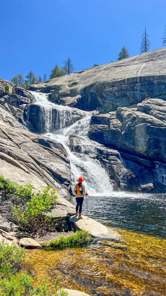
5. Panorama Trail to Illilouette Fall
Starting Point: Panorama Trail Trailhead
Length: 5 miles (8 km) roundtrip
Elevation Gain: 1,430 feet
Difficulty: Challenging
Hiking Time: 3 to 4 hours
Route Type: Out-and-back
Pet-friendly? No, pets are not allowed
Hike Features: Epic views of the Yosemite Valley, Illilouette Fall, Illilouette Creek and footbridge
✨ READ THIS: Panorama Trail Hiking Guide
6. Ostrander Lake
Starting Point: Ostrander Lake Trailhead
Length: 12.3 miles (20 km) roundtrip
Elevation Gain: 1,830 feet
Difficulty: Challenging
Hiking Time: 6 to 7 hours
Route Type: Out-and-back
Pet-friendly? No, pets are not allowed
Hike Features: Ostrander Lake, amazing views of Mount Starr King and the Clark Range
7. McGurk Meadow
Starting Point: McGurk Meadow Trailhead
Length: 3.7 miles (6 km) roundtrip
Elevation Gain: 485 feet
Difficulty: Easy
Hiking Time: 1.5 to 2 hours
Route Type: Out-and-back
Pet-friendly? No, pets are not allowed
Hike Features: McGurk Meadow, historic McGurk cabin, trail is unmaintained
8. McGurk Meadow Trail to Dewey Point
Starting Point: McGurk Meadow Trailhead
Length: 7.9 miles (13 km) roundtrip
Elevation Gain: 1,360 feet
Difficulty: Moderate to hard
Hiking Time: 4 to 5 hours
Route Type: Out-and-back
Pet-friendly? No, pets are not allowed
Hike Features: McGurk Meadow, Dewey Point, incredible views of Yosemite Valley, El Capitan, and Half Dome
🥾 Dewey Point via McGurk Meadow Trail Map
🥾 Explore more of Yosemite Valley and Glacier Point with these hikes!
Glacier Point Road Map
Tips for Visiting Glacier Point in Yosemite
1. Yosemite’s Entrance Fee:
Entrance to Yosemite National Park costs $35 per vehicle for a 3-day pass. However, if you have the America the Beautiful Annual Pass, your entry is free!
For those who love exploring national parks, investing in the Annual Pass is a smart choice. At just $80, for U.S. residents, it grants you access to over 2,000 federal recreation sites across the country!
FEE UPDATES! Beginning January 1, 2026, non-U.S. residents (without an annual pass) will pay a $100 per person in addition to the standard entrance fee. The Annual Pass for non-US residents will cost $250.
Reservations are not required this year. (updated June 3, 2026).
2. Check Road Status: Glacier Point Road closes seasonally typically from November to May, so check if the road is open before visiting. You can also call 209-372-0200 (press 1 then 1) for the most up-to-date road conditions.
3. Avoid Crowds, Get There Early: Arrive at Glacier Point early in the morning to watch sunrise. There still might be a small crowd of people but it won’t be anywhere near as crazy as mid-morning. You can even get there later in the day for sunset.
4. Closest Gas Station: The closest gas station is at Wawona which is about 28 miles (45 km) from Glacier Point.
5. RVs on Glacier Point Road: Only RVs 30 feet and shorter are allowed past Sentinel Dome Trailhead or at Glacier Point.
6. Be Prepared for Snowy or Wet Trails in Early Spring: If you’re hiking in the Glacier Point area in early spring, whether the road is open or not, be prepared for snowy or wet conditions on the trails. Read AllTrail reviews to better learn about current conditions and check the “Trails and Wilderness Conditions” on Yosemite’s current conditions page.
7. Limited Services: Gas stations, EV charging stations, and cell service are limited in the Glacier Point area. There are vault toilets and seasonal drinking water at the end of Glacier Point Road along with a gift shop and store.
8. Be Cautious Near Cliffs: Spots like Glacier Point Overlook and Taft Point have steep drop-offs that go straight down towards the valley. Please stay behind any barriers or guard rails and stay away from cliffs. If you have kids, keep them close!
9. Watch for Wildlife: Black bears are active within Yosemite. Follow these guidelines to avoid any negative interactions with a black bear.
🐻 Note: bear spray is prohibited in Yosemite!
10. Respect Nature: Follow Leave No Trace principles – plan ahead, pack out all trash, avoid disturbing wildlife, be considerate of others, and respect the natural beauty of Yosemite National Park.
FAQs: Glacier Point Road
-
Is Glacier Point Road open?
Yes, Glacier Point Road is currently open (updated May 15, 2026).
-
Can you drive to Glacier Point?
Yes, you can drive to Glacier Point by taking Glacier Point Road 16 miles (26 km) one way to the top. Be aware that the road is open sometime from May to November and closes seasonally during the snowy months.
-
Is Glacier Point Road worth it?
Yes, Glacier Point Road is worth it. There are incredible viewpoints and hikes along this road that will blow your mind!
-
How long is the Glacier Point Road?
Glacier Point Road is about 16 miles (26 km) one way from the turnoff to Glacier Point.
-
Is Glacier Point Road scary?
Glacier Point Road is a curvy mountain road. For some people, it can be scary but, in my opinion, it’s really not that bad. Drive the speed limit, be cautious around turns, and you’ll be fine!
-
How much parking is at Glacier Point?
Glacier Point has a huge parking lot that can fit about 200 vehicles. However, despite the large number of parking spots, the lot can fill up during peak summer months, especially on the weekends.
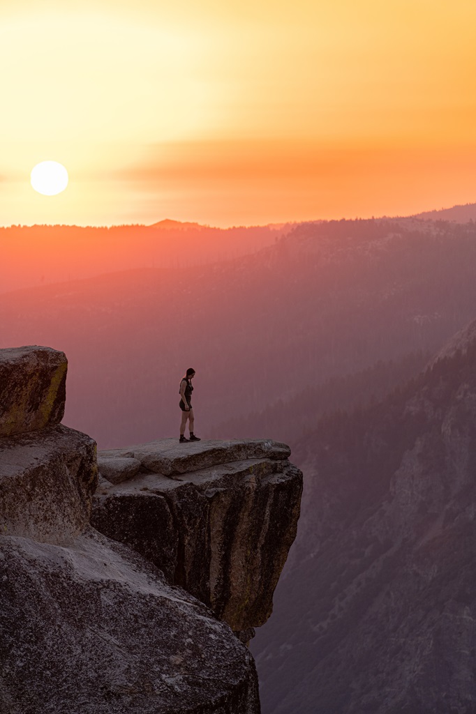
Glacier Point Photos
One thing I love about creating blog posts and helping people plan unforgettable trips is sharing my pictures. I’m no professional photographer by any means, but sometimes I take pretty nice pictures.
Here are more of my favorite Glacier Point photos – all taken by yours truly 💁🏻♀️ or by my husband.
😍 View from Glacier Point
🌄 Glacier Point Sunrise
🛣️ Glacier Point Road (famous curve)
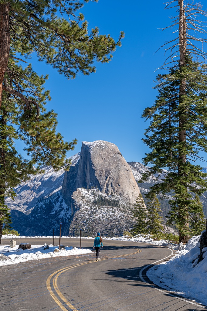
❄️ Glacier Point in Winter
Glacier Point 1-Day Itinerary
A lot of people tend to split their time between Yosemite Valley and Glacier Point. If you’re just sightseeing and doing the really short hikes, then you can easily spend a full day in Yosemite Valley and Glacier Point.
✨ READ THIS: How to Spend One Day in Yosemite National Park
You can also split your day by spending half of your time at Glacier Point and the other half at Mariposa Grove of Giant Sequoias.
But if you want to spend one full day at Glacier Point, then it’s very possible if you’re up for some hiking! Below is a complete 1-day Glacier Point itinerary featuring all the best viewpoints, hikes, and things to do. 👇
🌄 Morning:
- Sunrise at Glacier Point Overlook (30 minutes)
- Hike to Illilouette Fall via Panorama Trail (5 miles / 8 km, challenging, 3-5 hours)
- Eat lunch and grab an ice cream from the Glacier Point store
☀️ Afternoon:
- Check out Washburn Point (15-20 minutes)
- Hike one of the following:
- Sentinel Dome (2.2 miles / 3.5 km, moderate, 1.5 hours)
- Taft Point (2.4 miles / 3.9 km, easy to moderate, 1.5 hours)
- Sentinel Dome and Taft Point Loop (5.2 miles / 8.4 km, moderate, 3-4 hours)
- Hike to McGurk’s Meadow (3.7 miles / 6 km, easy, 2 hours)
This itinerary does involve a lot of hiking, so don’t feel like you need to hike all these trails. Like I said above, most people tend to split their time between Yosemite Valley and Glacier Point.
👉 If it’s your first time visiting Glacier Point, these are my top recommendations:
- Watching sunrise at Glacier Point Overlook (30 minutes)
- Hiking the Panorama Trail to Illilouette Fall (5 miles / 8 km, challenging, 3-5 hours)
- Hiking either to Taft Point (2.4 miles / 3.9 km, easy to moderate, 1.5 hours) or Sentinel Dome (2.2 miles / 3.5 km, moderate, 1.5 hours)
Where to Stay Near Glacier Point in Yosemite
There are no lodging options along Glacier Point Road. There is the Bridalveil Creek Campground if you’re for roughing it a bit!
The most convenient places to stay near Glacier Point would be in Yosemite Valley, Fish Camp or Oakhurst near Yosemite’s South Entrance, or El Portal near Yosemite’s Arch Rock Entrance.
You can also stay at either Yosemite West or Wawona. These communities are located off Wawona Road and offer a variety of vacation rentals.
With that being said, here are the top places to stay in and near Yosemite! 👇
👉 Places to Stay in Yosemite Valley
- Luxury – The Ahwahnee Hotel
- Midrange – Yosemite Valley Lodge
- Budget – Curry Village
👉 Places to Stay Near Yosemite’s South Entrance
- Luxury – Tenaya Lodge
- Midrange – Sierra Sky Ranch
- Budget – Best Western Plus Yosemite Gateway Inn
✨ Is staying at Tenaya Lodge worth it? Read my honest, in-depth Tenaya Lodge review!
👉 Places to Stay Near Yosemite’s Arch Rock Entrance
- Luxury Glamping – AutoCamp Yosemite
- Midrange – Yosemite View Lodge
- Budget – Yosemite Bug Rustic Mountain Resort
✨ Should you stay at Yosemite View Lodge? Read my Yosemite View Lodge guide and review!
👉 Places to Stay Near Yosemite’s Big Oak Flat/Hetch Hetchy Entrance
- Luxury – Rush Creek Lodge at Yosemite
- Midrange – Yosemite Westgate Lodge
- Budget – Berkshire Inn
✨ Need more options when finding the perfect place to stay near Yosemite?
Don’t worry, I got you covered! I created an ultimate guide to help you find a place to stay when visiting Yosemite National Park. I’ve broken everything down by town, organized by the park entrance they’re closest to.
From there, I list different types of accommodations, including hotels, resorts, B&Bs, vacation rentals, campgrounds, and RV parks. Click the button below and explore top-rated places to stay outside of Yosemite, based on your travel style, budget, and the parts of the park you plan to visit!
What to Bring to Yosemite
🎟️ Entrance Pass – You will need to purchase an entrance pass once you reach the entrance station or you can buy the America the Beautiful Pass ahead of time and use that for the entire year.
👚 Layers of Clothing (top) – Pack a moisture-wicking base layer, a fleece mid-layer, an insulated jacket, and an outer shell to protect you from the elements, such as rain and wind. You may not need all these layers, especially in the summer months, but it’s always best to be over-prepared!
Check out my favorite tops 👇
- Base layer: REI Co-op Sahara Shade Hoodie (warm/mild conditions) and REI Co-op Midweight Long-Sleeve Base Layer (cooler conditions)
- Fleece mid layer: Cotopaxi Teca Fleece Full-Zip Jacket
- Down mid layer: Cotopaxi Fuego Hooded Down Jacket
- Outer shell: In the summer I always pack a light windbreaker, such as the Cotopaxi Teca Crop Windbreaker or the RevolutionRace Unit Light Windbreaker. Make sure to also pack a waterproof rain jacket – I like the Patagonia Torrentshell 3L Jacket.
🩳 Hiking Shorts or Pants – Pack a comfortable, durable, and stretchy pair of hiking shorts or pants. Also think about what conditions you might run into, such as warm or cold temperatures, wind and/or rain, bugs, and overgrown trails.
Check out my favorite hiking bottoms 👇
- Cotopaxi Losdos Zip-Off Pants
- RevolutionRace Breezy Ankle Outdoor Pants
- Baleaf Fleece-Lined Jogger Pants
- RevolutionRace Summit Pocket Tights
- Revolution Race Hike & Dive Shorts
🥾 Hiking Footwear – Bring a good pair of hiking boots or shoes with good traction. If I’m not expecting to hike in too much mud or snow, my go-to hiking shoes are the Altra Lone Peak trail runners. They have a wide-toe box, 0 mm heel-to-toe drop, and MaxTrac rubber outsole. Plus, they’re lightweight and so comfy!
🧦 Socks – Moisture-wicking, quick-drying socks are the way to go. My favorite pair of hiking socks are Darn Tough Hiker Micro Crew Cushion Socks. Always pack an extra pair!
🎒 Day Pack – What you plan to do (sightseeing, hiking, etc.), determines what size pack you’ll need. Here is what I typically bring based on what I’m doing that day 👇
- Short walks and sightseeing: Cotopaxi Kapai 1.5L Del Dia Hip Pack
- Short, easy to moderate day hikes: REI Co-op Flash 22L Pack
- Long, moderate to challenging day hikes: REI Co-op Trail 25L Pack or Cotopaxi Luzon Del Dia 24L Pack
🥢 Trekking Poles – Essential for stability, balance, and support when hiking trails, especially on tough, rocky, and uneven terrain. I use REI Co-op Trailmade Trekking Poles and love them!
❄️ Microspikes – Bring a pair of microspikes if you’re visiting in the winter and you’re planning to hike along icy trails. They will give you good traction to avoid slipping! I use Black Diamond Access Spike Traction Device.
🦟 Mosquito/Bug Repellants – In the warmer months, be prepared for annoying gnats, mosquitoes, and flies. Wear long-sleeve clothing, a head net, and use bug spray.
🧤 Extra Warm Layers – If you expect cooler conditions or hiking to higher elevations, make sure to pack extra layers for added warmth, such as gloves, beanie, neck gaiter, and a light jacket.
🗺️ Navigation – Carry a physical topographic map, compass, a satellite messenger (or personal locator beacon), and download offline maps to help you stay on course, find your way in unfamiliar terrain, and call for help if needed.
🔦 Headlamp/Flashlight – A reliable light source with extra batteries, in case you end up hiking in the dark or need it for emergency situations.
💧 Water – Water bottles to carry sufficient water to stay hydrated, along with a filtration system or purification tablets if you plan to refill from natural sources.
🍕 Food – Energy-rich snacks or meals to keep your energy levels up during the hike.
😎 Sun Protection – Sunscreen, sunglasses, and a sunhat to protect yourself from harmful UV rays, even when it’s cloudy. Also, polarized sunglasses are important when it’s bright outside and to reduce glare from reflective surfaces like water, snow, and roads.
🩹 First-Aid Kit – A basic first-aid kit with items like bandages, antiseptic, pain relievers, and any personal medications you may need.
🥶 Emergency Shelter – Pack an emergency bivy sack or space blanket for shelter in case of sudden weather changes.
🔥 Fire – A lighter, matches, or fire starter to help you build a fire for warmth or signaling in case of emergency. Along with matches, I also carry a multi-tool carabiner that has a fire starter, utility blade, screwdriver, and bottle opener.
🗡️ Multi-Tool and Repair Kit – A versatile tool/knife and repair kit to handle any task, from preparing food to making repairs.
💩 Waste Disposal Supplies – WAG bags, trowel, toilet paper, pee cloth, wipes, Ziploc bags – be sure to pack out everything!
Conclusion
If you have time to add Glacier Point to your itinerary, do it! You will not regret it. 🙌
Enjoy a beautiful sunrise from Glacier Point Overlook, hike some of the most scenic trails in Yosemite, and grab an ice cream from Glacier Point store.
If you’ve visited Yosemite National Park and driven along Glacier Point Road, I’d love to hear about your experience! Leave a comment and let me know how your trip went.
🤩 Yosemite National Park Travel Guides
- 1-Day Yosemite Itinerary for First-Time Visitors
- Where to Stay Outside of Yosemite (best places in 2026)
- 13 Best Hikes in Yosemite Valley You Can’t Miss!
- Fresno to Yosemite Day Trip: Itinerary for Every Season
- First Timer’s Guide to Glacier Point Road in Yosemite
- Best Spots to Find Giant Sequoia Trees in Yosemite
- 10 Must-Do Easy Hikes in Yosemite for All Skill Levels
- Hetch Hetchy Hikes: Explore This Hidden Gem
- 20 Best Yosemite Waterfalls You Can’t Miss!
- Ultimate Guide to Visiting Yosemite in May
- Is Tioga Pass Open? Plan an Epic Trip with This Guide
- 13 Best Tioga Pass Hikes for Adventure Lovers
- 20 Best Things to Do in Tuolumne Meadows and Tioga Pass in Yosemite
📌 Enjoyed this post? Pin for later!
🏞️ Explore more incredible places in California!