So, you want to spend one day in Kings Canyon National Park? Well, I think that’s… a great idea! Kings Canyon is one of the most beautiful and underrated parks in California. 😍
It’s also less crowded as compared to its neighbor – Sequoia National Park. But that doesn’t make Kings Canyon any less amazing! There are so many hidden gems within the park – I know, that phrase is a bit cringy now – but it’s true. And I’m going to share with you all the best spots to see in one day!
Usually, one day isn’t enough to explore a national park, but for first time visitors, seeing Kings Canyon in a day works perfectly! In this 1-day Kings Canyon itinerary, you will see giant sequoia trees, roaring waterfalls, incredible geological displays, lush meadows, and jaw-dropping views. Yes, all that, in one day!
In addition to the best Kings Canyon National Park one day itinerary, this guide also includes the best time to visit, where to stay, first timer tips, what to pack, and so much more. If you want to have an unforgettable day trip to Kings Canyon, read my guide first to help plan your trip! 🙌
Affiliate Disclaimer: Some links on this page may be affiliate links, meaning I may earn a small commission at no extra cost to you. As an Amazon Associate, I earn from qualifying purchases. Thanks for supporting the blog! 🫶
- Kings Canyon National Park One Day Itinerary
- Sample 1-Day Kings Canyon National Park Itinerary
- Best Time to Visit Kings Canyon for One Day
- Visiting Kings Canyon in One Day Logistics
- Where to Stay for One Day in Kings Canyon National Park
- What to Bring to Kings Canyon National Park
- First Timer Tips for Visiting Kings Canyon in One Day
- More Things to Do in Kings Canyon National Park
- Things to Do Near Kings Canyon National Park
- Conclusion
Kings Canyon National Park Trip Info
📍 Location: California, USA
🗓️ Best Time to Visit: May-October
🏞️ Ideal Trip Length: 1-2 days
✈️ Closest Airport: Fresno Yosemite International (1.25 hours from Kings Canyon Visitor Center)
🏨 Where to Stay: John Muir Lodge, Grant Grove Cabins, and Cedar Grove Lodge in Kings Canyon, Wuksachi Lodge and Montecito Sequoia Lodge in Sequoia, or Gena’s Sierra Inn in Dunlap
🚙 Getting Around: Rent a vehicle from rentalcars.com or discovercars.com
💵 Entrance Fee: $35 per vehicle (7 days) or buy an America the Beautiful Pass (covers the entrance fee for 1 year). There are new non-resident fees – learn more here
🤩 Check out my Kings Canyon National Park Guide for more travel, hiking, and seasonal guides
Kings Canyon National Park One Day Itinerary
There is actually so much to do and see in Kings Canyon National Park! Thankfully, one day is enough to see the main highlights and hike several short, scenic trails.
Much of Kings Canyon is made up of backcountry trails, so unless you’re backpacking, then you are actually stuck to a few “small areas” of the park. But don’t worry, there is still plenty to do and honestly exploring smalls areas makes trip planning and visiting new places so much simpler for first time visitors!
✨ Travel Tip: Planning a 2-day trip? Spend one day in Kings Canyon and another in Sequoia! Check out my 1-day Sequoia National Park itinerary.
We will be exploring Big Stump Grove, Grant Grove, and Cedar Grove as well as driving down the Kings Canyon Scenic Byway. If you’re a first-time visitor, family with children, or someone just looking for a fun-filled day in Kings Canyon, this itinerary is perfect for you!
Since this is just a day trip, you want to be able to maximize your time in the park. So, this means less driving and more time having fun! I recommend staying either inside Kings Canyon National Park or close to the Big Stump Entrance.
Also, this itinerary is designed for a summer trip! Summer months have the longest daylight hours and all the roads are snow-free and open.
💵 Entrance Fee: You will need to purchase an entrance pass ($35 per vehicle – valid for 7 days) or use your America the Beautiful Pass (if you don’t have one, purchasing this annual pass grants you access to all national parks for a year). There are more fees for non-U.S. residents (learn more HERE).
🏞️ Quick overlook at one day in Kings Canyon:
- Morning – Big Stump Trail, General Grant, Kings Canyon Visitor Center
- Mid-morning – Scenic stops and short hikes along the Kings Canyon Scenic Byway
- Afternoon – Picnic lunch, relaxing and swimming at Muir Rock
- Evening – Panoramic Point, dinner at Grant Grove Restaurant
Ok, let’s get into the nitty-gritty of this 1-day Kings Canyon National Park itinerary! 👇
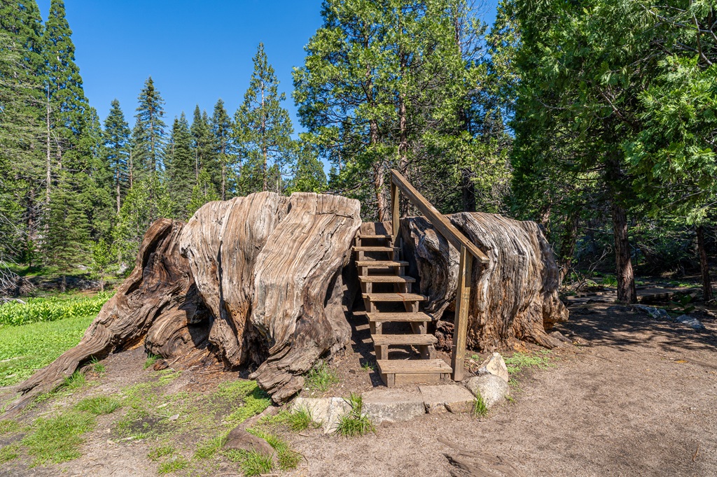
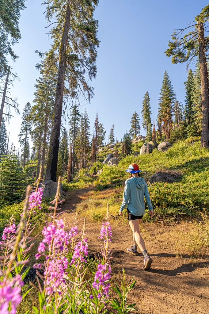
Big Stump Trail
If you are entering through the Big Stump Entrance into Kings Canyon National Park, the first thing on the itinerary is hiking the Big Stump Trail.
The Big Stump, also known as the Mark Twain Stump, is a really neat thing to see. Before this giant sequoia tree was cut down, it was about 16 feet in diameter!
The reason it was cut down was so a cross-section of it could be displayed at the American Museum of Natural History in New York City. Completely unnecessary in my opinion. Anyway, there are steps that lead to the top of the stump so you can get a better sense of how massive this tree was.
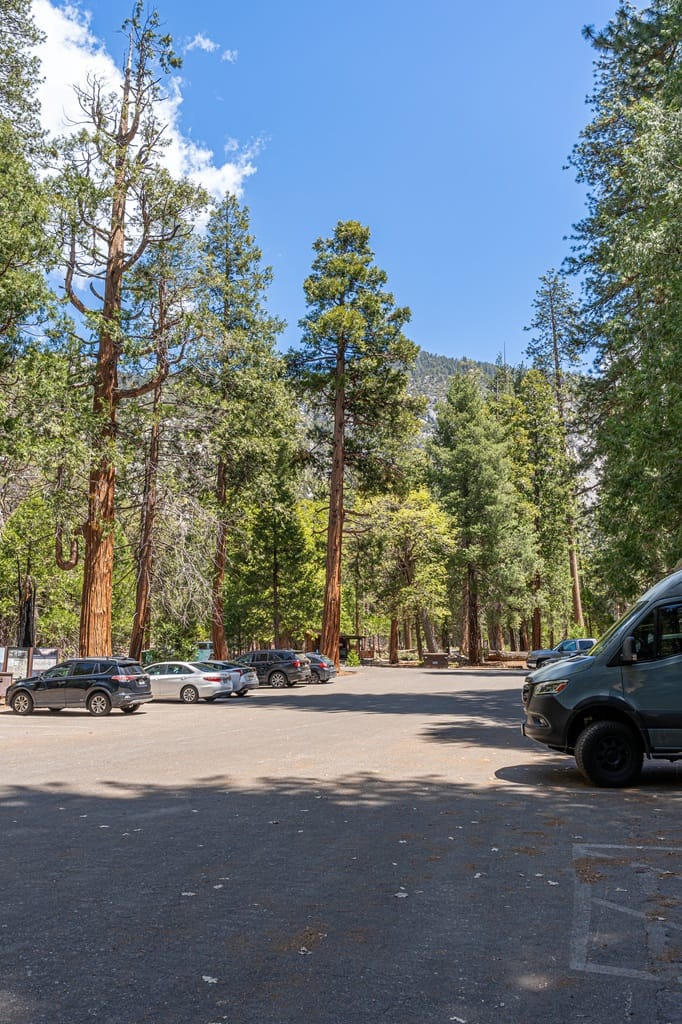
🅿️ Big Stump Trailhead/Parking: This hike starts from the Big Stump Picnic Area. There is a big parking lot with about 40 parking spots and a few extra big spots for buses and RVs. You will also find restrooms (flush toilets), covered picnic tables, and drinking water.
📍 Google Maps Location: Big Stump Picnic Area
🥾 Big Stump Trail Stats:
- Starting Point: Big Stump Picnic Area
- Length: 2 miles (3.2 km) roundtrip
- Elevation Gain: 200 feet
- Difficulty: Easy
- Hiking Time: 1 hour
- Pet-friendly? No
- Highlights: Big Stump (also called the Mark Twain Stump)
- Big Stump Trail Map
🚗 Distance/Drive Time to Big Stump Picnic Area: From Big Stump Entrance, it’s 0.8 miles (1.3 km) with a drive time of 3 minutes.
➡️ Tip: If you are starting your day later in the morning and you have to take one thing off the itinerary, I recommend skipping the Big Stump Trail. It’s cool to see, but personally I wouldn’t prioritize it. If you still have time for it later, go for it!
See the General Grant Tree
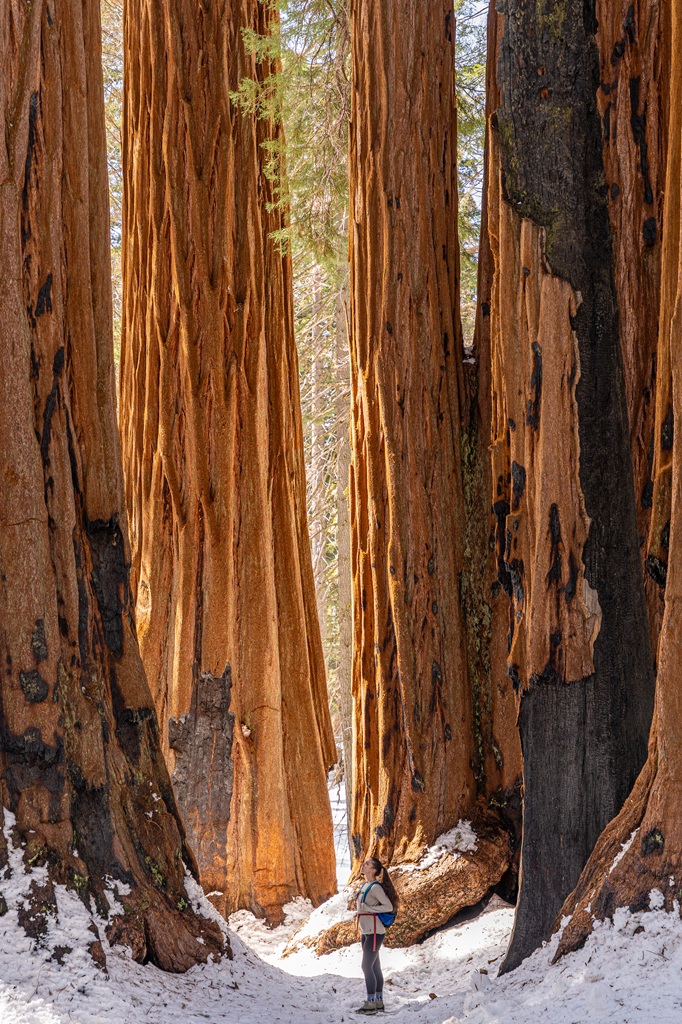
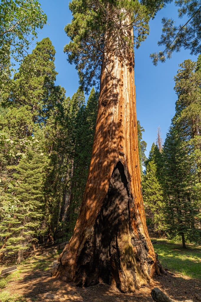
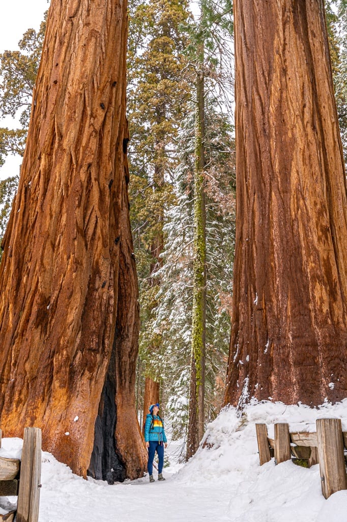
Meet the third largest tree in the world! By volume. That’s an important distinction – largest tree in the world by volume. The General Grant Tree is a must-see when visiting Kings Canyon National Park.
Located in Grant Grove, a 90-acre sequoia grove, the General Grant Tree is the most popular attraction in the park. Because of this, it’s a good idea to get here as early as you can – before 9 AM on weekdays and 8 AM on summer weekends/holidays.
If you have another day, check out the largest and second largest trees in the world located in Sequoia National Park! That largest tree by volume is the General Sherman Tree and the second is the President Tree which can be found along the Congress Trail.
The General Grant Tree in Kings Canyon has a height of 268 feet, weighs 1,254 tons, and is about 1,700 years old. Apparently, it would take about 20 people, holding hands, to reach all the way around the base of three. 🤯
In 1926, President Calvin Coolidge designated the General Grant as the Nation’s Christmas Tree. And in 1956, President Eisenhower declared the General Grant Tree to be a national shrine. It was dedicated to the men and woman in the Armed Forces who served and fought for the United States.
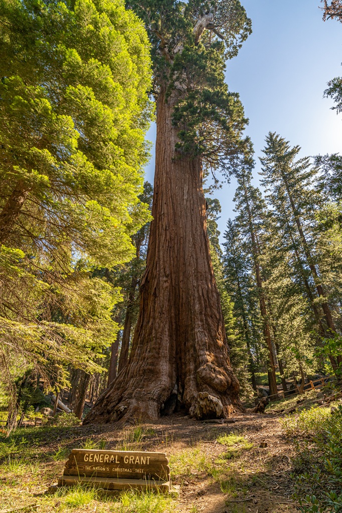
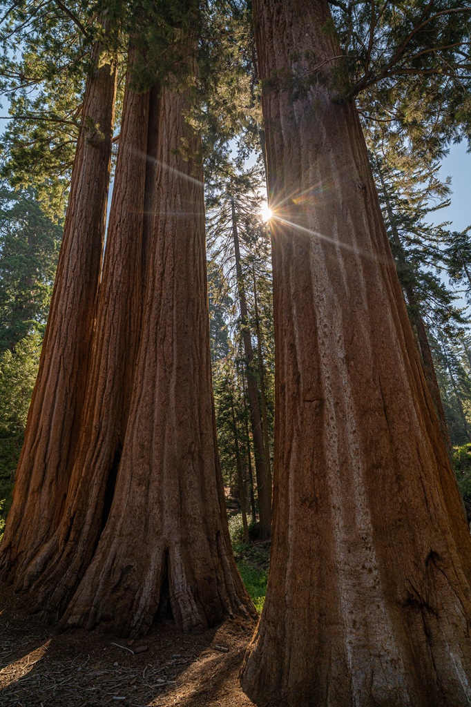
A short and easy loop trail takes you through Grant Grove where you will see the famous General Grant Tree, walk through a fallen giant sequoia trunk, read educational placards about the area, and see other neat highlights like a historical cabin and giant sequoia stump.
The General Grant Tree sits at an elevation of about 6,300 feet. Thankfully, the short hike to see the sequoia tree doesn’t have much elevation gain so you shouldn’t be too affected by the altitude. But if you do feel more winded, take breaks and stay hydrated!
Once you reach the General Grant Tree, you can walk around the tree along a paved path. At the backside of the tree, you will see a huge burn scar from past wildfires.
🌳 Preservation Tip: You will notice a fence around the tree. Please do not cross it! The fence is there to protect the General Grant Tree’s shallow root system. To help protect this tree for many more generations, do not cross the fence!
🅿️ General Grant Tree Trailhead/Parking: The General Grant Tree Trailhead is located at the end of Grant Tree Road. The parking lot is big with plenty of spots. Buses and RVs can park here too! You will also find restrooms (flush toilets) and drinking water here.
📍 Google Maps Location: General Grant Tree Trailhead
🥾 General Grant Tree Trail Stats:
- Starting Point: General Grant Tree Trailhead
- Length: 0.6 miles (1 km) roundtrip
- Elevation Gain: 30 feet
- Difficulty: Easy
- Hiking Time: 30 to 45 minutes
- Pet-friendly? No
- Highlights: General Grant Tree, Fallen Monarch (walk inside a fallen giant sequoia trunk), Centennial Stump, Gamlin Cabin, and educational placards along the trail
- General Grant Tree Trail Map
🚗 Distance/Drive Time to General Grant Tree Trailhead: From the Big Stump Picnic Area, it’s 3.5 miles (5.6 km) with a drive time of 10 minutes.
Kings Canyon Visitor Center
Located in Grant Grove Village at 6,500 feet in elevation, the Kings Canyon Visitor Center is a convenient place to stop before doing the next thing on the itinerary – driving down the Kings Canyon Scenic Byway.
You can stock up on some supplies, such as maps, snacks, drinks, and talk to a park ranger to learn more about the Kings Canyon. You will also find a gift shop and restrooms with flush toilets.
You can learn more about giant sequoias and Kings Canyon National Park through exhibits and short films. Operating hours can vary by season. Find more information about visitors center in Sequoia and Kings Canyon HERE.
If you haven’t eaten breakfast yet, you can either buy grab-and-go snacks from the Grant Grove Market or buy a full meal at the Grant Grove Restaurant. Both the store and restaurant are within walking distance from the visitor center.
🅿️ Kings Canyon Visitor Center Parking: There’s a large parking lot with plenty of spots plus some for those with a disability placard. You will find restrooms (flush toilets) and drinking water here.
📍 Google Maps Location: Kings Canyon Visitor Center
🚗 Distance/Drive Time to Kings Canyon Visitor Center: From the General Grant Tree parking area, it’s 1 mile (1.6 km) with a drive time of 3 minutes.
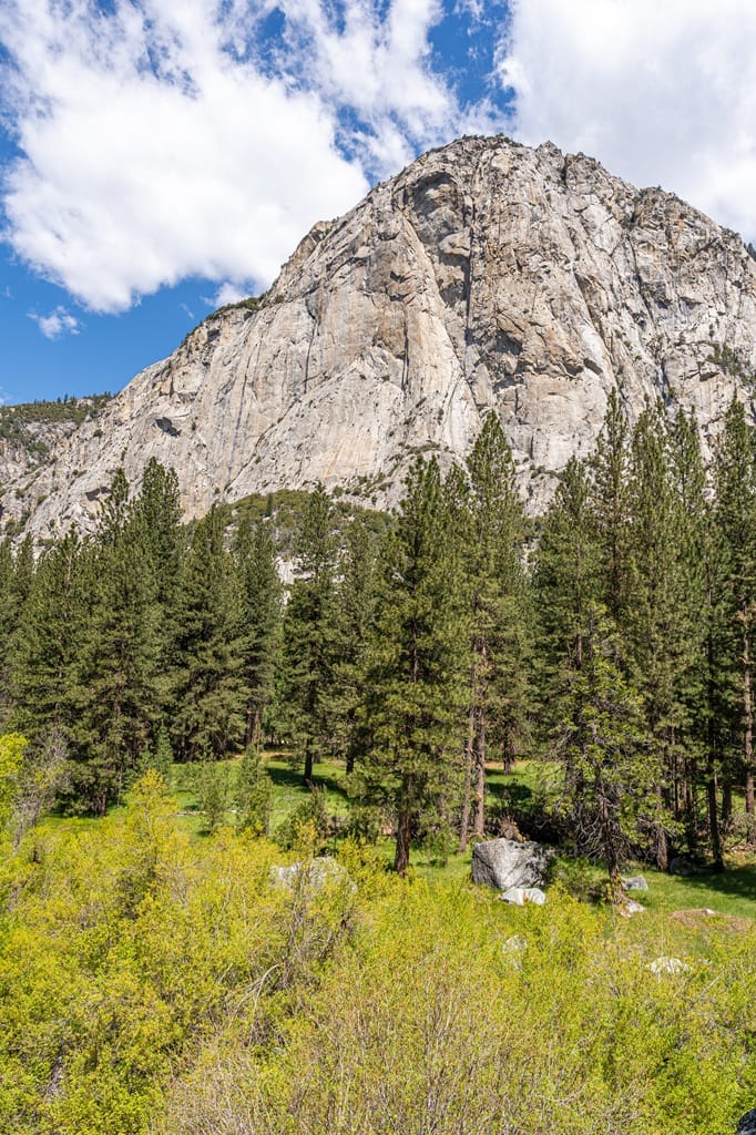
Drive the Kings Canyon Scenic Byway
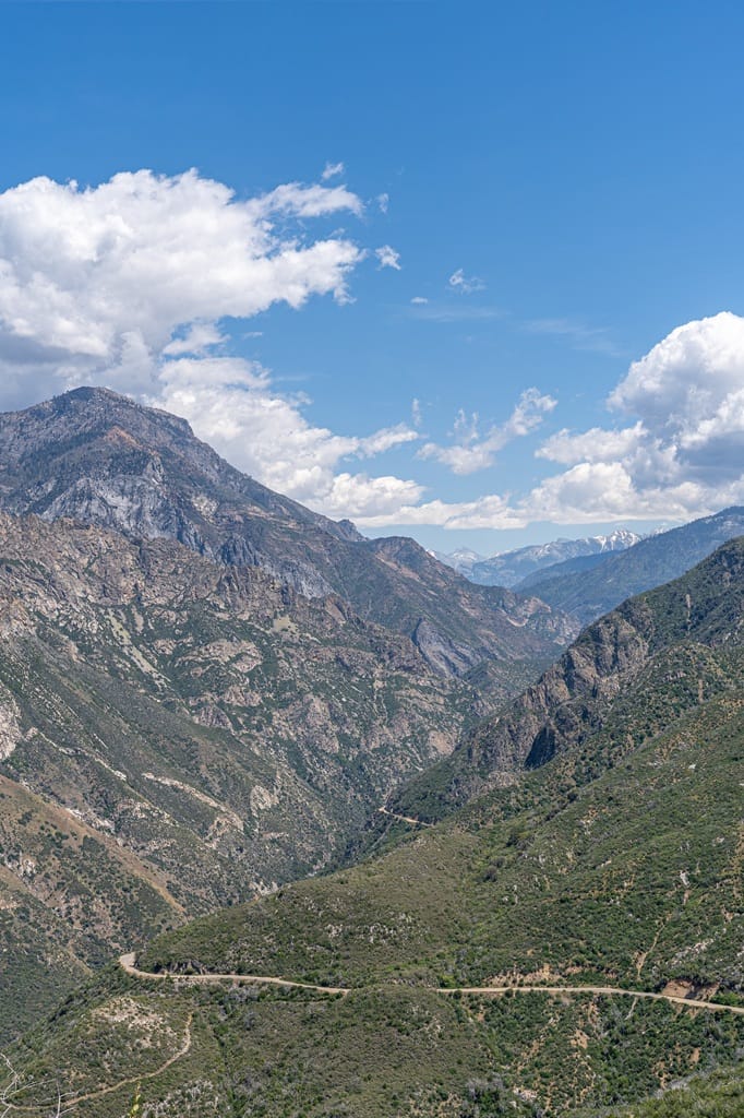
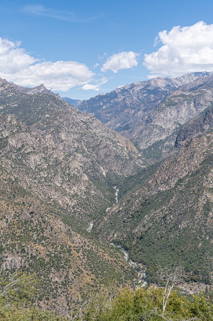
Ready for an epic drive along an incredibly scenic road!? Driving the Kings Canyon Scenic Byway is my favorite thing to do in Kings Canyon! There are so many fun stops and beautiful roadside viewpoints.
Did you know that Kings Canyon is one of the deepest canyons in North America? And you get to drive into it! Not actually all the down to the very bottom but enough to get a taste of how incredible it is.
This is a 38-mile (61-km) drive starting from the Big Stump Entrance and ending at Road’s End which is literally the end of the road. It’ll take about 1 hour and 30 minutes just to drive the entire route one way (without stops).
It’s a decent bit of driving but trust me, it’s worth it! Just make sure your vehicle is fueled up (or charged). This route is interesting because you will start in Kings Canyon National Park at Grant Grove, leave the national park and enter the Giant Sequoia National Monument, then re-enter Kings Canyon near Cedar Grove.
So if you see a sign saying something along the lines of “leaving national park” or “entering national monument/national forest”, don’t worry! You’re going the right way. Just trust the process – you’ll eventually re-enter the national park.
The Kings Canyon Scenic Byway is seasonal, so it’s open sometime between late April/early May through mid-November – dates vary each year! If you’re planning a trip to Kings Canyon in April, May, October, or November, check the current road status and call 559-565-3341 (press 1, then 1) for up-to-date road conditions.
There are so many cool things to do and see along the Kings Canyon Scenic Byway. The next several activities on this itinerary involve quick stops and hikes along this road. I don’t mention it below in the itinerary but make sure you stop at Junction View – it’s the best roadside viewpoint!
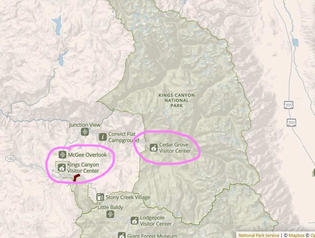
🏞️ Kings Canyon Scenic Byway Stops: (the ones bolded are included on this itinerary – if you have time for the other spots, feel free to add them to your itinerary)
- Big Stump Trail
- Kings Canyon Visitor Center
- General Grant Tree
- McGee Vista Point
- Chicago Stump
- Boole Tree
- Indian Basin Grove
- Hume Lake
- Junction View
- Boyden Cavern
- Grizzly Falls
- Cedar Grove Visitor Center
- Knapp’s Cabin
- Roaring River Falls
- Zumwalt Meadow
- Road’s End
- Muir Rock
🚗 Distance/Drive Time on the Kings Canyon Scenic Byway: From the Big Stump Entrance to Road’s End, it’s 38 miles (61 km) one way with a drive time of about 1.5 hours.
✨ Read my complete Kings Canyon Scenic Byway guide to learn about all the exciting things you can do along this road, including scenic viewpoints, best hikes, cave tour, and more!
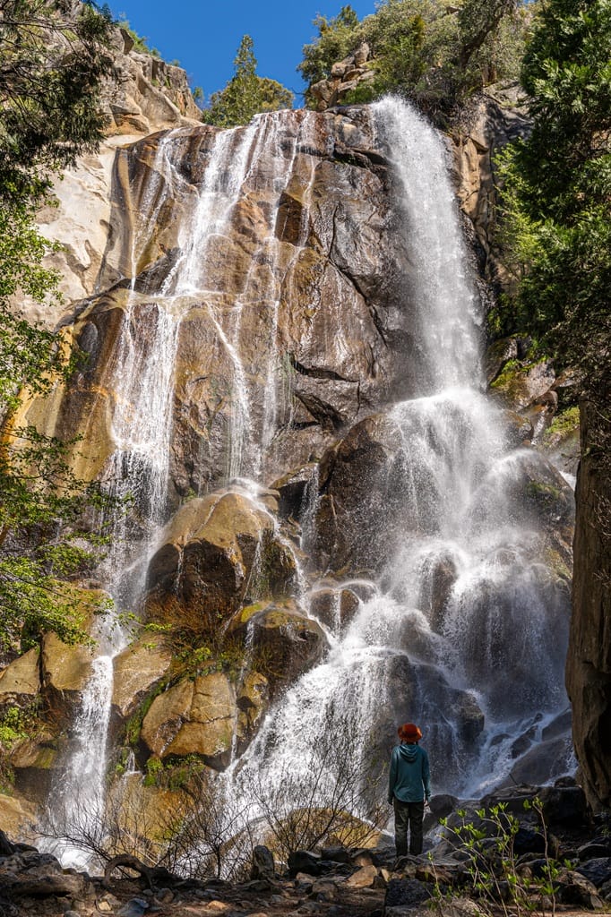
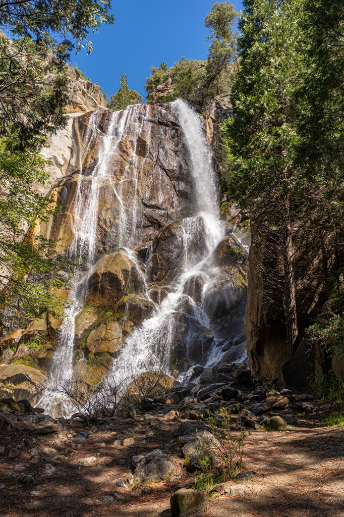
Grizzly Falls
The second stop along the Kings Canyon Scenic Byway is Grizzly Falls! Wait… second stop? What was the first? I briefly mentioned it above (and even bolded it) but it’s Junction View! This roadside overlook has some of the best views of the canyon.
From Junction View, continue driving about 14 miles (22.5 km) to reach the Grizzly Falls Picnic Area. Here you will walk a very short distance to an 80-foot waterfall called Grizzly Falls. It’s best seen in late spring when the waterfall is at its peak flow.
If you are not able to walk on the (unpaved) trail towards the waterfall, you can actually see it through the trees from the parking lot. This is a quick stop, so you don’t have to spend much time here unless you want to relax and eat some snacks at the picnic area.
🅿️ Grizzly Falls Parking: Grizzly Falls is actually located in the Giant Sequoia National Monument. The parking lot isn’t too big and it’s a popular spot, so plan to get here early if you can. You will also find vault toilets, bear-proof trashcans, and picnic tables here.
📍 Google Maps Location: Grizzly Falls Picnic Area
🚗 Distance/Drive Time to Grizzly Falls: From the Kings Canyon Visitor Center to Grizzly Falls, it’s 25 miles (40 km) with a drive time of about 55 minutes.
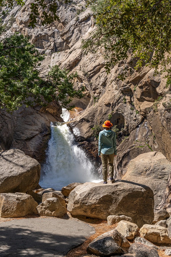
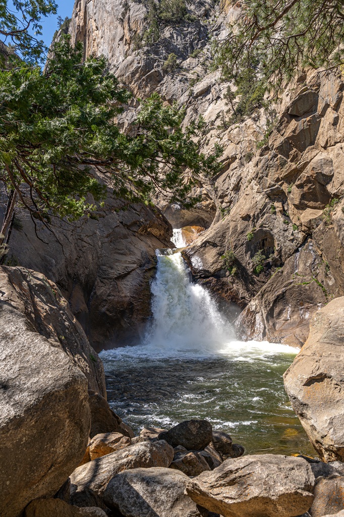
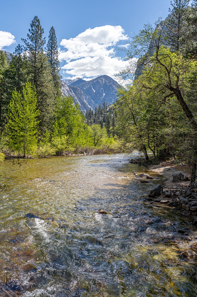
Roaring River Falls
If you’re a waterfall lover, you’ll be thrilled to learn that the next stop along the Kings Canyon Scenic Byway is another waterfall! Roaring River Falls is a powerful 40-foot waterfall. Oh, by the way, you’re now back in Kings Canyon National Park. 🙂
A short, paved path leads to a viewing platform so you can get an up-close look at the waterfall. The best time to see this waterfall is in late spring when it’s at its peak flow. You can actually here it roaring – hence the name!
The paved trail is said to be wheelchair accessible. There is a little bit of an incline so just be aware of that. But this easy hike is great for individuals of all ages and abilities!
If you want a longer hiking option, follow the River Trail to Zumwalt Meadow – the next stop on the itinerary. It’s an easy-going 3.9 miles (6.3 km) roundtrip hike. If you’re not interested in hiking this far, don’t worry, just hop in your car and drive down the road to the Zumwalt Meadow parking area.
🅿️ Roaring River Falls Trailhead/Parking: The parking lot has about 16 spots with one being a handicap accessible spot. It’s a popular area so spots can fill up quickly during peak season.
📍 Google Maps Location: Roaring River Falls Trailhead
🥾 Roaring River Falls Trail Stats:
- Starting Point: Roaring River Falls Trailhead
- Length: 0.3 miles (0.5 km) roundtrip
- Elevation Gain: 30 feet
- Difficulty: Easy
- Hiking Time: 30 to 45 minutes
- Pet-friendly? No
- Highlights: Roaring River Falls
- Roaring River Falls Trail Map
🚗 Distance/Drive Time to Roaring River Falls: From Grizzly Falls, it’s 7.5 miles (12 km) with a drive time of 15 minutes.
Zumwalt Meadow
Zumwalt Meadow is one of Kings Canyon’s most scenic meadows. Along with Grizzly Falls and Roaring River Falls, this meadow is one of the most popular spots along the Kings Canyon Scenic Byway.
Hike along a relatively short trail for incredible views of the meadow and Kings River. The boardwalk section of the trail that goes through the meadow is unfortunately closed. It’s been closed for several years now so I’m not sure when it’ll reopen. But this hike is still worth doing!
The trail takes you beside the rushing Kings River, over a fun suspension bridge, through a peaceful forest, and over a rocky hillside where you will get the best views of Zumwalt Meadow.
🅿️ Zumwalt Meadow Trailhead/Parking: The parking lot can hold about 30 vehicles with one handicap accessible spot. You will also find a vault toilet and picnic tables here.
📍 Google Maps Location: Zumwalt Meadow Trailhead
🥾 Zumwalt Meadow Trail Stats:
- Starting Point: Zumwalt Meadow Trailhead
- Length: 1.5 miles (2.4 km) roundtrip
- Elevation Gain: 155 feet
- Difficulty: Easy to moderate
- Hiking Time: 1 to 1.5 hours
- Pet-friendly? No
- Highlights: Zumwalt Meadow, suspension bridge, and access to Kings River
- Zumwalt Meadow Trail Map
🚗 Distance/Drive Time to Zumwalt Meadow: From Roaring River Falls, it’s 1.7 miles (2.7 km) with a drive time of 3 minutes.
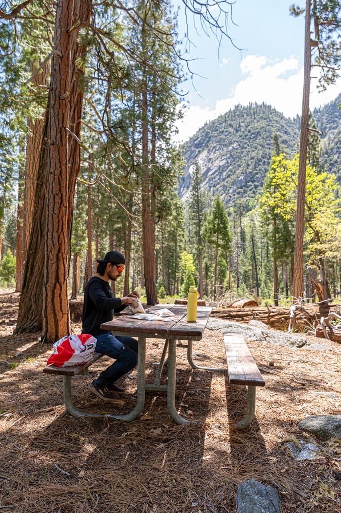
Picnic at Road’s End
You’ve been driving, hiking, and soaking in Kings Canyon’s beauty all morning, it’s time for a well-deserved lunch break! The end of Kings Canyon Scenic Byway is known as Road’s End.
Here you will find several parking lots, wilderness permit station, vault toilets, and picnic tables scattered around. This is a great spot to stop and refuel.
If you’re not interested in eating outside at a picnic area, you could eat lunch at the Cedar Grove Grill. You passed this area earlier, but there’s no reason to stop here unless you want to eat lunch here, fill up your water bottles with potable water, or use the restrooms.
If you do decide to have a picnic lunch, please remember to pack out all your trash and never feed wild animals, even the cute little squirrels!
🅿️ Road’s End Parking: There are several parking lots at Road’s End, so you shouldn’t have any issues finding a parking spot. Here you will find vault toilets, picnic tables, drinking water, and bear-proof lockers.
📍 Google Maps Location: Road’s End
🚗 Distance/Drive Time to Road’s End: From Zumwalt Meadow, it’s 0.8 miles (1.3 km) with a drive time of 3 minutes.
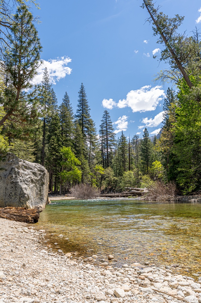
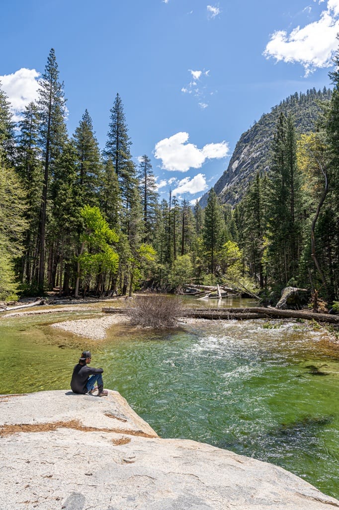
Muir Rock and Swimming
Muir Rock is a large granite boulder named after a famous naturalist and environmental advocate, John Muir. Located just a short walk from the Road’s End parking lot, Muir Rock is said to be a spot where John Muir gave speeches about the importance of protecting natural places like Kings Canyon and beyond.
I recently visited this spot for the first time and was blown away by the beauty of this area. The Kings River flows by here and in mid to late summer (when the river is calmer), it’s a great spot for swimming.
Some even jump off Muir Rock into the water – just be careful and be prepared for freezing cold water! You can lay down a towel and sunbathe on top of Muir Rock or go to the little rocky beach on the other side.
Spend some time here and relax after all the driving and sightseeing. Again, please follow Leave No Trace while visiting this beautiful and pristine area – pack out everything you bring with you, do not litter, leave what you find (don’t take rocks, plants, etc.), do not carve into trees or rocks, leave wildlife alone, and be considerate of others. 😊
🅿️ Muir Rock Parking: Muir Rock is located at Road’s End, so you will find several parking lots with plenty of spots. There are also vault toilets, drinking water, and bear-proof lockers.
📍 Google Maps Location: Muir Rock
🚗 Distance/Drive Time to Muir Rock: No driving required if you’re already at Road’s End – it’s just a short walk from the parking lot.
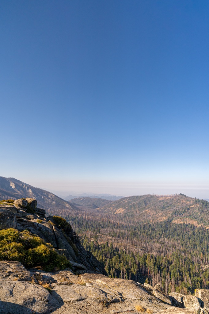
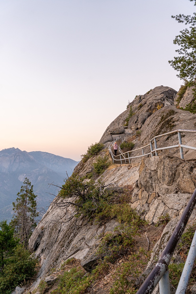
Sunset at Panoramic Point
Panoramic Point has some of the best views in Kings Canyon National Park. The trail to reach the overlook is short and paved with minimal elevation gain. At the top, you’ll be rewarded with breathtaking 360-degree views of the High Sierra, Kings Canyon, Hume Lake, and the distant San Joaquin Valley.
It’s a great spot to watch either sunrise or sunset. For this particular itinerary, I added watching sunset at Panoramic Point, but you could always watch sunrise here instead.
Before you go, make sure Panoramic Point Road is open (check road status here)! It closes seasonally when snow accumulates and reopens sometime in late May (dates vary each year). Also, it’s important to note that road is narrow – RVs and trailers are not permitted!
🅿️ Panoramic Point Trailhead/Parking: The parking area is fairly big with vault toilets, picnic tables, and bear-proof lockers.
📍 Google Maps Location: Panoramic Point Trailhead
🥾 Panoramic Point Trail Stats:
- Starting Point: Panoramic Point Trailhead
- Length: 0.5 miles (0.8 km) roundtrip
- Elevation Gain: 95 feet
- Difficulty: Easy
- Hiking Time: 45 minutes to 1 hour
- Pet-friendly? No
- Highlights: Breathtaking views from Panoramic Point
- Panoramic Point Trail Map
🚗 Distance/Drive Time to Panoramic Point Trailhead: From Road’s End, it’s 37 miles (60 km) with a drive time of 1 hour and 15 minutes.
Alternate Option – Hike to Mist Falls
If you’re looking for something a bit more adventurous then I recommend hiking to Mist Falls. I have yet to hike this trail but I’ve heard so many great things about it! This hike is best in late spring when the waterfall is at its peak flow.
You can still hike it later in summer but the waterfall’s flow will be a lot smaller and the temperature can get hot – if that’s the case, I recommend hiking this trail first on the itinerary then hitting all the other spots later!
This popular hike begins at Road’s End along the Paradise Valley Trail then onto the Mist Falls Trail. You will hike deeper into the wilderness with beautiful canyon views along the way. The trail ends at a beautiful 100-foot waterfall known as Mist Falls.
🅿️ Mist Falls Trailhead/Parking: The Mist Falls Trailhead is located at Road’s End. There are several parking lots, so you shouldn’t have any issues finding a parking spot. You will also find vault toilets, drinking water, and bear-proof lockers here.
📍 Google Maps Location: Mist Falls Trailhead
🥾 Mist Falls Trail Stats:
- Starting Point: Mist Falls Trailhead at Road’s End
- Length: 8 miles (12.9 km) roundtrip
- Elevation Gain: 905 feet
- Difficulty: Moderately challenging
- Hiking Time: 3.5 to 4 hours
- Pet-friendly? No
- Highlights: Mist Falls
- Mist Falls Trail Map
🚗 Distance/Drive Time to Mist Falls Trailhead: If you are driving the Big Stump Entrance, it’s 38 miles (61 km) with a drive time of 1.25 to 1.5 hours.
💦 Alternate itinerary if you hike Mist Falls:
- 8:00 AM: Drive straight to the Mist Falls Trailhead via Kings Canyon Scenic Byway
- 9:30 AM: Hike Mist Falls (8 miles / 12.9 km, moderate)
- 2:30 PM: Quick stops along the Kings Canyon Scenic Byway – Zumwalt Meadow (1.5 miles / 2.4 km, easy to moderate), Roaring River Falls (0.3 miles / 0.5 km, easy), Grizzly Falls (0.1 miles / 0.2 km, easy), and Junction View (roadside viewpoint)
- 5:30 PM: General Grant Tree (0.6 miles / 1 km, easy)
- 6:30 PM: Sunset at Panoramic Point (0.5 miles / 0.8 km, easy)
Sample 1-Day Kings Canyon National Park Itinerary
This is a sample itinerary for one epic day in Kings Canyon National Park. It includes times, trails and highlights, parking, drive time, and important things to know. Basically, it’s the exact same itinerary as described above – just less wordy.
Be aware, when following an itinerary, things may not go exactly as planned. That’s why it’s important to have a backup plan! And don’t stress about trying to squeeze in everything. There’s quite a bit packed into one day, so feel free to take things out that don’t interest you as much.
Further below in this guide I include more things to do in Kings Canyon National Park, so feel free to create your own personalized 1-day itinerary!
🥾 7:30 AM – Big Stump Trail
- Parking: Big parking lot (~40 spots) at the Big Stump Picnic Area with flush toilets, covered picnic tables, and drinking water.
- Hike Details: 2 miles / 3.2 km roundtrip with 200 feet of elevation gain (easy) starting from the Big Stump Picnic Area.
- Highlights: Big Stump / Mark Twain Stump
- Time for Activity: 1 hour
🌳 8:30 AM – General Grant Tree
- Parking: Big parking lot at end of General Grant Tree Road with flush toilets and drinking water.
- Hike Details: 0.6 miles / 1 km roundtrip with 30 feet of elevation gain (easy) starting from the General Grant Tree Trailhead. Trail is entirely paved but not wheelchair accessible.
- Highlights: General Grant Tree
- Time for Activity: 45 minutes
🏫 9:30 PM – Kings Canyon Visitor Center
- Parking: Big parking lot at the visitor center with flush toilets and drinking water. There’s also a nearby restaurant and market.
- Details: Talk to a parker ranger for more information about the park, stock up on supplies (maps, snacks, drinks), and learn more about giant sequoias and Kings Canyon through exhibits and short films.
- Time for Activity: 30 minutes
🛣️ 10:00 AM – Start Driving on the Kings Canyon Scenic Byway
- Details: 38-mile (61-km) drive starting from the Big Stump Entrance and ending at Road’s End which is literally the end of the road. The Kings Canyon Scenic Byway is seasonal, so it’s open sometime between late April/early May through mid-November – dates vary each year!
- Highlights: For this specific itinerary, highlights include Junction View, Grizzly Falls, Roaring River Falls, Zumwalt Meadow, and Muir Rock.
- Time for Activity: 1 hour and 15 minutes (drive time from Kings Canyon Visitor Center to Road’s End without stops)
💦 11:00 AM – Grizzly Falls
- Parking: Parking lot at Grizzly Falls Picnic Area with vault toilets, bear-proof trashcans, and picnic tables here.
- Hike Details: 0.1 miles / 0.2 km roundtrip (easy) starting from the Grizzly Falls Picnic Area.
- Highlights: Grizzly Falls
- Time for Activity: 15 to 30 minutes
Tip: On your way to Roaring River Falls, you can stop at the Cedar Grove Grill for lunch. In the itinerary I included eating a picnic lunch at Road’s End, but choose whichever option works best for you!
🥾 11:30 PM – Roaring River Falls
- Parking: The parking lot has about 16 spots with one being a handicap accessible spot.
- Hike Details: 0.3 miles / 0.5 km roundtrip (easy) with 30 feet of elevation gain starting from the Roaring River Falls Trailhead.
- Highlights: Roaring River Falls
- Time for Activity: 30 to 45 minutes
🌿 12:30 PM – Zumwalt Meadow
- Parking: Trailhead parking area holds about 30 vehicles with a vault toilet and picnic tables.
- Hike Details: 1.5 miles / 2.4 km roundtrip with 155 feet of elevation gain (easy to moderate) starting from the Zumwalt Meadow Trailhead.
- Highlights: Zumwalt Meadow
- Time for Activity: 1 to 1.5 hours
🥪 2:00 PM – Picnic at Road’s End
- Parking: Several big parking lots with vault toilets, picnic tables, drinking water, and bear-proof lockers.
- Details: You will find picnic tables scattered around at Road’s End. Be sure to throw away trash in the bear-proof trash receptacles and pack out everything else with you. Never leave food scraps behind!
- Time for Activity: 1 hour
- Alternate Option: I mentioned this earlier, but if you would rather eat a freshly cooked meal, you can stop at the Cedar Grove Grill for lunch instead. It’s located between Grizzly Falls and Roaring River Falls.
🏞️ 3:00 PM – Muir Rock (swimming and relaxing)
- Parking: Several big parking lots with vault toilets, picnic tables, drinking water, and bear-proof lockers.
- Highlights: Muir Rock and fun swimming hole (safest in mid to late summer when the river is calmer)
- Time for Activity: 1 to 2 hours
Tip: If you have time, you can stop by the Grant Grove Restaurant for a quick dinner before watching sunset! Or just skip sunset and end the day with a nice, warm meal.
🌄 7:00 PM – Sunset at Panoramic Point
- Parking: Parking lot is fairly big with vault toilets, picnic tables, and bear-proof lockers.
- Hike Details: 0.5 miles / 0.8 km roundtrip with 95 feet of elevation gain (easy) starting from the Panoramic Point Trailhead.
- Highlights: Incredible views from Panoramic Point
- Time for Activity: 45 minutes to 1 hour
Best Time to Visit Kings Canyon for One Day
The best time to visit Kings Canyon National Park is anytime from late May to early November. The roads are open and snow-free, both day hiking and backpacking trails are more accessible, and everything seems to come to life with wildlife out and about and wildflowers blooming.
🗓️ Here are my favorite months to visit and why:
- Late May/Early June (late spring) – big waterfalls, less crowded trails, and mild temperatures
- Late September/Early October (early fall) – mild temperatures, great time for swimming as the river is calmer, and summer crowds are gone
➡️ Tip: The Kings Canyon Scenic Byway typically opens sometime in late April/early May and closes sometime in mid-November. These dates vary each year depending on winter conditions. Check the current road status before going and call 559-565-3341 (press 1, then 1) for up-to-date road conditions.
July and August are good months as well because all the roads will definitely be open for the season and all the restaurants/shops are open by now. This is also peak tourist season so expect crowds! If you plan to visit during either of these months, get into the park early (before 7 AM) and knock out all the most popular attractions and trails first, such as General Grant Tree, Grizzly Falls, Roaring River Falls, and Zumwalt Meadow.
If you are planning a visit in April, May, October, or November, be aware that some roads, including a section of the Kings Canyon Scenic Byway and Panoramic Point Road, could be closed for the season due to winter conditions. This will greatly limit the things you can do in the park if these roads are still closed. If that does happen to you, never fear! That’s why backup plans are important.
⛔ If the Kings Canyon Scenic Byway to Cedar Grove and Panoramic Point Road are closed, here’s a “Plan B 1-Day Kings Canyon Itinerary”:
- 8:00 AM: Big Stump Trail (easy 2 miles / 3.2 km roundtrip, 1 hour)
- 9:00 AM: General Grant Tree (easy 0.6 miles / 1 km roundtrip, 45 minutes)
- 10:00 AM: Kings Canyon Visitor Center (educational exhibits, snacks/drinks, restrooms)
- 10:45 AM: Viola Falls and Ella Falls (moderate 5.7 miles / 9.2 km roundtrip and a great option in mid to late spring, 3-4 hours)
- 3:00 PM: Buena Vista Peak (moderate 2 miles / 3.2 km roundtrip, 1-1.5 hours) OR Big Baldy (moderate 4.7 miles / 7.6 km roundtrip, 2.5-3 hours)
- 5:00/6:30 PM: Dinner at Grant Grove Restaurant
Visiting Kings Canyon in One Day Logistics
After reading through the fun-filled itinerary, I hope you’re excited about planning a trip to Kings Canyon National Park! 🤗
Now that you know what to do in the park and how to spend one full day, it’s time to figure out the rest of the logistics of planning a trip, such as how to get to the park, entrance fees, and where to stay.
Don’t skip this part! It contains important information that will make visiting Kings Canyon a smooth and stress-free experience.
How to Get to Kings Canyon National Park
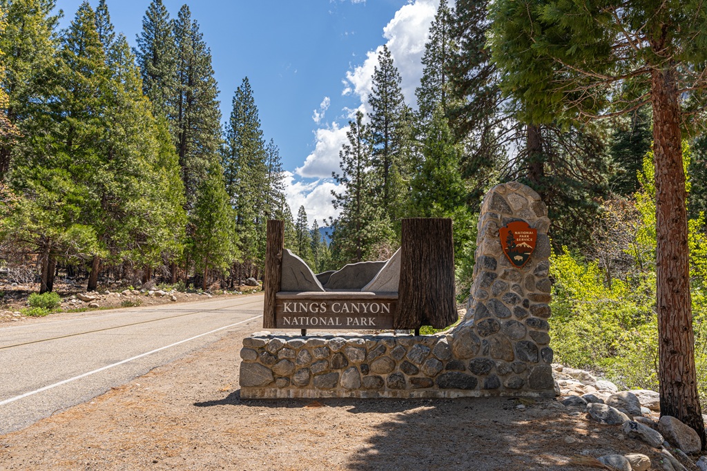
One great thing about Kings Canyon National Park is that it’s really simple to get there. Just hop on Highway 180 heading east until you reach the Big Stump Entrance – it’s the only entrance into Kings Canyon.
You might be planning to fly into a bigger city then drive to the park. If that’s the case, I recommend flying into Fresno as it’s the closest international airport to Kings Canyon, but it honestly depends on your overall plans. If you’re just planning to visit Kings Canyon and maybe even Sequoia National Park, then flying into Fresno will the best choice.
✈️ Now, let’s take a look at the drive times from nearby major cities with airports to help you plan your visit more easily.
- Fresno Yosemite International (FAT)
- City: Fresno, CA
- Distance to Big Stump Entrance: 51 miles (82 km)
- Drive Time: 1 hour and 15 minutes
- San José Mineta International (SJC)
- City: San José, CA
- Distance to Big Stump Entrance: 205 miles (330 km)
- Drive Time: 4 hours
- Oakland San Francisco Bay Interanational (OAK)
- City: Oakland, CA
- Distance to Big Stump Entrance: 220 miles (354 km)
- Drive Time: 4.5 to 5 hours
- Sacramento International (SMF)
- City: Sacramento, CA
- Distance to Big Stump Entrance: 235 miles (378 km)
- Drive Time: 4.5 hours
- San Francisco International (SFO)
- City: San Francisco, CA
- Distance to Big Stump Entrance: 245 miles (394 km)
- Drive Time: 5 to 5.5 hours
- Los Angeles International Airport (LAX)
- City: Los Angeles, CA
- Distance to Big Stump Entrance: 250 miles (402 km)
- Drive Time: 5.5 hours
Like I mentioned above, the only entrance into Kings Canyon National Park is the Big Stump Entrance. If you’re planning a trip to Sequoia National Park as well, the Generals Highway connects the two parks making it easy to drive from one park to the other.
The distance from the Kings Canyon Visitor Center to the Lodgepole Visitor Center in Sequoia National Park is 26 miles with a drive time of about 45 minutes. Might as well make a day trip to Sequoia if you have an extra day!
✨ READ THIS: How to Spend One Day in Sequoia National Park
The best way to get to Kings Canyon National Park is by renting a car or driving your own. Unfortunately, there are not any public transportation options to Kings Canyon. You could book a tour where they provide transportation. This will make it impossible to stick to this specific one day itinerary, but tours can be a fun option!
There are NO gas stations or EV charging stations in Kings Canyon National Park. Make sure to fuel up (or charge up) before you start your day. Gas stations can be found in Fresno, Visalia, Squaw Valley, Hume Lake, and Stony Creek Lodge. EV charging stations can only be found in Fresno and Visalia.
Kings Canyon Entrance Fee
Entrance to Kings Canyon National Park costs $35 per vehicle for a 7-day pass. However, if you have the America the Beautiful Annual Pass, your entry is free!
For those who love exploring national parks, investing in the Annual Pass is a smart choice. At just $80, it grants you access to over 2,000 federal recreation sites across the country!
FEE UPDATES! Beginning January 1, 2026, non-U.S. residents (without an annual pass) will pay a $100 per person in addition to the standard entrance fee. The Annual Pass for non-US residents will cost $250.
Since Kings Canyon and Sequoia are grouped together as one national park, you only have to pay for one entrance pass to get into both parks.
Driving in Kings Canyon National Park
The only way to get around Kings Canyon is by driving. There are no in-park shuttles at Kings Canyon! There is a shuttle system in Sequoia National Park, but there is no shuttle that goes from Sequoia to Kings Canyon.
There might be third party tours that provide transportation throughout the park, but if you want to stick to this exact itinerary then you will have to drive yourself around.
RVs and trailers are allowed in Kings Canyon National Park. You can find RV parking spaces at Kings Canyon Visitor Center, Grant Grove Village, General Grant Tree, Columbine Picnic Area, Big Stump Picnic Area, Cedar Grove Visitor Center, Cedar Grove Village, Roaring River Falls, and Zumwalt Meadow.
RVs and trailers are allowed on all roads in Kings Canyon EXCEPT for the Panoramic Point Road – it’s very narrow and curvy. They’re allowed all along the Kings Canyon Scenic Byway – this road is also very curvy so make sure to drive the speed limit (slower if needed), use pullouts to let other cars pass, and be careful not to cross into the other lane.
Where to Stay for One Day in Kings Canyon National Park
Lodging inside the park is pretty limited, but there are a few choices. If you’re more into camping, Kings Canyon has several campgrounds for tents, RVs, and car campers.
For this one day itinerary, the best places to stay would either be inside Kings Canyon or near the Big Stump Entrance. Nearby options are limited so book a place to stay in advance.
If you don’t mind driving a bit further, you could stay in Fresno or Visalia. Both cities are about 1 hour and 15 minutes away from the Big Stump Entrance. And there’s a lot more lodging options in Fresno and Visalia!
Here is a list of the best places to stay in and near Kings Canyon National Park 👇
1. John Muir Lodge
- Location: Kings Canyon National Park
- Cost: Midrange
- Distance from Grant Grove Village: 0.3 miles (0.5 km), 2 minutes’ drive
- Details: Planning to spend one day in Kings Canyon and another day in Sequoia? This is a great place to stay! It’s a rustic, comfortable lodge with a restaurant and gift shop within walking distance, common areas with fireplaces and games, and WiFi.
- Book your stay at John Muir Lodge! ✨
2. Cedar Grove Lodge
- Location: Kings Canyon National Park
- Cost: Midrange
- Distance from Grant Grove Village: 29 miles (47 km), 1 hour drive
- Details: This is a great place to stay if you want to spend most of your time in Cedar Grove! You’ll be a lot closer to places like Zumwalt Meadow, Roaring River Falls, and Mist Falls Trailhead. The lodge also has a gift shop, market, snack bar, and the Cedar Grove Grill.
- Book your stay at Cedar Grove Lodge! ✨
3. Wuksachi Lodge
- Location: Sequoia National Park
- Cost: Midrange to luxury
- Distance from Grant Grove Village: 25 miles (40 km), 45 minutes’ drive
- Details: Planning to spend one day in Sequoia and another in Kings Canyon? Stay at Wuksachi Lodge! It offers a convenient location near popular spots in the Giant Forest and Lodgepole areas. It also has an on-site restaurant, gift shop, and WiFi.
- Book your stay at Wuksachi Lodge! ✨
4. Montecito Sequoia Lodge
- Location: Sequoia National Forest between Kings Canyon and Sequoia National Park
- Cost: Midrange
- Distance from Grant Grove Village: 13 miles (21 km), 28 minutes’ drive
- Details: This lodge is perfectly located between Kings Canyon and Sequoia so if you’re planning to visit both parks this is a convenient place to stay. The lodge offers vintage lodge rooms, family-style rooms and suites, and newer forest cabins and lakeview lodge suites. It’s also very family-friendly with seasonal activities throughout the year!
- Book your stay at Montecito Sequoia Lodge! ✨
5. Gena’s Sierra Inn
- Location: Dunlap, CA
- Cost: Budget
- Distance from Grant Grove Village: 17 miles (27 km), 30 minutes’ drive
- Details: Gena’s Sierra Inn is a budget-friendly stay that offers comfortable rooms from standard rooms and studios to larger family-style options. There’s even an on-site restaurant along with a sun terrace, picnic areas, outdoor seating, and nearby trails.
- Book your stay at Gena’s Sierra Inn! ✨
🗺️ Find more places to stay using this map ⬇️
What to Bring to Kings Canyon National Park
🎟️ Entrance Pass – You will need to purchase an entrance pass once you reach the entrance station or you can buy the America the Beautiful Pass ahead of time and use that for the entire year.
👚 Layers of Clothing (top) – Pack a moisture-wicking base layer, a fleece mid-layer, an insulated jacket, and an outer shell to protect you from the elements, such as rain and wind. You may not need all these layers, especially in the summer months, but it’s always best to be over-prepared!
Check out my favorite tops 👇
- Base layer: REI Co-op Sahara Shade Hoodie (warm/mild conditions) and REI Co-op Midweight Long-Sleeve Base Layer (cooler conditions)
- Fleece mid layer: Cotopaxi Teca Fleece Full-Zip Jacket
- Down mid layer: Cotopaxi Fuego Hooded Down Jacket
- Outer shell: In the summer I always pack a light windbreaker, such as the Cotopaxi Teca Crop Windbreaker or the RevolutionRace Unit Light Windbreaker. Make sure to also pack a waterproof rain jacket – I like the Patagonia Torrentshell 3L Jacket.
🩳 Hiking Shorts or Pants – Pack a comfortable, durable, and stretchy pair of hiking shorts or pants. Also think about what conditions you might run into, such as warm or cold temperatures, wind and/or rain, bugs, and overgrown trails.
Check out my favorite hiking bottoms 👇
- Cotopaxi Losdos Zip-Off Pants
- RevolutionRace Breezy Ankle Outdoor Pants
- Baleaf Fleece-Lined Jogger Pants
- RevolutionRace Summit Pocket Tights
- Revolution Race Hike & Dive Shorts
🥾 Hiking Footwear – Bring a good pair of hiking boots or shoes with good traction. If I’m not expecting to hike in too much mud or snow, my go-to hiking shoes are the Altra Lone Peak trail runners. They have a wide-toe box, 0 mm heel-to-toe drop, and MaxTrac rubber outsole. Plus, they’re lightweight and so comfy!
🧦 Socks – Moisture-wicking, quick-drying socks are the way to go. My favorite pair of hiking socks are Darn Tough Hiker Micro Crew Cushion Socks. Always pack an extra pair!
🎒 Day Pack – What you plan to do (sightseeing, hiking, etc.), determines what size pack you’ll need. Here is what I typically bring based on what I’m doing that day 👇
- Short walks and sightseeing: Cotopaxi Kapai 1.5L Del Dia Hip Pack
- Short, easy to moderate day hikes: REI Co-op Flash 22L Pack
- Long, moderate to challenging day hikes: REI Co-op Trail 25L Pack or Cotopaxi Luzon Del Dia 24L Pack
🥢 Trekking Poles – Essential for stability, balance, and support when hiking trails, especially on tough, rocky, and uneven terrain. I use REI Co-op Trailmade Trekking Poles and love them!
❄️ Microspikes – Bring a pair of microspikes if you’re visiting in the winter and you’re planning to hike along icy trails. They will give you good traction to avoid slipping! I use Black Diamond Access Spike Traction Device.
🦟 Mosquito/Bug Repellants – In the warmer months, be prepared for annoying gnats, mosquitoes, and flies. Wear long-sleeve clothing, a head net, and use bug spray.
🧤 Extra Warm Layers – If you expect cooler conditions or hiking to higher elevations, make sure to pack extra layers for added warmth, such as gloves, beanie, neck gaiter, and a light jacket.
🗺️ Navigation – Carry a physical topographic map, compass, a satellite messenger (or personal locator beacon), and download offline maps to help you stay on course, find your way in unfamiliar terrain, and call for help if needed.
🔦 Headlamp/Flashlight – A reliable light source with extra batteries, in case you end up hiking in the dark or need it for emergency situations.
💧 Water – Water bottles to carry sufficient water to stay hydrated, along with a filtration system or purification tablets if you plan to refill from natural sources.
🍕 Food – Energy-rich snacks or meals to keep your energy levels up during the hike.
😎 Sun Protection – Sunscreen, sunglasses, and a sunhat to protect yourself from harmful UV rays, even when it’s cloudy. Also, polarized sunglasses are important when it’s bright outside and to reduce glare from reflective surfaces like water, snow, and roads.
🩹 First-Aid Kit – A basic first-aid kit with items like bandages, antiseptic, pain relievers, and any personal medications you may need.
🥶 Emergency Shelter – Pack an emergency bivy sack or space blanket for shelter in case of sudden weather changes.
🔥 Fire – A lighter, matches, or fire starter to help you build a fire for warmth or signaling in case of emergency. Along with matches, I also carry a multi-tool carabiner that has a fire starter, utility blade, screwdriver, and bottle opener.
🗡️ Multi-Tool and Repair Kit – A versatile tool/knife and repair kit to handle any task, from preparing food to making repairs.
💩 Waste Disposal Supplies – WAG bags, trowel, toilet paper, pee cloth, wipes, Ziploc bags – be sure to pack out everything!
First Timer Tips for Visiting Kings Canyon in One Day
If it’s your first time visiting Kings Canyon National Park and you only have one day, here are some essential tips to help you maximize your time in the park!
💵 Kings Canyon National Park Entrance Fee:
Entrance to Kings Canyon National Park costs $35 per vehicle for a 7-day pass. However, if you have the America the Beautiful Annual Pass, your entry is free!
For those who love exploring national parks, investing in the Annual Pass is a smart choice. At just $80, it grants you access to over 2,000 federal recreation sites across the country!
FEE UPDATES! Beginning January 1, 2026, non-U.S. residents (without an annual pass) will pay a $100 per person in addition to the standard entrance fee. The Annual Pass for non-US residents will cost $250.
🌄 Get to the Big Stump Entrance Early: The Big Stump Entrance is not as busy as the Ash Mountain Entrance in Sequoia National Park, but I still would recommend getting to the entrance early to beat the crowds, beat the heat, and have plenty of time to complete this 1-day itinerary. I recommend getting there no later than 8 AM. If you’re visiting on a summer weekend or holiday, try getting there by 7 AM.
🗺️ Plan Your Route and Download Offline Maps: Know where you’re going before you get to Kings Canyon! Look at a map, know the area, and plan out your route along with stops. Also, download offline maps on Google – there is little to no cell service inside the park.
🚗 Check Road Conditions: Always check road conditions before heading out. This is especially important in the winter months! You can also call 559-565-3341 (press 1, then 1) for up-to-date road conditions.
🌦️ Check the Weather Forecast: Check the weather forecast before going and be prepared for changing conditions. Weather in the mountains can be unpredictable. Always pack extra layers, rain gear, and sun protective clothing.
🌲 Respect Nature: Follow Leave No Trace principles – plan ahead, pack out all trash, avoid disturbing wildlife, be considerate of others, and respect the natural beauty of Kings Canyon National Park.
🚰 Bring a Reusable Water Bottle: Some spots mentioned in the itinerary have drinking water available. Bring a reusable water bottle and refill it each time so you can stay hydrated. This is especially important during the summer months, especially at Cedar Grove as it’s at lower elevation than Grant Grove.
⛽ Fuel Up: Make sure to fuel up (or charge your vehicle) before entering the park. There are NO gas stations or EV charging stations inside Kings Canyon National Park! There is a gas station at Hume Lake just off Highway 180 (Kings Canyon Scenic Byway).
🐶 Pets in Sequoia: For this 1-day Kings Canyon National Park itinerary, you will not be able to bring your furry friend along due to pets being prohibited on all trails (even the paved ones). Pets are only allowed on paved roads, parking lots, campgrounds, and picnic areas – they must be on a leash (no longer than 6 feet) at all times.
🐻 Be Bear Aware: Black bears are active within Kings Canyon. Follow these guidelines to avoid any negative interactions with a black bear. Also, bear spray is prohibited in Kings Canyon National Park!
More Things to Do in Kings Canyon National Park
If you have another day to explore Kings Canyon National Park, here are a few more exciting things to do!
Hike the Big Baldy Trail
The Big Baldy Trail gradually leads up to a giant granite dome with panoramic views of the Great Western Divide, Kings Canyon, and Redwood Canyon.
The summit stands at about 8,200 feet in elevation. It’s definitely worth adding to a 2-day Kings Canyon itinerary!
🥾 Big Baldy Trail Stats:
- Length – 4.7 miles (7.6 km) roundtrip
- Elevation Gain – 1,030 feet
- Difficulty – Moderate
- Hike Features – Incredible views from Big Baldy
- Big Baldy Trail Map
Hike to Buena Vista Peak
Sitting at 7,605 feet, Buena Vista Peak offers incredible panoramic views from the summit. It’s an amazing short hike that’s worth your time if you have an extra day.
You will walk through a scenic mixed conifer forest, pass by seasonal wildflowers, and be greeted by massive granite boulders at the top. You will be treated to amazing 360-degree views of Redwood Canyon, the High Sierra peaks, and Kings Canyon.
🥾 Buena Vista Peak Trail Stats:
- Length – 2 miles (3.2 km) roundtrip
- Elevation Gain – 400 feet
- Difficulty – Moderate
- Hike Features – Stunning views from Buena Vista Peak
✨ READ THIS: Buena Vista Peak Hiking Guide
Go on a Tour at Boyden Cavern
Book a tour at Boyden Cavern to see unique geological features within a marble cave. It’s a privately owned business located within the Giant Sequoia National Monument just off the Kings Canyon Scenic Byway.
Tours usually begin in late April or early May and end sometime in November. Dates of operation vary each year depending on weather and road conditions. When open, you can purchase tickets online or in-person – I recommend buying them online ahead of time to avoid any wait times.
Tours last about 45-60 minutes and require a short, steep hike into the cave. Once inside, the real fun begins! Be prepared to walk over uneven surfaces, up and over rocky formations, and up and down steps. Don’t worry, no scrambling involved. Just a bit of easy maneuvering around some rocks.
I have yet to take a tour but looks like it’s worth the time and money! This is definitely something I’m doing next time I’m driving down the Kings Canyon Scenic Byway.
Things to Do Near Kings Canyon National Park
Looking to explore beyond Kings Canyon National Park? Or planning a road trip and want to add a few more epic stops? You’re in luck – here are some incredible places nearby that are worth the extra drive!
Sequoia National Park
Sequoia National Park is located right next to Kings Canyon National Park. They’re often grouped together as one national park. I recommend dedicating one day in Sequoia National Park.
🥾 A few must-do hikes in Sequoia:
General Sherman Tree and Congress Trail – Combining the General Sherman Tree Trail and the Congress Trail is the best way to see lots of beautiful and unique giant sequoias. The most famous sequoia in this area is the General Sherman which is the largest tree in the world (by volume)! The hike to the General Sherman Tree is short along a paved path which makes it easy to add on the Congress Trail – 2.8 miles (4.5 km) roundtrip leading to famous giant sequoias, such as Chief Sequoyah, The President Tree, The Senate Group, The House Group, and McKinley Tree.
Moro Rock – This giant granite dome sits at 6,725 feet in elevation and offers stunning 360° views from the summit. The hike is short (0.5 miles / 0.8 km roundtrip) but requires going up about 350 steps! Moro Rock is one of the most popular hikes in the park so be prepared to share the top with others. I highly recommend watching sunrise or sunset from the top.
Tokopah Falls – Hike to the tallest waterfall in Sequoia National Park – Tokopah Falls! The waterfall is amazing but the scenery you see along the trail is just as beautiful. You will follow the Marble Fork of the Kaweah River through the canyon into a peaceful forest with views of lush meadows and giant granite cliffs. At the end of the trail, you will be greeted by the 1,200-foot waterfall which is best seen in late spring when snowmelt fuels the falls.
Big Trees Trail – This is one of the most scenic and family-friendly hikes in the park. The Big Trees Trail is an easy 1.2-mile (1.9-km) walk through the Giant Forest. Highlights along this trail include Sentinel Tree, Clara Barton Tree, young giant sequoia trees, and Round Meadow.
Lakes Trail – This is an incredible hike that takes you to four sparkling alpine lakes – Heather, Aster, Emerald, and Pear. The Lakes Trail is about 13 miles (21 km) roundtrip with 3,200 feet of elevation making it difficult but so worth it if you’re up for the challenge!
Crescent Meadow Loop – This easy 1.8-mile (2.8-km) loop trail takes you to one of the most peaceful and beautiful spots in Sequoia. Highlights include an open, lush meadow (Crescent Meadow), giant sequoias, and a unique historical structure called Tharp’s Log which is a cabin built in the 1800s by Hale Tharp out of a downed, giant sequoia. The meadow is also a great spot to potentially see wildlife, such as black bears, deer, and marmots.
Alta Peak – Looking to bag a tall peak in Sequoia? Add Alta Peak to your bucket list! Be aware, this is not just any casual hike. This hike is 14 miles (22.5 km) roundtrip with 4,000 feet of elevation gain. It’s a full day adventure! If you’re prepared for such a trek, you will be rewarded with incredible scenery from start to finish.
Planning to visit Sequoia National Park? Check out my travel guides! 👇
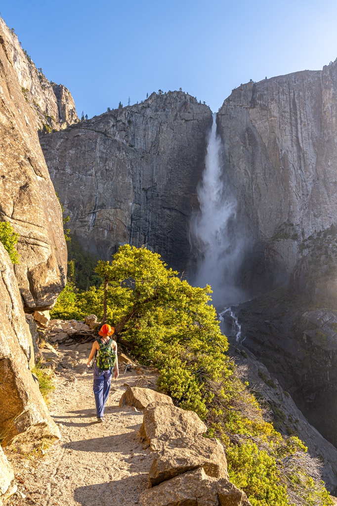
Yosemite National Park
Yosemite National Park is one of my favorite places in the world! I’ve visited this park many times, and I love helping others experience just how incredible it is (along with Sequoia and Kings Canyon).
Below I’ve listed some of the best hikes in Yosemite. I also have lots of blog posts about trip planning, itineraries, and detailed trail guides, so you can easily plan an epic trip to this wonderful national park!
🥾 A few must-do hikes in Yosemite:
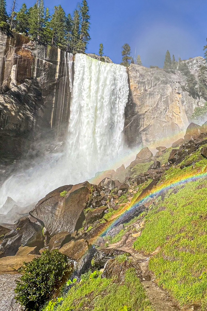
Mist Trail to Vernal and Nevada Falls – This is the most popular and most iconic hike in Yosemite National Park. Hike 1.5 miles (2.4 km) one way to the top of Vernal Fall along the famous granite steps embracing the powerful mist. If you have more energy and time, continue to the top of Nevada Fall – it’s worth the extra effort!
Four Mile Trail to Glacier Point – Want to see amazing views of Yosemite Falls, Half Dome, and the High Sierra peaks? Tackle the Four Mile Trail! It’s about 9.8 miles (15.7 km) from Yosemite Valley to Glacier Point and back down. Be prepared for a tough climb with 3,420 feet of elevation gain!
Upper Yosemite Fall Trail – This is one of my favorite hikes in Yosemite! It’s not as scenic as the Four Mile Trail but if you go during peak flow, you’ll get to feel the power of Upper Yosemite Fall up close! It’s one of the most challenging day hikes in the valley – 7 miles (11 km) roundtrip with 3,200 feet of elevation gain.
Sentinel Dome and Taft Point – Looking for short and moderately challenging hikes that lead to some of the most beautiful views in Yosemite? Add Sentinel Dome and Taft Point to your list! Sentinel Dome is 2.2 miles (3.5 km) roundtrip with 500 feet of elevation gain and Taft Point is 2.4 miles (3.8 km) roundtrip with 350 feet of elevation gain. They’re both great spots for watching sunrise or sunset!
Panorama Trail to Illilouette Fall – This is an insanely scenic hike with views of Half Dome, Vernal Fall, Nevada Fall, and distant granite peaks. It’s all downhill to Illilouette Fall (2.2 miles / 3.5 km one-way). You can continue a bit further to the Illilouette Creek Footbridge which is a great spot to rest and eat a meal before the tough climb back up to Glacier Point.
Wapama Falls Trail – Head over to the lesser-visited side of Yosemite – Hetch Hetchy! There you can hike the Wapama Falls Trail 2.5 miles (4 km) one-way to the 1,300-foot waterfall known as Wapama Falls.
Planning to visit Yosemite National Park? Check out my travel guides! 👇
- 1-Day Yosemite Itinerary for First-Time Visitors
- Where to Stay Outside of Yosemite (best places in 2026)
- 13 Best Hikes in Yosemite Valley You Can’t Miss!
- Fresno to Yosemite Day Trip: Itinerary for Every Season
- First Timer’s Guide to Glacier Point Road in Yosemite
- Best Spots to Find Giant Sequoia Trees in Yosemite
- 10 Must-Do Easy Hikes in Yosemite for All Skill Levels
- Hetch Hetchy Hikes: Explore This Hidden Gem
- 20 Best Yosemite Waterfalls You Can’t Miss!
- Ultimate Guide to Visiting Yosemite in May
- Is Tioga Pass Open? Plan an Epic Trip with This Guide
- 13 Best Tioga Pass Hikes for Adventure Lovers
- 20 Best Things to Do in Tuolumne Meadows and Tioga Pass in Yosemite
Conclusion
After reading this guide, I hope you feel confident planning the most epic one day trip to Kings Canyon National Park. It’s such an underrated park that deserves more love and appreciation.
If you’re visiting Kings Canyon, I recommend planning another day or two to visit Sequoia National Park too! Some people try to squeeze both parks into one day, but I would not recommend. Dedicate at least one full day for Kings Canyon then another full day (or two) for Sequoia.
If you followed this 1-day Kings Canyon National Park itinerary, I’d love to hear about your trip! Leave a comment and share your experience.
🤩 Kings Canyon Trip Planning Resources
📌 Enjoyed this post? Pin for later!
🏞️ Explore more incredible places in California!